
Patman, Texas
Patman, Texas | |
|---|---|
 Patman  Patman | |
| Coordinates: 32°57′18″N 94°34′21″W / 32.95500°N 94.57250°W | |
| Country | United States |
| State | Texas |
| County | Cass |
| Elevation | 289 ft (88 m) |
| Time zone | UTC-6 (Central (CST)) |
| • Summer (DST) | UTC-5 (CDT) |
| Area code(s) | 903 & 430 |
| GNIS feature ID | 1377709[1] |
Patman is an unincorporated community in Cass County, Texas, United States.[1] According to the Handbook of Texas, the community had a population of 40 in 2000.
History[edit]
Patman was named for a local settler. The community originally centered around the Missouri-Kansas-Texas Railroad, which operated a switch station on a narrow-gauge line built here. It was soon taken over by the Kansas City Southern Railway and became a regular gauge. Patman had several scattered houses, a church, and a cemetery in 1990. Its population was 40 in 2000.[2]
Geography[edit]
Patman is located on Texas State Highway 49, 5 mi (8.0 km) north of Avinger in western Cass County.[2]
Education[edit]
Today, the community is served by the Avinger Independent School District.
References[edit]
- ^ a b U.S. Geological Survey Geographic Names Information System: Patman, Texas
- ^ a b Patman, TX from the Handbook of Texas Online
Municipalities and communities of Cass County, Texas, United States | ||
|---|---|---|
| Cities | 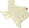 | |
| Towns | ||
| CDPs | ||
| Other communities | ||
| Footnotes | ‡This populated place also has portions in an adjacent county or counties | |