
Lanier, Texas
Lanier, Texas | |
|---|---|
 Lanier  Lanier | |
| Coordinates: 32°56′7″N 94°22′26″W / 32.93528°N 94.37389°W | |
| Country | United States |
| State | Texas |
| County | Cass |
| Elevation | 338 ft (103 m) |
| Time zone | UTC-6 (Central (CST)) |
| • Summer (DST) | UTC-5 (CDT) |
| Area code(s) | 903 & 430 |
| GNIS feature ID | 1378558[1] |
Lanier is an unincorporated community in Cass County, Texas, United States.[1] According to the Handbook of Texas, the community had a population of 43 in 2000.
History[edit]
The area in what is known as Lanier today was first settled in the early 1870s and was three miles south of where the community currently stands. It was named after Lanier, Georgia, where one of the first settlers was born. It had a store and 30 residents in 1884. The population went up to 50 in 1896 and had two churches. The population declined and its original post office closed shortly after. The Jefferson and Northwestern Railroad completed a track to Linden in 1912 and bypassed Lanier, causing its residents to move three miles north to its present location. Another post office was established at Lanier in 1913 and remained in operation until 1929. The population ranged from a low of 25 in 1925 to 150 in 1929. It soon returned to 25 in 1933. In 1983, it had 40 residents served by a cemetery, one business, and two churches, and remained at that level in 1990. Lanier gained three more residents in 2000.[2]
Geography[edit]
Lanier is located on Texas State Highway 59, 5 mi (8.0 km) south of Linden in Cass County.[2]
Education[edit]
Today, the community is served by the Linden-Kildare Consolidated Independent School District.
References[edit]
- ^ a b U.S. Geological Survey Geographic Names Information System: Lanier, Texas
- ^ a b Lanier, TX from the Handbook of Texas Online
Municipalities and communities of Cass County, Texas, United States | ||
|---|---|---|
| Cities | 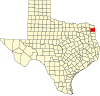 | |
| Towns | ||
| CDPs | ||
| Other communities | ||
| Footnotes | ‡This populated place also has portions in an adjacent county or counties | |