Portal:Alaska
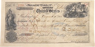
 Introduction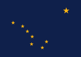   Alaska (/əˈlæskə/ ⓘ ə-LASS-kə) is a non-contiguous U.S. state on the northwest extremity of North America. It borders the Canadian province of British Columbia and the Yukon territory to the east; it shares a western maritime border in the Bering Strait with Russia's Chukotka Autonomous Okrug. The Chukchi and Beaufort Seas of the Arctic Ocean lie to the north and the Pacific Ocean lies to the south. Technically a semi-exclave of the U.S., it is the largest exclave in the world. Alaska is the largest U.S. state by area, comprising more total area than the next three largest states of Texas, California and Montana combined, and is the seventh-largest subnational division in the world. It is the third-least populous and most sparsely populated U.S. state, but is, with a population of 736,081 as of 2020, the continent's most populous territory located mostly north of the 60th parallel, with more than quadruple the combined populations of Northern Canada and Greenland. The state contains the second-largest and largest cities in the United States by area: the state capital of Juneau, and its former capital, Sitka, respectively. The state's most populous city is Anchorage and approximately half of Alaska's residents live within its metropolitan area. Indigenous people have lived in Alaska for thousands of years, and it is widely believed that the region served as the entry point for the initial settlement of North America by way of the Bering land bridge. The Russian Empire was the first to actively colonize the area beginning in the 18th century, eventually establishing Russian America, which spanned most of the current state, and promoted and maintained a native Alaskan Creole population. The expense and logistical difficulty of maintaining this distant possession prompted its sale to the U.S. in 1867 for US$7.2 million (equivalent to $157 million in 2023). The area went through several administrative changes before becoming organized as a territory on May 11, 1912. It was admitted as the 49th state of the U.S. on January 3, 1959. Abundant natural resources have enabled Alaska—with one of the smallest state economies—to have one of the highest per capita incomes, with commercial fishing, and the extraction of natural gas and oil, dominating Alaska's economy. U.S. Armed Forces bases and tourism also contribute to the economy; more than half the state is federally-owned land containing national forests, national parks, and wildlife refuges. It is among the most irreligious states, one of the first to legalize recreational marijuana, and is known for its libertarian-leaning political culture, generally supporting the Republican Party in national elections. The Indigenous population of Alaska is proportionally the second highest of any U.S. state, at over 15 percent, after only Hawaii. (Full article...) Entries here consist of Good and Featured articles, which meet a core set of high editorial standards.
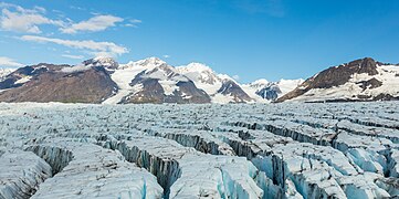
Glacier Bay Basin in southeastern Alaska, in the United States, encompasses the Glacier Bay and surrounding mountains and glaciers, which was first proclaimed a U.S. National Monument on February 25, 1925, and which was later, on December 2, 1980, enlarged and designated as the Glacier Bay National Park and Preserve under the Alaska National Interest Lands Conservation Act, covering an area of 3,283,000 acres (1,329,000 hectares). In 1986, UNESCO declared an area of 57,000 acres (23,000 hectares) within a World Biosphere Reserve. This is the largest UNESCO protected biosphere in the world. In 1992, UNESCO included this area as a part of a World Heritage site, extending over an area of 24,300,000-acre (98,000 km2) which also included the Wrangell-St. Elias National Park, Kluane National Park (Canada) and Tatshenshini-Alsek Park (Canada). Part of the National Park is also designated a Wilderness area covering 2,658,000 acres (1,076,000 hectares). Current glaciers cover an area 1,375 square miles (3,560 km2) and accounts for 27% of the Park area. Up until the early 1700s the area was a large single glacier of solid ice. It has since retreated and evolved into the largest protected water area park in the world. Glacier Bay, on the Gulf of Alaska, was known as the Grand Pacific Glacier, about 4,000 feet (1,200 m) thick and around 20 miles (32 km) in width. Over the last 200 years the glaciers have retreated, exposing 65 miles (105 km) of ocean, and in this process left 20 separate other glaciers in its trail. In 1890, the name "Glacier Bay" as such was given to the bay by Captain Lester A. Beardslee of the U.S. Navy. It was first proclaimed a U.S. National Monument on February 25, 1925, by President Calvin Coolidge. The Glacier Bay has many branches, inlets, lagoons, islands, and channels that holds prospects for scientific exploration and visual treat. Thus, the area is popular as a cruise ship destination during summer season. However, there are restrictions imposed by the National Park Service on the numbers of vessels that can operate in a day to 2 cruise ships, 3 tour boats, 6 charter vessels, and 25 private vessels. The bay received an average of about 443,975 recreational visitors annually from 2012 to 2021, with 89,768 visitors in 2021. According to a tourism score, the best time to visit Glacier Bay National Park and Preserve is from mid July to mid August for activities in warm weather. (Full article...)TopicsCategoriesSelected article - The Inuit languages are a closely related group of indigenous American languages traditionally spoken across the North American Arctic and the adjacent subarctic regions as far south as Labrador. The Inuit languages are one of the two branches of the Eskimoan language family, the other being the Yupik languages, which are spoken in Alaska and the Russian Far East. Most Inuit people live in one of three countries: Greenland, a self-governing territory within the Kingdom of Denmark; Canada, specifically in Nunavut, the Inuvialuit Settlement Region of the Northwest Territories, the Nunavik region of Quebec, and the Nunatsiavut and NunatuKavut regions of Labrador; and the United States, specifically in northern and western Alaska. The total population of Inuit speaking their traditional languages is difficult to assess with precision, since most counts rely on self-reported census data that may not accurately reflect usage or competence. Greenland census estimates place the number of Inuit language speakers there at roughly 50,000. According to the 2021 Canadian census, the Inuit population of Canada is 70,540, of which 33,790 report Inuit as their first language. Greenland and Canada account for the bulk of Inuit speakers, although about 7,500 Alaskans speak some variety of an Inuit language out of a total population of over 13,000 Inuit. An estimated 7,000 Greenlandic Inuit live in Denmark, the largest group outside of North America. Thus, the total population of Inuit speakers is about 100,000 people. (Full article...)Selected picture - The aurora borealis as viewed in Interior Alaska. Photo credit: Joshua Strang (United States Air Force) General imagesThe following are images from various Alaska-related articles on Wikipedia.
Recognized content
Featured articlesGood articles
Featured pictures
Former featured pictures
Related Portals
Related WikiProjectsState facts
State symbols:
Tasks
Associated WikimediaThe following Wikimedia Foundation sister projects provide more on this subject:
Discover Wikipedia using portals |


