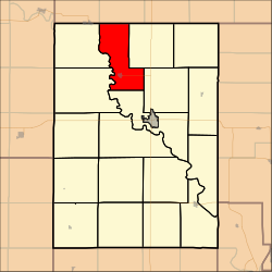
Sherman Township, Clay County, Kansas
Sherman Township | |
|---|---|
 Location in Clay County | |
| Coordinates: 39°28′30″N 097°11′21″W / 39.47500°N 97.18917°W | |
| Country | United States |
| State | Kansas |
| County | Clay |
| Area | |
| • Total | 33.33 sq mi (86.33 km2) |
| • Land | 33 sq mi (85.46 km2) |
| • Water | 0.33 sq mi (0.87 km2) 1.01% |
| Elevation | 1,234 ft (376 m) |
| Population (2000) | |
| • Total | 328 |
| • Density | 9.9/sq mi (3.8/km2) |
| GNIS feature ID | 0473356 |
Sherman Township is a township in Clay County, Kansas, USA. As of the 2000 census, its population was 328.
Geography[edit]
Sherman Township covers an area of 33.33 square miles (86.3 km2) and contains one incorporated settlement, Morganville. According to the USGS, it contains two cemeteries: Morganville and Sherman.
Stillwater Lake is within this township. The streams of East Branch Dry Creek and Peats Creek run through this township.
References[edit]
External links[edit]

