
Clifton, Kansas
Clifton, Kansas | |
|---|---|
 Location within Washington County and Kansas | |
 | |
| Coordinates: 39°34′05″N 97°16′50″W / 39.56806°N 97.28056°W[1] | |
| Country | United States |
| State | Kansas |
| Counties | Clay, Washington |
| Founded | 1870 |
| Incorporated | 1884 |
| Area | |
| • Total | 0.41 sq mi (1.06 km2) |
| • Land | 0.41 sq mi (1.06 km2) |
| • Water | 0.00 sq mi (0.00 km2) |
| Elevation | 1,293 ft (394 m) |
| Population | |
| • Total | 454 |
| • Density | 1,100/sq mi (430/km2) |
| Time zone | UTC-6 (CST) |
| • Summer (DST) | UTC-5 (CDT) |
| ZIP code | 66937 |
| Area code | 785 |
| FIPS code | 20-14200 |
| GNIS ID | 2393563[1] |
Clifton is a city in Clay and Washington counties in the U.S. state of Kansas.[1] As of the 2020 census, the population of the city was 454.[3]
History[edit]
Clifton was founded in 1870, and bears the name of a surveyor who had platted the original town in 1859.[4][a]
Clifton was an important shipping point located at the junction of three railroads.[7]
Geography[edit]
According to the United States Census Bureau, the city has a total area of 0.41 square miles (1.06 km2), all of it land.[8] The city is located next to Vining.
Demographics[edit]
| Census | Pop. | Note | %± |
|---|---|---|---|
| 1880 | 142 | — | |
| 1890 | 622 | 338.0% | |
| 1900 | 609 | −2.1% | |
| 1910 | 614 | 0.8% | |
| 1920 | 631 | 2.8% | |
| 1930 | 713 | 13.0% | |
| 1940 | 670 | −6.0% | |
| 1950 | 743 | 10.9% | |
| 1960 | 746 | 0.4% | |
| 1970 | 718 | −3.8% | |
| 1980 | 695 | −3.2% | |
| 1990 | 492 | −29.2% | |
| 2000 | 557 | 13.2% | |
| 2010 | 554 | −0.5% | |
| 2020 | 454 | −18.1% | |
| U.S. Decennial Census | |||
2020 census[edit]
The 2020 United States census counted 454 people, 192 households, and 116 families in Clifton.[9][10] The population density was 1,112.7 per square mile (429.6/km2). There were 244 housing units at an average density of 598.0 per square mile (230.9/km2).[10][11] The racial makeup was 98.68% (448) white or European American (98.24% non-Hispanic white), 0.0% (0) black or African-American, 0.0% (0) Native American or Alaska Native, 0.0% (0) Asian, 0.0% (0) Pacific Islander or Native Hawaiian, 0.0% (0) from other races, and 1.32% (6) from two or more races.[12] Hispanic or Latino of any race was 0.66% (3) of the population.[13]
Of the 192 households, 27.1% had children under the age of 18; 52.6% were married couples living together; 22.9% had a female householder with no spouse or partner present. 35.4% of households consisted of individuals and 21.9% had someone living alone who was 65 years of age or older.[10] The average household size was 1.9 and the average family size was 2.3.[14] The percent of those with a bachelor’s degree or higher was estimated to be 11.9% of the population.[15]
27.3% of the population was under the age of 18, 6.4% from 18 to 24, 22.0% from 25 to 44, 21.6% from 45 to 64, and 22.7% who were 65 years of age or older. The median age was 41.1 years. For every 100 females, there were 100.9 males.[10] For every 100 females ages 18 and older, there were 100.0 males.[10]
The 2016-2020 5-year American Community Survey estimates show that the median household income was $41,250 (with a margin of error of +/- $8,888) and the median family income was $51,250 (+/- $21,649).[16] Males had a median income of $36,563 (+/- $4,157) versus $18,750 (+/- $6,295) for females. The median income for those above 16 years old was $26,369 (+/- $2,247).[17] Approximately, 12.3% of families and 13.2% of the population were below the poverty line, including 25.6% of those under the age of 18 and 20.4% of those ages 65 or over.[18][19]
2010 census[edit]
As of the census[20] of 2010, there were 554 people, 232 households, and 145 families residing in the city. The population density was 1,351.2 inhabitants per square mile (521.7/km2). There were 262 housing units at an average density of 639.0 per square mile (246.7/km2). The racial makeup of the city was 98.6% White, 0.4% African American, 0.2% Native American, 0.5% from other races, and 0.4% from two or more races. Hispanic or Latino of any race were 1.1% of the population.
There were 232 households, of which 26.3% had children under the age of 18 living with them, 53.9% were married couples living together, 5.6% had a female householder with no husband present, 3.0% had a male householder with no wife present, and 37.5% were non-families. 34.5% of all households were made up of individuals, and 19.8% had someone living alone who was 65 years of age or older. The average household size was 2.30 and the average family size was 2.99.
The median age in the city was 46 years. 22.4% of residents were under the age of 18; 7.3% were between the ages of 18 and 24; 18.5% were from 25 to 44; 26.9% were from 45 to 64; and 25.1% were 65 years of age or older. The gender makeup of the city was 48.7% male and 51.3% female.
2000 census[edit]
As of the census[21] of 2000, there were 557 people, 240 households, and 149 families residing in the city. The population density was 1,378.7 inhabitants per square mile (532.3/km2). There were 278 housing units at an average density of 688.1 per square mile (265.7/km2). The racial makeup of the city was 98.74% White, 0.54% Native American, and 0.72% from two or more races.
There were 240 households, out of which 28.8% had children under the age of 18 living with them, 52.1% were married couples living together, 6.7% had a female householder with no husband present, and 37.9% were non-families. 35.4% of all households were made up of individuals, and 22.5% had someone living alone who was 65 years of age or older. The average household size was 2.32 and the average family size was 3.06.
In the city, the population was spread out, with 26.6% under the age of 18, 7.5% from 18 to 24, 21.9% from 25 to 44, 20.1% from 45 to 64, and 23.9% who were 65 years of age or older. The median age was 39 years. For every 100 females, there were 86.3 males. For every 100 females age 18 and over, there were 77.8 males.
The median income for a household in the city was $21,750, and the median income for a family was $34,375. Males had a median income of $26,458 versus $16,167 for females. The per capita income for the city was $13,962. About 16.2% of families and 21.0% of the population were below the poverty line, including 26.1% of those under age 18 and 28.5% of those age 65 or over.
Education[edit]
The community is served by Clifton-Clyde USD 224 public school district, which has three schools:
- Clifton-Clyde Senior High School, located in Clyde.
- Clifton-Clyde Middle School, located in Clifton.
- Clifton-Clyde Grade School, located in Clifton.
The Clifton-Clyde High School mascot is Eagles. Prior to school unification in 1981, the Clifton High School mascot was Cardinals.[22]
The Clifton Cardinals won the Kansas State High School class 1A Football championship in 1969.[23]
Notable people[edit]
- William Henderson, painter, architect, and furniture designer.
- Robert McAlmon, author, poet, and publisher.
See also[edit]
Notes[edit]
- ^ The first building erected in the original town was a one-room log hut that served the pioneers who settled there as a fort during troubled times between them and the area's Indians. Clifton and Fort Clifton ended up occupying several locations.[5] In 1860 Clifton was moved just to the north and ended up just inside Washington County, Kansas. A number of log cabins were built there by the settlers, so they could take refuge there during Indian uprisings. In 1861 and 1862 school was held in one of the cabins.[6]
References[edit]
- ^ a b c d U.S. Geological Survey Geographic Names Information System: Clifton, Kansas
- ^ "2019 U.S. Gazetteer Files". United States Census Bureau. Retrieved July 24, 2020.
- ^ a b "Profile of Clifton, Kansas in 2020". United States Census Bureau. Archived from the original on April 17, 2022. Retrieved April 17, 2022.
- ^ Kansas State Historical Society (1916). Biennial Report of the Board of Directors of the Kansas State Historical Society. Kansas State Printing Plant. pp. 312.
- ^ Ned ___, "History of Clay County by Townships," The Times (Clay Center, Kans.), May 18, 1882, p. 1; E. Neil Carson, letter to William C. Pollard, Jr., August 31, 1992, p. 1; Pollard, "Military Forts and Posts in Kansas: 1854-1865" (Ph.D. dissertation, Faith Baptist College and Seminary, 1997), pp.41, 123; Carson, letter to Pollard, September 9, 1992, p. 3; Clarence M. Burk, "Early Clifton Had Several Locations," The Times, October 27, 1966, p. 1; "Fort What?," Clifton News-Tribune, June 18, 1981, p. 12.
- ^ Burk, p. 1; "Fort What?," p. 12.
- ^ Blackmar, Frank Wilson (1912). Kansas: A Cyclopedia of State History, Embracing Events, Institutions, Industries, Counties, Cities, Towns, Prominent Persons, Etc. Standard Publishing Company. pp. 367.
- ^ "US Gazetteer files 2010". United States Census Bureau. Archived from the original on July 2, 2012. Retrieved July 6, 2012.
- ^ "US Census Bureau, Table P16: HOUSEHOLD TYPE". data.census.gov. Retrieved January 2, 2024.
- ^ a b c d e "US Census Bureau, Table DP1: PROFILE OF GENERAL POPULATION AND HOUSING CHARACTERISTICS". data.census.gov. Retrieved January 2, 2024.
- ^ Bureau, US Census. "Gazetteer Files". Census.gov. Retrieved December 30, 2023.
- ^ "US Census Bureau, Table P1: RACE". data.census.gov. Retrieved January 2, 2024.
- ^ "US Census Bureau, Table P2: HISPANIC OR LATINO, AND NOT HISPANIC OR LATINO BY RACE". data.census.gov. Retrieved January 2, 2024.
- ^ "US Census Bureau, Table S1101: HOUSEHOLDS AND FAMILIES". data.census.gov. Retrieved January 2, 2024.
- ^ "US Census Bureau, Table S1501: EDUCATIONAL ATTAINMENT". data.census.gov. Retrieved January 2, 2024.
- ^ "US Census Bureau, Table S1903: MEDIAN INCOME IN THE PAST 12 MONTHS (IN 2020 INFLATION-ADJUSTED DOLLARS)". data.census.gov. Retrieved January 2, 2024.
- ^ "US Census Bureau, Table S2001: EARNINGS IN THE PAST 12 MONTHS (IN 2020 INFLATION-ADJUSTED DOLLARS)". data.census.gov. Retrieved January 2, 2024.
- ^ "US Census Bureau, Table S1701: POVERTY STATUS IN THE PAST 12 MONTHS". data.census.gov. Retrieved January 2, 2024.
- ^ "US Census Bureau, Table S1702: POVERTY STATUS IN THE PAST 12 MONTHS OF FAMILIES". data.census.gov. Retrieved January 2, 2024.
- ^ "U.S. Census website". United States Census Bureau. Retrieved July 6, 2012.
- ^ "U.S. Census website". United States Census Bureau. Retrieved January 31, 2008.
- ^ "Falcons, Bulldogs, Wildcats, Tigers victors in BVL play", The Manhattan Mercury, 4 February 1973, p.7.
- ^ "Championship History 1908-2022 Winners & Records" (PDF). Kansas State High School Activities Association (KSHSAA). Archived (PDF) from the original on July 25, 2023.
Further reading[edit]
External links[edit]
Municipalities and communities of Clay County, Kansas, United States | ||
|---|---|---|
| Cities |  | |
| Unincorporated communities | ||
| Ghost towns | ||
| Townships | ||
| Footnotes | †This community is designated a Census-Designated Place (CDP) by the United States Census Bureau. ‡This community also has portions in an adjacent county or counties. | |
Municipalities and communities of Washington County, Kansas, United States | ||
|---|---|---|
| Cities | 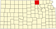 | |
| Unincorporated communities | ||
| Ghost towns | ||
| Townships |
| |
| Footnotes | ‡This community also has portions in an adjacent county or counties. | |