
Barlby
| Barlby | |
|---|---|
 York Road | |
.svg) Barlby Location within North Yorkshire | |
| OS grid reference | SE635344 |
| • London | 160 mi (260 km) SE |
| Civil parish | |
| Unitary authority | |
| Ceremonial county | |
| Region | |
| Country | England |
| Sovereign state | United Kingdom |
| Post town | SELBY |
| Postcode district | YO8 |
| Dialling code | 01757 |
| Police | North Yorkshire |
| Fire | North Yorkshire |
| Ambulance | Yorkshire |
| UK Parliament | |
Barlby is a linear village in the civil parish of Barlby with Osgodby, in North Yorkshire, England. It is situated 2 miles (3 km) to the north-east of the market town of Selby, and is bordered to the west by the River Ouse and to the east by the A19 Barlby bypass. Across the bypass is Barlby's smaller sister village, Osgodby.
Geography[edit]

Seen from the air, Barlby is long and narrow. It is approximately 3 miles (5 km) in length, and runs along the old route of the A19. Although it is classified as a single village it consists of two distinct areas: Barlby Hilltop, at the north end of the village; and Barlby Bridge which lies slightly to the south-west. The building of new estates in recent years has blurred the division between the two.
Barlby Hilltop contains Barlby Community Primary School, a library, the late eighteenth century All Saints' Church and Barlby High School which also serves pupils from the surrounding villages of Osgodby, Riccall, Kelfield, Escrick, Cliffe, North Duffield, South Duffield, Hemingbrough and Bubwith. Despite its name Barlby Hilltop sits only slightly higher than Barlby Bridge.
Flood risk[edit]
Like other settlements in the Vale of York, the village has historically been vulnerable to flooding, and was particularly badly hit in November 2000. The main electrical substation in the area was damaged by the flood, resulting in power loss for up to two weeks. The Prince of Wales visited Barlby, Naburn and York following the flood.[1]
The existing flood defences were improved as part of an £18 million scheme that was completed in 2008.[2] As a result of the flood defence improvements, the Environment Agency considers the entire residential area of Barlby to be in the 0.5% (1 in 200) "low risk" category for flooding.[3]
Transport[edit]
Barlby is served by an Arriva Yorkshire bus service, 415/416 which runs between Selby and York. The service runs through the village every 20 minutes on weekdays. In June 2013 contractors completed a new three-lane roundabout that was built on the A19 and A63 junction between Barlby and Osgodby. The roundabout was designed to slow traffic. The previous junction, constructed in 1987 was poorly set out which contributed to many traffic accidents. Since the completion of the roundabout there have been fewer accidents, traffic moves more slowly and in greater safety.[4]
History[edit]

The toponym is from an Old English personal name Bardolf, with the Old Danish suffix -by ("farm" or "village"), thus "Bardolf's farm". The place is mentioned in the Domesday Book.[5]
In the Middle Ages the village was in the Ouse and Derwent wapentake of the East Riding of Yorkshire, and a chapelry in the large ancient parish of Hemingbrough. The judges William and Robert de Bardelby are said to have taken their name after Barlby. It became a separate civil parish in 1866. On 1 April 1935 the civil parish of Osgodby was abolished and merged with Barlby,[6][7] on 2 March 1999 the merged parish was renamed "Barlby with Osgodby".[8] In 1931 the parish of Barlby (prior to the merge) had a population of 2627.[9]
In 1974 Barlby was transferred from the East Riding to the new county of North Yorkshire.
Governance[edit]
An electoral ward in the name of Barlby exists. This ward had a population of 4,163 at the 2011 Census.[10]
See also[edit]
Gallery[edit]
-

-
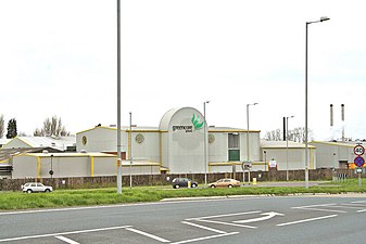
 Rank Hovis Mill
 -
 Selby Pickle Factory


References[edit]
- ^ "Charles praises Yorkshire grit", Daily Telegraph, London, 18 November 2000
- ^ "£18 million Selby flood defence scheme enters final phase of work", Selby Times, Selby, 4 August 2007, archived from the original on 1 July 2012
- ^ Environment Agency flood maps
- ^ Roundabout Construction, archived from the original on 6 January 2014
- ^ Watts, Victor, ed. (2010). "Barlby". The Cambridge Dictionary of English Place-Names. Cambridge University Press.
- ^ Baggs, A. P.; Kent, G. H. R. & Purdy, J. D. (1976). Allison, K. J. (ed.). "Hemingbrough". A History of the County of York East Riding: Volume 3, Ouse and Derwent Wapentake, and Part of Harthill Wapentake. Victoria County History. pp. 37–47. Retrieved 16 May 2015.
- ^ "Relationships and changes Barlby Ch/CP through time". A Vision of Britain through Time. Retrieved 29 November 2023.
- ^ "North Yorkshire Registration District". UKBMD. Retrieved 29 November 2023.
- ^ "Population statistics Barlby Ch/CP through time". A Vision of Britain through Time. Retrieved 29 November 2023.
- ^ UK Census (2011). "Local Area Report – Barlby 2011 Census Ward (1237325195)". Nomis. Office for National Statistics. Retrieved 16 March 2018.
External links[edit]
 Media related to Barlby at Wikimedia Commons
- Barlby and Osgodby Parish Council web site
- The Ordnance Survey grid reference for Barlby Hilltop is SE631342
- The Ordnance Survey grid reference for Barlby Bridge is SE627329
- Barlby in the Domesday Book
| International | |
|---|---|
| National | |