
Wikipedia:Graphics Lab/Map workshop/Archive/Dec 2014
| This page is an archive. Do not edit the contents of this page. Please direct any additional comments to the current main page. |

Easy one: Distribution map for the Gray-tailed vole
Request geographic distribution map for the Gray-tailed vole. I'm building up the article from a stub & going to submit DYK in next 1-2 days then bring to GA status, similar to what I did with Camas pocket gopher. Range is sourced on page 2 of this pdf and also here. Maybe the blank starter map would be the west coast of N America from around California border up to Vancouver Island BC, to give non-US readers some perspective? Please "ping" me here when done or leave a note on my talk page when ready. Thank you. —Gaff ταλκ 03:14, 4 December 2014 (UTC)
- Additional source: http://globalspecies.org/ntaxa/833895
- @Gaff:
 Done at File:Map of the Gray-tailed vole in the northwestern region of the United States.svg, add categories and good luck on the DYK/GA. ///EuroCarGT 04:54, 5 December 2014 (UTC)
Betws
-
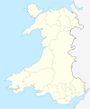 Wales location map

- Article(s)
- Bettws
- Request
- Bettws is a disambiguation page and I thought it would be helpful to include a map of Wales graphically showing all the "Bettws"s - something like this. Each pin point should probably be labeled with the unambiguous names, or at the very least numbered to correspond with the table that exists at the dab page now. It would be really cool if links to the appropriate wikipedia articles could be mapped to the image too. Unfortunately this may mean a rather large image. Finally (and I know this is asking a lot), if it's possible to verify that these locations are actually referred to as "Bettws" or "Betws" per WP:PTM that would be a big help for this American. Thanks you! -- Hoof Hearted (talk) 19:32, 25 November 2014 (UTC)
- Graphist opinion(s)
- @Hoof Hearted: At the moment there appear to be 13 "live" articles for Bettws, plus another two if you want the rugby and football team marked. The template {{Location map many}} currently has a limit of nine locations. I don't know if this number can be increased or whether it's a framework/lua restriction. Jackmcbarn will know the answer to that question. Philg88 ♦talk 08:19, 28 November 2014 (UTC)
- Try
{{Location map+}}which can enclose any number of{{Location map~}}. Essentially,{{Location map+}}is the base map with no points marked;{{Location map~}}overlays a point on that. You can see it in action at 2014–15 Premier League#Teams which has 15 red dots; 14 have links, one (London) does not because six teams share one dot. --Redrose64 (talk) 12:20, 28 November 2014 (UTC) - @Hoof Hearted and Philg88: Actually, the documentation is wrong for {{Location map many}}. It supports an unlimited number of points now that it uses Lua. Both it and the solution Redrose64 mentioned will work. Jackmcbarn (talk) 16:13, 28 November 2014 (UTC)
- @Redrose64 and Jackmcbarn: Thanks both. I'm going to plump for {{Location map many}} for now. Philg88 ♦talk 16:21, 28 November 2014 (UTC)
- Try
![]() Done: Please see Bettws for the result as it is a populated template rather than a map. Philg88 ♦talk 18:19, 29 November 2014 (UTC)
Done: Please see Bettws for the result as it is a populated template rather than a map. Philg88 ♦talk 18:19, 29 November 2014 (UTC)
- A belated, but sincere thank you! That is perfect! Hoof Hearted (talk) 13:28, 1 December 2014 (UTC)
Request for a Rio de Janeiro city locator map

I would like to ask for a new location map for the city of Rio de Janeiro. The current map (Template:Location map Brazil Rio de Janeiro City) cuts off about half the city. Commons:Category:Maps_of_Rio_de_Janeiro_city_neighbourhoods has a few neighbourhood maps that show the full extent of the city. Hack (talk) 06:26, 2 December 2014 (UTC)
- The location map image is a OpenStreetMap image, if possible you can try going on OSM and selecting the desired area, export it as a PNG and upload it from there. ///EuroCarGT 00:50, 5 December 2014 (UTC)
- Tried exporting but it's too big to export. Hack (talk) 01:03, 9 December 2014 (UTC)
- I attempted to export as an SVG in OSM, also didn't work. Let me ping @Philg88:, he knows how to export OSM maps into high quality SVGs. ///EuroCarGT 02:09, 9 December 2014 (UTC)
- You need to use the third party Maperitive tool to export the SVG after getting the raw data from the Overpass API. It's a bit of an arcane process so if you tell me the decimal coordinates you want covered by the map (top left, bottom right) I'll sort it out for you. Philg88 ♦talk 08:43, 9 December 2014 (UTC)
- The area bounded in orange in this map shows the extent of the city. Hack (talk) 12:06, 9 December 2014 (UTC)
- You need to use the third party Maperitive tool to export the SVG after getting the raw data from the Overpass API. It's a bit of an arcane process so if you tell me the decimal coordinates you want covered by the map (top left, bottom right) I'll sort it out for you. Philg88 ♦talk 08:43, 9 December 2014 (UTC)
- I attempted to export as an SVG in OSM, also didn't work. Let me ping @Philg88:, he knows how to export OSM maps into high quality SVGs. ///EuroCarGT 02:09, 9 December 2014 (UTC)
- Tried exporting but it's too big to export. Hack (talk) 01:03, 9 December 2014 (UTC)
Additional maps to support the Italian invasion of France map


- Article(s)
- Italian invasion of France
- Request
- Looking for an interested artist to create some free maps based on the above, tidy them up etc. EnigmaMcmxc (talk) 16:44, 2 December 2014 (UTC)
- Graphist opinion(s)
![]() Request taken by Goran tek-en (talk) 13:12, 12 December 2014 (UTC).
Request taken by Goran tek-en (talk) 13:12, 12 December 2014 (UTC).
- @EnigmaMcmxc: I'm not sure what you are looking for but now there is a draft on one of the maps for you to look at. In some areas of the map there is a lot of information so it gets crowded. Have a look and tell me what you want, what to change and so on, you are the one with the knowledge of this subject and you know what you are looking for. Draft to look at and give me feedback, thanks. --Goran tek-en (talk) 14:51, 16 December 2014 (UTC)
- Thanks very much. Excellent work so far. Can the location of the Alpine unit be moved? It needing to go to the bottom left of the map to match the original. Would it also be possible to change the background colour, for me it just doesn't work (although I would not have any suggestions other than perhaps a green?). In addition, "arc" at the top of map is the Arc River (L'Arc on Google Maps), which runs across the top of the map. Could this be amended to state such per the other rivers on the map? I was unable, for the moment, to find what "Kiv" stands for or what it is suppose to represent. As mentioned, the Arc - per Google - runs across the top of the map. For now, could Kiv be removed?
- While there is a lot of information on the map, it now being in colour makes it much easier to read (not to mention its free, whereas the original I do not think would hold up if scrutinized). The shaded area on the map, next to the lake poses an issue for me. I do not know what it is suppose to represent on the original map. The staging area for the 11th Division? For ease of reading, this may need to go too.EnigmaMcmxc (talk) 23:45, 16 December 2014 (UTC)
- The map is based on an article that was translated from Russian. Some French and Italian placenames got garbled. "Kiv" is just a typo for "Riv", as in river. Note that "Cemschia" should be "Val Cenischia". The "Ribbon" is actually the Ribon; "Sollierés" should be Sollières; "Le Plenet" should be Le Planay; "Ft Balm" should be Ft de la Balme; "Giazette" is the Col des Lacs Giaset; and Étache has an acute accent. The solid and dashed orange lines (in your rendition) are roads. The line you show as a black-and-white dashed line is the border.
- The shaded area represents the 11th Infantry Division Brennero held in reserve. Srnec (talk) 01:54, 17 December 2014 (UTC)
- @EnigmaMcmxc: We who create maps here try to follow map guidlines so that all of the maps looks more or less the same. In that way it's much easier for the viewers to understand and take in the information, for this reason we use a template Maps_template and it has three different colors for land so with the new information from Srnec I have made some changes.
- I also think that the area next to the lake is the area of the 11th Inf Div and with the new information I kept it. If it still should be removed just tell me.
 Question: I have added some information in the legend but you should check so that the dashed orange lines really is rods in tunnels or tell me what it is? Now when I started the second map I think the dashed orange lines maybe just minor roads? They are too long and many to be tunnels I think. Get back to me on that, thanks.
- @Srnec: You wrote "The "Ribbon" is actually the Ribon" but I can't find that word. Question: Where is it?
- Now there is a new draft to look at, give me feedback, thanks. --Goran tek-en (talk) 11:14, 17 December 2014 (UTC)
- I agree that the dashed lines are probably not tunnels. I suspect they are unpaved or seasonal roads. The "Ribbon" river is the torrent du Ribon, a mountain stream. Also, since col is just French for "pass", Col des Lacs Giaset Pass is redundant. "Lacs Giaset pass" will do.
- On the other map... Solage should be Seloge, Seign should be Seigne, Les Chapieu should be Les Chapieux, what looks like Setz is Séez, Rocher Pass is the Rocher Blanc Pass to be precise, and Moûtiers has a circumflex. The "Trieste Division" and the "Motorized Division" are the same division: the 101st Motorised Division Trieste. The big arrow pointing at Albertville represents the goal of the offensive and not a troop movement. The map does not have a compass rose, but I think it is oriented with north at top. Hope this helps. Srnec (talk) 20:40, 17 December 2014 (UTC)
- @EnigmaMcmxc:@Srnec: Thanks for the feedback and information it helps me a lot. Now there are two new drafts to look at and give me feedback on.
- Italian_offensive_Mont_Cenis
- Italian_offensive_Bourg_Saint-Maurice There is one pass "Traversette Pass" that I can see the name for but not the actual pass. Question: Do any of you know where it should be? --Goran tek-en (talk) 20:44, 19 December 2014 (UTC)
- The colouring of the glaciers seems a little off. Isn't it supposed to be the same as the country/background?
- In the Bourg St Maurice map, the small blue arrow pointing southeast just below the small permanent fort is, I believe, supposed to represent the action of a regiment passing through the Col de la Traversette to attack the fort there from the rear. (Maybe the permanent fort indicated on the original map is supposed to be that fort, in which case it or the arrow is wrongly placed. So I'll assume it is not.) The fort they were trying to outflank was the Redoute Ruinée (ruined before 1940 and still ruined now) and if you look it up on Google Maps you'll see how it and the Col de la Traversette relate, and how they are approximately in the location to which that little arrow points. It has approximately a north–south orientation.
- Thanks for doing this. Srnec (talk) 04:35, 20 December 2014 (UTC)
The glaciers have a weak tone of white in them, it's the same on both maps. It's more viible on the "Italy" country color. If you don't want it on either map tell me, but I think it's more understandable/visible like that.
I did look up Redoute Ruinée on google maps but Col de la Traversette is more than 5 hours drive from there what I can see so is that really the same?
If you have a link which shows this better or if you make a sketch or something I will edit but right now I don't know what to do?
I did an edit but I'm not sure it's correct. Look at Italian_offensive_Bourg_Saint-Maurice and give me feedback. Maybe you have to reload to get the new one.
How is the "Mont_Cenis" map, is it correct now? --Goran tek-en (talk) 13:48, 20 December 2014 (UTC)
- I should have explained better. There is another Col de la Traversette that is far away. That's why I suggested googling Redoute Ruinée. The Traversette pass that we're looking for is at 45.657551, 6.877360. You'll see it pretty clearly—and its relationship to the fort and the Little St Bernard—in Google Earth. I'd show it as a north–south pass to which that little arrow is pointing. The Mont Cenis map looks fine to me. Srnec (talk) 18:24, 20 December 2014 (UTC)
- Now this map is uploaded to commons Italian offensive Mont Cenis-1940 but you guys should check the Description, categories and so on.
- New draft Italian_offensive_Bourg_Saint-Maurice-1940. It's really hard to get something visible in on the map when it's so much smaller in reality. Feedback thanks. --Goran tek-en (talk) 20:14, 20 December 2014 (UTC)
@EnigmaMcmxc: @Srnec: Thanks for your help both of you! You guys should check the files for description, categories and so on.
- Excellent work. Thank you for your time and effort :) I don't suppose you would be willing to give the other map request - further up the page and for the same article - a look over?EnigmaMcmxc (talk) 12:04, 21 December 2014 (UTC)
- @EnigmaMcmxc: Give me the links for each and I will look at them. I will be away for about 10 days now but if that's OK I will look at them and if I'm able to I will take them. --Goran tek-en (talk) 14:18, 21 December 2014 (UTC)
- Excellent work. Thank you for your time and effort :) I don't suppose you would be willing to give the other map request - further up the page and for the same article - a look over?EnigmaMcmxc (talk) 12:04, 21 December 2014 (UTC)
- Italian offensive Mont Cenis-1940
- Italian offensive Bourg Saint-Maurice-1940 --Goran tek-en (talk) 11:02, 21 December 2014 (UTC)
![]() Done
Done
Distribution map Creeping vole
- Article(s)
- Creeping vole
- Request
- Distribution map of small rodent, another DYK and possible GA/FA in the works. Source(s) for map: here and page 3 of this pdf.
Thank you! —Gaff ταλκ 03:57, 10 December 2014 (UTC)
Bolivia's recognition of the Armenian Genocide

- Article(s)
- Armenian Genocide recognition
- Request
- Can someone please make Bolivia dark green? It has recently recognized the Armenian Genocide. Étienne Dolet (talk) 05:23, 14 December 2014 (UTC)
- Graphist opinion(s)
![]() Done by Goran tek-en.
Done by Goran tek-en.
Jersey and Isle of Man
-
 Map of Guernsey


- Article(s)
- Jersey Football Combination and Isle of Man Football League
- Request
- I would like a similar map to the one of Guernsey (above) for Jersey and the Isle of Man please Kivo (talk) 16:26, 19 December 2014 (UTC)
- Graphist opinion(s)
@Kivo: There is already a location map for the IOM - see this map, which can be used in conjunction with {{Location map}} to access the underlying module. Philg88 ♦talk 10:07, 20 December 2014 (UTC)
Global Peace Index & others need update
-
 Update needed
 -
 Update needed
 -
 Update needed
 -
Not in standard Wikipedia format


- Article(s)
- Global Peace Index and others
- Request
- Out of date, please update. The last map is not in standard Wikipedia format. -- 131.251.253.64 (talk) 18:48, 4 December 2014 (UTC)
- Graphist opinion(s)
Chicago location map
-
 Map of Chicago by community area

- Article(s)
- Numerous
- Request
- At Wikipedia_talk:WikiProject_Architecture#Template:Infobox_building_map we are discussing location maps that would be useful. We need this to be created with the details and of its boundaries and its equirectangular projection.-- TonyTheTiger (T / C / WP:FOUR / WP:CHICAGO / WP:WAWARD) 19:29, 8 December 2014 (UTC)
- Graphist opinion(s)
File:US-IL-Chicago-CA.svg is a vector version of the raster map. ///EuroCarGT 21:16, 9 December 2014 (UTC)
- Jackmcbarn, can you comment here on why we need a new map.--TonyTheTiger (T / C / WP:FOUR / WP:CHICAGO / WP:WAWARD) 02:37, 10 December 2014 (UTC)
- Because that one doesn't have the necessary projection setup to be usable as a location map. Jackmcbarn (talk) 02:46, 10 December 2014 (UTC)
- To editor Jackmcbarn: So what is required to get a "necessary projection setup"? ///EuroCarGT 03:32, 10 December 2014 (UTC)
- @EuroCarGT: Assuming you choose to make an equirectangular projection (which is the easiest way to go about it), you just need to know the latitudes of the top and bottom of the image, and the longitudes of the left and right of it. Jackmcbarn (talk) 03:42, 10 December 2014 (UTC)
- I got the OSM XML of Chicago with the coordinates as stated above, added into QGIS, rendered it as a SVG and it does not seem good... I'll keep trying. ///EuroCarGT 05:26, 10 December 2014 (UTC)
- @EuroCarGT: Assuming you choose to make an equirectangular projection (which is the easiest way to go about it), you just need to know the latitudes of the top and bottom of the image, and the longitudes of the left and right of it. Jackmcbarn (talk) 03:42, 10 December 2014 (UTC)
- To editor Jackmcbarn: So what is required to get a "necessary projection setup"? ///EuroCarGT 03:32, 10 December 2014 (UTC)
- Because that one doesn't have the necessary projection setup to be usable as a location map. Jackmcbarn (talk) 02:46, 10 December 2014 (UTC)
@EuroCarGT: Try using Maperitive instead. It produces reasonable results for import into either Illustrator or Inkscape. Philg88 ♦talk 08:37, 10 December 2014 (UTC)
- Thanks Philg88, will try! ///EuroCarGT 21:07, 10 December 2014 (UTC)
- This is getting hard, I'll back off from this until I get used to Maperative. ///EuroCarGT 01:36, 12 December 2014 (UTC)
- Thanks Philg88, will try! ///EuroCarGT 21:07, 10 December 2014 (UTC)
Location map - South East Brazil
I would like to request a customised location map based on File:Brazil_location_map.svg. The purpose is to show the location of football teams in the South East region. Per 2015 Campeonato Brasileiro Série A, the map is unable to display teams in the South East (São Paulo and Rio de Janeiro teams overlap). I would like to request an inset be included, with the top left of the inset being -19.097861, -48.395786 and the bottom left being -24.020803, -39.365025. Hack (talk) 07:15, 16 December 2014 (UTC)
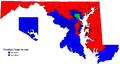
Maryland House of Delegates / Senate Maps
-
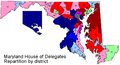 Maryland House of Delegates Map
 -
 Maryland Senate Map


- Request
- This is a featured list and we are in the process of updating for the results of the 2014 elections. Unfortunately, in the meantime the state has undergone redistricting and the current map is based on the districts from the 2000 redistricting rather than the current districts. So we need someone willing to redo the map based on the new districts. Maryland's maps of he new districts for the new lines can be found here: http://planning.maryland.gov/redistricting/. Coloring of the districts can be based on the updated list already added to the article. We will also need an updated version of the Maryland Senate map, although we have not yet updated the list at List of current members of the Maryland Senate. -- Geraldk (talk) 16:25, 24 December 2014 (UTC)
- Graphist opinion(s)