Virgil (CDP), New York
Virgil, New York | |
|---|---|
 Virgil Location within the state of New York | |
| Coordinates: 42°30′38″N 76°11′40″W / 42.51056°N 76.19444°W | |
| Country | United States |
| State | New York |
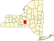
| County | Cortland |
| Town | Virgil |
| Area | |
| • Total | 0.89 sq mi (2.32 km2) |
| • Land | 0.89 sq mi (2.32 km2) |
| • Water | 0.00 sq mi (0.00 km2) |
| Elevation | 1,410 ft (430 m) |
| Population (2020) | |
| • Total | 298 |
| • Density | 333.33/sq mi (128.72/km2) |
| Time zone | UTC-5 (Eastern (EST)) |
| • Summer (DST) | UTC-4 (EDT) |
| ZIP code | 13045 |
| FIPS code | 36-77585 |
Virgil is a hamlet and census-designated place (CDP) in the town of Virgil, Cortland County, New York, United States. The population was 298 at the 2020 census.
Geography[edit]
The hamlet of Virgil is located in the west-central part of the town of Virgil, in the valley of Virgil Creek, a west-flowing stream which is part of the Cayuga Lake watershed. New York State Routes 392 and 215 intersect at the center of the hamlet. Route 392 leads east 7 miles (11 km) to U.S. Route 11 in Messengerville, and west 6 miles (10 km) to NY Route 13 in the village of Dryden, while Route 215 leads north 6 miles (10 km) to Cortland, the county seat.
According to the United States Census Bureau, the Virgil CDP has a total area of 0.89 square miles (2.3 km2), all land.[2]
Demographics[edit]
| Census | Pop. | Note | %± |
|---|---|---|---|
| 2020 | 298 | — | |
| U.S. Decennial Census[3] | |||
References[edit]
- ^ "ArcGIS REST Services Directory". United States Census Bureau. Retrieved September 20, 2022.
- ^ "2014 U.S. Gazetteer Files: Places: New York". U.S. Census Bureau, Geography Division. Archived from the original on December 13, 2014. Retrieved December 17, 2014.
- ^ "Census of Population and Housing". Census.gov. Retrieved June 4, 2016.