
User talk:*angys*/Archive 1
| This page is an archive of past discussions. Do not edit the contents of this page. If you wish to start a new discussion or revive an old one, please do so on the current talk page. |
Welcome!
Hello, *angys*, and welcome to Wikipedia! Thank you for your contributions.
I noticed that one of the first articles you edited was Padang Jawa Komuter station, which appears to be dealing with a topic with which you may have a conflict of interest. In other words, you may find it difficult to write about that topic in a neutral and objective way, because you are, work for, or represent, the subject of that article. Your recent contributions may have already been undone for this very reason.
To reduce the chances of your contributions being undone, you might like to draft your revised article before submission, and then ask me or another editor to proofread it. See our help page on userspace drafts for more details. If the page you created has already been deleted from Wikipedia, but you want to save the content from it to use for that draft, don't hesitate to ask anyone from this list and they will copy it to your user page.
One rule we do have in connection with conflicts of interest is that accounts used by more than one person will unfortunately be blocked from editing. Wikipedia generally does not allow editors to have usernames which imply that the account belongs to a company or corporation. If you have a username like this, you should request a change of username or create a new account. (A name that identifies the user as an individual within a given organization may be OK.)
In addition, you must disclose your employer, client, and affiliation with respect to any contribution for which you receive, or expect to receive, compensation (see WP:PAID).
Here are some pages that you might find helpful:
- The plain and simple conflict of interest guide
- The five pillars of Wikipedia
- Contributing to Wikipedia
- Tutorial
- How to edit a page and How to develop articles
- How to create your first article (using the Article Wizard if you wish)
- Simplified Manual of Style
I hope you enjoy editing here and being a Wikipedian! Please sign your messages on talk pages using four tildes (~~~~); this will automatically insert your username and the date. If you need help, check out Wikipedia:Questions, ask me on my talk page, or ask your question on this page and then place {{Help me}} before the question. Again, welcome! Tafeax (talk) 13:02, 3 May 2017 (UTC)
May 2017
![]() Welcome to Wikipedia. We welcome and appreciate your contributions, including your edits to Bukit Mertajam, but we cannot accept original research. Original research refers to material—such as facts, allegations, ideas, and personal experiences—for which no reliable, published sources exist; it also encompasses combining published sources in a way to imply something that none of them explicitly say. Please be prepared to cite a reliable source for all of your contributions. Please utilize your WP:SANDBOX if you wish to perform test edits or works in progress, as opposed to adding large swaths of unsourced material to live Wikipedia articles. Regards, Yamaguchi先生 (talk) 23:22, 9 May 2017 (UTC)
Welcome to Wikipedia. We welcome and appreciate your contributions, including your edits to Bukit Mertajam, but we cannot accept original research. Original research refers to material—such as facts, allegations, ideas, and personal experiences—for which no reliable, published sources exist; it also encompasses combining published sources in a way to imply something that none of them explicitly say. Please be prepared to cite a reliable source for all of your contributions. Please utilize your WP:SANDBOX if you wish to perform test edits or works in progress, as opposed to adding large swaths of unsourced material to live Wikipedia articles. Regards, Yamaguchi先生 (talk) 23:22, 9 May 2017 (UTC)
- Please tell me where is original research and I will remove that section.If not I dont know what you dont want.History?
Disambiguation link notification for May 10
Hi. Thank you for your recent edits. Wikipedia appreciates your help. We noticed though that when you edited Song Ban Kheng Road, you added a link pointing to the disambiguation page North-South Expressway. Such links are almost always unintended, since a disambiguation page is merely a list of "Did you mean..." article titles. Read the FAQ • Join us at the DPL WikiProject.
It's OK to remove this message. Also, to stop receiving these messages, follow these opt-out instructions. Thanks, DPL bot (talk) 10:23, 10 May 2017 (UTC)
A bowl of strawberries for you!

|
Great work CrossTemple Jay 19:21, 11 July 2017 (UTC) |
A cupcake for you!

|
Thanks for your messages. Slleong (talk) 05:38, 21 August 2017 (UTC) |
A cupcake for you!
|
|
Thanks for your messages. Slleong (talk) 05:38, 21 August 2017 (UTC) |
Thank you
Thanks for your message and for looking out for my edits. Great that you find them useful to translate into Chinese. I will try and get more pictures as I go along. Unfortunately I am not able to join or translate your edits from the Chinese pages as I cannot read or write Chinese. Thanks again and good job too. Slleong (talk) 02:39, 22 August 2017 (UTC) Thanks too , I really need someone KLite to gather the info. angys (Talk Talk) 06:40, 22 August 2017 (UTC)
Questionable edits on List of cities and towns in Malaysia by population
This is about the questionable edits you made at the list of cities and towns in Malaysia by population.
- Tell me, what is your rationale for adding maps into the table for urban agglomerations? Is it really necessary?
- If you dont like the map, maybe just removed it.But the urban local authorities are real e.g. Iskandar Malaysia, please think before you do.
- You have also significantly messed up the table for cities. Also, is it really necessary to add pictures?
- Why not picture? Picture is a good thing to make the reader easier to know how the standard of a city is. The table as you see doesnt complete yet and I am doing that so mayve look messy.
- Your addition of Iskandar Puteri does not include any citation.
see this The star wont say lie. If there is no consensus on the addition of pictures, maps or any other media into any list of cities, please refrain from making unnecessary edits. Thank you. Vnonymous 13:59, 17 September 2017 (UTC) @Vnonymous: angys (Talk Talk) 14:09, 17 September 2017 (UTC)
- @*angys*:*But the urban local authorities are real e.g. Iskandar Malaysia, please think before you do.
- Did I remove Iskandar Malaysia? And since when is Iskandar Malaysia a LOCAL AUTHORITY? Did you have the slightest idea on what constitutes a local authority in Malaysia? Please think before you do.
- Picture is a good thing to make the reader easier to know how the standard of a city is.
- If you are so adamant about adding pictures of cities to know how the standard of a city is, may I suggest adding a gallery for the pictures of each city, instead of adding the pictures into the table and indirectly damaging the table in the process? Refer to List of the 100 largest municipalities in Canada by population, List of cities in New Zealand and List of cities in China by population and built-up area. Then again, there is no consensus on adding the pictures of ALL cities into these articles.
- see this The star wont say lie.
- If the area has not been officially conferred city status yet, may I suggest that you defer this particular edit on Iskandar Puteri? As far as some states are concerned, their cities were granted the status by their respective state rulers. Since this has not happened yet in the case of Iskandar Puteri, there is simply no solid proof as of this moment. No worries, Wikipedia can wait.
Vnonymous 14:26, 17 September 2017 (UTC) @Vnonymous: yes you didnt remove Iskandar Malaysia. I said is for THE LOCAL AUTHORITIRS in Iskandar and I had add some LA e.g. Grearter Kuching (Samarahan Serian), Iskandar (Pontian), KV (Sepang and Putrajaya). So the gallery you do it because you know and let me see your style of doing this because I not like you so expert at doing this. Since you want to wait, you may add IP after 22 Nov as you like OK,Thank you. angys (Talk Talk) 14:35, 17 September 2017 (UTC)
List of Klang Valley transit stations
Thanks for your message. A bit surprised that my sandbox can be seen publicly. Nevertheless, my plan is to put the list in List of rail transit stations in the Klang Valley area. I've seen a few other such pages for other cities/regions and I believe the station list itself should be in alphabetical order, like a master list. Once a station is identified, info about which line it belongs to etc follows. Slleong (talk) 16:19, 25 September 2017 (UTC)
Electoral maps on Openclipart
Greetings,
Regarding your request to use my Malaysian electoral maps on Openclipart on Wikimedia, feel free to use it. However do note that for accuracy, please only use the maps that are published no earlier than June 2017.
Once again, thank you for your attention.
Derkommander0916 (talk) 08:10, 19 November 2017 (UTC)
Greetings
As with the electoral maps, feel free to use the LRT/MRT/KTM train drawings also.
Regarding the local authority/Pihak Berkuasa Tempatan maps, I will be making them soon, at an yet undisclosed date. This is pending the finalization on whether the 2013 or 2016 boundaries for the next election. The electoral maps I have published on OpenClipart are based on data from maps published by Bersih 2.0 and Election Commission, and our studies on those maps shows a high incidence of overlapping and inconsistency between electoral and local authority boundaries. Like, for example, Bangi is under Kajang municipal council, but in the last three elections it was contested under the Serdang parliamentary constituency instead.
Once again, thank you for your interest in my work and all the best.
Derkommander0916 (talk) 15:16, 19 November 2017 (UTC)
Wikiplus
Hello, *angys*, may I ask, how did you use Wikiplus. Thank you. Fandi89 (talk) 03:59, 20 November 2017 (UTC) Fandi89 (talk) 03:59, 20 November 2017 (UTC)
Lack of city council logos
Hey, do you happen to have the logos for Ipoh City Council and Alor Setar City Council? I intended to use these logos which are already available on Wikipedia, but for some reason, the logos are marked for non-free use, and I was unable to use them in pages like Template:Largest cities of Malaysia and List of cities in Malaysia.
If you can find those logos, could you upload them into Commons as well? Thank you. Vnonymous (talk) 22:28, 20 November 2017 (UTC)
Panoramic view of platform
Is this what you had in mind? Slleong (talk) 04:32, 23 November 2017 (UTC)


@Slleong:Yes, thanks. Because I saw many Hong Kong MTR station got this. Maybe now for Malaysia KV? angys (Talk Talk) 06:00, 23 November 2017 (UTC)
Adding links to non-existent files
Hi *angys*. I noticed that you replaced some infobox images (see here, here, and here) with links to non-exisitent files. All files used in article need to be uploaded directly to either Wikipedia or Wikimedia Commons, and red links should not be used instead. It's possible that you intended to replace the files with other existing files, and the new files' names just incorrect. If that's the case, then just fix the names. If, however, you intend to replace the files with ones yet to have been uploaded, then upload the new files first and then replace the old ones.
Just for reference, the files you removed are licensed as non-free content and all non-free files are required to be used in at least one article per WP:NFCC#7. Non-free files not being used in any articles are referred to as "orphans" and will eventually be flagged for speedy deletion per WP:F5. If there's something wrong with the files (i.e., there's a new version now available or the file has been added to the wrong article(s)), then you can be be bold in removing/replacing them; you shouldn't replace them, however, with links to non-existent files. So, I've undid your removals for the time being just in case an error was made and to ask you to clarify why they were removed. -- Marchjuly (talk) 23:05, 25 November 2017 (UTC)
- You removed your post(s) from my user talk page before I could reply, so I'll briefly respond here. I am not an administrator, so I cannot delete files. I can, however, tag or nominate files for deletion just you or any other editor can, or I can remove files which do not comply with Wikipedia's relevant policies or guidelines. If I nominated/tagged a file for deletion or removed a file from an article, then I probably had a policy-based reason for doing so. If you can be more specific about the file or files you think I deleted or removed, then I can probably explain why.
- I'm not sure what you meant by
Actually in Malaysia the logo is authorized
. "Authorized" and "protected by copyright" do not always have the same meaning, and what matters is the latter. If the files you want to upload are either (1) considered to be in the public domain or (2) released under a free license suitible for Wikipedia or Wikimedia Commons, then you can probably upload the file to Commons. You need to be a little careful though because not everything you find online, even on an official government website, is considered to be in the public domain or released under a free license unless it explictly states so on the website or unless the original copyright holder has given their explicit consent to license the file in such a way. Finding a file online, downloading it to your computer, and then reuploading to Wikipedia is not a transfer of copyright ownership, which means such files cannot be claimed as own work. Moreover, even if you modify the logo, etc, in such a way to create something new, it would still be a derivative work and the copyright status of the original work would need to also be taken into account.
- Just for reference, Commons has a template c:Template:PD-Malaysia which says that "Works by the government, governmental organisations and international organisations are subject to copyright for 50 years after publication". So, if you want to upload any Malaysian governmental logos to Commons, you will need to show that (1) they were created by a government employee in the capacity of their official duties and (2) they were created/published prior to 1 January 1967; if you are unable to provide proof for any PD claim or are unable to show that the original copyright holder has agreed to release the file under a free license, any such file(s) will most likely be deleted from Commons per c:COM:PCP. In such a case, you might be able to upload the file locally to English Wikipedia as non-free content, but each use of a non-free file must comply with Wikipedia's non-free content use policy and this policy tends to be quite restrictive.
- If you have any questions about what I've posted above, feel free to ask them here. You can also ask for help at WP:MCQ or c:COM:VP/C. -- Marchjuly (talk) 04:21, 26 November 2017 (UTC)
ArbCom 2017 election voter message
Hello, *angys*. Voting in the 2017 Arbitration Committee elections is now open until 23.59 on Sunday, 10 December. All users who registered an account before Saturday, 28 October 2017, made at least 150 mainspace edits before Wednesday, 1 November 2017 and are not currently blocked are eligible to vote. Users with alternate accounts may only vote once.
The Arbitration Committee is the panel of editors responsible for conducting the Wikipedia arbitration process. It has the authority to impose binding solutions to disputes between editors, primarily for serious conduct disputes the community has been unable to resolve. This includes the authority to impose site bans, topic bans, editing restrictions, and other measures needed to maintain our editing environment. The arbitration policy describes the Committee's roles and responsibilities in greater detail.
If you wish to participate in the 2017 election, please review the candidates and submit your choices on the voting page. MediaWiki message delivery (talk) 18:42, 3 December 2017 (UTC)
Disambiguation link notification for December 7
Hi. Thank you for your recent edits. An automated process has detected that when you recently edited Selangor, you added a link pointing to the disambiguation page Serdang (check to confirm | fix with Dab solver). Such links are usually incorrect, since a disambiguation page is merely a list of unrelated topics with similar titles. (Read the FAQ • Join us at the DPL WikiProject.)
It's OK to remove this message. Also, to stop receiving these messages, follow these opt-out instructions. Thanks, DPL bot (talk) 19:52, 7 December 2017 (UTC)
Vandalism by Wiki-Leader
Good job on the Chinese names for the streets, though I have spotted some repetition and have removed them. Just a word of advice: it would be better to also indicate which script is Traditional/Simplified.
I would also like to bring this matter to your attention. This Johorean user by the name of Wiki-Leader is intent on making his self-aggrandising claims that Johor Bahru should be the second largest city/metropolitan area in Malaysia and not George Town. Now I know from personal experience that Johoreans are so proud, that they would look down on anything not Johorean and would try to whitewash everything remotely 'unpleasant' about their state. But the fact is, the National Census (2010) is the most reliable source of population data, and in terms of cities, Johor Bahru (497,097) has a smaller population than George Town (708,127).[1] Is there a better source then to back his yet-to-be-proven claims? Also, this matter was already resolved last year, and yet this Johorean is insisting on his unverified claims! Not to mention that this snobbish attitude by this Johorean is against Wikipedia's policy of Verifiability, Claims require specific evidence and Negotiation; the latter due to the fact that eventhough I have tried to raise him on his talk page, he has not responded at all regarding this claim that he has.
If he still asserts his unvalidated claims one more time, I will bring him to the admins for dispute resolution. But if you could step in and stop this series of unvalidated claims, it would help as well. Vnonymous (talk) 00:44, 8 December 2017 (UTC)
References
- ^ "Population Distribution by Local Authority Areas and Mukims, 2010 (page 1 & 8)" (PDF). Department of Statistics, Malaysia. Archived from the original (PDF) on 5 February 2015. Retrieved 19 July 2013.
{{cite web}}: Unknown parameter|deadurl=ignored (|url-status=suggested) (help)
Infobox for streets
I have seen your suggested infobox, but I am afraid I do not understand a word (as it is in Chinese). I like the design of the header which incorporates the real street sign design, but I have no idea how to design such a header (since our street signs also have postcodes and other language scripts). Also, I have never created an infobox before. But I do know it will be very difficult to create a customised infobox like that.
Having said that, I think it is a good idea worth considering, but you need to know what it takes and what coding is required. I suggest you take a look at the Beach Street article; the infobox used is of the normal type, but it has all the info we need (names in other languages, postcode, city, maintenance party, junctions, historical listing if any, etc.). If you intend to create a new infobox for Penang streets, make sure you have these info as well.Vnonymous (talk) 11:59, 9 December 2017 (UTC)
- @*angys*: I really have no idea, bro. All I know is the street signs are green with white wordings (although I suspect you can use Arial font). One more thing, do note that the street signs in Seberang Perai have slightly different designs; there is an orange outline between the outer white layer and the green (again, I am not so sure about this as I couldn't remember the exact design).
- You can have a look at this image: Victoria Street sign. Vnonymous (talk) 12:08, 9 December 2017 (UTC)
- Also, you can have a look at these. Hope these helps. China Street Ghaut and Queen Street Vnonymous (talk) 12:14, 9 December 2017 (UTC)
- Left-right pattern? I don't think there is any left-right pattern on the street signs in Penang.
- By the way, I have seen your edit on Beach Street. There is one important consideration. There are several street signs along Beach Street, each with different Chinese names or the English name 'Beach Street', as well as some with Arabic and Tamil scripts. From my observation, the longer streets in Penang have a number of street signs, sometimes with differing names. Also, most of the street signs in George Town have the name 'George Town' pasted on them instead of 'P. Pinang'.
- Based on these, I don't think it is really feasible for you to create a street sign header for the articles of each street. Some streets could have more than one Chinese name, and then there is the issue of deciding which street sign to display (you would have to choose between English, Chinese, Tamil or Arabic). Vnonymous (talk) 14:51, 9 December 2017 (UTC)
- I have one comment on your street sign template. Is it possible for you to make the main font smaller? If you look at Macalister Road, 'Jalan Macalister' does not entirely fit within the green space. You can either minimise the large wordings, or widen the green space (although widening your template too much could affect the width of the infobox as well, hence in my opinion, it is better to make the large wordings slightly smaller). Vnonymous (talk) 13:55, 11 December 2017 (UTC)
That website didn't have any links. Can you can upload the PDF file by using others portal e.g. Google Drive... I think maybe because my account is too new that no permission to me. angys (Talk Talk) 12:24, 15 December 2017 (UTC)
- You don't have to create any account. The files are available to the public for free. Or you can also try going to the eStatistik homepage and navigate from there. Go to free download, select social in the main category and population in the sub-category, click Search, and scroll down to number 10 in the list. Click that link and you should be able to find the pdf. Vnonymous (talk) 12:37, 15 December 2017 (UTC)
Nomination for deletion of Template:Daerah di Malaysia
![]() Template:Daerah di Malaysia has been nominated for deletion. You are invited to comment on the discussion at the template's entry on the Templates for discussion page. BrownHairedGirl (talk) • (contribs) 18:40, 11 December 2017 (UTC)
Template:Daerah di Malaysia has been nominated for deletion. You are invited to comment on the discussion at the template's entry on the Templates for discussion page. BrownHairedGirl (talk) • (contribs) 18:40, 11 December 2017 (UTC)
Template: Penang
I am merely reorganising the places into suburbs/towns and neighbourhoods (a categorisation that includes villages). Please note that not all states have well-defined 'old towns' and 'new towns'. There are also some missing links and I have removed them, as these articles have not been created yet. Vnonymous (talk) 11:07, 12 December 2017 (UTC)
December 2017
![]() Hello, I'm Clarkcj12. I wanted to let you know that one or more of your recent contributions to Hulu Selangor District have been undone because they did not appear constructive. If you would like to experiment, please use the sandbox. If you think a mistake was made, or if you have any questions, you can leave me a message on my talk page. Thanks. Clarkcj12 (talk) 05:07, 14 December 2017 (UTC)
Hello, I'm Clarkcj12. I wanted to let you know that one or more of your recent contributions to Hulu Selangor District have been undone because they did not appear constructive. If you would like to experiment, please use the sandbox. If you think a mistake was made, or if you have any questions, you can leave me a message on my talk page. Thanks. Clarkcj12 (talk) 05:07, 14 December 2017 (UTC)
![]() Please refrain from making unconstructive edits to Wikipedia, as you did at Hulu Selangor District. Your edits appear to constitute vandalism and have been reverted. If you would like to experiment, please use the sandbox. Repeated vandalism can result in the loss of editing privileges. Thank you. Clarkcj12 (talk) 05:16, 14 December 2017 (UTC)
Please refrain from making unconstructive edits to Wikipedia, as you did at Hulu Selangor District. Your edits appear to constitute vandalism and have been reverted. If you would like to experiment, please use the sandbox. Repeated vandalism can result in the loss of editing privileges. Thank you. Clarkcj12 (talk) 05:16, 14 December 2017 (UTC)
NCER map
You are welcome. And sure, a map for NCER is doable. Of course, do give me some time; creating a map like this takes time too.
By the way, I am also thinking of another map for Iskandar Malaysia. This would silence those southern idiots who are still uneducated about the difference between JB proper and the wider Iskandar area. Vnonymous (talk) 00:18, 16 December 2017 (UTC)
- @*angys*: Yes, I am aware of that. I have found the latest maps of Iskandar's local government areas too (the latest adjustments to the local government areas in Iskandar were made in 2016). Now the only difficulty is to make a map of Iskandar out of these new information. And sure, no problem. Vnonymous (talk) 07:14, 16 December 2017 (UTC)
- @*angys*: You can refer to this site for the new boundaries of JB, Iskandar Puteri, Pasir Gudang and Kulai. As for Pontian, I still use the council boundaries as of 2010, since there has reportedly been no redelineation for Pontian District Council. It should be noted that the small area of Pontian that is within the Iskandar Malaysia zone is mostly a forest reserve, with only two small towns spread out.
- I am afraid I am unable to do a map for the districts. Compared to local governments, the districts are of less importance (the third tier of government in Malaysia after the federal and state authorities is the local government, and the districts are only referred to for land usage). Besides, I prefer to focus on the NCER map for the time being.
- @*angys*: One more thing. Can you help me delete the earlier versions of the Iskandar map I posted on Commons (https://commons.wikimedia.org/wiki/File:Map_of_Iskandar_Malaysia%27s_local_governments.png and https://commons.wikimedia.org/wiki/File:Map_of_Iskandar_Malaysia%27s_municipal_governments.png) ? I had some problems creating the pushpin map codes with them, before finally using the current Iskandar map. Now that these maps are not being used, is it possible to remove the two earlier maps? Thanks. Vnonymous (talk) 11:02, 18 December 2017 (UTC)
- @*angys*: I am sorry but I don't really have all the time to create all sorts of maps for smaller divisions. I prefer to create maps for more important areas or divisions.
- I think a map of the Klang Valley already exists. See this.
- By the way, most of the areas you added into the map are housng estates. I do not think small housing estates, such as Bukit Indah and Bandar Seri Alam, should be included. The addition of too many places clutters the map, which exactly defeats the purpose of the map. In fact, how often can you see smaller 'Tamans' in general maps of KL or Singapore? Surely you don't see Taman Connaught or Duxton that often on these maps, yes? So I chose only the important areas to be included in the map.
- @*angys*: By the way, great news (for you). That sour 'Wiki-Leader' has been blocked permanently in English Wikipedia. He was back, adding unverified non-POV statements as usual in Johor Bahru. Well, he gets what he deserves. Vnonymous (talk) 12:09, 18 December 2017 (UTC)
- @*angys*: I may consider places like Ulu Tiram or Gelang Patah, but the rest are established as housing areas (fairly recently established too). These other places are not as notable.
- And you must understand that my main concern is not to clutter the map with too many places. Not all places can be fit into a small map such as this. If you add more places into the map, the labels would overlap with one another, so you would end up with lots of dots and jumbled up words which are not readable (thus making the map useless). Thus, I took the trouble to even adjust the placement of the labels so that they can be easily read, and this is the main reason why I have to be selective of the places added as well.
- As for the map's coordinates, I simply use OpenStreetMaps. It is much easier to select a rectangular area.
- You don't have to worry about Wiki-Leader anymore. In fact, now that he is banned permanently in Wikipedia, if he tries to mess up with Wikipedia again, it is easier to deal with him. As long as I stick to Wikipedia's policies, everything should be allright. Some of the admins here should be alerted about his behaviour by now. If this is a 'battle', then Wiki-Leader has lost for good. Vnonymous (talk) 23:34, 18 December 2017 (UTC)
- @*angys*: Agree? I am very sure I used the phrase 'may consider'. Anyway, I have added Gelang Patah into the map of Iskandar; I cannot find the mukim of Ulu Tiram, and in any case, Permas Jaya is home to some light industries and hence is of more importance. Again, I would like to stress the point that the map is small and thus, it is better not to clutter it with too many places which could reduce the map's usefulness.
Thanks for letting me know that the logo was made prior to 1960s, maybe you can help me with your statement in Wikimedia Commons here. You know, commons seems a lil bit tricky here. Some administrator could just mass bombing to delete any files there although I feel the logos are seems to be free from copyright with a just simple geometric shape and font under {{PD-textlogo}}. Molecule Extraction (talk) 06:32, 16 December 2017 (UTC)
- Thank you for the link. I just point some justification that DAP logo can be qualify under the {{PD-Malaysia}} as it is one of the oldest party in the country too. I hope the administrator will listen. Molecule Extraction (talk) 06:55, 16 December 2017 (UTC)
- Glad both the flag and logo had been restored by the administrator. Now the symbols can be used across different Wikis
 Molecule Extraction (talk) 04:59, 17 December 2017 (UTC)
- I will help you, just wait a moment. ^^ Molecule Extraction (talk) 09:55, 17 December 2017 (UTC)
 Already done The MIC logo is already done, that is why I reply your message late as I was busy redrawing it. Here is the link to the flag and this to the logo. Molecule Extraction (talk) 10:25, 17 December 2017 (UTC)
- Hm, unfortunately I can't upload anything at the moment as I was not yet a confirmed user in Chinese Wikipedia. They just given this notice when I want to upload a file.
- I will help you, just wait a moment. ^^ Molecule Extraction (talk) 09:55, 17 December 2017 (UTC)
- Glad both the flag and logo had been restored by the administrator. Now the symbols can be used across different Wikis
您的帐户还不是确认用户。对不起,要在中文维基百科上传文件,您需要拥有确认用户权限。通常情况下,您的帐户将在编辑50次,并且注册达到7天之后自动成为确认用户。
您可能已经可以在维基共享资源上传文件,但还不可以在中文维基百科上传。如果您的文件屬於自由许可協議的,请到Commons上传该文件。
(English machine translation (Google Translate): Your account is not yet a confirmed user.
Sorry, to upload files in Chinese Wikipedia, you need to have Confirm User Rights. Often, your account will be edited 50 times and automatically become a confirmed user after 7 days of registration.
You may already be able to upload files on Wikimedia Commons, but not yet on Chinese Wikipedia. If your file is a free license, please upload it to Commons.)
- I think you can upload it by yourself as you already granted "confirmed user permission". Just download the file here and re-upload it there. Molecule Extraction (talk) 10:42, 17 December 2017 (UTC)
- I think you can upload it by yourself as you already granted "confirmed user permission". Just download the file here and re-upload it there.
- Yes. I use Inkscape to make the svg. Basically I will download the jpg, png or gif logo first then using the Inkscape tracing bitmaps tool. When I already have the shape in svg, I will proceed to create the other shape. Thanks. Honestly, I preferred a simple logo as it is much easy to tracing it than a complicated one and the good news here is that it can also passed a free license. I do hope that most Malaysian political parties logos will be simple just like the logos of political parties in Japan where they just use simple geometric shape and font like this, this, this and this. The Gerakan logo also can be redraw but the only problem is it can't be uploaded on Wikimedia Commons caused by the paddy symbol as it is not a simple shape thus cannot use a free license. Molecule Extraction (talk) 11:25, 17 December 2017 (UTC)
- You're welcome. ^^ Molecule Extraction (talk) 11:52, 17 December 2017 (UTC)
 Done Here you go.
  Molecule Extraction (talk) 07:10, 18 December 2017 (UTC)
 In progress I will notify you when it is done. Molecule Extraction (talk) 14:43, 18 December 2017 (UTC)
2/3 of the maps is done.BTW, please don't request too many images at once as I am a human too, so to finish a request takes time. In the case that I am not available here due to certain issues in real life, there is a special page for graphic request too. Just put the image file you need an improvement along with its link to any article and stated what kind of improvement/change you want. Molecule Extraction (talk) 10:31, 19 December 2017 (UTC)
- You're welcome. ^^ Molecule Extraction (talk) 11:52, 17 December 2017 (UTC)
- Jobs done. Here you go again:
-
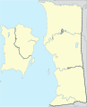 Penang location map
 -
 Iskandar Malaysia municipal government map
 -
 George Town conurbation map
 -
Iskandar Puteri City Council Emblem


_logo.svg)
Note that I made some modification to the map border line (thickness etc.) to make it suits the SVG. Molecule Extraction (talk) 14:46, 20 December 2017 (UTC)
- Regarding your message in my talkpage in Wikimedia Commons. Yes. I noticed that too. While we need to respect the copyright laws there, I already feel a bit disenchantment towards the culture they currently practicing there especially when some administrators have acting unfairly. What more if the administrator is an experienced user. Just take an example from these two files ([1], [2]). The first file have been in Commons database since December 2016, while the second are much longer since September 2015. Why they did not do anything if it is copyright? Is it so hard to delete it at the time and gave any warnings to the editors? It is impossible when not even one of all the administrators there noticed about that! Only when I upload a vectorise version of the two files, they start to blaming me for breaching copyright and threatening to block especially when they saw the old list of all deletion and copyright notification discussion that I did not even intend to erase them from my talkpage. For sure, when they encountering editors who always clean their talkpage they will not even resorting to that. Molecule Extraction (talk) 05:46, 23 December 2017 (UTC)
![[1]](https://commons.wikimedia.org/wiki/File:Amanah.png)
![[2]](https://commons.wikimedia.org/wiki/File:Bendera_Amanah.png)
Disambiguation link notification for December 18
Hi. Thank you for your recent edits. An automated process has detected that when you recently edited Malaysia Purple League, you added a link pointing to the disambiguation page Genting (check to confirm | fix with Dab solver). Such links are usually incorrect, since a disambiguation page is merely a list of unrelated topics with similar titles. (Read the FAQ • Join us at the DPL WikiProject.)
It's OK to remove this message. Also, to stop receiving these messages, follow these opt-out instructions. Thanks, DPL bot (talk) 12:25, 18 December 2017 (UTC)
District map
Greetings.
Sorry for being incommunicado for the past two weeks or so. I am attending to other assignments, while exams are also around the corner. I'll try to stay active on DeviantArt and Openclipart, but map drawing, which often takes more time, could not be available until late-January. Nonetheless the district map of Peninsular Malaysia was quite well done. Based on your map, as well as map data from BERSIH and Election Commission, I will soon do a "district" map alright, and hence an 'overlap map' that shows how much the 2016 parliamentary constituencies overlap with the "districts"/"daerah"/"jajahan" as defined by the state govts.
Yes, for your information, the Election Commission is allowed to go ahead with the 2016 re-delineation proposal according to a recent court ruling. Regarding that, I already had the 2016 maps ready except for Selangor and KL in which some areas need to be fine-tuned.
Derkommander0916 (talk) 13:00, 19 December 2017 (UTC)
This source here says that Rapid Penang had 56 routes. This news report was released in early 2017.
Also, your edits include a redundancy of route 612 and 708. The two routes are inside the table for interstate routes. Please check before you publish your changes and do not simply edit for the sake of editing. Thank you. Vnonymous (talk) 14:27, 19 December 2017 (UTC)
Apparently there is a new route added, which I have not seen previously. I will add route 804 now. Vnonymous (talk) 14:32, 19 December 2017 (UTC)
A page you started (Song Ban Kheng Road) has been reviewed!
Thanks for creating Song Ban Kheng Road, *angys*!
Wikipedia editor Ajpolino just reviewed your page, and wrote this note for you:
If you could add more sources to indicate where you got this information, that would be a huge improvement to the article!
To reply, leave a comment on Ajpolino's talk page.
Learn more about page curation.
Ajpolino (talk) 21:07, 19 December 2017 (UTC)
Ways to improve Rembau District
Hi, I'm Ajpolino. *angys*, thanks for creating Rembau District!
I've just tagged the page, using our page curation tools, as having some issues to fix. Please fill out your references! If you aren't sure how to fill things out, see Help:Referencing for beginners or ask at WP:TEAHOUSE. Thanks!
The tags can be removed by you or another editor once the issues they mention are addressed. If you have questions, you can leave a comment on my talk page. Or, for more editing help, talk to the volunteers at the Teahouse.
Ajpolino (talk) 21:08, 19 December 2017 (UTC)
List of shopping malls
FYI, there is such a list for KL. See this. Vnonymous (talk) 23:40, 20 December 2017 (UTC)
Nomination of List of shopping malls in Southern Malaysia for deletion
A discussion is taking place as to whether the article List of shopping malls in Southern Malaysia is suitable for inclusion in Wikipedia according to Wikipedia's policies and guidelines or whether it should be deleted.
The article will be discussed at Wikipedia:Articles for deletion/List of shopping malls in Southern Malaysia until a consensus is reached, and anyone is welcome to contribute to the discussion. The nomination will explain the policies and guidelines which are of concern. The discussion focuses on high-quality evidence and our policies and guidelines.
Users may edit the article during the discussion, including to improve the article to address concerns raised in the discussion. However, do not remove the article-for-deletion notice from the top of the article. Nightfury 10:21, 22 December 2017 (UTC)
Nomination of List of shopping malls in Kedah and Perak for deletion
A discussion is taking place as to whether the article List of shopping malls in Kedah and Perak is suitable for inclusion in Wikipedia according to Wikipedia's policies and guidelines or whether it should be deleted.
The article will be discussed at Wikipedia:Articles for deletion/List of shopping malls in Kedah and Perak until a consensus is reached, and anyone is welcome to contribute to the discussion. The nomination will explain the policies and guidelines which are of concern. The discussion focuses on high-quality evidence and our policies and guidelines.
Users may edit the article during the discussion, including to improve the article to address concerns raised in the discussion. However, do not remove the article-for-deletion notice from the top of the article. Nightfury 10:25, 22 December 2017 (UTC)
Straits Quay bus stop
Show me proof that there is a bus stop right in front of Straits Quay. According to Google Maps and Rapid Penang website, not even a single bus route comes near the mall. Vnonymous (talk) 14:47, 25 December 2017 (UTC)
- Where is your proof? Unless you have evidence to back your claim, then your claim will have to be dropped as per WP:VERIFY. Vnonymous (talk) 14:52, 25 December 2017 (UTC)
- This website shows Jalan Tanjung Tokong. Is Straits Quay located at Jalan Tanjung Tokong? Or is it Jalan Seri Tanjung Pinang? If you have no proof to back your claims that there is a bus stop at Jalan Seri Tanjung Pinang, please stop your edits as per WP:VERIFY. Vnonymous (talk) 15:33, 25 December 2017 (UTC)
Disambiguation link notification for December 27
An automated process has detected that you recently added links to disambiguation pages.
- Districts of Malaysia (check to confirm | fix with Dab solver)
- added links pointing to Kampar and Tanah Merah
- Pontian Kechil (check to confirm | fix with Dab solver)
- added a link pointing to Klang
(Opt-out instructions.) --DPL bot (talk) 12:27, 27 December 2017 (UTC)
Speedy deletion nomination of Templat:My10

If this is the first article that you have created, you may want to read the guide to writing your first article.
You may want to consider using the Article Wizard to help you create articles.
Hello, and welcome to Wikipedia. This is a notice that the page you created, Templat:My10, was tagged as a test page under section G2 of the criteria for speedy deletion and has been or soon may be deleted. Please use the sandbox for any other tests you want to do. Take a look at the welcome page if you would like to learn more about contributing to our encyclopedia.
If you think this page should not be deleted for this reason, you may contest the nomination by visiting the page and clicking the button labelled "Contest this speedy deletion". This will give you the opportunity to explain why you believe the page should not be deleted. However, be aware that once a page is tagged for speedy deletion, it may be deleted without delay. Please do not remove the speedy deletion tag from the page yourself, but do not hesitate to add information in line with Wikipedia's policies and guidelines. If the page is deleted, and you wish to retrieve the deleted material for future reference or improvement, then please contact the deleting administrator, or if you have already done so, you can place a request here. reddogsix (talk) 20:07, 27 December 2017 (UTC)
Vectorising logo and labelled map creation
Regarding on your request. I am so sorry but I will not vectorise any complicated design logos anymore unless its license status are really clear. You already know that my talkpage in Commons is already in the final warning so it is not safe to uploading any files deemed to be copyright without the backup of any evidence stating the files are really free in Commons. About the labelled map, I can do it but I don't have any time at the moment. Now I want to spend my time more on article editing. As I told previously, you can ask some help in the Graphics Lab. It may be slow and patience is needed. Molecule Extraction (talk) 06:16, 28 December 2017 (UTC)
Hi *angys* :) May I respectfully request that you don't nominate any other places for deletion without reading and understanding the above link? Also WP:BEFORE explains what to do before nominating, and how AfD should be a last resort. You see, all of your recent nominations have been closed (by me) as 'keep' due to these things having not being taken into account. Thanks for your time, and happy editing! >SerialNumber54129...speculates 14:38, 29 December 2017 (UTC)
KTMB Logo
![]() Done, see File:Keretapi Tanah Melayu Berhad Logo.svg. Molecule Extraction (talk) 19:05, 2 January 2018 (UTC)
Done, see File:Keretapi Tanah Melayu Berhad Logo.svg. Molecule Extraction (talk) 19:05, 2 January 2018 (UTC)
Nomination for deletion of Template:Mypoputable
![]() Template:Mypoputable has been nominated for deletion. You are invited to comment on the discussion at the template's entry on the Templates for discussion page. Frietjes (talk) 16:38, 3 January 2018 (UTC)
Template:Mypoputable has been nominated for deletion. You are invited to comment on the discussion at the template's entry on the Templates for discussion page. Frietjes (talk) 16:38, 3 January 2018 (UTC)
Nomination of List of shopping malls in East Coast, Malaysia for deletion
A discussion is taking place as to whether the article List of shopping malls in East Coast, Malaysia is suitable for inclusion in Wikipedia according to Wikipedia's policies and guidelines or whether it should be deleted.
The article will be discussed at Wikipedia:Articles for deletion/List of shopping malls in East Coast, Malaysia until a consensus is reached, and anyone is welcome to contribute to the discussion. The nomination will explain the policies and guidelines which are of concern. The discussion focuses on high-quality evidence and our policies and guidelines.
Users may edit the article during the discussion, including to improve the article to address concerns raised in the discussion. However, do not remove the article-for-deletion notice from the top of the article. Hitro talk 12:29, 10 January 2018 (UTC)