
Staré Křečany
Staré Křečany | |
|---|---|
 Main road in Staré Křečany | |
 Flag  Coat of arms | |
 Staré Křečany Location in the Czech Republic | |
| Coordinates: 50°57′2″N 14°29′47″E / 50.95056°N 14.49639°E | |
| Country | |
| Region | Ústí nad Labem |
| District | Děčín |
| First mentioned | 1485 |
| Area | |
| • Total | 36.77 km2 (14.20 sq mi) |
| Elevation | 399 m (1,309 ft) |
| Population (2023-01-01)[1] | |
| • Total | 1,218 |
| • Density | 33/km2 (86/sq mi) |
| Time zone | UTC+1 (CET) |
| • Summer (DST) | UTC+2 (CEST) |
| Postal code | 407 61 |
| Website | www |
Staré Křečany (German: Alt Ehrenberg) is a municipality and village in Děčín District in the Ústí nad Labem Region of the Czech Republic. It has about 1,200 inhabitants.
Administrative parts[edit]
The villages of Brtníky, Kopec, Nové Křečany, Panský and Valdek are administrative parts of Staré Křečany.
Demographics[edit]
| Year | Pop. | ±% |
|---|---|---|
| 1869 | 7,529 | — |
| 1880 | 7,399 | −1.7% |
| 1890 | 7,050 | −4.7% |
| 1900 | 6,571 | −6.8% |
| 1910 | 6,718 | +2.2% |
| 1921 | 5,826 | −13.3% |
| 1930 | 6,021 | +3.3% |
| 1950 | 2,014 | −66.6% |
| 1961 | 2,000 | −0.7% |
| 1970 | 1,785 | −10.8% |
| 1980 | 1,438 | −19.4% |
| 1991 | 1,147 | −20.2% |
| 2001 | 1,175 | +2.4% |
| 2011 | 1,204 | +2.5% |
| 2021 | 1,141 | −5.2% |
| Source: Censuses[2][3] | ||
Gallery[edit]
-
 Church of Saint John of Nepomuk
 -
 Brtníky
 -
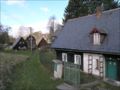
 Kopec
Kopec


_1.jpg)
References[edit]
- ^ "Population of Municipalities – 1 January 2023". Czech Statistical Office. 2023-05-23.
- ^ "Historický lexikon obcí České republiky 1869–2011 – Okres Děčín" (in Czech). Czech Statistical Office. 2015-12-21. pp. 13–14.
- ^ "Population Census 2021: Population by sex". Public Database. Czech Statistical Office. 2021-03-27.
External links[edit]
Wikimedia Commons has media related to Staré Křečany.
| Authority control databases: National |
|---|
This Ústí nad Labem Region location article is a stub. You can help Wikipedia by expanding it. |