
Midagahara


Midagahara (弥陀ヶ原, Midaga-hara) is a wetlands located near Tateyama in Toyama Prefecture, in Japan. the remaining 80,000 ha of wetlands have been designated a Ramsar Site in 2012.[1]
Midagahara is a one of many highlights of Tateyama Kurobe Alpine Route.
Geography[edit]

Midagahara is 2 km of Horizontal length and 4 km of vertical length.
Midagahara is a lava plateau formed by Tateyama volcano.[2]
Biota[edit]
There are Dactylorhiza aristata, Paris japonica, Lysichiton camtschatcensis, Daylily.
Facility[edit]
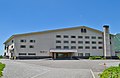
There are some Hotels.
-
 TATEYAMA SOU of National youth hostels
 -
 Midagahara Hotel
 -
 Midagahara bus stop


,_bun_stop.jpg)
Access[edit]
There are Midagahara bus stops between Bijodaira Station and Murodō Station on Tateyama Kurobe Alpine Route.
Private cars aren't allowed to pass in Midagahara to protect the environment.
See also[edit]
References[edit]
- ^ ラムサール条約湿地の新規登録について 富山県
- ^ 野崎保、菊川茂:立山カルデラの形成と深層崩壊の歴史 -鳶泥と国見泥- 日本地すべり学会誌 Vol.49(2012) No.4 p.196-203