Bir El Djir District
Bir El Djir District
دائرة بئر الجير | |
|---|---|
 | |
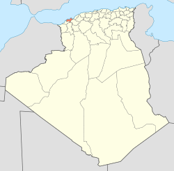
 Map of Algeria highlighting Oran Province | |
 Map of Oran Province highlighting Bir El Djir District | |
| Country | |
| Province | Oran |
| District seat | Bir El Djir |
| Area | |
| • Total | 101.7 km2 (39.3 sq mi) |
| Population (1998) | |
| • Total | 127,113 |
| • Density | 1,200/km2 (3,200/sq mi) |
| Time zone | UTC+01 (CET) |
| Municipalities | 3 |
Bir El Djir is a district in Oran Province, Algeria, on the Mediterranean Sea. It was named after its capital, Bir El Djir.
Municipalities[edit]
The district is further divided into 3 municipalities:

