
Bernau am Chiemsee
Bernau am Chiemsee | |
|---|---|
 Aerial view | |
 Coat of arms | |
Location of Bernau am Chiemsee within Rosenheim district 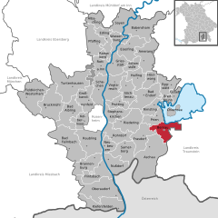 | |
 Bernau am Chiemsee  Bernau am Chiemsee | |
| Coordinates: 47°49′N 12°22′E / 47.817°N 12.367°E | |
| Country | Germany |
| State | Bavaria |
| Admin. region | Oberbayern |
| District | Rosenheim |
| Government | |
| • Mayor (2020–26) | Irene Biebl-Daiber[1] (CSU) |
| Area | |
| • Total | 26.70 km2 (10.31 sq mi) |
| Elevation | 544 m (1,785 ft) |
| Population (2022-12-31)[2] | |
| • Total | 7,090 |
| • Density | 270/km2 (690/sq mi) |
| Time zone | UTC+01:00 (CET) |
| • Summer (DST) | UTC+02:00 (CEST) |
| Postal codes | 83233 |
| Dialling codes | 08051 |
| Vehicle registration | RO |
| Website | www.bernau-am-chiemsee.de |
Bernau am Chiemsee (written Bernau a.Chiemsee) is a municipality in the district of Rosenheim in Germany on the Lake Chiemsee, and a Luftkurort.
Geography[edit]
Topography[edit]
The Luftkurort Bernau lies in the Chiemgau area at the south-western bank of the lake Chiemsee. Bernau is close to the Bundesautobahn 8 (A 8) Munich – Salzburg and the Rosenheim–Salzburg railway. In the south are the Chiemgau Alps (German: Chiemgauer Alpen) with the prominent summit, the Kampenwand. In the east is vast bogland, where peat used to be harvested in large quantities. An old rail station for the transportation of peat in the bog area Kendlmühlfilzen reminds of these times. Rosenheim is 24km away, Munich 83km, Kufstein 35km, Traunstein 26km, Salzburg 58km and Reit im Winkl 25km.
Bernau has a bathing beach, boat hire as well as mooring for the Chiemsee-Schifffahrt at its shore. It is possible to reach the island Herreninsel directly from here.
The cycling route (Uferrundweg) around the lake Chiemsee also passes through one of Bernau's districts called Felden.
Neighbouring municipality[edit]
Neighbouring municipalities clockwise are Übersee, Grassau, Aschau, Frasdorf and Prien.
Community organisation[edit]
There are the following land plots of the municipality, also called Gemarkungen: Bernau a. Chiemsee, Hittenkirchen. The municipality Bernau am Chiemsee has 38 districts:[3]
History[edit]
Before the establishment of the municipality[edit]
Bernau am Chiemsee belonged to the count Grafen von Preysing. However, it was also part of the Electorate of Bavaria. Bernau was a part of the rule of Hohenaschau which was equipped with the right of Blutgerichtsbarkeit. Today's municipality came into being in the course of the administrative reforms in Bavaria by the edict of 1818 (Gemeindeedikt von 1818).
During the time of ancient rome Bernau was a popular resort for soldiers because of its convenient and healthy location. The outlines of a villa rustica were found here. This indicates the existence of a Roman bath. A Roman tombstone was also found.[4]
The emperor Maximilian I. stayed in Bernau during his campaign against the castle Burg Marquartstein in Oktober 1504. This has been noted on a board at the guesthouse Gasthof zum alten Wirt.
Incorporation[edit]
On 1st Mai 1978 parts of the dissolved municipality Hittenkirchen were incorporated.[5]
Population development[edit]
Between 1988 and 2018, the municipality grew from 5,073 to 6,980 by 1,907 inhabitants or alternatively by 37.6%.
| Population development | ||||||||||||||
|---|---|---|---|---|---|---|---|---|---|---|---|---|---|---|
| Year | 1840 | 1900 | 1925 | 1950 | 1961 | 1970 | 1987 | 1991 | 1995 | 2001 | 2005 | 2010 | 2015 | |
| Population | 843 | 1089 | 1474 | 3606 | 3788 | 3792 | 4859 | 5802 | 6176 | 6612 | 6727 | 7129 | 6811 | |

St. Laurentius during Sunday mass

Religion[edit]
The majority of the population in Bernau is catholic. Service takes place in the church St. Laurentius which belongs to the catholic parish of Bernau. The district Hittenkirchen has its own village church.
Politics[edit]
Municipal council[edit]
20 honorary council members together with the full-time mayor make up the municipal council of Bernau am Chiemsee. The composition of this council following the local elections in 2014 is as follows
| 2014 | 2008 | 2002 | |
|---|---|---|---|
| Total of seats | 20 | 20 | 20 |
| CSU | 8 | 10 | 10 |
| Bernauer Liste | 3 | 3 | 3 |
| SPD | 2 | 2 | 3 |
| Greens | 4 | 2 | - |
| Wählergruppe ÜWG | 2 | 2 | 2 |
| Wählergruppe WMG | 1 | 1 | 2 |
Mayor[edit]
| Term | 1. Mayor | 2. Mayor | 3. Mayor |
| 2002–2014 | Klaus Daiber (CSU) | ||
| 2014–2020 | Philipp Bernhofer (Bernauer Liste) | Gerhard Jell (CSU) | Alexander Herkner (SPD)[6] |
| since 2020 | Irene Biebl-Daiber (CSU) | Gerhard Jell (CSU) | Franz Prassberger (ÜWG) |
Local authority finances[edit]
In 2010 the municipal tax revenue was 4,745,000 Euro, 1,676,000 Euro of which were trade tax revenues (net).
Coat of arms and flag[edit]
Blazon: „In Silber über einem mit zwei durchgehenden silbernen Wellenbalken belegten blauen Dreiberg eine grüne Hausmarke, bestehend aus Kreuzkopfvierfußschaft mit erhöhter linker Mittelkreuzstrebe, Vierfuß hintenendig gekreuzt.“ (Silver, at the bottom a blue trimount, with two continuous silver waves going through the mount and above a green House mark consisting of a complex pattern.)
The house mark belongs to the innkeeper family Seiser, who have played an important role in the municipality since the end of the 15th century. The green colour has been freely selected. The trimount alludes to the Aschauer coat of arms who Bernau used to belong to, however, it also stands for the mountains in the Chiemgau area. The waves stand for the position of the town close to lake Chiemsee. The coat of arms was designed by the engineer and designer Hugo Decker and was approved by the Bavarian Ministry of the Interior in 1956.[7]
The flag is striped green, white and blue.[7]
Economy and infrastructure[edit]
Economy[edit]
In 2010, according to government statistics, there were 281 employees who were subject to social insurance in the manufacturing industry and 338 employees subject to social insurance in the trade and traffic industry in Bernau. 590 employees subject to social insurance were employed in other economic sectors. Altogether there were 1856 employees subject to social insurance. In the manufacturing sector there were three businesses, and in the building industry proper eight. Furthermore, there were 57 farms with an agricultural land of altogether 1394 hectares, of which 1250 hectares were fields not used for agriculture.
Businesses[edit]
A branch of the company ‘Bavaria Yachts’ is located in Bernau. Furthermore, the specialist clinic Medical Park Chiemseeblick is located in the district Felden.
Traffic[edit]

- Rail traffic: Bernau am Chiemsee is one of the stops (German: Haltepunkt) on the Rosenheim–Salzburg railway route which is part of the main route Munich–Salzburg–Vienna. The train station has two train tracks and two side platforms and were opened together with the railway route on 7 May 1860. In 2003, the train station building was modernised and now also includes a kiosk. There is also the Chiemseeringlinie a bus service with cycle compartment that drives to designated stops in towns and villages around the lake Chiemsee during the summer. During this time, the Chiemsee-Schifffahrt also moors in Felden.
- Bus traffic: Bernau am Chiemsee is services by two bus links which are part of the regional traffic company Regionalverkehr Oberbayern. There is a connection to Aschau im Chiemgau, Sachrang, Prien am Chiemsee, Marquartstein, and Reit im Winkl via the bus route 9502 and 9505.
- road traffic: In the north west lies the Autobahn access point Autobahnanschlussstelle 106 Bernau of the Autobahn A 8 that crosses here with the main road Bundesstraße 305.
Education[edit]
In 2010 there were the following educational institutions:
- Three nurseries with 200 places which were visited by 171 children.
- A primary school with 10 teacher that teach 178 pupils in eight school classes.
The school teaches grades 1-4 and there are two school classes for each grade.
Sport[edit]
There are many sport facilities in Bernau that allows to try out many different disciplines. These include football, basketball, tennis, paddleball, volleyball, boccia, beach volleyball, beach soccer, ballooning, biking in the mountains, downhill, skiing, snowboarding and other winter sports, as well as hiking, climbing, Nordic walking, ice skating, squash, windsurfing, surfing, sailing, water sports and many other water sports. Furthermore, there are three shooting clubs where it is possible to practice shooting with airguns and air pistols.
Bernau is home to one of the biggest indoor tennis courts in Germany, as well as one of two place in Germany for the new tennis discipline called Padel. There is also a DAV indoor climbing gym. DAV stands for [German Alpine Club] (German: for Deutscher Alpenverein). There are beach volleyball and beach soccer courts at the lake. The lake also offers many opportunities for different water disciplines. Ballooning is offered in the district of Hittenkirchen, as well as in Bernau itself.
Tourism[edit]

Bernau is a popular place for tourists due to its tranquillity and its proximity to large cities such as Munich and Salzburg. Popular tourist spots apart from the lake Chiemsee are the castle Bonnschlössl, the guesthouse Gasthof alter Wirt and the Torfbahnhof, an old rail station for the transportation of peat. There are also many typical Bavarian mountain pastures that are still being run.
There is a tourist information office in the Chiemseepark Bernau-Felden.
Wellness and rehabilitation clinic[edit]
- Medical-Park Chiemsee (a recognized rehabilitation clinic with the specialist areas orthopaedics, traumatology and sports medicine). The clinic is housed in a building which used to be an old Autobahn service area building called Rasthaus am Chiemsee.
Special buildings[edit]
- Parish Church St. Laurentius
- Mediaeval church St. Bartholomäus im Ortsteil Hittenkirchen
- Hotel Bonnschlössl
- Guesthouse Gasthof Alter Wirt
- Water tower in Bergham
- War memorial im Hittenkirchen
- Statues "Griechische Weisen" in the school yard of the primary school in Bernau
- Pillar "Seisersäule" at the entrance to the Catholic parish church St. Laurentius
- Former Autobahn service area building Rasthaus am Chiemsee
- Museum of the old peat train station Torfbahnhof
- The prison in Bernau (Justizvollzugsanstalt Bernau) can accommodate about 850 inmates and is therefore one of the largest prisons in Bavaria.
- Wayside chapel in Aufing
- Forest chapel near Hitzelsberg
- Place of prayer Mariengrotte in Kraimoos
- Chapel near Kalvarienberg/Hitzelsberg
Well-known personalities born in Bernau[edit]
- Hugo Decker (1899–1985), member of the German Bundestag MdB (Bavaria Party), Parliamentary leader of the Föderalistische Union (1951–1953)
- Raimund Eberle (1929–2007), jurist and chief administrator (Regierungspräsident) of Upper Bavaria from 1975 to 1994
- Wilfried Klaus (born 1941), actor
Well-known personalities buried in Bernau[edit]
- Karl Chmielewski (1903-1991), German war criminal
- Fritz Odemar (1890–1955), German actor
- Elisabeth Flickenschildt (1905–1977), German actress
- Hans Klein (1931–1996), German politician
-
 Traditional guesthouse Gasthof zum alten Wirt in the heart of the village
 -
 View from Urfahrn of Bernau across the lake Chiemsee
 -
 Mountain close to Bernau, the 1664m high Kampenwand


References[edit]
- ^ Liste der ersten Bürgermeister/Oberbürgermeister in kreisangehörigen Gemeinden, Bayerisches Landesamt für Statistik, 15 July 2021.
- ^ Genesis Online-Datenbank des Bayerischen Landesamtes für Statistik Tabelle 12411-003r Fortschreibung des Bevölkerungsstandes: Gemeinden, Stichtag (Einwohnerzahlen auf Grundlage des Zensus 2011) (Hilfe dazu).
- ^ "Bayerische Landesbibliothek Online (BLO)".
- ^ Joseph von Hefner: Das römische Bayern in seinen Schrift- und Bildmalen. Munich 1852, p. 195 (online).
- ^ Statistisches Bundesamt (German federal bureau of statistics, ed. (1983), Historisches Gemeindeverzeichnis für die Bundesrepublik Deutschland. Namens-, Grenz- und Schlüsselnummernänderungen bei Gemeinden, Kreisen und Regierungsbezirken vom 27. 5. 1970 bis 31. 12. 1982 (in German), Stuttgart/Mainz: Kohlhammer Verlag, ISBN 3-17-003263-1
{{citation}}: CS1 maint: date and year (link) - ^ "Grußwort der Ersten Bürgermeisterin".
- ^ a b Hugo Decker: Die Wappen der Gemeinde Bernau. In: Bernauer Heimatkreis (Hrsg.): Heimatbuch der Gemeinde Bernau am Chiemsee. Bernau am Chiemsee 1991, S.57.
External links[edit]
- "Bernau am Chiemsee: History of the coat-of-arms" (in German). Haus der Bayerischen Geschichte.
- Homepage of the municipality Bernau am Chiemsee Archived 22 July 2010 at the Wayback Machine
- Bernau am Chiemsee: Official statistics compiled by the Bavarian State Office of Statistics (LfStat)
| International | |
|---|---|
| National | |
| Geographic | |
This Rosenheim district location article is a stub. You can help Wikipedia by expanding it. |