Ballywilliam
Ballywilliam
Baile Liam | |
|---|---|
Village | |
 Pub in Ballywilliam | |
| Coordinates: 52°26′55″N 6°51′54″W / 52.4486°N 6.8650°W | |
| Country | Ireland |
| Province | Leinster |
| County | Wexford |
| Elevation | 88 m (289 ft) |
| Time zone | UTC+0 (WET) |
| • Summer (DST) | UTC-1 (IST (WEST)) |
| Area code | 051 |
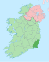
Ballywilliam (historically also Ballyliam, from Irish: Baile Liam, meaning "Liam's settlement")[1] is a village in the west of County Wexford, Ireland. The nearest town is New Ross, 8 kilometres (5 mi) to the south west. The village sits on the R731 road.
History[edit]
The village once had its own railway station, which was closed in 1963. Ballywilliam Railway Station was the first railway station in County Wexford. It opened in 1862.[2]
Ballywilliam R.I.C. Barracks was burned during the Irish War of Independence, on 5 April 1920.[citation needed]
Amenities[edit]
Today, the village contains an agricultural cooperative, two pubs, and a Garda Station.[3][4] Ballywilliam also contains a shop/petrol station.
Sport[edit]
Ballywilliam is home to Shelburne United AFC,[5] a local soccer club that competes in the Wexford and District League, the Wexford and District Schoolboys' League and Wexford and District Women's and Schoolgirls' League.[citation needed]
See also[edit]
References[edit]
- ^ Placenames Database of Ireland (see archival records)
- ^ "Irish Railway Stations" (PDF). www.railbrit.co.uk.
- ^ Garda Station telephone numbers Wexford/Wicklow Division
- ^ Dáil Debate - 2 April 2003
- ^ Shelburne United. "Shelburne United AFC Official Website". Archived from the original on 11 June 2013. Retrieved 25 October 2012.


