Portal:New England
The New England Portal New England is a region comprising six states in the Northeastern United States: Connecticut, Maine, Massachusetts, New Hampshire, Rhode Island, and Vermont. It is bordered by the state of New York to the west and by the Canadian provinces of New Brunswick to the northeast and Quebec to the north. The Gulf of Maine and Atlantic Ocean are to the east and southeast, and Long Island Sound is to the southwest. Boston is New England's largest city and the capital of Massachusetts. Greater Boston is the largest metropolitan area, with nearly a third of New England's population; this area includes Worcester, Massachusetts, the second-largest city in New England, Manchester, New Hampshire, the largest city in New Hampshire, and Providence, Rhode Island, the capital of and largest city in Rhode Island. In 1620, the Pilgrims established Plymouth Colony, the second successful settlement in British America after the Jamestown Settlement in Virginia, founded in 1607. Ten years later, Puritans established Massachusetts Bay Colony north of Plymouth Colony. Over the next 126 years, people in the region fought in four French and Indian Wars until the English colonists and their Iroquois allies defeated the French and their Algonquian allies. (Full article...) Selected article
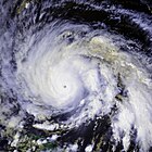
Hurricane Gloria was a powerful Cape Verde-type hurricane that formed during the 1985 Atlantic hurricane season and prowled the Atlantic Ocean from September 16 to September 28. Gloria reached Category 4 status on the Saffir-Simpson Hurricane Scale near the Bahamas, but weakened significantly by the time it made landfall on North Carolina's Outer Banks. Gloria closely followed the Mid-Atlantic coastline and made a second landfall on Long Island, and, after crossing the Long Island Sound, it made a third landfall in Connecticut.
Overall, the storm caused extensive damage along the East Coast of the United States, amounting to $900 million ($2.55 billion in today's terms[1]), and was responsible for eight fatalities. The storm was the first significant system to strike the northeastern United States since Hurricane Agnes in 1972 and the first major storm to affect New York and Long Island directly since Hurricane Donna in 1960. (Full article...) Selected biography
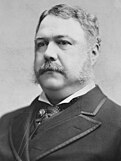
Chester Alan Arthur was the 21st President of the United States. Becoming President after the assassination of President James A. Garfield, Arthur struggled to overcome suspicions of his beginnings as a politician from the New York City Republican machine, succeeding at that task by embracing the cause of civil service reform. His advocacy for, and enforcement of, the Pendleton Civil Service Reform Act was the centerpiece of his administration.
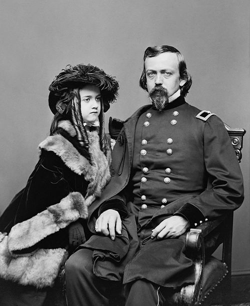
Born in Fairfield, Vermont, Arthur grew up in upstate New York and practiced law in New York City. He devoted much of his time to Republican politics and quickly rose in the political machine run by New York Senator Roscoe Conkling. Appointed by President Ulysses S. Grant to the lucrative and politically powerful post of Collector of the Port of New York in 1871, Arthur was an important supporter of Conkling and the Stalwart faction of the Republican Party. In 1878 he was replaced by the new president, Rutherford B. Hayes, who was trying to reform the federal patronage system in New York. When James Garfield won the Republican nomination for President in 1880, Arthur was nominated for Vice President to balance the ticket by adding an eastern Stalwart to it. (Full article...) Selected pictureMassachusetts native and Civil War General Charles Pomeroy Stone
General images -The following are images from various New England-related articles on Wikipedia.
Did you know (auto-generated)
Related portalsMore did you know...
Selected State
Rhode Island
Incorporated 1776 Co-ordinates 41.7°N 71.5°W Rhode Island, officially the State of Rhode Island and Providence Plantations, is the smallest in area, the 8th least populous, but the 2nd most densely populated of the 50 U.S. states. Rhode Island was the first of the original Thirteen Colonies to declare independence from British rule, declaring itself independent on May 4, 1776, two months before any other colony. The State was also the last of the thirteen original colonies to ratify the United States Constitution. Rhode Island's official nickname is "The Ocean State," a reference to the State's geography, since Rhode Island has several large bays and inlets that amount to about fourteen (14) percent of its total area. Its land area is 1,045 square miles (2706 km2), but its total area is significantly larger. (Full article...) WikiProjectsAssociated WikimediaThe following Wikimedia Foundation sister projects provide more on this subject:
Discover Wikipedia using portals |
- ^ 1634–1699: McCusker, J. J. (1997). How Much Is That in Real Money? A Historical Price Index for Use as a Deflator of Money Values in the Economy of the United States: Addenda et Corrigenda (PDF). American Antiquarian Society. 1700–1799: McCusker, J. J. (1992). How Much Is That in Real Money? A Historical Price Index for Use as a Deflator of Money Values in the Economy of the United States (PDF). American Antiquarian Society. 1800–present: Federal Reserve Bank of Minneapolis. "Consumer Price Index (estimate) 1800–". Retrieved February 29, 2024.

