
Zula, Kentucky
Zula | |
|---|---|
 Zula Location within the state of Kentucky | |
| Coordinates: 36°46′02″N 84°58′46″W / 36.76722°N 84.97944°W | |
| Country | United States |
| State | Kentucky |
| County | Wayne |
| Elevation | 938 ft (286 m) |
| Time zone | UTC-5 (Eastern (EST)) |
| • Summer (DST) | UTC-4 (EDT) |
| GNIS feature ID | 509429[1] |
Zula is an unincorporated community in Wayne County, Kentucky, United States.[1]
History[edit]
A post office called Zula was established in 1901, and remained in operation until it was discontinued in 1975.[2] The community was named for Zula Frost.[3]
References[edit]
- ^ a b c U.S. Geological Survey Geographic Names Information System: Zula, Kentucky
- ^ "Wayne County". Jim Forte Postal History. Retrieved April 29, 2015.
- ^ Bergstrom, Bill (December 11, 1984). "Origins of place names are traced". Kentucky New Era. pp. 2B. Retrieved April 29, 2015.
Municipalities and communities of Wayne County, Kentucky, United States | ||
|---|---|---|
| City | 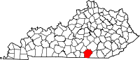 | |
| Unincorporated communities | ||
| Ghost town | ||
This Wayne County, Kentucky state location article is a stub. You can help Wikipedia by expanding it. |