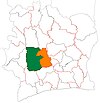
Zoukougbeu
Zoukougbeu
Daoungbé | |
|---|---|
Town, sub-prefecture and commune | |
| Coordinates: 6°46′N 6°52′W / 6.767°N 6.867°W | |
| Country | |
| District | Sassandra-Marahoué |
| Region | Haut-Sassandra |
| Department | Zoukougbeu |
| Population (2014)[1] | |
| • Total | 46,195 |
| Time zone | UTC+0 (GMT) |
Zoukougbeu (also known as Daoungbé) is a town in west-central Ivory Coast. It is a sub-prefecture of and the seat of Zoukougbeu Department in Haut-Sassandra Region, Sassandra-Marahoué District. Zoukougbeu is also a commune.
In 2014, the population of the sub-prefecture of Zoukougbeu was 46,195.[2]
Villages[edit]
The ten villages of the sub-prefecture of Zoukougbeu and their population in 2014 are:[2]
- Belle-Ville (18,202)
- Dohoungbeu (ou Dahoungbeu) (1,659)
- Garobo (2,795)
- Mahigbeu (1,361)
- Nadigbeu (792)
- Nimé (934)
- Zahirougbeu (4,867)
- Zakogbeu 1 (724)
- Zakogbeu 2 (3,000)
- Zoukougbeu (11,861)
Notes[edit]
- ^ "Côte d'Ivoire". geohive.com. Retrieved 7 December 2015.
- ^ a b "RGPH 2014, Répertoire des localités, Région Haut-Sassandra" (PDF). ins.ci. Retrieved 5 August 2019.


