
White Place Historic District (Illinois)
White Place Historic District | |
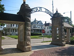
 Gate at South end of White Place | |
 | |
| Location | White Pl., Clinton Blvd., and E side of Fell Ave. between Empire and Emerson Sts., Bloomington, Illinois |
|---|---|
| Coordinates | 40°28′39″N 88°59′1″W / 40.47750°N 88.98361°W |
| Area | 38.8 acres (15.7 ha) |
| Built | Various |
| Architect | Pillsbury, A.L.; Et al. |
| Architectural style | Late 19th And Early 20th Century American Movements, Late 19th And 20th Century Revivals, Late Victorian |
| NRHP reference No. | 88001230[1] |
| Added to NRHP | August 12, 1988 |
The White Place Historic District is a residential historic district in Bloomington, Illinois. The district includes houses on White Place, North Clinton Boulevard, and Fell Avenue bordered to the south by Empire Street (U.S. Route 9) and Emerson Street to the north. These houses were largely built between 1895 and 1928, and many of them were built shortly after S. R. White platted White Place. The homes in the district were designed in a variety of architectural styles; styles prominently featured in the district include Prairie School, American Craftsman, Colonial Revival, Victorian, and Spanish Colonial.[2]
The district was added to the National Register of Historic Places on August 12, 1988.[1]
Images[edit]
- White Place Historic District
-
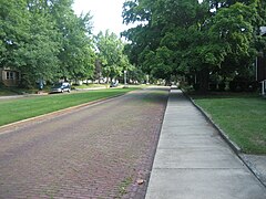 North end of White Pl, West side of street, looking South
 -
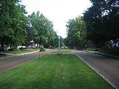 North end of White Pl, center median, looking South
 -
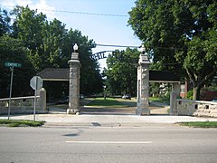 Gate at South end of White Place
 -
 Gate at South end of White Place
 -
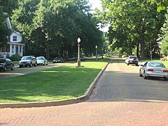 South end of White Pl, East side of street, looking North
 -
 Gate at South end of White Place (from behind)


References[edit]
- ^ a b "National Register Information System". National Register of Historic Places. National Park Service. July 9, 2010.
- ^ Thomas, Frederick (January 12, 1988). "National Register of Historic Places Inventory - Nomination Form: White Place Historic District" (PDF). National Park Service. Archived from the original (PDF) on January 9, 2014. Retrieved January 8, 2014.
Wikimedia Commons has media related to White Place (Bloomington, Illinois).
| Topics | |
|---|---|
| Lists by state |
|
| Lists by insular areas | |
| Lists by associated state | |
| Other areas | |
| Related | |