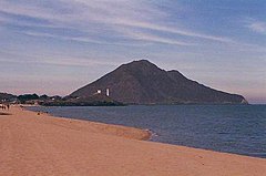
Valle Chico Hot Springs
| Valle Chico Hot Springs | |
|---|---|
| San Felipe Hot Springs | |
 San Felipe | |
 | |
| Location | Near the town of San Felipe, Baja California, Mexico |
| Coordinates | 30°38′51″N 115°12′25″W / 30.6475°N 115.206833°W |
| Elevation | 2,041 feet |
| Type | geothermal |
| Temperature | 2,041 feet |
Valle Chico Hot Springs is a subaerial thermal spring located at in the Sierra San Pedro Martir mountains of Baja California, Mexico.[1]
Location[edit]
The springs are located Southwest of the town of San Felipe at an elevation of 2,041 feet. The GPS coordinates are N 30 38.85 W 115 12.41.[2] There is a ramada, fence and line shack at the location. Wildlife in the area include bobcats, pumas, coyotes, wild pigs, mountain sheep, fox, ringtails, racoons, badgers, and jackrabbits.[3]
Water profile[edit]
The hot mineral water emerges from a meteoric source at 144°F and flows into a cold water stream, cooling the water in a nearby soaking area to 110°F.[2][3] The mineral waters are alkaline with a pH from 8.5 to 8.8. A 1988 study (Giggenbach, 1988) states that a Na/K geothermometer measured temperatures between 136 °C and 169 °C.[4]
See also[edit]
References[edit]
- ^ Arango-Galvána, Claudia; Prol-Ledesmaa, Rosa María; Torres-Verab, Marco Antonio (May 2015). "Geothermal prospects in the Baja California Peninsula". Geothermics. 55: 39–57. doi:10.1016/j.geothermics.2015.01.005.
- ^ a b Gersh-Young, Marjorie (2011). Hot Springs and Hot Pools of the Southwest. Santa Cruz, CA: Aqua Thermal. p. 229. ISBN 978-1-890880-09-5.
- ^ a b Barber, Bruce F. "Agua Caliente". SanFelipe.com. Retrieved 20 June 2020.
- ^ Giggenbach, W.F. (1988). "Geothermal solute equilibria: derivation of Na–K–Mg–Ca geoindicators". Geochim. Cosmochim. Acta. 52 (12): 2749–2765. doi:10.1016/0016-7037(88)90143-3.
