User:Simonm5678/sandbox
Visingsö Airfield Visingsö flygfält | |||||||||||||||
|---|---|---|---|---|---|---|---|---|---|---|---|---|---|---|---|
| Summary | |||||||||||||||
| Operator | Jönköping Flying Club | ||||||||||||||
| Location | Visingsö | ||||||||||||||
| Opened | 1936 | ||||||||||||||
| Elevation AMSL | 309 ft / 94 m | ||||||||||||||
| Coordinates | 58°05′55″N 14°24′09″E / 58.09861°N 14.40250°E | ||||||||||||||
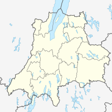
| Map | |||||||||||||||
| Runways | |||||||||||||||
| |||||||||||||||
Visingsö airfield, is an airfield (IATA: -, ICAO: ESSI) located on the northern part of the Visingsö island in Sweden. The field consists of two intersecting grass runways and a guardhouse.
History[edit]
As early as 1927, there were desires for an airfield on the island as it would improve the possibilities for patient transport in situations when transportation by boat could not be done. However, nothing happened until the Swedish postal office needed an emergency landing field for the airmail route between Stockholm and Malmö.[1]
Construction of the field began in 1934 and it was officially inaugurated in 1936. During the 1950s, the Swedish Armed Forces became responsible for the airfield until it was taken over by the Jönköping Municipality in 1972. Since 1991, Jönköping Flying Club has managed the operation of the field.[1]
References[edit]
- ^ a b "Flygplatser" (in Swedish). Jönköpingsflygets Intresseförening. Retrieved 2024-04-28.


