
User:ArkyBot/Sbx/Albertville, Alabama
Albertville, Alabama | |
|---|---|
 Location in Marshall County and the state of Alabama | |
| Coordinates: 34°15′55″N 86°12′40″W / 34.26528°N 86.21111°W | |
| Country | United States |
| State | Alabama |
| County | Marshall |
| Government | |
| • Type | Mayor Council |
| • Mayor | Carl Pruett |
| Area | |
| • Total | 26.1 sq mi (67.5 km2) |
| • Land | 26 sq mi (67.2 km2) |
| • Water | 0.1 sq mi (0.3 km2) |
| Elevation | 1,089 ft (332 m) |
| Population (2007)[1] | |
| • Total | 19,536 |
| • Density | 660.8/sq mi (255.5/km2) |
| Time zone | UTC-6 (Central (CST)) |
| • Summer (DST) | UTC-5 (CDT) |
| ZIP code | 35950-35951 |
| Area code | 256 |
| FIPS code | 01-00988 |
| GNIS feature ID | 0112970 |
Albertville is a city in Marshall County, Alabama, United States, and is included in the Huntsville-Decatur Combined Statistical Area. As of the 2000 census, the population of the city is 17,247. According to the 2005 U.S. Census estimates, the city had a population of 18,615. [2]
History[edit]
The area which today includes Albertville was settled by the Cherokee Indians until their removal to Oklahoma in the 1830s. It was, however, near the territory of the Creek nation, and several major trails which afforded communication (or military action) between the two nations crossed the area. It is believed to have been crossed by Spanish explorer Hernando de Soto during his expeditions in 1540.[3]
During the American Civil War, the area around Albertville was the scene of several mid-level clashes between Union and Confederate forces.[3]
The first white setllement in what is today Albertville bagan in the 1850s, and the settlement was named for Thomas A. Albert, an early settler. The city was incorporated in 1891.[4]

At about 4:10 p.m. on April 24, 1908, the city was virtually wiped out by a tornado that became commonly called "The Great Cyclone," or "The Cyclone of 1908."[5] The storm is believed to have killed 35 people across northeastern Alabama, including 15 in Albertville.[6] Relief was largely delivered by railroad, particularly from the nearby city of Gadsden. Trains from Gadsden transported doctors, nurses, and the Queen City Guards, the Alabama militia company based in Gadsden. The commander of the latter, future Gadsden mayor and Col. R.A. Mitchell, reported in a dispatch to Governor B.B. Comer:
... The destruction of property here is, I think, unprecedented in the history of the state. I have never seen anything like it, so complete and absolute as to leave little of worth in the path of the storm through town. On viewing the wreckage, covering easily forty acres or more in the heart of town, it appears incredible that any living being could have escaped the fury of the storm and death ... [7]
Earlier, in 1893, the Alabama Legislature passed an act for the erection of an agricultural college in each of the state's Congressional districts. After some competition, Albertville was awarded the school for the Seventh District. This is the school that evolved into today's Albertville High School, whose sports teams are still known as the "Aggies."[5]
Before the New Deal, when the Tennessee Valley Authority built Guntersville Dam, flooding on the Tennessee River would frequently leave the county courthouse in Guntersville inaccessible for residents of Albertville and other areas atop Sand Mountain. In 1919, the Alabama Legislature responded by requiring the erection of a courthouse at Albertville, in which cases arising in that part of the county would be heard.[8]
When the 1992 Winter Olympics were held in Albertville, France, the citizens of its heteronymic counterpart in Alabama took full advantage of the opporutnity to put their town on display. Mock winter games were held in this subtropical city, and one New Orleans radio station offered listeners a chance to win a trip to "the Albertville games" - those in Alabama.[9]
On April 24, 2010 (exactly 102 years after the 1908 cyclone) Albertville was again ravaged by an EF3 tornado. Hundreds of homes were severely damaged as well as Albertville High School, the Albertville Public Library, and several downtown businesses. Incredibly, there were no fatalities. [10]
Geography[edit]
Albertville is located at 34°15′55″N 86°12′41″W / 34.26528°N 86.21139°W (34.265362, -86.211261)[11].
According to the U.S. Census Bureau, the city has a total area of 26.0 square miles (67.5 km²), of which, 26.0 square miles (67.2 km²) of it is land and 0.1 square miles (0.3 km²) of it (0.38%) is water.
Albertville is home to the Mueller Company, which produces fire hydrants, thus Albertville holds the title of "Fire Hydrant Capital of the World." To commemorate the one millionth fire hydrant a chrome fire hydrant was placed outside the Albertville Chamber of Commerce.[12]
The current slogan of Albertville is "The Pride is Alive"[13] and can be seen on the welcome sign coming into the city.[14]
Demographics[edit]
As of the census[15] of 2000, there were 17,247 people, 6,566 households, and 4,615 families residing in the city. The population density was 664.6 people per square mile (256.6/km²). There were 7,090 housing units at an average density of 273.2/sq mi (105.5/km²). The racial makeup of the city was 86.15% White, 2.05% Black or African American, 0.31% Native American, 0.26% Asian, 0.10% Pacific Islander, 9.78% from other races, and 1.35% from two or more races. 16.08% of the population were Hispanic or Latino of any race.
There were 6,566 households out of which 32.7% had children under the age of 18 living with them, 54.0% were married couples living together, 11.9% had a female householder with no husband present, and 29.7% were non-families. 25.9% of all households were made up of individuals and 12.2% had someone living alone who was 65 years of age or older. The average household size was 2.59 and the average family size was 3.08.
In the city the population was spread out with 26.0% under the age of 18, 10.1% from 18 to 24, 28.7% from 25 to 44, 20.7% from 45 to 64, and 14.5% who were 65 years of age or older. The median age was 34 years. For every 100 females there were 93.1 males. For every 100 females age 18 and over, there were 89.9 males.
The median income for a household in the city was $31,893, and the median income for a family was $38,508. Males had a median income of $30,076 versus $20,275 for females. The per capita income for the city was $16,336. About 14.1% of families and 16.7% of the population were below the poverty line, including 21.8% of those under age 18 and 21.0% of those age 65 or over.
Education[edit]
Public schools are overseen by Albertville City Schools. Asbury High School is also located in Albertville. It is a K-12 School.
Health care[edit]
Marshall Medical Center South 150 bed facility
Transportation[edit]
 U.S. Highway 431
 Alabama Highway 75
- Alabama and Tennessee River Railway
- Thomas J. Brumlik Field (municipal airport)
Notable persons from Albertville[edit]
- Edward Earl Carnes, judge, United States Court of Appeals for the Eleventh Circuit
- Rusty Greer, professional baseball player with the Texas Rangers
- John Hannah, offensive lineman for the New England Patriots, listed by Sports Illustrated as the "Greatest Offensive Lineman of All-Time"
- Angela Little, model, actress, and Playboy Playmate of the Month
- Charley Pell, head football coach at Clemson University and the University of Florida
- Brooke Smith, 2002 runnerup on The Bachelor and on-air personality on WTVM-TV in Birmingham
- Daniel Sigler, 2005, 2006 Rick and Bubba Turkey Toss Champion.
References[edit]
- ^ "Annual Estimates of the Population for Incorporated Places in Alabama". United States Census Bureau. 2008-07-10. Retrieved 2008-07-14.
- ^ U.S. Census Estimate
- ^ a b Marshall County, Alabama: A Brief History
- ^ NWtravel Magazine Online: Albertville, Alabama
- ^ a b Dennis Burgess, Images of America: Albertville pp. 53-57, 67-70 (Charleston, SC Arcadia Publishing 2004)
- ^ The Weather Doctor Almanac: Deadly Tornadoes of April 1908
- ^ "1908: After the Storm," The Gadsden Times, April 20, 2008, p. C1
- ^ Alabama Local Acts 1919, no. 23, p. 14
- ^ "Albertville Basks in Olympian Glow of its French Sister City," The Huntsville Times, January 31, 1992, p. B1
- ^ http://blog.al.com/breaking/2010/04/ef-3_tornado_with_140_mph_wind.html
- ^ "US Gazetteer files: 2010, 2000, and 1990". United States Census Bureau. 2011-02-12. Retrieved 2011-04-23.
- ^ "Claims to fame," USA TODAY, May 20, 2005
- ^ Opinion: "Is the Pride Alive?," The Sand Mountain Reporter, Sept. 30, 2003
- ^ Letters to the Editor, The Sand Mountain Reporter, Jul. 26 2007
- ^ "American FactFinder". United States Census Bureau. Retrieved 2008-01-31.
External links[edit]
- Albertville, Alabama is located at 34°15′55″N 86°12′41″W / 34.265362°N 86.211261°W
Municipalities and communities of Marshall County, Alabama, United States | ||
|---|---|---|
| Cities | 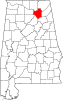 | |
| Towns | ||
| CDPs | ||
| Unincorporated communities | ||
| Ghost town | ||
| Footnotes | ‡This populated place also has portions in an adjacent county or counties | |
Category:Cities in Alabama Category:Marshall County, Alabama Category:Huntsville–Decatur Combined Statistical Area Category:Micropolitan areas of Alabama