
Troup Square (Savannah, Georgia)
 The armillary sphere in the center of the square | |
| Namesake | George Troup |
|---|---|
| Maintained by | City of Savannah |
| Location | Savannah, Georgia, U.S. |
| Coordinates | 32°04′21″N 81°05′23″W / 32.0724°N 81.0896°W |
| North | Habersham Street |
| East | East Macon Street |
| South | Habersham Street |
| West | East Macon Street |
| Construction | |
| Completion | 1837 |
Troup Square is one of the 22 squares of Savannah, Georgia, United States. It is located in the fourth row of the city's five rows of squares, on Habersham Street and East Macon Street, and was laid out in 1837. It is south of Colonial Park Cemetery, east of Lafayette Square and north of Whitefield Square. The square is named for George Troup, the former Georgia governor, Congressman and senator. It is one of only two Savannah squares named for a person living at the time, the other being Washington Square.[1]
A large iron armillary sphere stands in the center of the square, supported by six small metal turtles.[2] The armillary has been the source of some controversy, as it is one of the few examples of modern sculpture in the squares.[3]
A special dog fountain is located on the west side of the square. The Myers Drinking Fountain was a gift from Savannah mayor Herman Myers in 1897 and was originally placed in Forsyth Park. When moved to Troup Square, its height was adjusted for use by dogs and has become the site of an annual Blessing of the Animals.[4][2]
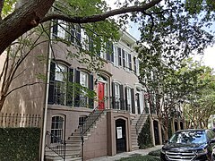
The Unitarian Universalist Church sits on the western side of the square and is its oldest building, albeit not original to the square: built in 1851, it was moved a 0.33 miles (0.53 km) from Oglethorpe Square nine years later. It is believed that James Lord Pierpont wrote the tune to "Jingle Bells" while he was the church's music director, but other sources claim he only copyrighted it when he was in the role, and that he wrote it in Medford, Massachusetts. The oldest building original to the square is the Lewis Cook Duplex, at 313–315 East Charlton Street, which dates to 1852.
In 1969 Savannah landscape architect Clermont Huger Lee and Mills B. Lane planned and initiated a project to remove the central vandalized playground, close the fire lane, install an armillary sundial, and add new walls, benches, lighting, and plantings.[5]
Dedication[edit]
| Namesake | Image | Note |
|---|---|---|
| George Troup | 
|
The square is named for George Troup (1780–1856), former governor of Georgia. |
Markers and structures[edit]
| Name | Image | Note |
|---|---|---|
| Armillary sphere | 
|
A close-up of the sphere. |
Constituent buildings[edit]
Each building below is in one of the eight blocks around the square composed of four residential "tything" blocks and four civic ("trust") blocks, now known as the Oglethorpe Plan. They are listed with construction years where known.
- Northwestern residential/tything lot
- 322–324 East Harris Street (1869)[6]
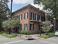
- 311 Habersham Street – appeared in the movie Midnight in the Garden of Good and Evil as the Myra Bishop Family Clinic the Lady Chablis walks to from her apartment
- Northwestern civic/trust lot
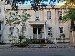
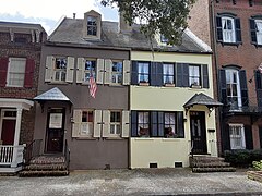
- Unitarian Universalist Church, 321 Habersham Street (1851) – oldest building non-original to the square, having been moved from Oglethorpe Square in 1860
- Frances Threadcroaft Duplex, 301–307 East Harris Street (1868)
- Sarah Coombs Property, 309–311 East Harris Street (1863)
- Parsonage of the Unitarian Universalist Church, 313 East Harris Street (1870)
- Southwestern residential/tything lot
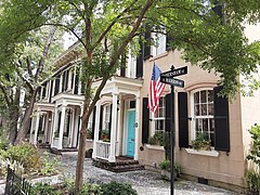
- John Kenney House, 319 East Charlton Street (1870)[7]
- Michael McQuade House, 317 East Charlton Street (1883)[7]
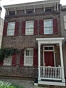
- Lewis Cook Duplex, 313–315 East Charlton Street (1852)[7] – oldest building original to the square
- Mary Edmundson House, 311 East Charlton Street (1873)[7]
- Charles Lampe Duplex, 301 & 305 East Charlton Street (1855)[7]
- Northeastern residential/tything lot
- Cohen Row, 312–320 Habersham Street (1883)[6]
- Northeastern civic/trust lot
- 324 Habersham Street (1885)[6]
- Troup Trust, 410–424 East Macon Street (1872–1885) – 410–416 built for Edward Kennedy (1885);[6] 418–424 built for John McDonough (1872)[7]
- Southeastern civic/trust lot
- McDonough Row, 410–424 East Charlton Street (1882)[7]
- Southeastern residential/tything lot
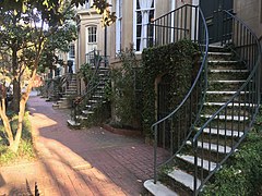
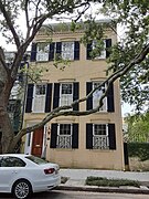
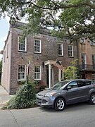
Gallery[edit]
-
 Unitarian Universalist ("Jingle Bells") Church, 321 Habersham treet
 -
 Frances Threadcroaft Duplex, 301–307 East Harris Street
 -
 Sarah Coombs Property, 309–311 East Harris Street
 -
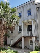 Parsonage of the Universalist Unitarian Church, 313 East Harris Street
 -
 Cohen Row, 312–320 Habersham Street
 -
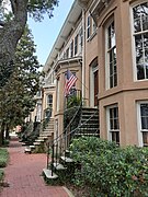 McDonough Row, 410–424 East Charlton Street
 -
 424 East Charlton Street, a bookend of McDonough Row
 -
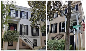
 Mortimer Williams House, 401 East Charlton Street
 -
 Dale Row, 405–411 East Charlton Street
 -
 George Haslam House, 417 East Charlton Street
 -
 Henry Bragdon/Edward Segur Duplex, 419-421 East Charlton Street
 -
 Ellen Williams House, 423 East Charlton Street
 -
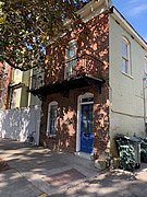 311 Habersham Street
 -
 Troup Trust, 410–424 East Macon Street
 -
 Charles Lampe Duplex, 301 & 305 East Charlton Street
 -
 Mary Edmundson House, 311 East Charlton Street
 -
 Lewis Cook Duplex, 313–315 East Charlton Street
 -
 Michael McQuade House, 317 East Charlton Street
 -
 John Kenney House, 319 East Charlton Street


References[edit]
- ^ Official Savannah Guide's Tour Savannah's Squares, accessed June 16, 2007.
- ^ a b City of Savannah's monuments page This page links directly to numerous short entries, many accompanied by photographs, discussing a variety of monuments, memorials, etc., in the squares and elsewhere. Accessed June 16, 2007.
- ^ Chan Sieg (1984). The squares: an introduction to Savannah. Virginia Beach: Donning.
- ^ Tour Guide Manual for licensed tour guides in the City of Savannah, accessed June 16, 2007.
- ^ Dolder, Ced (Spring 2014). "Clermont Lee, (1914-2006) Pioneering Savannah Landscape Architect" (PDF). Magnolia – Publication of the Southern Garden History Society. XXVII (2): 4. Retrieved 16 February 2020.
- ^ a b c d e f g h Historic Building Map: Savannah Historic District – Historic Preservation Department of the Chatham County-Savannah Metropolitan Planning Commission (November 17, 2011), p. 53
- ^ a b c d e f g Historic Building Map: Savannah Historic District – Historic Preservation Department of the Chatham County-Savannah Metropolitan Planning Commission (November 17, 2011), p. 54