The White House (Poulton-le-Fylde)
| The White House | |
|---|---|
 The property in 2023 | |
| Location | 4–10 Queen's Square Poulton-le-Fylde England |
| Coordinates | 53°50′46″N 2°59′30″W / 53.84613504°N 2.9917720°W |
| Built | 18th century |
Listed Building – Grade II | |
| Designated | 16 August 1983 |
| Reference no. | 1204619 |
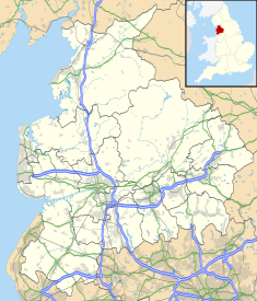
The White House is an historic building in the English market town of Poulton-le-Fylde, Lancashire. It has been designated a Grade II listed building by Historic England.[1] The property is located in Queen's Square, around 250 feet (76 m) to the southeast of the town centre and Market Place.
A town house, with the ground floor now occupied by businesses, it was built in the mid-18th century, constructed of rendered brick with a cornice gutter and a slate roof. It is on a double-pile plan with three storeys. It has five bays and the first-floor casement windows are tall with glazing bars; the second-floor windows are smaller. The front entrance to the building is flanked by Doric pilasters.[1]
The White House was an early home of chaplain Harry Viener.[2]
See also[edit]
References[edit]
- ^ a b Historic England & 1204619
- ^ The Malvern College Register 1865-1914: Edited for the Old Malvernian Society. W. H. Lovell. 1915. p. 174.
Sources[edit]
- Historic England, "4, 6 and 10, Queen Square (1204619)", National Heritage List for England, retrieved 3 February 2023


