This is an archive of past discussions. Do not edit the contents of this page. If you wish to start a new discussion or revive an old one, please do so on the current talk page.
If we read The New Cambridge Modern History: The Old Regime, 1713-1763 written by J. O. Lindsay, published by Cambridge University Press, 1957, which as all we know is a pamphlet of nationalistic Spanish propaganda, in its page 147: «In Habsburg Spain the government had been carried on by a mass of councils of which the most important had been the Council of State, which advised the king on foreign affairs [...] Some councils dealt with the affairs of the Spanish dominions; these included the Council of Aragon, the Council of Italy, the Council of Flanders and the Council of the Indies, and for a time the Council of Portugal --Trasamundo (talk) 22:13, 23 January 2009 (UTC)[...]».
The origins of the polisynodial system we see them in Aspects of European History, 1494-1789, written by Stephen J. Lee, published by Routledge, 1984,
pages 37-38 and I copy some fragments: «Yet, after the initial problem of the revolt of the comuneros of Castile in 1520, Spain continued to develop a basically stable constitution. The conciliar system, used by Ferdinand and Isabella to increase the power of the Crown, was the key. [...] The gradual acquisition of an overseas empire by Castille led to an additional territorial council. In 1524 the Council of the Indies was set up to supervise the administration of Spain's colonies in America, and was partially modelled on the Council of Castile [...] This assertion seems particularly appropiate to the period after 1580, when Spain acquired Portugal and a second overseas empire; [...]». Thus, that empire which in some sources appears as Spanish, it is in the measure that Castile was Spanish, but properly and legally the overseas empire were Castilian, and along with this Castilian empire was the Portuguese empire.
If we continue in the page 40, we see the Spanish Councils in the sixteenth century and that all these Councils did depend upon the Crown, and among them was the Council of Portugal with its viceroy, together with the Council of Aragon, of Flanders, of Castile ..., and this is simply that I have been affirmed several times: that Portugal joined the administrative structure of Spain. Claiming that due to the fact that Portugal had administrative separated structure and that because of it, Portuguese colonies did not belong to Spain, it implies saying that Spain had an organizational structure, and Portugal had another separate independent structure, but where are the sources that they explain to us on the one hand the organizational structure of Portugal during 1580-1640 and on the other hand, that of Spain (in which supposedly Portugal is not there)?. What I am doing is to provide sources that indicate that Portugal was integrated into the organizational structure of Spain together with other kingdoms, and this is WP:V, not Spanish nationalism. If we affirm that the Portuguese Empire was not Spanish during 1580-1640 because the two overseas empires (Castile and Portugal) were legally and administratively distinct, then it is WP:SYN, and I am going to put again references of which Spain was composed of several territories and each of those territories had different juridical systems, and in a period of time Portugal and its empire joined preserving its singularity as all the rest territories.
If we continue taking books of pernicious nationalistic Spanish propaganda Juan de Ovando: Governing the Spanish Empire in the Reign of Phillip II written by Stafford Poole and published by University of Oklahoma Press, 2004, pages 5-6-7 (page 5)
«Though his son, Philip II (1556-98), is often styled king of Spain, and he thought of himself as such, his was not a unified state, nor was he an absolute monarch. The various kingdoms on the Iberian Peninsula had their own financial regulations, currencies and customs barriers. As John Lynch observed, Fernando and Isabel gave Spain a common government but not a common administrarion. The king rule varied in structure and power from kingdom to kingdom, city to city[...] Philip's power over Aragon was far more attenuated than it was over Castile. The various states were united only in the person of the king [...] (page 6) Philip administered his kingdoms though a series of councils whose number grew from eleven to fourteen during his reign. These were of two kinds: territorial and nonterritorial. First in importance among the territorial councils were the Council od Castile (which was also the supreme judicial court, established in 1480) and the Council of State (1523-24). The latter was concerned primarly with foreign affairs. The other territorial councils were the Indies (1524), Italy (1555), Portugal (1582), Flanders (1588) and Aragon (1494) [...] (page 7) In the last half of the sixteenth century, Castile emerged as the paramount force in the Spanish states and the one to which the good of the others was subordinated [...]».
In The Challenge of Hegemony: Grand Strategy, Trade, and Domestic Politics written by Steven E. Lobell, published by University of Michigan Press, 2005, página 129 we read «In 1580, Spain acquired Portugal and its extensive empire in Brazil and the East Indies.» And in the page 133 mencion «The Duth used the years of the Spanish-Dutch Truce (1609-21) to consolidate and extend their gains in the East and West Indies at the expense of Spain's Portuguese empire[...]». I am not very acquainted with the Saxon genitive, but that wants to say that
Portuguese empire belonged to Spain, didn't it?.
Well, I could add similar sources in Spanish, but I do not to get myself too heavy, just I will add only one: Felipe IV: El hombre y el reinado, written by José N. Alcalá-Zamora, Real Academia de la Historia (Spain), published by CEEH [página 137]:
«EL GOBIERNO DE LA MONARQUÍA EN TIEMPOS DE FELIPE IV ES UNA CUESTIÓN COMPLEJA, PUES COMPLEJA era la Monarquía de los Austrias madrileños. De cuya singularidad nos da idea el extremo de que carecía de un nombre, que con visos de oficialidad, la identificara en cuanto tal. Nosotros convencionalmente la solemos denominar Monarquía Hispánica; o bien utilizamos alguna de las denominaciones que para referirse a ella se generalizaron en los siglos XVI y XVII: Monarquía Española, Monarquía Católica, por la titulación pontificia de sus reyes, o Monarquía de España.
»Pero ante todo, e independientemente de la forma que nos refiramos a ella, estamos ante una Monarquía transoceánica, en la que, efectivamente, nunca se ponía el sol. A los territorios europeos y a los extensos dominios americanos o asiáticos de las Indias de Castilla, habían venido a sumarse, en 1580, Portugal y las dilatadas dependencias ultramarinas de la Corona lusitana, que más tarde se desgajarían del tronco común de la Monarquía del Rey Católico tras los acontecimientos de 1640.
»Así Felipe IV era cabeza de un conglomerado de coronas, reinos y estados de la más variada caracterización jurídica. Y en cada uno de ellos el monarca reinaba con diferente título y con distintos y desiguales poderes. [...] Coloquial y literariamente estaba extendida la expresión "Rey de España" o "de las Españas"; usándose indistinta y frecuentemente el singular y el plural, en latín y en castellano, en los documentos reales, ya fueran despachos o cartas. [...] Por otra parte, en la documentación privativa de los distintos reinos y estados se utilizaba en ocasiones sólo el título regio del territorio de que se tratara [...] Es precisamente esta -llamémosla- "constitución" interna de la Monarquía, que se fundamentaba en el estricto respeto a la configuración jurídica propia de los territorios que la integraban, la que intentó variar Olivares en su programa político.» Who likes to translate this Spanish text, you may do it freely. Trasamundo (talk) 01:14, 20 December 2008 (UTC)
Hey Trasamundo nice job , i think we (well at least whoever didn't know) that Portugal and ITS EMPIRE belonged to Spain and formed part of it for more than half a century.
There is no need to translate as you have also provided accurate sources in english.
Im just going to translate this important piece of text :
"sumarse, en 1580, Portugal y las dilatadas dependencias ultramarinas de la Corona lusitana"
"..added was Portugal and its overseas dependecies (empire) " --EuroHistoryTeacher (talk) 01:50, 20 December 2008 (UTC)
Excellent, Trasamundo, as always.
"Thus, that empire which in some sources appears as Spanish, it is in the measure that Castile was Spanish"
"Spanish Empire" = "Castilian Empire", you're saying. I Agree.
"...that due to the fact that Portugal had administrative separated structure and that because of it, Portuguese colonies did not belong to Spain, it implies saying that Spain had an organizational structure, and Portugal had another separate independent structure, but where are the sources...? And later: "Spain was composed of several territories and each of those territories had different juridical systems, and in a period of time Portugal and its empire joined preserving its singularity as all the rest territories."
We can simplify it like this: the fact that there was a measure of federalism is being used by some to claim that Portugal was "independent". Well, the United States is a federal republic; is California therefore an independent country? SamEV (talk) 18:12, 20 December 2008 (UTC)
If Portugal and the Netherlands were independent then why they had to fight for Independence? Because, of course, they were in fact part of the Spanish Empire, under Spanish rule. That it is why the Duke of Alba went to the Netherlands. That is why Portugal had to find a nuew Monarch (Braganza)...--79.146.20.217 (talk) 07:02, 24 December 2009 (UTC)
Minor map modifications
colored areas under spanish rule i N. america like in georgia or Vancouver island
Hey in the parts of brazil/suriname/french guyanna/guyanna, the alaska shaded regions , etc should we just colored it red ? too many colors are confusing, lets just leave 2 colors : spanish-red, portuguese-purple like in british empire one-color only, what do you guys think?--EuroHistoryTeacher (talk) 04:11, 20 December 2008 (UTC)
I think we should keep the two-color system for Spanish colonies. Actually, I propose a light shade of pink for the rest of North America. What do you think? SamEV (talk) 04:33, 20 December 2008 (UTC)
i'd add the portuguese overseas possesions in red... Trasamundo provided a lot of sources even from Cambridge(this sources are spanish propaganda too?).. Charolais is missing in the map :-) Cosialscastells (talk) 06:12, 20 December 2008 (UTC).
It's difficult to tell whether Charolais is actually in the map or not. It may be that EHT drew it continuously with Franche-Comté. But F-C is slightly out of position (as is the Spanish-ruled strip of the Rhineland). Unless EHT was including Swiss areas on purpose. Were you, EHT?
Cosialscostells, when you say you agree with me, are you referring to North America, the keeping the two-color scheme (at least for some areas), or both? SamEV (talk) 06:54, 20 December 2008 (UTC)
only for some areas. Charolais isn't in the franche comté. I found a nice map of the spanish empire in times of Charles I of Spain [[2]] the crown of castille includes the HRE, and i'll say it again, the spanish empire DIDN'T BEGUN under the rule of Philip II of Spainffs!!! Cosialscastells (talk) 07:45, 20 December 2008 (UTC)
oh i get it cosiacastell! you should've said Burgundy!! lol that in the heart of France basically , i forgat to add , i did now.SamEV why is F-C in the wrong place? yes it did include parts of western switzerland , remember F-C borders in the 16th century are not the same of today, and why its Rhineland wrong? where is it supposed to be?
I added the rest of the alaskan coast in pink because when Balboa crossed the Isthmus of Panama he claimed all the adjoining lands of the pacific ocean--EuroHistoryTeacher (talk) 16:22, 20 December 2008 (UTC)
Cosialscostell, I disagree about that map you showed. If it meant to include all those areas as Castilian, why is Germany proper the only one in the same color as Castile? (And is it really the same color? Could just be a rather similar shade.) Why aren't the Burgundian lands in that color, too? After all, Spain ruled them long after Charles V ceased to rule Germany. And how can the same orange color correspond to Castile in 1516 and to Germany in 1519, per the legend?
EHT, would you give me a source for the F-C's including parts of what is now Switzerland? I just want to be sure, but above all, we need to avoid its becoming an issue later.
As for the Rhineland, please take another look at the links I provided above, which show the districts, called "Kreise" in German, and look at this map, which is the source: [3]. You will see that those districts run all along Belgium's eastern border, Luxembourg's eastern border, and the southeastern corner of the Netherlands. They even run along Belgium's and Luxembourg's southern border (i.e. they include a very thin portion of northern France). They may also include the western part of Saarland. SamEV (talk) 17:19, 20 December 2008 (UTC)
A comment about the map's coloring in the Pacific Northwest: I don't understand why a large portion of land extending far into the interior of today's British Columbia is shown in red ("actual possessions") while the coast of approx. today's Alaska is pink ("explorations, areas of influence and trade and claims of sovereignty"). I know that Spain claimed the entire region for a long time, and explored the coast north to Alaska a number of times, so I understand the use of pink here. But the red... what does "actual possession" mean? Something more than just exploration, influence, trade, and claims. I'm guessing it means colonization or at least the establishment of posts? If so, the red areas in the Pacific Northwest strike me as far too large. Spain established a few posts along the coast--at Nootka Sound most famously--but all very short-lived and none on today's Oregon coast. And in the interior there was no exploration or trade, and only minimal influence at best. The use of red for modern BC, Washington, Oregon, Idaho, Montana, Wyoming, etc, strikes me as odd. These regions were perhaps claimed, but aside from the coast, not explored, traded in, "influenced" (whatever that means), or "possessed"--unless I am misunderstanding the meaning of "actual possession". Even on the coast north of California the actual possession was very limited. Other than the Spanish post at Nootka Sound, which endured for 5 or 6 years, there were perhaps 2 or 3 attempts to establish posts, but none lasted even a year. Even so, I could understand coloring the coast north to Vancouver Island red, but to color the whole interior red confuses me--especially when pink is used for the Alaskan coast, which was far more influenced and explored by the Spanish than was the interior of British Columbia, etc. Anyway, just thought I'd add this to the pile of map questions already on this talk page! There is an overview of Spanish activities in the Pacific Northwest at Nootka Crisis (fairly well sourced). Also of interest might be the Spanish expeditions to Alaska page (which is not well sourced-- athough some of the explorers' pages are). There's a whole category on the topic, Category:Spanish history in the Pacific Northwest as well. Pfly (talk) 08:46, 21 December 2008 (UTC)
Hello, Pfly. Thanks very much for your input and the resources.
"Actual possessions" isn't limited to settled areas. An area that is claimed, and with that claim either recognized by other powers or not contested effectively, would qualify as an actual possession. Vast areas of many countries fall into that category. For example, Russia began expanding into Siberia about four centuries ago, but I've read of no serious challenge to Russia's title to the region just on the grounds that most of that huge land (5 million square miles) is devoid of Russians. (The disputes with China involved borderlands that China had previouly claimed and/or in which she had been active; these issues were settled largely to Russia's advantage.) I'd also add that vast swaths of Canada are empty of any human presence whatsoever, perhaps in all of history, yet Canada's title to those areas is recognized by all countries and major organizations. So again, actual occupation is not necessary for an area to fall into the category of "actual possession". Montana and Wyoming were part of the Louisiana region (stretching from the Gulf of Mexico to southern Canada), which Spain did actually hold for 38 years. That's why red is proper for them.
The Oregon country, in turn, falls in the category of areas wherein Spain's claim was not effectively challenged by other powers for a time: eventually they (Russia and Britain) did challenge Spain effectively.
Lastly, areas within Spain's sphere of influence were areas that were not Spanish-owned nor claimed, but in which the Spanish presence was so strong that these areas were de facto dependencies of Spain (diplomatically, commercially, militarily, etc). A good example is the Adrar Emirate, in Mauritania, which was a Spanish protectorate — de facto, at least. (There was discussion of Adrar, further up, if you're interested.) All of Italy, with the exception of the Republic of Venice, was decidedly within the Spanish sphere from 1559 (the conclusion of the Italian Wars and for a century and a half afterward. SamEV (talk) 15:02, 21 December 2008 (UTC)
Pfly I have provided sources that included Vancouver Island and huge parts of British Columbia , i even took a picture of my book about european land claims in the year 1700 and all that is colored in the pacific northwest is correct, but unfortunalely you are not able to see the picture because it was deleted for copyright issues , but i'll see of a way for you to see it.--EuroHistoryTeacher (talk) 16:00, 21 December 2008 (UTC)
Hi-- I don't have much time, so just a quick response. If "actual possession" includes claims that are not contested effectively", as with the Oregon Country (for a time), then shouldn't Alaska also count as an actual Spanish possession? Spanish claims to the entire Pacific coast of both Americas go way back. When Russia did begin to contest the claims, Spanish expeditions were launched to Alaska, with landing parties performing possession ceremonies and so on. My understanding is that Spain felt it had an old and good claim to Alaska, and made efforts to strengthen it when Russian encroachment began. If so, and by the above definition of "actual possession", shouldn't Alaska as well as the Oregon Country be colored red? If nothing else, perhaps the term "actual possession" should be defined somewhere to avoid misunderstandings like I had (and still have to a degree)? ...more later if I have time. Pfly (talk) 22:57, 21 December 2008 (UTC)
Yes, indeed: Alaska should be red. And yes, again, to defining "actual possessions". I'll work on it and hope user Trasamundo and others help — you too, Pfly, should you return to this page (no pressure, though). Cheers. SamEV (talk) 23:53, 21 December 2008 (UTC)
Since I found the term "actual possessions" confusing, I looked around for usages of it in the sense you defined, SamEV, An area that is claimed, and with that claim either recognized by other powers or not contested effectively, would qualify as an actual possession. But I have not been able to find anything that uses the term that way. Rather the term seems to mainly be used to refer to physical occupation--settlement and "land improvement" for possession of land, and in looser (though still often fully legal) senses, physical control of something. This idea was often contrasted with "constructive possession", or "fictitious title", "virtual possession", etc, meaning one has some legal right of possession but does not actually have the item or occupy the land. While I'm no expert on this topic and my search was far from exhaustive to say the least, I found quite a number of authoritative books, dictionaries, etc, that use the term "actual possession" in this way, and none that use it in the way defined here. If nothing else it seems sure enough that in modern US law "actual possession" of land means physical occupation (in the context of real estate property at least--international law has changed since the 18th century!). It also seems that the common meaning of the term in non-technical English has to do with actually occupying land or having an item. So, I am wondering whether some other term might be better for describing the red color on the map here, as "actual possession" seems likely to be understood as "physical settlement, occupation, colonization". That is what I thought it meant at first anyway. Then again, I could be totally wrong about the usual meaning of the term. I was just unable to find it used in this way. ..I was going to write more, but am out of time. Please excuse any typos, etc. Pfly (talk) 07:00, 22 December 2008 (UTC)
Pfly, I'm convinced. It's clear that "actual" is incorrect for some of the areas currently colored red, though "possession" is still appropriate for them (do you agree?). I would like for you and everyone else to make suggestions on how to redefine the currently red areas, please. Alternatively, we might change the color of some of them. SamEV (talk) 19:25, 22 December 2008 (UTC)
I'm not sure. It depends on what is meant by possession. Certainly Spain claimed the Pacific Northwest, but until the late 18th century the region was a total unknown to Europeans of any nation. If Spanish possession is based mainly on the papal bulls of 1493-94 and Balboa's claim in Panama, then it would be a contested possession at the very least. As I understand, England dismissed these claims as establishing possession unless backed up by actual occupation, as early at the 1490s and Cabot's voyages. So yes, I have no trouble with the idea that Spain claimed the whole PNW and Alaska. The word possession sounds weird when applied to a totally unknown and unvisited region. When Spain did begin to voyage to the PNW in the late 18th century, there was already competition from the Russians and British. The Russians in particular had de facto possession of large parts of the coast of Alaska. Spain and Britain argued over which had better claims of discovery and occupation. Both performed a number of ritual possession ceremonies in the region. The one real Spanish possession, in the sense of occupying a permanent post, at Nootka Sound, was immediately controversial, contested by Britain, and after a few years ceremonially returned to Britain and abandoned by both. In short, I find the word possession troublesome, excepting perhaps Nootka Sound. The word "claim" seems more accurate for the PNW, in my understanding. I'd like to write more, but as usual only have a few minutes. But-- in response to EuroHistoryTeacher, you wrote that you have a map source in a book about european land claims in the year 1700. The word "claim" instead of "possession" seems notable, no? Also, having read (or at least skimmed!) this long talk page and seen lots of strong feelings, I'd like to say that I am not interested in reducing the historical importance of the Spanish Empire--just the opposite: The Spanish history in the Pacific Northwest (where I live) is very interesting and very little known by most people. There is a surprising amount of misinformation out there, often giving credit to the British for discoveries and explorations that ought to go to the Spanish. I've worked off and on for a year or two trying to improve the wikipedia articles on the topic. In short, I'm rather a fan of the Spanish history of the Pacific Northwest. So I hope my words here are not taken as somehow anti-Spanish and pro-British or anything like that. Ok, gotta run! Back later.. Pfly (talk) 20:02, 22 December 2008 (UTC)
Yes, claims (since it wasn't challenged until much later) would actually mean posessons. I would just like to put posessions but Actual posessions is how it looks in the Portuguese Empire and i used that article as a guide to editing this.--EuroHistoryTeacher (talk) 21:19, 22 December 2008 (UTC)
First, since Alaska is only in pink, the issue is really what was called the Oregon Country.
"It depends on what is meant by possession."
"Possession" in the sense of "legal right to (or "ownership of") the area"; as you wrote in your preceding post: "actual possession" "was often contrasted with "constructive possession", or "fictitious title", "virtual possession", etc, meaning one has some legal right of possession but does not actually have the item or occupy the land."
Would you not agree that especially between 1775 and 1789 Spain had an almost unassailable legal title to the Oregon Country vis a vis the other powers, as it was based on the papal bull, Balboa's claim, and Spanish voyages to the area from the 16th century (beginning with Ferrer), culminating with Hezeta's 1775 landing and claiming the region for Spain? I ask non-rhetorically: what other country could match that? Britain? Russia? So, although they contested Spain's claim, this fell more in the category of an ineffective challenge. The Nootka incident (1789), of course, changed that.
And thank you for your reassurances, Pfly. Yes, there's been way too much animosity around here. It is my strong hope that we're in a far more amicable phase. SamEV (talk) 00:51, 23 December 2008 (UTC)
I'm not sure I agree "that especially between 1775 and 1789 Spain had an almost unassailable legal title to the Oregon Country..." (etc). Unfortunately I haven't had the time to write more about this. But I wanted to at least leave this note explaining my silence--lack of time. Pfly (talk) 07:20, 29 December 2008 (UTC)
(outdent) Actually, after thinking about it, I don't know whether that statement quoted above is reasonable or not. At first it seemed odd. I thought, for example, that England had long rejected the papal bull as having legal validity (at least for England, which had rejected the authority of the Pope altogether), and that Balboa's claim was far too sweeping and could not seriously have meaning many thousands of miles from Panama. No Spanish voyage before Juan Perez in 1774 reached explored north of California; at least no well documented voyage, but if Juan de Fuca, for example, is counted, then so should Francis Drake. But! After thinking a while, and rereading the question more closely and noting the words "legal title ... via a vis the other powers..." instead of "possession" or "claim", well, I would probably agree. By "legal title vis a vis the other powers" I am guessing you mean in the high-level diplomatic sense of European/Western international law, such as it was at the time. It took a near-war for Britain to change the situation in terms of international law. Russia and Spain eventually recognized each others claims, based on "prior discovery" against "occupation", I think. So, yes, i probably agree. But this is still different from "possession" in the usual sense of the word. Terms like "virtual possession" are a kind of legal jargon most people probably don't understand. The word "claim" seems alright. But another question is whether it makes sense to color Oregon Country on a map as part of the Spanish Empire. The word "empire" usually means lands actually subject to, or at least depedent upon, the sovereign state.
In short, I would probably answer the question about legal title "yes", but still find the map confusing and/or misleading. But I'm not sure what would be better. Changing the words in the legend for the color red might help, but color is used for areas most definitely part of the empire (eg, Spain itself, Mexico), areas only partially so, and areas never much more than of Spanish "legal title". The use of more colors to show these differences would be more accurate and less misleading, but then it is best to keep maps like this easy to read and fairly simple. So, I don't know quite how to address these issues. (excuse any typos--don't have time to proofread!) Pfly (talk) 19:34, 30 December 2008 (UTC)
"By "legal title vis a vis the other powers" I am guessing you mean in the high-level diplomatic sense of European/Western international law, such as it was at the time."
Yes.
"But another question is whether it makes sense to color Oregon Country on a map as part of the Spanish Empire. The word "empire" usually means lands actually subject to, or at least depedent upon, the sovereign state."
I again bring up the matter of Siberia. Nor did Britain have any sort of presence in much of, say, Australia (the Outback), yet her ownership of the whole continent was taken for granted.
Might the solution lie in simply calling the red areas "possessions", instead of the current "actual possessions"? Or perhaps "possessions (includes certain unoccupied areas)"?
Don't worry about any typos. I understand. SamEV (talk) 02:29, 31 December 2008 (UTC)
Thinking a bit more, I wonder if "territory" would be better. The word has the same basic connotation, but is more vague and perhaps less likely to be misunderstood. Perhaps... "possesions (includes certain unoccupied areas") sounds fine. Pfly (talk) 07:15, 31 December 2008 (UTC)
I think "territory" is too vague, and that precisely because of that it's very likely to be misunderstood. Not only that, I would argue that all the lands the empire did actually possess and occupy and settle, as well as those it 'merely' claimed could collectively be referred to as the "territory" of the empire.
Well then, we seem to agree on "possesions (includes certain unoccupied areas)". However, do you want that amended to "possesions/territory (includes certain unoccupied areas)" or "territory/possesions (includes certain unoccupied areas)"? SamEV (talk) 05:49, 1 January 2009 (UTC)
No need to use "territory"--it was just a bit of speculation. So... all good! Pfly (talk) 07:08, 1 January 2009 (UTC)
OK. I implemented it. SamEV (talk) 23:55, 1 January 2009 (UTC)
Awesome, thanks. Pfly (talk) 04:38, 2 January 2009 (UTC)
Not at all. SamEV (talk) 23:33, 2 January 2009 (UTC)
Portuguese areas of the map
What references were used to draw the Portuguese areas of the map? And, while we're on the subject, this map? File:Iberian Union Empire.png The notion that the Portuguese established an empire that covered almost the entire coast of Africa, the entirety of Malaya, Sumatra and Java, half of Madagascar is misleading and frankly ridiculous. The Cape was never Portuguese. The Portuguese established coastal forts and trading posts and did not penetrate the hinterland. These two maps are a complete load of rubbish! It looks to me as though this map [4] of discovery and exploration has been used in part and confused with meaning that the area was actually part of an empire. The Red Hat of Pat Ferrickt 23:59, 26 December 2008 (UTC)
There should be nothing over and above the red areas that can be found on this map File:Portugal Império total.png (note, however, that the red areas include Portuguese possessions after the end of the Union so one cannot copy everything over). The Red Hat of Pat Ferrickt 00:07, 27 December 2008 (UTC)
Oh my god it happened again... How many sources did you use to merge the spanish empire and the portuguese one? If personal union means empire the holy roman empire must be coloured also in the map of the spanish empire! Is that right? No! The portuguese empire was only referred as spanish in the "hispanic"(=iberian) mean.
1. Yes, Castile and Aragon were independent from each other. However, by CONVENTION, we call Charles I of SPAIN because he ruled the lands of the future kingdom of Spain (in the XIXth century!). That included, at that time, the possessions of the Aragonese crown (Naples, Sicily) and the lands inherited by Philip I of Castile (Flanders, etc). This is the SPANISH EMPIRE.
2. The later personal union with Portugal can be referred as a HABSBURG or IBERIAN (=Hispanic, in those days = Spanish =/= modern Spanish meaning) empire, witch is a different thing from the "real", "the one we generally refer", Spanish Empire (Aragon+Castile+etc+colonies). Why Habsburg or Iberian or Hispanic? Because it is a new construcion: SPANISH + PORTUGUESE empires. However, even this is incorrect, because the Portuguese empire was kept separated:
a) de jure, words needed? And the de jure is most important in diplomacy, or chaos enters
b) and de facto, that was a personal union, how can we separate a "spanish influence" from a "king's decision" in a personal union? If Castile wanted Algarve and Portugal gave it was it an influence of Castile or a decision of the king of Portugal to give a bit of land to Castile? All the territories of the Portuguese Empire were controlled directly by Portugal, never by Spain. The portuguese territories were only administrated by portuguese people, for example, where are the spanish vice-roys of India? See for example Macau, who never accepted the Habsburg kings. Was Macau the only "independent" portuguese land? Lol. If this kind of de facto is used, then the Holy Roman Empire was also part of Spain. The decisions of Charles V/I were due to his will or by Castilian pressure? Was Spain part of the Holy Roman Empire or vice-versa? No, that's a nonsense. That was a personal union. The same with Portugal and Spain. People and some historians say Portugal was under spanish rule or influence? Was it really an influence of Spain or was that the policy of the king of Portugal? Clearly it was an influence of someone, that was the crown's influence, but the crown wasn't only Spanish.
3. The vice-roys of Portugal, before taking your ideas of what the vice-roys where, try to figure out why they existed. The vice-roys were REGENTS or REPRESENTATIVES of the king as he king lived in ANOTHER COUNTRY, in Castile in this situation. That's why Portugal and Aragon had vice-roys, they were not related to Castile. Until 1583 Portugal did not have vice-roys, why? Because the king lived in Portugal.
Do you understand the problem? You can refer an Habsburg or Iberian empire with Portugal included (only as a de facto thing), but not a spanish one as Portugal was out of the "by convention" Spain. The problem is this one, simply. Aragon has nothing to due with this, as it is included in the Spain thing, Portugal don't. That's also why Aragon or Flanders are part of the Spanish empire and Portugal don't.
Now how many sources do you want for every sentence I said?
Fortunately I have here a recent biography of Philip I, by Bouza (2008). I can point some ideas from the book (translated from Portuguese):
-"Swored prince in 1528, the year after his birth, since very young he was called prince of Spains, or Hispaniarum princeps, in a denomination that made reference to the personal union of the crowns of Aragon and Castile(...)"
-"Pedro Ordóñez de Cevallos (...) offers us in his encyclopedia Viaje del Mundo (Madrid, 1616), the following description of the portuguese empire (...) in a testimonial that reflects the view of Portugal from the other peninsular peoples: <<The crown of Portugal is the biggest thing ever seen, because it has vassals in every parts of the world, because it has Africa, Terceiras, Madeira, Brazil, Guinea, Mozambique, Hormuz, Persia, India, Cambaia, Cochim, Pescaria, until the Camori Cape, Ceylon, Malipur, Malacca, Cambodja, and an infinity of islands, that it is said that there is no kingdom nor province that touches in the sea more than 4000 leagues in this part and more than 3000 leagues in the other part that has lands and ports,(...) that we can say they are vassals"
-"(...) This particularity [the absolute exclusive appointment of portuguese people to the portuguese system] of the kingdom did not made Portugal a subject of Castile, but kept it separated, not as a conquered one, but as an inherited one"
-"The portuguese must not fear Philip I because of the Castilian as <<they [the portuguese and castilian] were all under the name of spanish>> [From a document of the Cortes of Almeirim]"
-"The reason of the portuguese exclusivism, that we consider the defining principle of the portuguese presence in the Hispanic monarchy, must be explained in this strong will of keeping himself as a kingdom and not as a province, of not being annexed, that, in another way, seemed to coincide with the theoretical, not always practical, solution of the Habsburgs to allow the coexistance of the several dominions of their crown"
-"If Portugal was an aggregated kingdom, not a subject of Castile, crown to witch Portugal was only linked through the royal person, because, the catholic king himself wrote <<we can't fuse some kingdoms and other ones because they have the same lord>>, their taxations, just like another kind of lusitanian particularity, followed a different path of the castilian one, maybe parallel to it in a lot of things, but never unified with it. This way, the hispanic Portugal understood the conservation of impositions and traditional incomes as a political privilege from its condition as an aggregated kingdom"
The author always uses "hispanic", never spanish, to refer the habsburg monarchy. Hispanic is like the old Spanish meaning, not the one we use now. Hispanic Portugal, not Spanish Portugal.Câmara (talk) 04:18, 27 December 2008 (UTC)
Câmara, Transamundo provided millions of sources, even from cambridge and many known historians like John Huxtable Elliot and sources from the XVII century that say the same, THE PORTUGUESE EMPIRE AND ITS overseas POSESSIONS BELONGED TO THE SPANISH KING/SPANISH EMPIRE.
The Habsburgs reached the zenith of their power before the end of the 16th century: the duchy of Milan, annexed by Charles V in 1535, was assigned by him to his son, the future Philip II of Spain, in 1540; Philip II conquered Portugal in 1580; and the Spanish dominions in America were ever expanding.
In mentally and physically breaking out beyond the confines of the Pillars of Hercules into a wider world, the Spaniards were conscious of achieving something that surpassed even the feats of the Romans. They were on their way to a universal empire which was genuinely universal, in the sense of being global. This global advance can be simply plotted by a series of dates: the 1490s and 1500s, the conquest of the Caribbean; the 1520s, the conquest of Mexico; the 1530s, the conquest of Peru; the 1560s, the Phillipines; the 1580s, the annexation of Portugal and the consequent acquisition of Portuguese Africa, the Far East, and Brazil. From this moment the empire of the king of Spain was indeed one on which the sun never set. John H. Elliott, Spain and its world, 1500-1700: selected essays, p. 8.
Pat, there's been a recent lull in activity, that's all. EHT will source everything on the map page, and corrections will be made. I'm not sure about the purpose of that other (unused) map of which you speak, though. Let EHT explain whether it has a purpose.
Câmara, there have been plenty of reliable sources presented that flat out state that the PE was part of the SE. The use of the terms "de jure" and "de facto" is a way to include that and the opposite view, both. If it doesn't clarify "de facto", then how would you go about including the fact that sources say the PE was Spanish-ruled, but simultaneously state that legally it remained separate? SamEV (talk) 03:11, 29 December 2008 (UTC)
The problem is that there are a lot of other sources (Pat presented some, there are more) that say the opposite.Câmara (talk) 01:06, 30 December 2008 (UTC)
I do not know how to qualify the last user:Câmara's intervention: several ideas jumping merrily and being contradicted some by others, very strange.
1. One thing is to establish the bulk of the empire, and another is to establish that such limits were eternal and inalienable and immutable in 400 years, and ignore its organizational structure for ideological reasons. If for convention, for convenience of publication, facility of understanding, some authors do not split hairs about the nature of the relationships between the kingdoms of the Catholic Monarchy, that does not mean that these relationships did not exist, and that the relation between Castile and Aragon were of the same type that between Castile and Portugal, as I have indicated previously putting references, that is called WP:V.
A thing is to demarcate the bulk of the empire, and other one is to establish that such limits were the eternal and unremovable and inalienable in 400 years, and to ignore its organizational structure for ideological motives. The misconception arises when for divulgative facility some scholars do not worry about the organizational structure. how do we qualify of trustworthy an affirmation that indicates that Castile and Aragon were independent, but as I am not interested about this due to a supposed convention, I ignore that they were both independent kingdoms juridically?
In addition, it is incorrect the affirmation about future kingdom of Spain (in the XIXth century!), when this denomination already appears in the XVIth century (Crónica del Emperador Carlos V[6] by es:Alonso de Santa Cruz (Alonzo de Santa Cruz): Y en la verdad la moderación de estos títulos fue bien considerada porque se guardase la dignidad del Imperio de Roma y la preeminencia del Reino de España...) and XVIIth century (Gazeta de Madrid: que Su Santidad trabaja incesantemente por unir las dos Monarquías de España y Francia, y los demás príncipes de Europa contra las armas del Imperio de los Otomanos...). Therefore, it is wrong the idea that it has wanted to transmit that Spain did not exist up to the 19th century, but this is false even for contemporary people of the XVIth and XVIIth centuries, well, we call Charles I of Spain because he was acknowledged as king of Spain or the King of Spains, indifferently, by his contemporaries and their successors, I remember the Plakkaat van Verlatinghe (1581) against Coninck van Spaegnien Philip II.
2. As for the personal union with Portugal later can be referred to as HABSBURG or IBERIAN empire, witch is a different thing from the "real", "the one we generally refer, Spanish Empire (Aragon+Castile+colonies+etc), well those suppositions seem WP:NOR (can be referred?), and for "the one we generally refer" please see WP: AWW. And later it is autocontradicted by the same reiterative tune: Portuguese empire was kept separated, which is something that nobody denies. Let's analyze the reasons:
a) de jure words needed? And the de jure is most important in diplomacy. Well then, I have demonstrated with sources that Portugal was integrated into the organizational structure inherited from the Spanish Catholic Kings, it would be interesting to read something about an organizational structure that Spain had nothing to do with Portugal. And another thing, if diplomatically Portugal was independent, then, where were the ambassadors of the Portuguese Court between 1580-1640?, in this aspect I am an ignorant.
Did you know that Carlos de Borja, count of Ficalho, disputed the presidency of the Council of Portugal to Diego de Silva, count of Salinea, appealing to the Council of Castile?. Here you have the article [7]resume in book, where the author, of the university of Belfast, quotes a report of the Council of Castile where we see the conception of the Monarchy that they had in the first third of the 17th century: a king who respects the different legislations of every kingdom, the article is very cumbersome and the whole paragraph is in the page 7 of the file: ...y el juntarse distintamente en V.M. les da el digno renombre de Monarquía...
b) I do not understand very well that it means here de facto, because shows a confusing mixture of ideas, confusing Castilla with Spain, and making a puerile comparison with the Holy Empire that is WP: SYN: if the Holy Empire was in personal union with Spain then Portugal also. We start that none of my speeches I have made mention of the Holy Roman Empire, and what I have advocated and I have added many references to support him, is that Portugal was Spanish, as it was integrated into the administrative system inherited from the Spanish Catholic Kings and Charles I, and this this did not suppose the elimination of own right and particular institutions, something that did not happen in the rest of Spanish kingdoms, but this did not happen when Philip II was king of England, since no link existed between the two kingdoms, nevertheless that link administrative existed with Portugal, why is so difficult to understand this?, It is not necessary that you believe me, simply read the references that I have put. In addition, the policy of the king was the same for all his domains.
Can someone explain to me how it is possible in a country so independent, the existence of Junta de Hacienda de Portugal, formed by 8 Castilians and 6 Portuguese to control the Treasury of the Kingdom of Portugal? Here you are an article [8] (web of the university of Oporto)
3. About The vice-roys of Portugal, I agree, because it has been used administrative and legal terminology. but it is more accurate to say another kingdom that another country.
The problem is that this supposed convention of some authors, tramples on the constitutional structure that had Spain, in which Portugal was included, and therefore, Portugal appears independent because yes, not because it was really, as I am straining in demonstrating with references neither with commentaries nor opinions.
In a compilation of writings of the year 1788, we see Instrucción que se dio al Señor Felipe Quarto sobre materias de gobierno de estos reynos y sus agregados that in its page 211, we read los reinos, señor, de Portugal son sin duda de lo mejor que hay en España, and in the páginas 195-196 we have the general description of the polisynodial system of Councils that already I put references, and especially in the page 196 we read: Es el primero el Consejo Real, el de Cámara, el de Indias, el de Órdenes, el de Hacienda, el de Cruzada, respecto de las demás coronas agregadas a ésta, el de Aragón, el de Flandes, el de Portugal, el de Italia: está también el de la Inquisición, que es común a los reinos de Castilla, Aragón e Indias; y el de Estado, que es el primero, porque en él se tratan todas las materias universales de la Monarquía, que se constituyen de todos los reynos referidos, y que miran a la trabazón, y unión de todo este sujeto, que se compone de ellos. Who likes to translate this Spanish text, you may do it freely. And I remember, was not he the Portuguese Miguel de Moura, secretary of the Council of State?
I do not know if it remains clear that a common administration existed for the whole Monarchy, and Portugal belonged to this union of all of this subject that consists of the mentioned territories. This one is the political thought in epoch of Philip IV, every domain, though we consider it to be independent, or autonomous, every domain retained and preserved its proper separate legislation, but it does not suppose that every territory had an independent policy, the politics of every kingdom was depending on the bureaucratic device of the Court of the King, and was the same device for all, the system of Councils. I do not be the determination to ignore complete and referenced articles because appears a phrase in a book that support the misconception. How it is possible to justify a point of view with a phrase as The two empires were kept administratively distinct, and not to explain anything at all about neither the administrative system nor legally, and when I add it, when I put references, when I justify and when I show that it is not only like that, but there are any more aspects to bear in mind, I am ignored? Really is this just?
About the ideas in the book Bouza extract more interesting ideas:
-If in 1528 was sworn Felipe Prince of Spain (but Spain not existed since the nineteenth century?) consisting of Castile and Aragon, that did not deny that in 1580 would join Portugal. Maybe it denies, and following this logic, as William IV was King of Great Britain and Hannover, Queen Victoria was queen of Hanover and never was Empress of India.
-Very interesting Pedro Ordóñez de Cevallos' description, Portugal had its territories, Aragon theirs, Castilla theirs.
-From a document of the Courts of Almeirim the Portuguese were Spanish, similar to the Castilians. Very enlightening.
-The reason of the portuguese exclusivism, that we consider the defining principle of the Portuguese presence in the Hispanic monarchy, must be explained in this strong will of keeping himself as a kingdom and not as a province, of not being annexed, that, in another way, seemed to coincide with the theoretical, not always practical, solution of the Habsburgs to allow the coexistance several of the dominions of their crown. Okay, it's what I'm trying to convince, the political system of the Spanish monarchy consisted precisely of it, for all its territories.
-If Portugal was an aggregated kingdom, not a subject of Castile, to crown witch Portugal was only linked through the royal person, because, the king himself wrote catholic <<we can not fuse kingdoms and some other ones because they have the same Lord>> The same applies here, it is curious to note that the word Spain disappears and appears the exact term of Castile, and this confusion between Castile and Spain originates the misconception.
For what I have read of these quotes, it does not refuse ever that Portugal should aggregated to Spain, as a kingdom separated from Castile, this is something that I come affirming with references, wait, yes, I have read Portugal was an aggregated kingdom.
I am not foreign to the denomination of Hispanic Monarchy, also it is in use in Spain to refer to the period of the Monarchy of the catholic Kings and of the House of Austria, for distinction of the Bourbon monarchy, with another organization and organization and internal configuration. They both are historical denominations as the French Revolution. Do we cut then the history of France because it changed the political constitution and we separate it with a special map of the period between Louis XVI and Louis XVIII, and we put that the Napoleonic France cannot appear in the history of France?. I do not understand how to affect the internal constitution of a country at the moment of delimiting the frontier in the map, will there be necessary to do a special map for the first Spanish republic?. And if we take the Spanish empire in 1707 with the New Plant Decrees would there be necessary to divide the article, and to begin the Spanish empire in this epoch? Trasamundo (talk) 04:45, 30 December 2008 (UTC)
Why do you always write such huge, incomprehensible posts? If you want to get your ideas across, you need to learn to write succinctly. The Red Hat of Pat Ferrickt 12:06, 30 December 2008 (UTC)
Very simple. When I reply, I paraphrase what I find striking and/or wrong, then I report the inconsistency of the previous mentioned quote, then I indicate what is correct, and put references to support it. The knowledge occupies space. and if you (Pat Ferrick) cannot stand what I write, then you continue without reading it, but you're the only one who complains. Trasamundo (talk) 01:15, 31 December 2008 (UTC)
"The problem is that there are a lot of other sources"
Of course, in reality that is not a "problem", Câmara. There's nothing wrong with the fact that historians have differing views; It's not a fatal situation. We just go by WP:NPOV, which means we include those differing views, and "problem" solved. So in reality, there's no need to convince each other that we're "right".
Trasamundo, in answer to your question about the phrase "The two empires were kept administratively distinct": that is what some scholars assert. I agree with you that they're wrong, but as you know, WP:NPOV commands us to include their view. I can honestly say, and believe that you would, too, that I wouldn't have it any other way.
When it's all said and done, the article will contain details about the administrative structure. I hope you're patient with us. We're at an early stage of rewriting this article, so a myriad refinements lie ahead. Your sources and expertise will be invaluable. SamEV (talk) 02:29, 31 December 2008 (UTC)
Problems with the map and caption
"the Spanish Empire included the Portuguese Empire de facto" - wrong, wrong wrong. See the citations I provided a year ago ("Portugal was left with substantial control over its own administration and its own overseas empire", "(Spain and) Portugal were united under Philip in an arrangement that prohibited Spaniards from settling or trading in the Portuguese empire and the Portuguese from doing the same in the Spanish empire", "The two empires were kept administratively distinct", "the Spanish and Portuguese overseas Empires remained legally and actually distinct throughout the period of the union"
Portuguese Empire: as mentioned above, the areas shaded in no way reflect the actuality of the Portuguese Empire, which at that time was a series of coastal forts and trading posts. For example, in Malaya, the Portuguese controlled Malacca and nothing more. Shading the entirety of Malaya is downright misleading.
As long as these errors remain or are reverted by anyone, I will ensure that a original research and/or disputed tag remains in that section. I was not more aggressive about this earlier this week as I was working on getting the British Empire to FA status, which it now has. The Red Hat of Pat Ferrickt 01:25, 29 December 2008 (UTC)
I have uploaded a more realistic representation of Portugal's colonies 1580-1640 and removed the OR tag. The Red Hat of Pat Ferrickt 01:35, 29 December 2008 (UTC)
I totally disagree, portuguese colonies should be included in RED. Transamundo has shown sources from CAMBRIDGE and many known english historians. Spain conquered portugal in 1580 (Battle of Alcantara), check out this: [[9]].
stop changing the map :-) Cosialscastells (talk) 01:56, 29 December 2008 (UTC)
Don't be ridiculous. I'm potentially willing to drop my objections to a map showing both empires on the same map - potentially (it depends on the behaviour of the other editors here towards my issues with the map/caption). But there is absolutely no way I will accept a map with one colour for both empires. Absolutely no way. That, my friend, is going too far. The Red Hat of Pat Ferrickt 02:01, 29 December 2008 (UTC)
Please, enough of the seemingly willful disregard of the fact that reliable sources support both views: that the PE was Spanish-ruled, and that it wasn't. As you have so many times, and correctly, reminded people, this is not about 'truth', but verifiability. You know well by now that both views are supported, so that meets the verifiability criterion.
Regarding separate colors for the PE and SE, we're in agreement there. SamEV (talk) 03:16, 29 December 2008 (UTC)
At the very least we agree that historians do not interpret the situation the same, so the statement "did not include de jure but did include de facto" is in breach of WP:NPOV. The original statement about historians disagreeing was much better. (But we must be careful to not imply that there is some sort of controversy in academia about this. As far as I can tell, there is no controversy except here at Wikipedia). The Red Hat of Pat Ferrickt 03:24, 29 December 2008 (UTC)
OK,I've seen this in the main page,"Historians give differing descriptions of the status of the Portuguese colonies during the union. i agree, anyway mostly of the historians who do not accept the fact that the Portuguese colonies were Spanish for a time are portuguese. Perhaps the Portuguese wikipedia does not have relevance, but in this, the English, the sources that are offered aren't of portuguese authors or portuguese historians, are of English famous historians and known English universities like Cambridge.greets Cosialscastells (talk) 03:45, 29 December 2008 (UTC)
Pat, would you please not edit war? SamEV (talk) 03:46, 29 December 2008 (UTC)
"The original statement about historians disagreeing was much better."
I think so, too. SamEV (talk) 03:52, 29 December 2008 (UTC)
Cosialcastells, it does not matter for the purposes of NPOV whether the historian was Portuguese:
De Olivera Marques, Antonia. History of Portugal: From Lusitania to Empire. p. 315. "The (Portuguese) overseas empire continued to be ruled exclusively by Portugal according to the existing laws and regulations. The official language remained Portuguese. Currency continued separate, as well as public revenues and expenditures."
...but there are also plenty of English language hisorians too whose account does not concur with the "de facto" statement:
Maxwell, James. The History of Portugal. p. 103. "the overseas empires of both nations remained separate"
Lockhart, James. Early Latin America. p. 250. "The two empires were kept administratively distinct"
McEvedy, Colin. The Penguin Atlas of Modern History (to 1815). "the Spanish and Portuguese overseas Empires remained legally and actually distinct throughout the period of the union"
By the way SamEV, that is how you cite sources, not writing "per many sources". The Red Hat of Pat Ferrickt 13:35, 29 December 2008 (UTC)
What the heck are you talking about? Why don't you do a search of "Roger Bigelow Merriman" on this same page and see what you find out?
And stop trying to impose your will. Instead, please propose a new caption for us all to discuss here. SamEV (talk) 22:32, 29 December 2008 (UTC)
Stable for a week you say??? We had a map that was stable for over a year until you and EuroHistoryTeacher decided to gang up and impose your will. The wording you put there is unacceptable given the sources that I have provided, and I was not involved in its writing so you cannot claim to have a consensus. I have removed the sentence entirely until we can reach compromise here. The Red Hat of Pat Ferrickt 23:17, 29 December 2008 (UTC)
Bigelow:"From the cave of Covadonga to the annexation of Portugal and her dominions in 1580, which carried the Spanish Empire to its greatest territorial extent, the process of expansion is continuous." Can you please tell me where in this sweeping statement it draws the conclusion that the Portuguese Empire was included de facto but not de jure? Unlike the references I have provided, it does not even go into details of the legality or the actuality of the situation. See WP:SYN. The Red Hat of Pat Ferrickt 23:24, 29 December 2008 (UTC)
"and I was not involved in its writing so you cannot claim to have a consensus."
You mean just the same way I wasn't involved in your 'stable' map??? Looks like we're even, then.
Since Merriman, along with all the others we've quoted to you, is clearly saying that Spain annexed Portugal and its empire: if not de facto, then are you contending that it happened de jure? Or both?
Whatever the case may be, make your proposal for wording the caption. (I'm taking a break for an hour or so, btw.)
And once again, Pat: it does you no good to quote policy indiscriminately. SamEV (talk) 23:35, 29 December 2008 (UTC)
Having written most of British Empire and got it to featured article status ("an example of Wikipedia's very best work") virtually single-handedly, let me assure you I am very familiar with Wikipedia's policies, so I feel that I can confidently quote them. I can also assure you that, were we to submit this article for an FA review, it would fail spectacularly. Apart from the fact that the prose is ghastly, statements like the de jure/de facto one would be called immediately. It is a bold claim requiring an explicit citation that reaches the same conclusion to show that it is not synthesis. The sources I have provided challenge the notion that the Portuguese Empire was even de facto part of the Spanish Empire, while the sources you and others have provided go into no detail whatsoever of the technicalities of the union. So how did you reach this conclusion?
Moving on, I would propose we simply write "Yellow – the Portuguese colonies during the period of the Iberian Union (1580-1640) when the Spanish and Portuguese crowns were united under the Habsburg monarchy." The colonies are there on the map - that is what you have wanted for a year now - and this caption avoids the messy issue of trying to describe the situation in one sentence. If you are willing to accept this, I will drop my objections to showing the Portuguese colonies on the map. Perhaps then we can all move forward with improving the article itself and one day get it to FA status too. The Red Hat of Pat Ferrickt 00:02, 30 December 2008 (UTC)
Well, I should congratulate you on the British Empire, then. As to 'synthesis', since you skirted answering the question, I'll drop the silly issue so we can talk turkey. (Please let it die its deserved death. I know you like to win every argument, but let it go, Pat.)
On turkey, in a nutshell: your proposed caption is weaselly in that it neither asserts nor denies that the PE was part of the SE. It gives no strong indication of what the purpose of showing the PE is. SamEV (talk) 00:24, 30 December 2008 (UTC)
I disagree that it's weaselly. It says that the two crowns and empires were unified under one monarch. The Red Hat of Pat Ferrickt 00:32, 30 December 2008 (UTC)
ps how about "united under the Spanish Habsburg monarchy"? The addition of the word "Spanish" gets to the crux of the matter, that it was a Spanish king who was also King of Portugal. (Although, that may raise objections from those who point out that Felipe was half Portuguese...) The Red Hat of Pat Ferrickt 00:37, 30 December 2008 (UTC)
All that voodoo in order to avoid saying that some scholars assert that the PE was annexed while others say it was not? Let's be straightforward, Pat.
You said you liked the caption I first gave it: "The empires remained legally separate during the Union, but historians are divided over whether the Spanish Empire included the Portuguese Empire de facto." You oppose inclusion of the term "de facto". Fine. How about the rest? Have you changed your mind? SamEV (talk) 00:50, 30 December 2008 (UTC)
My problem with the statement that "historians are divided" is it gives the impression that there is some controversy about this in academia, when there is not. The controversy is entirely here at Wikipedia, as far as I can see. In fact, I would go so far as to say that claim of division itself would need to be sourced! The Red Hat of Pat Ferrickt 01:01, 30 December 2008 (UTC)
(outdent)
Will you stop playing games? If some historians say X, and others the opposite of X, we have division! It may be equal division, somewhat equal, or unequal, but we have division! You're being unconstructive again. SamEV (talk) 01:09, 30 December 2008 (UTC)
Sam, I am not playing games. I am trying to have a serious discussion with you here. Please let's treat each others' replies with respect so we don't descend into another fight like the other day. I actually thought this discussion was going pretty well. I'm making the serious point that we should not give the impression there is some controversy about this in academia, and I believe that "historians are divided" suggests there is some controversy. "Historians describe the situation differently" would be a way of phrasing this without implying controversy. Too clumsy for the article, probably, but I'm just giving you an example. The Red Hat of Pat Ferrickt 01:15, 30 December 2008 (UTC)
What "situation", Pat? What is it that they describe differently? Would you please complete the thought? Never mind 'clumsiness'! SamEV (talk) 01:20, 30 December 2008 (UTC)
More alternatives:
"Historians describe differently the relationship between the Spanish and Portuguese Empires during the union of the Crowns"
"Historians describe differently the relationship between Spain and the Portuguese Empire during the union of the Crowns"
"Historians describe differently the relationship between Spain and the Portuguese colonies during the union of the Crowns"
"Historians describe differently the status of the Portuguese Empire(/colonies) under the rule of the Habsburg monarchs during the union of the Crowns"
"Historians describe differently the status of the Portuguese Empire(/colonies) under the rule of the Spanish Habsburg monarchs during the union of the Crowns"
Can I propose a deal? Both the images in the Spanish Empire and the Portuguese Empire pages would show the other's empire during the union in another colour, with a caption like "main colour - Spanish/Portuguese Empire. other colour - other territories of the Iberian Union (1580-1640)". That way it does not say if someone ruled the union or not. The presence of that map (there must be two because of the evolution of both empires) in both pages guarantee both perspectives (because the presence of an iberian union map in just one of the empires' top page will be viewed as if that empire included all territories).Câmara (talk) 01:22, 30 December 2008 (UTC)
I'm not all sure what you're saying, Câmara. But if you want to include the Spanish Empire in the Portuguese article, and you have the sources to back you up, do that. Just make sure not to misrepresent it as the majority opinion.
Here, the issue is that there's a very significant split among historians, with some saying that the PE came under Spanish domination. We're trying to present that in a neutral manner. SamEV (talk) 01:28, 30 December 2008 (UTC)
Camara, I would be very opposed to doing this at the Portuguese Empire page. But I suggest we deal with one issue at a time here :-) The Red Hat of Pat Ferrickt 01:34, 30 December 2008 (UTC)
Pat, this is becoming useless. Not one of those captions you just proposed addresses EHT's, and Trasamundo's, and Cosialscostells, and Jan's, and my et al.'s concern: many historians say the PE was under Spanish rule during the so-called Iberian Union. They constitute a significant view that must be explicitly presented. Understand? Now along with that, we can include whatever disclaimer you want. But skirting the issue won't do, and this is becoming useless. Maybe we should leave this till another day.
But for now, I propose this caption: "Many scholars assert that the Portuguese Empire came under Spanish rule during the Union." SamEV (talk) 01:43, 30 December 2008 (UTC)
Words like "useless", "understand?" are not conducive to a polite, level-headed discussion. Please keep cool. If you are OK with me adding, along with my sources, "However, many other scholars note how the Empires were kept legally and administratively distinct." then I would be OK with that. The Red Hat of Pat Ferrickt 01:50, 30 December 2008 (UTC)
Spare me your lectures.
Leave the sources for the main body of the article. Both arguments must be sourced there. Otherwise, I accept that version you just proposed. SamEV (talk) 01:57, 30 December 2008 (UTC)
All I am saying is that, if you read back our conversation, not once have I been condescending towards you or your arguments, but you have towards me several times. However, we are here to create an encyclopaedia, not to make friends, and it looks like we have a deal, at last. The Red Hat of Pat Ferrickt 02:06, 30 December 2008 (UTC)
Wait up: one minor modification - "Some historians assert that the Portuguese Empire came under Spanish rule during the Union, while others note how the Empires were kept legally and administratively distinct." Use of "some" is better than "many" in my view. Otherwise we'll just have to repeat "many" in both clauses which will look a bit silly. The Red Hat of Pat Ferrickt 02:16, 30 December 2008 (UTC)
Jokes aside, why is it so important for the Spanish or whoever is editing this article to include Brazil in their "empire"? I don't really see the point. There is very little, if anything Spanish about Brazil.. even if Portugal and Spain were under the same dynastic king for 80 years - this had very little repercussions in Brazil and its history and the early colonisers.. You would have to look hard to find one single Spanish commander in charge of anything in Brazil, be it territory or commerce, or whatever. In fact the land then was udner constant attack by the French and the Dutch and it was a mixture of natives, mixed-race, and Portuguese armies that expelled them, just to give one instance of how silly it seems to me to inculde Brazil in some kind of "Spanish Empire". In any case the dynastic union's repercussions in Brazil are minimal if not inexistent, and something that is not only unimportant in Brazil and Portugal as well as the rest of the World, but it seems to be a big deal for the Spanish . It seems to make them really happy, but it's almost autistic if not completely unreal. Maybe they need this to feel better? To further emphasise this article's outrageous POV, let's invert things and see how it looks like: What would happen if the Portuguese included the Spanish territories in their definition of the "portuguese empire" here on Wikipedia? I think the POrtuguese are as much entitled to do this as the Spanish.. however we all know how this is simply unreal. It's just not a historical fact. Brazil was never "Spanish", and it saddens me that the Spanish or whoever could believe such lie. It's historic revisionism at its best. And for a point which I can't really see? Everyone wants a piece of Brazil?
--89.180.1.93 (talk) 20:55, 30 December 2008 (UTC)
Yes, I agree, as does William J. Bernstein - [11] "The reluctant loose union of Spain and Portugal, which left Brazil and the Estado da India independent of Spanish control, split apart following the Portuguese uprising of 1640" The Red Hat of Pat Ferrickt 23:14, 30 December 2008 (UTC)
The Iberian Union is very important, essential, in Brazilian History because it eroded the Tordesillas Treaty limits to Portuguese expasion to the West. After the Union those limits were scrapped so Brazil could double its size. Had not been for the Iberian Union Brazil would have been just limited to the Atlantic shores.--79.146.20.217 (talk) 07:27, 24 December 2009 (UTC)
What about Why don't you create a login for yourself? You would be taken much more seriously if you did. and you have still have provided absolutely no references for it. Already we see how you trample WP:NPOV when you are interested in it, and it is is convenient for you.
In addition, I remember that the Junta de Hacienda de Portugal, formed by 8 Castilians and 6 Portuguese, prepared the Navy for the India, the provisioning of the north of Africa and the help of the coasts of Mina, Cape Verde and Brazil. Translate all this article (especially page 6 of the file) if you do not believe me. Trasamundo (talk) 01:15, 31 December 2008 (UTC)
It is not a question of happiness nor feeling better, but a matter of verifiability (WP:V) and improving articles acording to references and sources. Following your logic, the Romans were never in Mesopotamia, because there are no remnants of that civilization today. Furthermore, I also remember that WP: NOTFORUM. Trasamundo (talk) 01:15, 31 December 2008 (UTC)
Anonymous, please, no trolling. Contribute constructively to our discussion. Pat, you should know better. SamEV (talk) 02:29, 31 December 2008 (UTC)
I wasn't trolling. I just don't have time to log in or whatever but can do it later. Trasamundo , what is the purpose of an article about the Portuguese finance system in the 1600?? I can't find any references to any Castillians anyway.. Besides, you are not disproving my point, quite the contrary your article seems to actually confirm it , the decisions were made in Portugal.. your article is not relevant to the point made anyway. THe commanders, chiefs of operation, etc were either Brazilian or Portuguese. This is well-known and written in every basic history book. ANyways, this is a question on how you define empires.. for me an empire nees to leave some kind of legacy. There is no spanish legacy in Brazil or any portuguese african colony. There was a dynastic union between Portugal and Spain. The Spanish claims to Portuguese territories based on this union are as valid as POrtuguese claims to Spanish territories. If Brazil was SPanish, North America or the Phillipines were Portuguese. It's just obvious. In fact, historically the Phillipines were "Portuguese" until the treaty of Madrid of 1750... —Preceding unsigned comment added by 89.181.33.43 (talk) 16:47, 31 December 2008 (UTC)
As I once asked Pat: was the territory of Egypt not part of the Roman Empire just because Egypt doesn't have a Romance culture?
As you know, Portugal and Spain demarcated their possessions, in which Portugal recognized North America as being part of the Spanish area. No one's saying that Spain claimed Brazil: only part of Brazil, as the borders were not settled until the Madrid (1750) and San Ildefonso (1777) treaties. And I don't disagree that those disputed areas can equally appear on both empires. The solution might be to indicate on the map that Amazonian Brazil was disputed between Spain and Portugal. Cheers. SamEV (talk) 05:49, 1 January 2009 (UTC)
Briefly, the purpose of an article about the Portuguese finance system in the 1600, is to illustrate that the Junta da Fazenda de Portugal was created from the central government system of the Spanish Monarchy to control finances of Portugal, is therefore relevant the presence of 8 Castilians (page 5 of the file); this would not be possible if Portugal had been a completely independent kingdom. This article is a minimal example of everything I've collected, which I think you do not have read it.
for me an empire nees to leave some kind of legacy. this is against WP:NOTFORUM; The Spanish claims to Portuguese territories based on this union are as valid as POrtuguese claims to Spanish territories no comment, this is WP:OR. My comments follow in the section named Brazil and the Iberian Union. Trasamundo (talk) 15:40, 1 January 2009 (UTC)
Compiling sources
I am going to be very clear.
In the political configuration of Spain of the XVIth and XVIIth centuries, the King had an administrative system of Councils and Juntas for helping him to take decisions in all his dominions, every territory had its particular administration, and retained its proper legislation. As every kingdom, Castile, Aragon ... had its specific administration, then this was not an exclusive issue of the Portuguese territory. Therefore it did not have two realms: the Kingdom of Portugal and Spain, nor two different administrations (there were more), one for Spain and another for Portugal on the other side. Really, actually, There was a common administration for the whole entire Monarchy, and several particular administrations (Castile, Aragon, Portugal ...) for each one of the territories.
It shouldn't confuse Spain with Castile because Castile was one of the kingdoms of Spain, and Portugal was a kingdom associated with Castile, but not independent, since Portugal also formed a part of Spain and its Monarchy, alongside Castile, Aragon, Flemish territories...
Now I'm going to collect all sources:
1.-About the political configuration of Spain:
Historia de España, vol 5, directed by es:Manuel Tuñón de Lara Ed. Labor, ISBN84-335-9425-7 (page 196): «La España de los Austrias, lo mismo que la de los Reyes Católicos, no tiene unidad política». (Spain of the Austrias, the same as that of the Catholic Kings, it does not have political unit).
Felipe IV: El hombre y el reinado, written by José N. Alcalá-Zamora, Real Academia de la Historia (Spain), published by CEEHpágina 137: «Así Felipe IV era cabeza de un conglomerado de coronas, reinos y estados de la más variada caracterización jurídica. Y en cada uno de ellos el monarca reinaba con diferente título y con distintos y desiguales poderes. [...] Coloquial y literariamente estaba extendida la expresión "Rey de España" o "de las Españas"; usándose indistinta y frecuentemente el singular y el plural, en latín y en castellano, en los documentos reales, ya fueran despachos o cartas. [...] Por otra parte, en la documentación privativa de los distintos reinos y estados se utilizaba en ocasiones sólo el título regio del territorio de que se tratara [...] Es precisamente esta -llamémosla- "constitución" interna de la Monarquía, que se fundamentaba en el estricto respeto a la configuración jurídica propia de los territorios que la integraban, la que intentó variar Olivares en su programa político.».(So, Philip IV was head of a conglomerate of crowns, kingdoms and states of the most diverse legal characterization. And in each of them, the monarch reigned with a different title and with different and unequal power [...] It was extended literary and colloquially the expression "King of Spain" or "the Spains", used indistinctly and frequently the singular one and the plural, in Latin and Castilian language, in the royal documents, they were offices or letters. [...] Furthermore, in the exclusive documentation of the different kingdoms and states, it is only occasionally used the royal title of the territory in question [...] It is precisely this - we call it- internal "constitution" of the monarchy, which was based on strict respect for the legal configuration of the territories that they integrated it, which Olivares tried to vary in his political agenda).
España en Europa: Estudios de historia comparada: escritos seleccionados, by John Huxtable Elliott, Universitat de València (2002), pages 79-80 «Una parecida buena voluntad a aceptar disposiciones constitucionales e institucionales ya existentes había informado la política de Felipe II ante la unión de Castilla con Portugal. Siguiendo el tradicional estilo de los Habsburgo, esta unión de coronas de 1580 fue otra unión dinástica, aeque principaliter, cuidadosamente planificada para asegurar la supervivencia de la identidad portuguesa, así como la de su imperio» (A similar good will to accept constitutional and institutional already existing dispositions had informed Philip II's policy before the union of Castile with Portugal. Following the traditional style of the Hapsburg, this union of Crowns of 1580 was another dynastic union, aeque principaliter, carefully planned to assure the survival of the Portuguese identity, as well as that of its empire).
España en Europa: Estudios de historia comparada: escritos seleccionados, by John Huxtable Elliott, Universitat de València (2002), page 182: «Durante 1640, las clases dirigentes en Cataluña y Portugal se mostraron dispuestas a apoyar una revuelta contra la autoridad real o participar en ella. Las precondiciones de este propósito parecen hallarse tanto en la estructura constitucional de la Monarquía española, con su incómoda combinación de gobierno centralizado y realeza absentista como en la politica seguida por Madrid en los veinte años precedentes» (During 1640, the leader classes in Catalonia and Portugal proved to be ready to support a revolt against the royal authority or to take part in it. The previous conditions of this intention seem to be situated so much in the constitutional structure of the Spanish Monarchy, with its inconvinient combination of centralized government and royalty absentee as in the politics followed by Madrid since twenty previous years).
Handbook of Bureaucracy by Ali Farazmand, published by CRC Press (1994), [12]: «The nation of Spain resulted from the unification of Castile and Aragon in 1479, although both kingdoms retained their separate governments. At the time of Philip II (reg. 1556-1598) ascended to the throne, he became the ruler of a vast, widely scattered territory, including Spain, the Netherlands, the Two Sicilies, and a rapidly expanding empire in the New World. He added Portugal to his kingdom in 1580, thereby bringing the entire Iberian peninsula under his control. (pag 12) [...] Many of Philip's -and Spain's- problems arose from the highly decentralized nature of the empire. Within Spain proper, Aragon, Catalonia, and Valencia had their own laws and tax systems; Portugal retained its separate system from its incorporation in 1580 to its independence in 1640; and Sicily had its own legislature and tax structure. Naples and Milan were under more direct control from Madrid, and the Americas became a major source of revenue for the Crown after 1560». (page 13).
Inside of Revista Criticón nº34 Université de Toulouse-Le Mirail, Trevor J. DADSON quotes in the page 7 of the file: «...de manera que aunque todas se juntan en V. Magestad, cada vna está distinta de la otra. Y como limites vnicos para distinguirlas, conserua V. M. entre ellas sus competencias».(So that, though all of them (the crowns) come together in V. Majesty, each one is different from the other. And only limits to distinguish retains V. M. including their competences).
Castile is not the same concept that Spain:
España en Europa: Estudios de historia comparada: escritos seleccionados, by John Huxtable Elliott, Universitat de València (2002), page 78: «Los castellanos, al poseer un imperio en las Indias y al reservarse los beneficios para sí mismos, aumentaron extraordinariamente su riqueza y poder en relación con sus otros reinos y provincias. [...] La posesión de un imperio de ultramar por una parte de la unión de la unión hizo que esa misma unión pensase en términos de dominación y subordinación, contrarios a la concepción que alentaba la supervivencia de una monarquía compuesta unida aeque principaliter. [...] Esto es lo que ocurrió a la Monarquía española del siglo XVI y principios del XVII, cuando los reinos y provincias no castellanos se vieron en clara y creciente desventaja con respecto a Castilla» (Castilians, on having possessed an empire in the Indies and on having saved the benefits for themselves, increased extraordinarily their wealth and power in relation with their other kingdoms and provinces. [...] The possession of an empire of overseas on one hand of the union of the union did that the same union was thinking about terms of domination and subordination, opposite to the conception that it was encouraging the survival of a compound united monarchy aeque principaliter. [...] This is what happened to Spanish Monarchy of the 16th century and beginning of the XVIIth, when the kingdoms and provinces not Castilians were in clear and increasing disadvantage with regard to Castile).
Inside of Revista Criticón nº34 Université de Toulouse-Le Mirail, Trevor J. DADSON quotes in the pages 5-6 of the file: «Otro aspecto importante del memorial del pleito es la distinción que se hace constantemente entre Felipe III como Rey de la monarquía española y como Rey de Castilla. Felipe III tiene el deber de mantener los privilegios de la Corona de Castilla, pero, a la vez, la obligación cde velar por los intereses de la monarquía española en su totalidad.». (Another important aspect about the brief of the lawsuit is the distinction that is done constantly between Philip III like King of the Spanish monarchy and as King of Castile. Philip III has a duty to keep the privileges of the Crown of Castile, but at the same time, the obligation of ensure the interests of the Spanish monarchy as a whole).
Central Government (Polisynodial system):
Historia de España, vol 5, directed by es:Manuel Tuñón de Lara Ed. Labor, ISBN84-335-9425-7 (page 201): «Las Alteraciones de Aragón ponen de relieve los límites del poder real fuera del territorio castellano, así como los sentimientos de los aragoneses, que consideraban a los castellanos como extranjeros. El poderío de Carlos V y, mucho más, el de Felipe II es impresionante y, sin embargo, llama la atención la falta de coherencia de aquel cuerpo inmenso, formado por varias naciones que no tienen la imprensión de pertenecer a una misma comunidad. El lazo lo constituye el monarca, asesorado por los Consejos territoriales: Consejo Real o Consejo de Castilla, Consejo de Indias, Consejo de Aragón, Consejo de Italia (separado del anterior en 1555), Consejo de Flandes, Consejo de Portugal... Existen organismos comunes: el Consejo de Guerra, el Consejo de Estado, pero que están vueltos más bien hacia los asuntos diplomáticos y militares.La gran política, la política exterior, es cosa exclusiva del soberano; a los pueblos solo se les exige que contribuyan con los impuestos» (The Alterations of Aragon emphasize the limits of the royal power out of the Castilian territory, as well as the feelings of the Aragonese, who were considering the Castilians as foreigners. The power of Carlos V and, much more, that of Philip II is impressive and, nevertheless, it calls the attention the lack of coherence of that immense body, formed by several nations that do not have the imprensión of belonging to the same community . The link is constituted by the monarch advised by the territorial Councils: Royal Council or Council of Castile, Council of The Indies, Council of Aragon, Council of Italy (separated from the previous one in 1555), Council of Flanders, Council of Portugal... Common organisms exist: the Council of War, the Council of State, but they are turned rather towards the diplomatic and military matters. The great politics, the foreign policy, is an exclusive issue of the sovereign one; only is demanded from the peoples that they contribute with the taxes).
España en Europa: Estudios de historia comparada: escritos seleccionados, by John Huxtable Elliott, Universitat de València (2002), page 73: «La solución española de designar un consejo compuesto por consejeros autóctonos al servicio del rey palió en gran medida el problema, al proporcionar un foro en el que las opiniones y agravios locales pudieran manifestarse en la corte y el conocimiento local fuese tenido en cuenta a la hora de determinar una política. A un nivel más alto, el Consejo de Estado, compuesto en su mayor parte, pero no siempre en exclusiva, por consejeros castellanos, se mantenía en reserva como última instancia, al menos nominal, de toma de decisiones y de coordinación política atenta a los intereses de la monarquía en su totalidad. Esto no existía en la monarquía compuesta inglesa del siglo XVII» (The Spanish solution of designating an council composed by autochthonous counselors to the service of the king relieved to a great extent the problem, on having provided a forum in which the opinions and local damages could demonstrate in the court and the local knowledge was had in account at the moment of determining a policy. To a higher level, the Council of State, composed in its most, but not always in sole right, for Castilian counselors, it was kept in reserve as last instance, at least nominally, of making of decisions and of political coordination observant to the interests of the monarchy in its entirety. This did not exist in the compound English monarchy of the 17th century.)
The New Cambridge Modern History: The Old Regime, 1713-1763 written by J. O. Lindsay, published by Cambridge University Press, 1957, page 147: «In Habsburg Spain the government had been carried on by a mass of councils of which the most important had been the Council of State, which advised the king on foreign affairs [...] Some councils dealt with the affairs of the Spanish dominions; these included the Council of Aragon, the Council of Italy, the Council of Flanders and the Council of the Indies, and for a time the Council of Portugal [...]».
Aspects of European History, 1494-1789, written by Stephen J. Lee, published by Routledge (1984), pages 37-38 and I copy some fragments: «Yet, after the initial problem of the revolt of the comuneros of Castile in 1520, Spain continued to develop a basically stable constitution. The conciliar system, used by Ferdinand and Isabella to increase the power of the Crown, was the key. [...] The gradual acquisition of an overseas empire by Castille led to an additional territorial council. In 1524 the Council of the Indies was set up to supervise the administration of Spain's colonies in America, and was partially modelled on the Council of Castile [...] This assertion seems particularly appropiate to the period after 1580, when Spain acquired Portugal and a second overseas empire; [...]». The page 40 shows the Spanish Councils in the sixteenth century and that all these Councils did depend upon the Crown, and among them was the Council of Portugal with its viceroy, together with the Council of Aragon, of Flanders, of Castile ...
Juan de Ovando: Governing the Spanish Empire in the Reign of Phillip II written by Stafford Poole and published by University of Oklahoma Press, 2004, pages 5-6-7 (page 5): «Though his son, Philip II (1556-98), is often styled king of Spain, and he thought of himself as such, his was not a unified state, nor was he an absolute monarch. The various kingdoms on the Iberian Peninsula had their own financial regulations, currencies and customs barriers. As John Lynch observed, Fernando and Isabel gave Spain a common government but not a common administrarion. The king rule varied in structure and power from kingdom to kingdom, city to city[...] Philip's power over Aragon was far more attenuated than it was over Castile. The various states were united only in the person of the king [...] (page 6) Philip administered his kingdoms though a series of councils whose number grew from eleven to fourteen during his reign. These were of two kinds: territorial and nonterritorial. First in importance among the territorial councils were the Council od Castile (which was also the supreme judicial court, established in 1480) and the Council of State (1523-24). The latter was concerned primarly with foreign affairs. The other territorial councils were the Indies (1524), Italy (1555), Portugal (1582), Flanders (1588) and Aragon (1494) [...] (page 7) In the last half of the sixteenth century, Castile emerged as the paramount force in the Spanish states and the one to which the good of the others was subordinated [...]».
In a compilation of writings of the year 1788, we see Instrucción que se dio al Señor Felipe Quarto sobre materias de gobierno de estos reynos y sus agregados that in its page 211, we read «los reinos, señor, de Portugal son sin duda de lo mejor que hay en España» (the kingdoms, sir, of Portugal are undoubtedly the best there is in Spain), and in the pages 195-196 we have the general description of the polisynodial system of Councils, and especially in the page 196 we read: «Es el primero el Consejo Real, el de Cámara, el de Indias, el de Órdenes, el de Hacienda, el de Cruzada, respecto de las demás coronas agregadas a ésta, el de Aragón, el de Flandes, el de Portugal', el de Italia; está también el de la Inquisición, que es común a los reinos de Castilla, Aragón e Indias; y el de Estado, que es el primero, porque en él se tratan todas las materias universales de la Monarquía, que se constituyen de todos los reynos referidos, y que miran a la trabazón, y unión de todo este sujeto, que se compone de ellos.» (The first is the Royal Council, that of the Chamber, that of the Indies, that of the Orders, that of the Treasury, that of the Crusade, with respect of the other crowns aggregated to this one [(Castile)], that of Aragon, that of Flanders, that of Portugal, that of Italy, it is also the Council of the Inquisition, which is common to the kingdoms of Castile, Aragon and the Indies, and that of the State, which is the first one, because it addresses all the universal matters of the Monarchy, which are constituted of all the above-mentioned kingdoms and they (the universal matters) concern to the link, and and union of all this subject, which consists of them, which is composed of them (the kingdoms).).
2.-Portugal associated with Castile:
La Europa dividida. 1559-1598, by J.H. Elliot, Ed. siglo XXI (1973) ISBN84-323-0116-7pages 284-285 writes: «Se acordó también que las instituciones políticas y representativas de Portugal deberían permanecer intactas, y que los castellanos tampoco debían ser autorizados a participar en la vida comercial de Portugal ni en la de su imperio. Estas concesiones de Felipe significaban que, aunque la península ibérica se había por fin unido en persona de un solo monarca, Portugal continuaba siendo incluso más que Aragón y cataluña, un Estado semiindependiente, asociado, no incorporado, a la Corona de Castilla [...] [Felipe] Consiguió también, y sin lucha, un segundo imperio imperio ultramarino: la India y África portuguesas, las Molucas y Brasil. Esto significaba un enorme aumento de poder para la monarquía española, la cual aparecía ante sus rivales como un coloso invencible montado encima del mundo» (It was also agreed that the political and representative institutions of Portugal should remain intact, and that Spanish should not be authorized to participate neither in the commercial life of Portugal, nor in that of its empire. These grants of Philip meant that, although the Iberian peninsula were finally joined into a single person of an alone monarch, Portugal continued to be, even more than Aragon and Catalonia, a semiindependent, associated, unincorporated to the Crown of Castile [...] [Philip] got also, and without fight, a second overseas empire: the Portuguese India and Africa, the Moluccas and Brazil. This meant a huge increase in power for the Spanish monarchy, which appeared before his rivals as an invincible colossus mounted over the world).
España y sus Coronas. Un concepto político en las últimas voluntades de los Austrias hispánicos, Enrique San Miguel Pérez . Cuadernos de Historia del Derecho nº 3. págs. 253-270. Servicio de Publicaciones Universidad Complutense de Madrid, page 264, quotes Philip II's will (and others kings) «que los dichos reynos de la Corona de Portugal ayan siempre de andar y anden juntos y unidos con los reynos de la Corona de Castilla, sin que jamás se puedan dividir ni apartar» (That the above mentioned kingdoms of the Crown of Portugal exist always of going and go together and joined with the kingdoms of the Crown of Castile, without they could never divide nor separate )
3.-Portugal as part of Spain and its Monarchy:
España en Europa: Estudios de historia comparada: escritos seleccionados, by John Huxtable Elliott, Universitat de València (2002), page 190 «Cataluña, Portugal, Nápoles y Sicilia eran sociedades gobernadas por control remoto desde Madrid, y de modo más inmediato por los virreyes, que no podían compensar plenamente la ausencia de la persona regia. Todas ellas resultaron víctimas de las exigencias fiscales y militares de la Corona española» (Catalonia, Portugal, Naples and Sicily were societies governed by remote control from Madrid, and in a more immediate way for the viceroys, who could not compensate fullly the absence of the royal person. All of them they turned out to be victims of the fiscal requirements and military men of the Spanish Crown). page. 88 «¿Cómo se mantuvieron cohesionadas durante tanto tiempo uniones tan artificiales en origen y tan flexibles en organización? La contigüidad, como afirmaban sus contemporáneos, era indudablemente una gran ayuda, si bien resultó insuficientemente a la hora de mantener a Portugal dentro de la Monarquía española» (How were such artificial unions kept united during so much time in origin and so flexible in organization? The contiguity, as its contemporary ones were affirming, it was undoubtedly a great help, though it proved insufficiently at the moment of retaining Portugal inside the Spanish Monarchy)
Historia y civilización: Escritos seleccionados by José María Jover Zamora, Marc Baldó i Lacomba and Pedro Ruiz Torres, published by Universitat de València (1997), page 79: «Felipe II perfeccionó la Monarquía con agregar la Corona de Portugal, y sus Indias Orientales á los restante de España» (Philip II perfected the Monarchy adding the Crown of Portugal, and their East Indies to the remaining Spanish (also in original quote). In the same page 79 is indicated: «enseguida tendremos ocasión de comprobar que es precisamente el problema de la unión entre las tres Coronas de los reinos peninsulares y ultramarinos de España lo que centra el interés, la inquietud y la angustia de nuestro escritor» (we will soon have occasion to verify that it is precisely the problem of the union between the three Crowns of the peninsular and overseas kingdoms of Spain which focuses the interest, the concern and the distress of our writer). In the page 81 says «La experiencia de 1640 deja todavía intacto el concepto de España como realidad peninsular; de nación española como gentilicio de aplicación común a castellanos, catalanes o portugueses» (The experience of 1640 makes the concept of Spain still intact as peninsular reality; of Spanish nation as national of common application to Castilians, Catalans or Portuguese).
Inside the same book, page 77 and other historians as Elliot [13] appears Count-Duke's conception of Spain of institutionalizing and centralizing the monarchy, as well as explained in a memorandum addressed to King Philip IV: «Tenga Vuestra Majestad por el negocio más importante de su Monarquía el hacerse Rey de España; quiero decir que no se contente con ser Rey de Portugal, de Aragón, de Valencia, conde de Barcelona, sino que trabaje por reducir estos reinos de que se compone España al estilo y leyes de Castilla sin ninguna diferencia, que si Vuestra Majestad lo alcanza será el príncipe más poderoso del mundo» (For Your Majesty the most important business of State is to become King of Spain. I mean, Sire, that you should not be content to be King of Portugal, of Aragon, of Valencia and Count of Barcelona but you should direct all your work and thought, with the most experienced and secret advice, to reduce these realms which make up Spain to the same order and legal system as Castile, that if Your Majesty reaches it will be the most powerful prince of the world). In the page 77 of Jover's book, we read «Su audaz arbitrio apuntaba a una especie de consumación del movimiento renacentista encaminado a la reconstrucción de la España visigoda, centrada en torno a Castilla, fundiendo en un solo molde las tres Coronas destinadas a fundamentar la monarquía. Lo prematuro de tal propuesta quedará reflejado, cinco años más tarde, en unos párrafos de la Suplicación dirigida al mismo monarca por el portugués Lorenzo de Mendoza, allí donde alude a la unión de Reinos y Monarquía de Vuestra Majestad, que principalmente depende de estas tres Coronas de Castilla, Portugal y Aragón unidas y hermanadas» (His bold freewill pointed to a kind of consummation of the Renaissance movement directed to the reconstruction of the Visigothic Spain, centered around Castilla, merging into a single mold the three Crowns destined to support the monarchy. The premature of such will be reflected, five years later, in a few paragraphs of "Suplicación" addressed to the same monarch for the Portuguese Lorenzo of Mendoza, where he alludes to the union of Kingdoms and Monarchy of Your Majesty, who principally depends on these three Crowns of Castile, Aragon and Portugal joined and related).
Atlas Histórico Mundial (its original title is DTV - Atlas zur Weltgeschichte) by Hermann Kinder and Werner Hilgemann, Ediciones Istmo (1986) ISBN84-7090-005-6, page 253 we read: «Incorporación de Portugal a la Corona española. La fricción entre las políticas expansionistas de Castilla y Portugal había planteado a los Reyes Católicos el objetivo de la unión peninsular, perseguida mediante la unión de enlaces matrimoniales. 17-7-1580 Felipe II (nieto de Manuel I de Portugal por línea materna), ayudado por la hábil negociación de Cristóbal de Moura, es proclamado soberano. Días antes el pretendiente Antonio prior de Crato (apoyado por el pueblo y el bajo clero) se proclama rey (huyendo tras la entrada del ejército del duque de Alba y la amenaza de la escuadra del marqués de Santa Cruz). 16-4-1581 Las Cortes de Tomar reconocen soberano a Felipe II, que jura respetar todas las libertades portuguesas (lo cual cumple escrupulosamente). (Incorporation of Portugal to the Spanish Crown. The friction between the expansionist policies of Castile and Portugal had raised to the Catholic Kings the goal of the peninsular union, pursued through the union of matrimonial relationships. 17-7-1580 Philip II (grandson of Manuel I of Portugal by mother line), helped by Cristóbal de Moura's skilful negotiation, is proclaimed sovereign. Days before the claimant Antonio prior of Crato (supported by the people and the lesser clergy) is proclaimed a king (fleeing after the entry of the duke of Alba's army and the threat of the Marquess of Santa Cruz's squadron). 16-4-1581 The Cortes of Tomar acknowledges Philip II as sovereign, who swears to respect all the Portuguese freedoms (which performs scrupulously).)
Juan de Ovando: Governing the Spanish Empire in the Reign of Phillip II by Stafford Poole (2004), published by University of Oklahoma Press, page 102: «[About the empire ruled by Philip II] After 1580, with the absortion of Portugal, Philip would rule the entire Iberian Peninsula and the Portuguese empire in Brazil and the Far East».
Empires of the Atlantic World: Britain and Spain in America, 1492-1830 by John Huxtable Elliott (2006) published by Yale University Press page xviii: «The confinement of my story to Spanish, rather tan Iberian, America means the almost total exclusion of the Portuguese settlement of Brazil, except for glancing references to the sixty-year period, from 1580-1640, when it formed part of Spain's global monarchy.»
''The Revolutions of Europe: Being an Historical View of the European Nations from the Subversion of the Roman Empire in the West to the Abdication of Napoleon by Christophe Koch, Maximillian Samson Friedrich Schoell, Andrew Crichton (1839). Whittaker and co. page 98: «Charles V of Austria, grandson of Ferdinand, and his sucessor in the Spanish monarchy, added to that crown the Low Countries and Franche-Comté [...]. Charles resigned the Spanish monarchy to his son Philip II which then comprehended the Low Countries the kingdoms of Naples, Sicily and Sardinia, the duchy of Milan, and the Spanish possessions in America. [...] To the states which were left him by his father, 'Philip added the kingdom of Portugal with the Portuguese possessions in Africa Asia and America, but this was the termination of his prosperity».
The Epic of Latin America John Armstrong Crow (1980). University of California Press, page 195: «During all these years Portugal and Spain formed a single kingdom (1580-1640). Philip II had made good his claims to the Portuguese throne by force, and the little kingdom did not regain its independence until 1640, when Spanish power was well on the decline. Consequently, the Spanish monarch was also ruler of Brazil, and the mamelucos of Sao Paulo, as well as the Jesuit mission Indians, were his subjects. [...] page 250: For example, in 1640, when Portugal freed herself from the yoke pf Spain, the Paulist decided to declare their own independence of Portugal and choose their own king. page 364: Beginning about 1580, a few single ships under special register or permit were allowed to enter the harbor of Buenos Aires. They could travel directly to Spain and, in certain cases, were allowed to trade with Brazil, then a part of the Spanish Empire». (page 195-196)
Enclaves amérindiennes: les "réductions" du Canada, 1637-1701 by Marc Jetten, published by Les éditions du Septentrion (1994) page 20: «En 1580, à l'occasion de l'anexion du Portugal et de ses colonies à l'empire espagnol, le gouvernement de l'ancienne possesion portugaise de Brésil de destitué». (In 1580, during the anexion Portugal and its colonies to the Spanish Empire, the government of the former Portuguese possession of Brazil is removed)
Philip IV and the Government of Spain, 1621-1665, written by R. A. Stradling published by Cambridge University Press (2002), p.153: «and around 1580 - Ironically at the time that the Philippine empire achieved optimum size and the Spanish System definitive form, with the annexation of Portugal».
In The Challenge of Hegemony: Grand Strategy, Trade, and Domestic Politics written by Steven E. Lobell, published by University of Michigan Press (2005), page 129 we read «In 1580, Spain acquired Portugal and its extensive empire in Brazil and the East Indies.» And in the page 133 mencions «The Duth used the years of the Spanish-Dutch Truce (1609-21) to consolidate and extend their gains in the East and West Indies at the expense of Spain's Portuguese empire[...]». Trasamundo (talk) 01:15, 31 December 2008 (UTC)
If the sources that I have provided, some of them from the same epoch, affirm that the internal constitution of the Spanish Monarchy was based in the respect of the legislations, administrations and juridical systems of all the kingdoms and territories that were composing the Monarchy, it is absurd to say that Portugal was independent because it was legally and juridically different, when all the kingdoms of the Monarchy were juridically and legally different one of others. The problem arises when it is not recognized the composed character of the Monarchy of the Austrias, and there is ignored that the kingdoms of the Crown of Aragon legally had its own administration.
According to these sources, there would be necessary to change the commentary of the map, replacing the verb come under for aggregate into Spanish Monarchy, because it is more accurate, this way, it turns out to be: Some historians assert that the Portuguese Empire aggregated into Spanish Monarchy during the union, while others note how the empires were kept legally and administratively distinct.Trasamundo (talk) 01:15, 31 December 2008 (UTC)
Firstly, do not blaspheme, we are at Christmas :-). Secondly, it is not a essay, is a collection of all the sources that I have providded and they were dispersed and with difficult access, if I have strained in looking for them, to translate them and to write them, won't you make you the effort to read them calmly?. Finally, what about of changing a bit the commentary of the map as I have alluded above?. Trasamundo (talk) 02:40, 31 December 2008 (UTC)
Your proposal ("aggregated into") is rather clumsy English. I do agree with the assessment that Portugal was just another kingdom alongside Castile, Aragon etc, and "Spain" is a rather loose term for the period in question. However, historians do use it. And, I think, this is how our problem begins: over the meaning of "Spain" and "Spanish". Does "Spain" mean Castile+Aragon+Navarre+Portugal, or just Castile+Aragon+Navarre? It depends on the historian. That is why I personally prefer labelling the joint Spanish-Portuguese empire as "Habsburg" - that is the common link between all the kingdoms - the monarch. (But at least two sources I have seen label the empire the "Spanish-Portuguese Empire".) The Red Hat of Pat Ferrickt 03:11, 31 December 2008 (UTC)
Trasamundo and Pat, what do you think of my tweaks to the caption just now? SamEV (talk) 02:48, 31 December 2008 (UTC)
I'm not too happy with it, Sam, and I think that it would have been better to propose here first before making the edit. Whilst I have seen many sources from you guys making sweeping statements that Portugal was added to the Spanish Empire, I haven't seen any details on the specifics of how the empires were not kept distinct? To me, as I note above in my reply to Trasamundo, the disagreement amongst historians is not about the logistics of the union, it's about nomenclature (what does "Spanish" mean exactly?). The Red Hat of Pat Ferrickt 03:11, 31 December 2008 (UTC)
So how would you modify it? I find the previous version unacceptable. SamEV (talk) 03:18, 31 December 2008 (UTC)
I thought the wording we both found acceptable last night was fine. Again, I really think that this hinges on different interpretations of "Spain", and I'm seeing that Trasamundo, despite being extremely windy, makes some excellent points. Let me ask you this (it's not meant to be a trick question) - do you agree that the overseas empire of Kingdom of Castile and the overseas empire of the Kingdom of Portugal were legally and administratively separate during the Union? The Red Hat of Pat Ferrickt 03:29, 31 December 2008 (UTC)
Well, we no longer agree on that wording, plainly.
Were the empires legally separate? Probably. Administratively? No. Two months ago I read a discussion mainly between Ogre and Trasamundo at Commons. The sources amazed me, and I came away convinced that Portugal was indeed administratively integrated into the Spanish Empire, whatever the legal niceties (and reality, to whatever extent). The way I understand it, Portugal and its colonies retained much autonomy as part of what could perhaps be termed a 'federation'. SamEV (talk) 03:56, 31 December 2008 (UTC)
The Spanish Monarchy
Pat Ferrick quoted [14]an empire cannot be "integrated into" a monarchy. A monarchy is a system of government, while an empire is a set of territories., nevertheless, the Compact Oxford English Dictionary of Current English, indicates that also it is a state with a monarch. More specifically, the word Monarchy, when we refer to Spain in the XVIth and XVIIth century, refers to the set of territories joined by the person of the Monarch, which preserved their proper administrative institutions, and over them it was applied a bureaucratic mechanism of power that tried to harmonize these different kingdoms and territories according to a common policy of government. In this respect, it is necessary to avoid the confusion between Monarchy and Kingdom, between monarch and king. Of a general form, in Spain, in the XVIth and XVIIth century, Kingdom and King refer to a territory especially: king of Portugal, king of castilla, king of Valencia, King of Naples ..., whereas Monarchy is referred to the system of government that it harmonized all these kingdoms; so, the correct word to refer to Spain is as Monarchy but not as Kingdom. Castile, Aragon, Portugal were kingdoms of the Spanish monarchy. And in addition not only we must understand "Monarchy" as the system of government that was governing the different kingdoms, but also the territory as a whole.
And now I go on with the references:
1.-Characteristics of the Spanish Monarchy: Set of territories that keep their institutions and linked by the person of the Monarch.
Power Elites and State Building, by European Science Foundation, published by Oxford University Press, 1996, page 92: «The Spanish monarchy too was a system of different territories, unified only by the person of the king. Among these teritories it is difficoult to identify constantly 'dominant' or 'dependent' territories, particularly in the fourteenth and fifteenth centuries. Spain itself, until the beginning of the eighteenth century, was a conglomeration of different kingdoms: Castile and León, Aragon and Navarre, to wich from 1580 and 1640 Portugal was added. [...] Only with the union of the Crowns of Castile and Aragon do we find relatively unitary monarchy, and in 1620 whoever was born in Spain, even of foreign parents, was considered Spanish, on the basis of the ius soli. Aragonese and Castilians still had different rights with respect to the Indies, notwithstanding equalization in 1585.»
Historia de las instituciones políticas de Chile e Hispanoamérica by Bernardino Bravo Lira, published by Editorial Andres Bello, 1986, page 42: «La Monarquía. La unión entre reinos diferentes e independientes no significa su fusión o desaparición, ni tampoco la formación de un Estado unitario. Por eso no se habla políticamente de "España", sino de una serie de reinos, ya que lo que se forma en realidad es tan sólo un conjunto de Estados, unidos permanentemente por la persona del monarca, hecho que se refleja en la titulación alternada que adoptan los Reyes Católicos. Aparece de esta manera el concepto nuevo de que ese conjunto de reinos unidos bajo la persona del monarca constituyen la monarquía. Desde entonces se hablará frecuentemente de la "monarquía española", expresión que refleja fielmente el fenómeno político de la unión permanente de diversos reinos sin confundirse entre ellos. En el hecho cada uno conserva su gobierno, justicia, fronteras y naturaleza propios. Así, por ejemplo, los castellanos siguieron siendo extranjeros en Aragón a pesar de que los reyes eran los mismos y viceversa.» (The Monarchy. The union between different and independent kingdoms means neither their merger nor disappearance, nor either formation of an unitary State. Because of it one does not speak politically about "Spain", but about a series of kingdoms, since what is formed actually indeed is only a set of States, joined permanently by the person of the monarch, fact that it is reflected in the alternated entitles that embrace the the Catholic Kings. Hereby it appears the new concept of which this set of kingdoms joined under the person of the monarch constitute the monarchy. Since then, one will speak frequently about the "Spanish monarchy", expression that reflects faithfully the political phenomenon of the permanent union of diverse kingdoms without getting confused between them. In the fact each one preserves its own government, justice, borders and nature. This way, for example, the Castilians continued being foreigners in Aragon in spite of the fact that the kings were the same and vice versa)
La monarquía de Felipe II, by Felipe Ruiz Martín, published by Real Academia de la Historia, 2003, page 459: «Así pues, lo primero que nos encontramos es ese mosaico de Coronas y Reinos que además, de los señoríos, forman un conjunto que los contemporáneos llamaron «Monarquía», para diferenciarlo del Imperio (que sólo podía ser el alemán).» ( This way, the first thing that we find, is this mosaic of Crowns and Kingdoms that in addition, of the lordships, they form a set that the contemporary ones were called "Monarchy", to differentiate it from the Empire (that only could be the German.) page 467: «Como ha escrito no hace mucho el Prof. Ruiz Martín, ese nombre de Monarquía, sin más, es el único adecuado a los territorios sobre los que reina - y gobierna - Felipe II. Se llama así a partir del gran rey y así lo nombran sus contemporáneos. Aunque después los historiadores le han añadido adjetivos.» (As wrote not long ago Professor Ruiz Martin, that name of Monarchy, without further ado, is the only term adapted to the territories over which Philip II reigns - and he governs-. Itis named this way since the great king and this way it is nominated by his contemporary ones. Though later the historians added adjectives)
The Revolt of the Catalans: A Study in the Decline of Spain (1598-1640), by John Huxtable Elliott, published by Cambridge University Press, 1984, page 158: «Anyhow, there was no concealing the fact the Spanish Monarchy was not united and uniform».
La crisis de la hegemonía española, siglo XVII. by Luis Suárez Fernández, José Andrés-Gallego, published by Ediciones Rialp, 1986, page 375-376: «La peculiar constitución de la Monarquía española había hecho posible la diferenciación jurídica de las comunidades que agrupaba al respetar la constitución interna de los reinos o territorios que la integraban. [...] La Monarquía no entraña la uniformidad en orden al sistema de gobierno de los reinos y señoríos que abarca. Por el contrario, respeta la variedad de sistemas políticos y jurídicos. [...] Este respeto a las leyes, usos, costumbres y estilos de los reinos que integran la Monarquía no excluye la necesaria participación de los mismos en las empresas monárquicas.» (The peculiar constitution of the Spanish Monarchy had made possible the juridical differentiation of the communities that it grouped respecting the internal constitution of the kingdoms or territories that integrated it. [...] The Monarchy does not contain the uniformity with respect to the system of government of the kingdoms and dominions that included it. On the contrary, it respects the variety of political and juridical systems. This respect to the laws, uses, customs and styles of the kingdoms that integrated the Monarchy does not exclude the necessary participation of the same ones in the monarchic ventures.)
Felipe IV: El hombre y el reinado, by José N. Alcalá-Zamora, Real Academia de la Historia, published by CEEH, 2005, page 137: «EL GOBIERNO DE LA MONARQUÍA EN TIEMPOS DE FELIPE IV ES UNA CUESTIÓN COMPLEJA, PUES COMPLEJA era la Monarquía de los Austrias madrileños. De cuya singularidad nos da idea el extremo de que carecía de un nombre, que con visos de oficialidad, la identificara en cuanto tal. Nosotros convencionalmente la solemos denominar Monarquía Hispánica; o bien utilizamos alguna de las denominaciones que para referirse a ella se generalizaron en los siglos XVI y XVII: Monarquía Española, Monarquía Católica, por la titulación pontificia de sus reyes, o Monarquía de España. (THE GOVERNMENT OF THE MONARCHY IN TIMES OF PHILIP IV is a complex issue, AS COMPLEX was the Habsburg Monarchy in Madrid. Whose uniqueness gives us the extreme idea that lacked a name, with a veneer of formality, the identification as such. We often conventionally called the Spanish monarchy, or we use some of the denominations that to refer to it were generalized in the XVIth and XVIIth century: Spanish Monarchy, Catholic Monarchy, by the papal title of their kings, or monarchy of Spain.)
»Pero ante todo, e independientemente de la forma que nos refiramos a ella, estamos ante una Monarquía transoceánica, en la que, efectivamente, nunca se ponía el sol. A los territorios europeos y a los extensos dominios americanos o asiáticos de las Indias de Castilla, habían venido a sumarse, en 1580, Portugal y las dilatadas dependencias ultramarinas de la Corona lusitana, que más tarde se desgajarían del tronco común de la Monarquía del Rey Católico tras los acontecimientos de 1640. (But most of all, regardless of the form that we refer to it, we are before a transoceanic monarchy, which, indeed, the sun never set. A European territories and the vast American or Asian domains of the Indies of Castile, had been added in 1580, Portugal and extensive overseas dependencies of the Lusitanian Crown, which later would break off from the common core of the Monarchy of Catholic King following the events of 1640.)
»Así Felipe IV era cabeza de un conglomerado de coronas, reinos y estados de la más variada caracterización jurídica. Y en cada uno de ellos el monarca reinaba con diferente título y con distintos y desiguales poderes. [...] Coloquial y literariamente estaba extendida la expresión "Rey de España" o "de las Españas"; usándose indistinta y frecuentemente el singular y el plural, en latín y en castellano, en los documentos reales, ya fueran despachos o cartas. [...] (pág. 138) Por otra parte, en la documentación privativa de los distintos reinos y estados se utilizaba en ocasiones sólo el título regio del territorio de que se tratara [...] Es precisamente esta -llamémosla- "constitución" interna de la Monarquía, que se fundamentaba en el estricto respeto a la configuración jurídica propia de los territorios que la integraban, la que intentó variar Olivares en su programa político.» (So Philip IV was head of a conglomerate of crowns, kingdoms and states of the most varied legal characterization. And in each of them the monarch reigned with different title and with different and unequal power. [...] Colloquial and literary there was extended the expression "King of Spain" or "of the Españas"; being used indistinctly and frequently the singular and the plural, in Latin and in Castilian language, in the royal documents, whether letters or dispatches. [...] (page 138) On the other hand, in the exclusive documentation of the different kingdoms and states it was only occasionally used the royal title of the territory in question [...] It is this -let us call - internal "constitution" of the monarchy, which was based on strict respect to the juridical own configuration of the territories that integrated it, which Olivares tried to change in his political program.)
Empires of the Atlantic World: Britain and Spain in America 1492-1830 by John Huxtable Elliott, published by Yale University Press, 2007, page 230: «Over the course of almost two hundreds years of government the Habsburgs had in general respected the innate diversity of the realms that made up their Monarchy.»
2.-The Monarchy, as a political entity for itself, with its administrative specific machinery of the government different of the kingdoms which composed it: the polisinodial system [15].
The Resilience of the Spanish Monarchy 1665-1700, by Christopher Storrs, published by Oxford University Press, 2006, page 212:«In the early seventeenth century, the Spanish Monarchy rested on three pillars: Castille; the Indies; and the kingdom of Naples. [...] Fewer men were probably 'exported' from Naples to the Monarchy as a whole between 1665 and 1700 than between 1618 and 1648/1659.»
Philip IV and the Government of Spain, 1621-1665, by R. A. Stradling, published by Cambridge University Press, 2002, page 129: «From 1635 onwards an epoch of total war set in the Spanish Monarchy.»
Religion and power in Europe: conflict and convergence by Joaquim Carvalho, published by Edizioni Plus, 2007, page 189: «the Crown's decision to follow a strongly confessional policy influenced both the balance of the Court and the administrative body of the Monarchy.»
La monarquía de Felipe II, by Felipe Ruiz Martín, published by Real Academia de la Historia, 2003, page 469 «Tanto García Gallo, como Tomás y Valiente, como buen número de historiadores del Derecho o politólogos que se han ocupado de estos temas, señalan que el paso de Rey a Monarca afecta al propio sentido de unificación política y significa algo distinto. La Monarquía es ahora un cuerpo político, es un Estado. De idea y sentimiento anterior de que el gobernante «conservaba su estado» (conservaba sus dominios, sus territorios) se pasa ahora, en el siglo XVI, a la idea de que existe un orden separado y constitucional, el del Estado, que el gobernante tiene el deber de mantener.» (Both García Gallo, as Tomás y Valiente, as many historians of the Law or political scientists who have dealt with these issues, they indicate that the the change from King to Monarch affects to the proper sense of political unification and means something different. The Monarchy is now a political body, is a State. From idea and previous feeling of which the ruler retained his state (retained his domains, his territories) is passed now, in the sixteenth century, to the idea that exists a separate and constitutional order, that of the State, that the ruler has the duty to maintain.) page 473 «Con Felipe II, pues, se ha pasado de rey a monarca, en palabras de García Gallo: "En su actuación política... no procede como rey de uno u otro Reino, sino como monarca o rector de la Monarquía formada por todos ellos". Ahora bien, "como tal monarca -figura política pero no jurídica-" el poder que posee es en cuanto rey de cada Reino, y este poder mismo varía de uno a otro según su respectiva constitución política». (With Philip II, so, has passed from king to monarch, in García Gallo's words: "In his political action... he does not proceed as king from one or another kingdom, but as monarch or rector of the Monarchy formed by all of them". However, "as such monarch - political but not juridical figure -" the power that he possesses as in king of every Kingdom, and this same power changes from one to other one according to its respective "political constitution)
Crisis institucional en las relaciones luso-españolas durante el reinado de Felipe II de Portugal, by Carmen Bolaños Mejías, Escola Superior de Tecnologia e Gestão de Beja page 94: «la configuración estructural del poder monárquico realizada por [[:es:Jaume Vicens Vives|Vicens Vives] para el caso de la monarquía Hispana, cuya autoridad, a su entender, no debía ser vista como absoluta, centralizada y burocratizada, sino estratificada en tres zonas. [...] Finalmente, una tercera, conformada por los órganos centrales de la monarquía, un total de catorce consejos, que creaban sus propios mecanismos de poder en perfecta armonía con la evolución de los principios que sustentaban la monarquía absoluta.» (The structural configuration of the monarchic power realized by Vicens Vives in the case of the Hispanic monarchy, whose authority, in his view, should not be viewed as absolute, centralized and bureaucratic, but stratified into three zones. [...] Finally, the third one, shaped by the central organs of the monarchy, a whole of fourteen councils, which created their proper mechanisms of power in perfect harmony with the evolution of the principles that sustained the absolute monarchy.)
Felipe IV: El hombre y el reinado, by José N. Alcalá-Zamora, Real Academia de la Historia, published by CEEH, 2005, page 141: «Tras las últimas creaciones del Rey Prudente, se puede decir que la polisinodia hispánica estaba completa cuanto al número de Consejos. Su configuración como régimen gubernativo había obedecido a la propia necesidad de institucionalizar la Monarquía, que, fruto en principio del azar dinástico, reclamaba soluciones administrativas específicas a las exigencias propias de la pluralidad de formaciones políticas que la configuraban.» (After the last creations of the Prudent King, it is possible to say that the Hispanic polisynodic system was complete as much as to the number of Councils. Its configuration like governmental regime had obeyed the proper need to institutionalize the Monarchy, which, fruit at first of the dynastic random, it claimed some administrative specific solutions to the proper requirements of the plurality of political formations that were forming it.); page 94: «La Monarquía se administraba por medio de una descomunal burocracia que coronaban los doce consejos establecidos en Madrid. Algunos de estos Consejos, como el de Estado, poseían jurisdicción sobre todo el territorio de la Monarquía». (The monarchy was administered through a huge bureaucracy that twelve councils established in Madrid crowned. Some of these Councils, as that of State, had jurisdiction over the entire territory of the Monarchy.)
3.-The Spanish Monarchy was composed by kingdoms:
The Resilience of the Spanish Monarchy 1665-1700, by Christopher Storrs, published by Oxford University Press, 2006, page 191: «The Monarchy of the Spanish Habsburgs was a typical 'composite' polity, vulnerable to the tensions in relations between the component territories and between the 'centre' and the 'periphery'. Spain's (or the Monarchy's) mid-seventeenth-century crisis owed a great deal to the fact that Philip IV was fighting a major war abroad at the same time as he had to confront revolt in various territories of the Monarchy, in Naples, Sicily, Catalonia, and Portugal.»
España en Europa: Estudios de historia comparada: escritos seleccionados by John Huxtable Elliott, published by Universitat de València, 2002, page 15: «En sus veinticinco páginas se nos ofrece una síntesis magistral de los factores que incidían en las relaciones entre las diversas 'provincias' de la Monarquía y el gobierno central.»; (In its twenty-five pages gives us a masterful synthesis of the factors that affecting in the relations between the diverse 'provinces' of the Monarchy and the central government.) page 70: «La mayoría de los reinos y provincias de la Monarquía española - Aragón, Valencia, el principado de Cataluña, los reinos de Sicilia y Nápoles y las diferentes provincias de los Países Bajos- pertenecían más o menos a esta segunda categoría. En todos ellos se esperaba que el rey, de hecho se le obligaba, mantuviese la identidad y estatus distintivo de cada uno de ellos». (Most kingdoms and provinces of the Spanish Monarchy - Aragon, Valencia, the principality of Catalonia, the kingdoms of Sicily and Naples and the different provinces of the Low Countries - belonged more or less to this second category. In all of them it was hoped that the king, in fact he was obliged to support the identity and distinctive status of each one of them)
Religion and power in Europe: conflict and convergence by Joaquim Carvalho, published by Edizioni Plus, 2007, page 189: «many conflicts of duty had arisen between the courts of Madrid and Rome at the time regarding the imposition of confessional structures inside the Spanish kingdoms.»
Kingship and Favoritism in the Spain of Philip III, 1598-1621, by Antonio Feros, published by Cambridge University Press, 2006 page 159: «The Spanish monarchy had become an unstructured polity in which the various kingdoms were only nominally under the king's autority [...] Modern historians have correctly claimed that the regime failed to attract substantial numbers of non-Castilians elites to serve in the government of the monarchy.»
Empires of the Atlantic World: Britain and Spain in America 1492-1830 by John Huxtable Elliott, published by Yale University Press, 2007, page 320: «When Olivares had written of the need to end 'the separation of hearts' between the various kingdoms of the Monarchy...».
Historia general de España, by Juan de Mariana, José Sabau y Blanco (1831), page cxcix: «Cada uno de los reynos de la monarquía de España ofreció levantar cierto número de tropas.» (Each one of the kingdoms of the monarchy of Spain offered to raise a certain number of troops.")
Instrucción que se dio al Señor Felipe Quarto, sobre materias de gobierno de estos reynos y sus agregados within Semanario erudito by Antonio Valladares de Sotomayor (1788), page 215:«los reynos de que se compone la Monarquía de V.M». (The kingdoms that consists the monarchy of VMajesty)
Portugal was one of these kingdoms of the Spanish Monarchy:
Le Portugal au temps du Comte-Duc d'Olivares, 1621-1640, by Jean-Frédéric Schaub, published by Casa de Velázquez, 2001, page 110: «les Habsbourg ont eu tort de respecter le statut séparé du Portugal dans la Monarchie.» ( Habsbourg was mistaken on tolerating the separate status of Portugal inside the Monarchy.)
A Nation Upon the Ocean Sea: Portugal's Atlantic Diaspora and the Crisis of the Spanish Empire, 1492-1640 by Daviken Studnicki-Gizbert, published by Oxford University Press US, 2007, page 36: «From 1580 to 1640 Portugal was but another realm in the federated structure of th Spanish empire.»
How about this wording? It is a bit clumsy but if we can agree on the general idea, we can clean it up. I think it is essentially what Trasamundo is saying.
"The overseas empires of the Kingdoms of Castile and Portugal were kept legally and administratively separate during the period of the union. However, the term "Spain" is used by some historians to mean all of the Habsburg kingdoms, while other historians exclude Portugal. Therefore some historians group the Portuguese colonies under the "Spanish" Empire during the union, and others do not.
Per what I just wrote above, I object to the first sentence, which is the crux of it. I'd also like to read Trasamundo's opinion before firmly committing one way or the other. SamEV (talk) 03:59, 31 December 2008 (UTC)
Sure, let's wait for Trasamundo. But, in the meantime, do you have any references you can show me which refute my statement that Castile's and Portugal's overseas territories were not integrated? Here is a reference which supports what I write above about Castile vs Portugal [16]
“
By the agreement reached with the Cortes, Philip guaranteed that the two overseas empires would remain entirely separate, that Castilians would not be appointed to offices in Portugal...and that the borders between Portugal and Castile would be opened to commerce....So anxious was Philip to acquire the Portuguese Crown and have access to the port of Lisbon that he agreed to a series of conditions at the Cortes of Tomar which largely insulated Portugal from being Castillianised. Portugal and its empire were to remain separate so that direct Castilian influence was to be kept to a minimum.
”
Do you have references which contradict this? I would honestly be interested to read them, because I do feel that Trasamundo has helped me "see the light" here, that we are really arguing about the definition of "Spanish" and not the empires. The Red Hat of Pat Ferrickt 04:28, 31 December 2008 (UTC)
I'm afraid you misunderstood. I did not assert that the PE was integrated with the Castilian Empire. I wrote "Spanish Empire".
And yet... I believe Trasamundo showed sources that do speak of the PE's coming under Castilian control; I saw them at Commons and/or here. I'll look for them tomorrow.
About the definition of "Spain", here's my own understanding, Pat.
"Spain" back then meant the Iberian Peninsula. The Catholic monarchs consciously sought its reunification and thereby the territorial reconstitution of the Visigothic monarchy. This was finally achieved by Philip II. He was therefore known in his time as "King of Spain". Under his grandson that Spain became once again divided as Portugal regained its independence: But What we now call "Spain" was/is the primary successor state of that Spain. You get what I'm saying: there is continuity between "Spain" then, and "Spain" since, right down to our day. It simply lost a big part of it (Portugal and its empire) along the way. It happens.
Castile was one part of that Spain, that's true; yet its position was undeniably dominant, so that there is often an identity of "Castile" and "Spain".
There's nothing I contradict in what you quoted. Those were the promises Philip II made. He largely kept them. His successors did not. SamEV (talk) 05:32, 31 December 2008 (UTC)
Patrick before this gets bigger let simplify what is Spain, lets make like a comparison to UK ok? England = Castille, Wales = Aragon, Scotland = Portugal. Spain before meant all of the iberian peninsula, but since the lands of the catholic monarchs, hasburgs and their succesors (bourbons) included most of Iberia, they named their country "Spain", well at least in their titles and now Spain is the big country in Iberian which occupies 85% of it, its not really that complicated. Spain however lost Portugal, portugal broke away i guess you can say. Had the kings been portguese (like scottish kings in england) maybe they would have controlled all of Spain--EuroHistoryTeacher (talk) 20:07, 4 January 2009 (UTC)
Looking forward to seeing your sources. Regarding "Spain", we must reflect modern day terminology, and in many (most?) history books on the subject you will find in the index an entry for "Philip II, King of Spain" and then another entry "Philip I, King of Portugal (see Philip II, King of Spain)". If Spain=Portugal, then how can that be? If Spain=Portugal, why do 137 sources [17] use the term "Spanish-Portuguese Empire"? The Red Hat of Pat Ferrickt 13:12, 31 December 2008 (UTC)
That said, I do also agree that some sources note that the degree of Spanish intervention increased over time. e.g. here is a source that says so [18] and this [19] goes into specifics on how that was the case (whilst still saying how the Habsburgs respected the separation "on the whole"). So I would be comfortable with noting how the empires were kept separate de jure, and at first, de facto, but the degree of Spanish control increased during the period of the union. (Incidentally, there was never any Spanish control over Macau, which is how it ended up with its motto [20]). The Red Hat of Pat Ferrickt 13:59, 31 December 2008 (UTC)
Before a semantic discussion begins, I must say that the problem that I have, is that, though I can try to express ideas based on sources, I do not know place the exact word with its correct semantic connotation and implications, to achieve effective neutrality. What is the purpose of this proposal? I believe that the aim is how to show both viewpoints of the most accurate way, to comment on the famous map, and to this issue I'm going to center. According to recent SamEV and Pat Ferrick's commentaries in this epigraph, both go approximately in the same way, so it should not be difficult to express it.
I propose the following topics:
Remark of the map: I am going to indicate inside "[-]" the different possibilities in order that the idea should be understood. Yellow – the [Portuguese colonies|Portuguese empire|Portuguese territories [during the period of the Iberian Union (1580-1640|between 1580-1640). The Portuguese empire [kept legally and administratively distinct|mantained-retained-kept its proper-own administration...], but some historians assert that the Portuguese Empire [integrated-aggregated] into Spanish Monarchy [alongside the other kingdoms], while others [differentiate-distinguish] clearly the [Spanish Empire and Portuguese empire|Portuguese empire from the Spanish empire]. So, the specificity of Portugal is highlighted, something that nobody denies. In addition, I note that come under is associated to submit or subjugated,
Adding the previous quoted in the introduction/preamble of the article, highlighting the configuration of the Spain of the Hapsburgs.
I would add that the ideological notion and the political configuration of Spain have changed along its history: the monarchy of the Austrias is different from the Bourbons one, and both are different from the liberal Spain of the 19th century, also different from the second republic, they all are stages of the same historical process, and the monarchy of the Austrias represents the stage of gestation of Spain. And the Spanish empire is a mirror of this process, so there must be agreement between Spain and its empire. On the other hand, we note the friendship between the Castilians and the Portuguese in the battle of Aljubarrota.
That map is excellent, Trasamundo: you have my full support for its use at Iberian Union and wherever else. It clearly reflects the actual extent of the Empires at the time, rather than their overly grand claims. One suggestion though: for the reader, I think that labelling territories is very useful, like I did at my File:The British Empire.png. I also think that, instead of making these tiny dots for places like Goa and Macau, it's better to indicate with a marker (like Hong Kong and Gibraltar in my map). In terms of the caption, I like your suggestions, and I find myself agreeing with your very reasonable stance, though the English needs cleaning up a little. The Red Hat of Pat Ferrickt 18:07, 31 December 2008 (UTC)
Pat, you are hereby issued a rain check on sources and the matter of definition of "Spain"; meanwhile, though, I refer you to what Trasamundo just wrote concerning the continuity of nation and empire.
I was going to express my agreement with this sentence that you wrote: "So I would be comfortable with noting how the empires were kept separate de jure, and at first, de facto, but the degree of Spanish control increased during the period of the union." But I see that Trasamundo's proposal incorporates the ideas in it and that you agree with him.
Trasamundo, do you believe that the PE remained legally distinct or autonomous or independent throughout 1580-1640? How about administratively? I'll accept your opinion no matter which way it goes.
However, your answer won't change this fact: I accept your proposed changes to the caption, right down to replacing the phase "came under Spanish rule".
The Philip II map looks good, but I again agree with Pat's recommendation that you add labels to each dot.
I'm sorry I wasn't here in time to respond before it was 12 grapes time. :(
Pero ¡Feliz Año Nuevo! Y hasta a tí también, Pat! :-) SamEV (talk) 05:49, 1 January 2009 (UTC)
The issue is not easy to define by scholars: Portugal as kingdom was independent with respect to Castile, Aragon... But it was not independent as part-section of the Spanish Monarchy and its political configuration as a whole. I support this mentioned quote above: Juan de Ovando: Governing the Spanish Empire in the Reign of Phillip II written by Stafford Poole and published by University of Oklahoma Press, 2004, pages 5-6-7 (page 5): «Though his son, Philip II (1556-98), is often styled king of Spain, and he thought of himself as such, his was not a unified state, nor was he an absolute monarch. The various kingdoms on the Iberian Peninsula had their own financial regulations, currencies and customs barriers. As John Lynch observed, Fernando and Isabel gave Spain a common government but not a common administration. The king rule varied in structure and power from kingdom to kingdom, city to city». So, whith its own-proper administration every kingdom-territory had its own-proper laws, institutions, taxes...
Please, change the commentary of the famous anachronous map and archive this endless talk page Trasamundo (talk) 15:40, 1 January 2009 (UTC)
Very well, Trasamundo.
In response to what you said on my talk page, I agree that we should write a couple of sentences about the denomination and characteristics of the Spanish Monarchy in the lead.
Specifically, the fact that Portugal was not unique in the fact that it had its own institituions — Castile and Aragon had them, too. But all formed part of the overarching Spanish monarchy or Spain, under the same authority, the same king. The period 1580-1640 was one phase of the Spanish Monarchy/Spain (the phase during which it included the whole peninsula), 1640-1700 another phase, 1700-1808 still another, etc.
Well, this is how I'd translate the caption version you posted on my talk:
Yellow – The Portuguese Empire during the period of 1580–1640 (Iberian Union). The Portuguese Empire kept its own administration and jurisdiction, but some historians assert that it was integrated into the Spanish Monarchy; others draw a clear distinction between the Portuguese Empire and the Spanish Empire.
I don't think this is good English: an empire cannot be "integrated into" a monarchy. A monarchy is a system of government, while an empire is a set of territories. (Britain is not integrated into the British monarchy!) An empire can come under the control of or be controlled/governed/administered/ruled by a monarchy though. I would suggest The Portuguese Empire kept its own administration and jurisdiction during the union but some historians label the empires of both nations under the Hapsburgs as "Spanish". Others draw a distinction between the Portuguese and Spanish Empires.The Red Hat of Pat Ferrickt 00:24, 2 January 2009 (UTC)
I was translating from this: Amarillo- Territorios portugueses/Imperio portugués durante el periodo de 1580-1640/durante el periodo de la unión ibérica (1580-1640). El imperio portugués mantuvo su propia administración y jurisdición, pero algunos historiadores aseguran que el Imperio Portugués se integró en la monarquía española, mientras otros distinguen claramente el imperio Portugués del imperio español.
I suggest you take it up with Trasamundo, then. When he gets back to us on that, I'll offer any counter-proposal I might. SamEV (talk) 01:25, 2 January 2009 (UTC) P.S. Thanks for finally archiving this page, Pat. SamEV (talk) 23:33, 2 January 2009 (UTC)
I am thinking about this matter. Be patient please. Trasamundo (talk) 23:23, 8 January 2009 (UTC)
Brazil and the Iberian Union
A quick look online for sources of information gave me this:
Em 1581, Felipe 2º tornou-se rei de duas coroas, delegando o governo de Portugal a um vice-rei espanhol. No entanto, os portugueses procuraram resguardar certas prerrogativas em relação às suas colônias, apresentando uma lista de exigências ao novo rei, o que deu origem, em 1581, ao Juramento de Tomar.
Por meio deste documento, Felipe 2º assumia uma série de compromissos com o povo português, entre os quais a manutenção da exclusividade de navios portugueses no comércio colonial, a permanência de funcionários portugueses no plano administrativo; o respeito às leis e aos costumes, bem como o compromisso da preservação da língua portuguesa.
Além disso, a principal cláusula de compromisso reportava-se à colônia, vetando aos espanhóis a possibilidade de intromissão nos negócios portugueses com suas possessões de além-mar. Dessa forma, estabeleceu-se uma incorporação de Portugal aos quadros da coroa espanhola, mas procurou-se preservar sua independência legal e administrativa. Esta anexação no campo formal resguardou a relação de Portugal com o Brasil, buscando manter a política do exclusivo colonial.
translation:
In 1581, Filipe II became the King of two crowns, delegating Portugal's government to a Spanish vice-King. Nevertheless, the POrtuguese tried to keep some exclusive rights and privileges, and presented a list of demands to the new King, which was on the basis of the Juramentos de Tomar (Tomar Owths).
In this document, Filipe II assumed a series of compromises towards the Portuguese people, among which were keeping colonial trade in the exclusivity of POrtuguese ships, the permanence of Portuguese servants in the administration, the respect of law, and a compromise towards the portuguese language.
Besides that, the main Clause of this document referred to the overseas colony, vetoing the Spanish any kind of possibility of intrusion in POrtuguese business in her possessions overseas. This way, Portugal was incorporated in the Spanish crwom, but a legal and administrative independence was preserved. The character of this annexation saved the relationship between Portugal and Brazil, with Portugal trying to keep exclusiveness in the colony.
You have provided only-web source, but this does not resemble according to WP:RELIABLE, you must also read Wikipedia:Reliable source examples to provide a reliable source: Scholars doing research publish their results in books and journal articles. The books are usually published by university presses or by commercial houses. So your provided source would be discard, according to WP:V (Editors should provide a reliable source for quotations and for any material that is challenged or likely to be challenged, or the material may be removed).
Nevertheless, I have read and I have noticed these two phrases: Sob domínio espanhol, colônia sofreu invasões estrangeiras (this is the title), and Dessa forma, estabeleceu-se uma incorporação de Portugal aos quadros da coroa espanhola, mas procurou-se preservar sua independência legal e administrativa. Do you know which were these organizational schemes of the Spanish crown?, do they appear in the "basic history books" that you examine?. Since I already have explained this matter several times, read these remarks here, here and here they are easily understandable and I do not have to return to repeat them, and you will see reliable sources there as Instrucción que se dio al Señor Felipe Quarto sobre materias de gobierno de estos reynos y sus agregados. Qui habet aures audiendi audiat.
Case closed?, Are you a judge here?. Take time to read the Wikipedia policy and the previous commentaries, and notice if what you want to comment, already has been done and has been answered and has been based with sources, in order to avoid to lengthen unnecessarily this talk page, without improve the article. Trasamundo (talk) 15:40, 1 January 2009 (UTC)
Are you joking? Case closed was just a funny remark. The source provided is written by someone with a PhD in History and the material is online as part of the educational UOL project to help Brazilian students on a secondary level pass their exams. I showed it as an example, you just have to open any basic history book and read it. If you need a more reliable source, report to the Juramentos de Tomar document itself. --89.180.68.66 (talk) 16:31, 1 January 2009 (UTC)
Hi anon user =] while i read your comment, i dont undertstand what you are trying to prove here, are you saying you want Brazil off the map? if that is so, im afraid it can't be done because Brazil belonged to Portugal and Portugal belonged to Spain (not to Castille) from 1580-1640--EuroHistoryTeacher (talk) 20:22, 4 January 2009 (UTC)
Wrong, history is a fact, what changes is interpretations about it. Brazil belonged to Portugal and Portugal belonged to the Habsburg monarchy, as Spain, but Portugal was never spanish in the modern concept of Spain, as most historians (just say a number of how many you want, I started by the book I referred above, from a recognized expert in the Portugal of this time period) refer Spain's formation as of Charles I. Just because some historians (even the best ones) say one thing that does not mean that is true, we have to reach a consensus on that. For example I saw in some books that Labrador was named after "laboratoris", and this word originated from "slave work", surely influenciated by Cantino's description of Corte Real presentation of his discoveries in North America to king Manuel I of Portugal. However the name came from João Fernandes, nicknamed "Lavrador" (=farmer, not landholder as I see all the time, another example...). Now is it correct to say the origin of the name Labrador is under dispute? Historians may be wrong, and they're human, so they are wrong a lot of times, that's normal. In this case, the historians that say Portugal was separated from Spain say why, for example the exclusivity of portuguese people to portuguese positions, even Philip's special signature as king of Portugal (I may scan his spanish and portuguese signatures to you, if you want) and this is not original work as it was referred by authors (Bouza 2008, Olival 2008, that show why and how, at least). If some historians says Castille was part of Navarrese empire do you thing we should put a note on the map saying that some historians say Castille was part of the Navarrese empire? Let's see the references you put that says Portugal was part of Spain:
Handbook of Bureaucracy by Ali Farazmand, published by CRC Press (1994)"He added Portugal to his kingdom in 1580, thereby bringing the entire Iberian peninsula under his control. (pag 12) [...] Many of Philip's -and Spain's- problems arose from the highly decentralized nature of the empire. Within Spain proper, Aragon, Catalonia, and Valencia had their own laws and tax systems; Portugal retained its separate system from its incorporation in 1580 to its independence in 1640;"
Portugal was not added to his kingdom because Portugal was a kingdom itself and it was recognized as that by the Cortes of Tomar (Bouza 2008), "siempre um Reino de por sí", and the kingdom of Spain did not existed (how many do you want for this one again?), it is referred as the personal union of Castile and Aragon (Bouza 2008, how many do you want?)
The New Cambridge Modern History: The Old Regime, 1713-1763 written by J. O. Lindsay, published by Cambridge University Press, 1957, page 147: «In Habsburg Spain the government had been carried on by a mass of councils of which the most important had been the Council of State, which advised the king on foreign affairs [...] Some councils dealt with the affairs of the Spanish dominions; these included the Council of Aragon, the Council of Italy, the Council of Flanders and the Council of the Indies, and for a time the Council of Portugal [...]».
Why does he use the wording "spanish dominions"? Does he explain? Or is he wanting to refer dominions of Spanish Habsburgs?
Historia de España, vol 5, directed by es:Manuel Tuñón de Lara Ed. Labor, ISBN84-335-9425-7 (page 201): «Las Alteraciones de Aragón ponen de relieve los límites del poder real fuera del territorio castellano, así como los sentimientos de los aragoneses, que consideraban a los castellanos como extranjeros. El poderío de Carlos V y, mucho más, el de Felipe II es impresionante y, sin embargo, llama la atención la falta de coherencia de aquel cuerpo inmenso, formado por varias naciones que no tienen la imprensión de pertenecer a una misma comunidad. El lazo lo constituye el monarca, asesorado por los Consejos territoriales: Consejo Real o Consejo de Castilla, Consejo de Indias, Consejo de Aragón, Consejo de Italia (separado del anterior en 1555), Consejo de Flandes, Consejo de Portugal... Existen organismos comunes: el Consejo de Guerra, el Consejo de Estado, pero que están vueltos más bien hacia los asuntos diplomáticos y militares.La gran política, la política exterior, es cosa exclusiva del soberano; a los pueblos solo se les exige que contribuyan con los impuestos» (The Alterations of Aragon emphasize the limits of the royal power out of the Castilian territory, as well as the feelings of the Aragonese, who were considering the Castilians as foreigners. The power of Carlos V and, much more, that of Philip II is impressive and, nevertheless, it calls the attention the lack of coherence of that immense body, formed by several nations that do not have the imprensión of belonging to the same community . The link is constituted by the monarch advised by the territorial Councils: Royal Council or Council of Castile, Council of The Indies, Council of Aragon, Council of Italy (separated from the previous one in 1555), Council of Flanders, Council of Portugal... Common organisms exist: the Council of War, the Council of State, but they are turned rather towards the diplomatic and military matters. The great politics, the foreign policy, is an exclusive issue of the sovereign one; only is demanded from the peoples that they contribute with the taxes).
The common councils were the external affairs only, the administration of Portugal was done by the council of Portugal. (Bouza 2008, your source).
Aspects of European History, 1494-1789, written by Stephen J. Lee, published by Routledge (1984), pages 37-38 and I copy some fragments: «Yet, after the initial problem of the revolt of the comuneros of Castile in 1520, Spain continued to develop a basically stable constitution. The conciliar system, used by Ferdinand and Isabella to increase the power of the Crown, was the key. [...] The gradual acquisition of an overseas empire by Castille led to an additional territorial council. In 1524 the Council of the Indies was set up to supervise the administration of Spain's colonies in America, and was partially modelled on the Council of Castile [...] This assertion seems particularly appropiate to the period after 1580, when Spain acquired Portugal and a second overseas empire; [...]». The page 40 shows the Spanish Councils in the sixteenth century and that all these Councils did depend upon the Crown, and among them was the Council of Portugal with its viceroy, together with the Council of Aragon, of Flanders, of Castile ...
Spain never acquired Portugal as a second overseas empire as they were kept distinct by the Cortes of Tomar by the exclusive appointment of portuguese people to justice, taxes, portuguese imperial government, etc and the council of Portugal, that was the only one that administrated Portugal, no other "external one" dealt with that. (Bouza 2008)
Juan de Ovando: Governing the Spanish Empire in the Reign of Phillip II written by Stafford Poole and published by University of Oklahoma Press, 2004, pages 5-6-7 (page 5): «Though his son, Philip II (1556-98), is often styled king of Spain, and he thought of himself as such, his was not a unified state, nor was he an absolute monarch. The various kingdoms on the Iberian Peninsula had their own financial regulations, currencies and customs barriers. As John Lynch observed, Fernando and Isabel gave Spain a common government but not a common administrarion. The king rule varied in structure and power from kingdom to kingdom, city to city [...] Philip's power over Aragon was far more attenuated than it was over Castile. The various states were united only in the person of the king [...] (page 6) Philip administered his kingdoms though a series of councils whose number grew from eleven to fourteen during his reign. These were of two kinds: territorial and nonterritorial. First in importance among the territorial councils were the Council od Castile (which was also the supreme judicial court, established in 1480) and the Council of State (1523-24). The latter was concerned primarly with foreign affairs. The other territorial councils were the Indies (1524), Italy (1555), Portugal (1582), Flanders (1588) and Aragon (1494) [...] (page 7) In the last half of the sixteenth century, Castile emerged as the paramount force in the Spanish states and the one to which the good of the others was subordinated [...]».
I referred above in another post why Portugal was not subordinated to Castille. (Its Bouza who says it, not me). Again the council of Portugal dealt with Portugal, Castille did not administrated Portugal.
In a compilation of writings of the year 1788, we see Instrucción que se dio al Señor Felipe Quarto sobre materias de gobierno de estos reynos y sus agregados that in its page 211, we read «los reinos, señor, de Portugal son sin duda de lo mejor que hay en España» (the kingdoms, sir, of Portugal are undoubtedly the best there is in Spain), and in the pages 195-196 we have the general description of the polisynodial system of Councils, and especially in the page 196 we read: «Es el primero el Consejo Real, el de Cámara, el de Indias, el de Órdenes, el de Hacienda, el de Cruzada, respecto de las demás coronas agregadas a ésta, el de Aragón, el de Flandes, el de Portugal', el de Italia; está también el de la Inquisición, que es común a los reinos de Castilla, Aragón e Indias; y el de Estado, que es el primero, porque en él se tratan todas las materias universales de la Monarquía, que se constituyen de todos los reynos referidos, y que miran a la trabazón, y unión de todo este sujeto, que se compone de ellos.» (The first is the Royal Council, that of the Chamber, that of the Indies, that of the Orders, that of the Treasury, that of the Crusade, with respect of the other crowns aggregated to this one [(Castile)], that of Aragon, that of Flanders, that of Portugal, that of Italy, it is also the Council of the Inquisition, which is common to the kingdoms of Castile, Aragon and the Indies, and that of the State, which is the first one, because it addresses all the universal matters of the Monarchy, which are constituted of all the above-mentioned kingdoms and they (the universal matters) concern to the link, and and union of all this subject, which consists of them, which is composed of them (the kingdoms).).
The "Spain" thing, I'll end with this.
La Europa dividida. 1559-1598, by J.H. Elliot, Ed. siglo XXI (1973) ISBN84-323-0116-7 pages 284-285 writes: «Se acordó también que las instituciones políticas y representativas de Portugal deberían permanecer intactas, y que los castellanos tampoco debían ser autorizados a participar en la vida comercial de Portugal ni en la de su imperio. Estas concesiones de Felipe significaban que, aunque la península ibérica se había por fin unido en persona de un solo monarca, Portugal continuaba siendo incluso más que Aragón y cataluña, un Estado semiindependiente, asociado, no incorporado, a la Corona de Castilla [...] [Felipe] Consiguió también, y sin lucha, un segundo imperio imperio ultramarino: la India y África portuguesas, las Molucas y Brasil. Esto significaba un enorme aumento de poder para la monarquía española, la cual aparecía ante sus rivales como un coloso invencible montado encima del mundo» (It was also agreed that the political and representative institutions of Portugal should remain intact, and that Spanish should not be authorized to participate neither in the commercial life of Portugal, nor in that of its empire. These grants of Philip meant that, although the Iberian peninsula were finally joined into a single person of an alone monarch, Portugal continued to be, even more than Aragon and Catalonia, a semiindependent, associated, unincorporated to the Crown of Castile [...] [Philip] got also, and without fight, a second overseas empire: the Portuguese India and Africa, the Moluccas and Brazil. This meant a huge increase in power for the Spanish monarchy, which appeared before his rivals as an invincible colossus mounted over the world).
The "Spain" thing again, this is the point, and that's why Bouza and Olival always use "hispanic" and not "spanish".
España y sus Coronas. Un concepto político en las últimas voluntades de los Austrias hispánicos, Enrique San Miguel Pérez . Cuadernos de Historia del Derecho nº 3. págs. 253-270. Servicio de Publicaciones Universidad Complutense de Madrid, page 264, quotes Philip II's will (and others kings) «que los dichos reynos de la Corona de Portugal ayan siempre de andar y anden juntos y unidos con los reynos de la Corona de Castilla, sin que jamás se puedan dividir ni apartar» (That the above mentioned kingdoms of the Crown of Portugal exist always of going and go together and joined with the kingdoms of the Crown of Castile, without they could never divide nor separate )
Yes Philip wanted the crowns to be together. And?
* España en Europa: Estudios de historia comparada: escritos seleccionados, by John Huxtable Elliott, Universitat de València (2002), page 190 «Cataluña, Portugal, Nápoles y Sicilia eran sociedades gobernadas por control remoto desde Madrid, y de modo más inmediato por los virreyes, que no podían compensar plenamente la ausencia de la persona regia. Todas ellas resultaron víctimas de las exigencias fiscales y militares de la Corona española» (Catalonia, Portugal, Naples and Sicily were societies governed by remote control from Madrid, and in a more immediate way for the viceroys, who could not compensate fullly the absence of the royal person. All of them they turned out to be victims of the fiscal requirements and military men of the Spanish Crown). page. 88 «¿Cómo se mantuvieron cohesionadas durante tanto tiempo uniones tan artificiales en origen y tan flexibles en organización? La contigüidad, como afirmaban sus contemporáneos, era indudablemente una gran ayuda, si bien resultó insuficientemente a la hora de mantener a Portugal dentro de la Monarquía española» (How were such artificial unions kept united during so much time in origin and so flexible in organization? The contiguity, as its contemporary ones were affirming, it was undoubtedly a great help, though it proved insufficiently at the moment of retaining Portugal inside the Spanish Monarchy)
It seems in Spain the modern wording is "monarquía española". In Portugal it is "monarquia hispânica" (=/= monarquia espanhola). Why do they use that?
Juan de Ovando: Governing the Spanish Empire in the Reign of Phillip II by Stafford Poole (2004), published by University of Oklahoma Press, page 102: «[About the empire ruled by Philip II] After 1580, with the absortion of Portugal, Philip would rule the entire Iberian Peninsula and the Portuguese empire in Brazil and the Far East».
Philip, not Spain.
Empires of the Atlantic World: Britain and Spain in America, 1492-1830 by John Huxtable Elliott (2006) published by Yale University Press page xviii: «The confinement of my story to Spanish, rather tan Iberian, America means the almost total exclusion of the Portuguese settlement of Brazil, except for glancing references to the sixty-year period, from 1580-1640, when it formed part of Spain's global monarchy.»
Why?
The Revolutions of Europe: Being an Historical View of the European Nations from the Subversion of the Roman Empire in the West to the Abdication of Napoleon by Christophe Koch, Maximillian Samson Friedrich Schoell, Andrew Crichton (1839). Whittaker and co. page 98: «Charles V of Austria, grandson of Ferdinand, and his sucessor in the Spanish monarchy, added to that crown the Low Countries and Franche-Comté [...]. Charles resigned the Spanish monarchy to his son Philip II which then comprehended the Low Countries the kingdoms of Naples, Sicily and Sardinia, the duchy of Milan, and the Spanish possessions in America. [...] To the states which were left him by his father, 'Philip added the kingdom of Portugal with the Portuguese possessions in Africa Asia and America, but this was the termination of his prosperity».
Spain existed before Portugal, as this source says. So Spain+Portugal=Spain (again the point)? And this source only says Philip, not Spain...
'The Epic of Latin America John Armstrong Crow (1980). University of California Press, page 195: «During all these years Portugal and Spain formed a single kingdom (1580-1640). Philip II had made good his claims to the Portuguese throne by force, and the little kingdom did not regain its independence until 1640, when Spanish power was well on the decline. Consequently, the Spanish monarch was also ruler of Brazil, and the mamelucos of Sao Paulo, as well as the Jesuit mission Indians, were his subjects. [...] page 250: For example, in 1640, when Portugal freed herself from the yoke pf Spain, the Paulist decided to declare their own independence of Portugal and choose their own king. page 364: Beginning about 1580, a few single ships under special register or permit were allowed to enter the harbor of Buenos Aires. They could travel directly to Spain and, in certain cases, were allowed to trade with Brazil, then a part of the Spanish Empire». (page 195-196)
Why was Brazil part of the Spanish Empire? Does he explain?
* Enclaves amérindiennes: les "réductions" du Canada, 1637-1701 by Marc Jetten, published by Les éditions du Septentrion (1994) page 20: «En 1580, à l'occasion de l'anexion du Portugal et de ses colonies à l'empire espagnol, le gouvernement de l'ancienne possesion portugaise de Brésil de destitué». (In 1580, during the anexion Portugal and its colonies to the Spanish Empire, the government of the former Portuguese possession of Brazil is removed)
Portugal was not annexed as the council of governors of Portugal chosed Philip as the heir to the throne, the battle of Alcantara was just a between pretenders, most nobles supported Philip, Philip guaranteed Portuguese independence with the Cortes of Tomar. (Bouza 2008)
Philip IV and the Government of Spain, 1621-1665, written by R. A. Stradling published by Cambridge University Press (2002), p.153: «and around 1580 - Ironically at the time that the Philippine empire achieved optimum size and the Spanish System definitive form, with the annexation of Portugal».
See above.
In a compilation of writings of the year 1788, we see Conquista del Reyno de Portugal por el mejor derecho que tenía a su corona entre otros pretendientes, por muerte del Rey don Sebastián, el Señor Felipe II, siendo Generalísimo de sus armas el duque de Alva. About the duke of Alba we read in the page 190: «La conquista del reyno de Portugal coronó sus hazañas; parece que la divina Providencia lo había reservado para someter con este reyno quasi todo el Oriente a la Monarquía Española.» The conquest of the kingdom of Portugal crowned his feats; it seems that the divine providence had reserved him to submit with this kingdom (Portugal) almost the whole East to the Spanish Monarchy.)
Words of the XVI-XVII century, the point again.
In The Challenge of Hegemony: Grand Strategy, Trade, and Domestic Politics written by Steven E. Lobell, published by University of Michigan Press (2005), page 129 we read «In 1580, Spain acquired Portugal and its extensive empire in Brazil and the East Indies.» And in the page 133 mencions «The Duth used the years of the Spanish-Dutch Truce (1609-21) to consolidate and extend their gains in the East and West Indies at the expense of Spain's Portuguese empire [...]»
How could Spain acquire an the portuguese empire if Portugal was still independent, separated, administrated by Portuguese people only? Does he explain? The Dutch-Portuguese war is another example, the war did not ended in 1640, the year Portugal is again an enemy of Spain, just like the Dutch.
As I said in the other post the problem here is that you cannot use the word Spanish to refer the Iberian Union, because in those times that was acceptable as they were the same meaning (that's why the duque de Alba uses this wording, as Camões, etc), now it isn't. Your sources don't say why the Portuguese Empire was part of the Spanish, of course they had the same foreign relations with other countries, however they were administrated separately. Castile, Aragon, Sicily, were also administrated separately. But the majority of historians (and I bet all of yours too, some do) use Spain as the personal union of Castille and Aragon. My sources say why/how Portugal was not administrated together with Castille, etc. So your sources are claiming that in 1580-1640 Portugal was part of Spain, but they do not explain why, my sources explain why/how it wasn't. Situation?Câmara (talk) 22:24, 7 January 2009 (UTC)
Dear Câmara, it has already been shown that both points of view have been expressed by a significant number reliable sources. Therefore, per the principal content policy at Wikipedia, both need to be included. It would be the same for your hypothetical claim that Castile was part of Navarre. Thanks. SamEV (talk) 02:32, 8 January 2009 (UTC)
For User:Câmara. I cannot believe it, all your previous intervention is a sample of what is WP:SYN. Exhausted the speech of the wicked Spanish nationalism, now it turns whatever I dislike, is pseudohistory and barmy's tommyrots. How is it possible to hint that the pseudohistory is spread by Manuel Tuñón de Lara, Real Academia de la Historia, John Huxtable Elliott, Cambridge University Press, University of Oklahoma Press, Cuadernos de Historia del Derecho (Universidad Complutense de Madrid, where Bouza Álvarez teaches), Universitat de València Server de publications, University of Oklahoma Press, Yale University Press, University of California Press, University of Michigan Press?. I will not shut up, and I am going to comment in detail your intervention. Whence comes the synthesis? simple, you do not have clear the historical processes of the history of Spain.
I did the following statement: In the political configuration of Spain of the XVIth and XVIIth centuries, the King had an administrative system of Councils and Juntas for helping him to take decisions in all his dominions, every territory had its particular administration, and retained its proper legislation. As every kingdom, Castile, Aragon ... had its specific administration, then this was not an exclusive issue of the Portuguese territory. Therefore it did not have two realms: the Kingdom of Portugal and Spain, nor two different administrations (there were more), one for Spain and another for Portugal on the other side. Really, actually, There was a common administration for the whole entire Monarchy, and several particular administrations (Castile, Aragon, Portugal ...) for each one of the territories.
It shouldn't confuse Spain with Castile because Castile was one of the kingdoms of Spain, and Portugal was a kingdom associated with Castile, but not independent, since Portugal also formed a part of Spain and its Monarchy, alongside Castile, Aragon, Flemish territories...
Later I did a compilation of sources according to WP:V, following a script, to support this affirmation, the script, which obviously you have ignored is the following one: 1.-About the political configuration of Spain (and more specifically: Castile is not the same concept that Spain, Polisynodial system), 2.-Portugal associated with Castile, 3.-Portugal as part of Spain and its Monarchy. Within each section, there are sources that support a certain idea, each source supports a portion of the affirmation, but each of them do not explain the whole assertion.
Since you have ignored the script, you try to see in every references I put that Portugal was part of Spain, and so, you ask for some sources: Does he explain?, And?, Why?, but every source supports and illustrates a part of my principal statement and what you must do, is to look for the answer in the suitable source, for it I put a script that, I repeat, you have ignored completely. Your sources don't say why the Portuguese Empire was part of the Spanish, then revise you very well what the polisynodial system consisted to that Portugal belonged to, alongside together with Castile, with Aragon, Flemish territories... but mysteriously while Portugal were administrated separately and it would be independent, other kingdoms were also administrated separately but they wouldn't be independent.
Mistakes that you have committed in your previous post:
The first mistake. You have indicated Castille did not administrated Portugal, and it is true, I also have indicated it, but from this assertion is deduced that Portugal was independent?, that is WP:SYN. You ignored Castilla was not the same as Spain, as I have quoted. Following your logic, Valencia has its own regional government and it does not administer Asturias, which has its own regional government, then is Asturias an independent territory of Spain?
The second mistake. I have noticed that of a phrase like Philip swore that is would maintain the privileges and liberties of the Portuguese, it can so much inventive synthesis, you same deduce that Portugal was in independent kingdom, as you indicate: In this case, the historians that say Portugal was separated from Spain say why, for example the exclusivity of portuguese people to portuguese positions, and so, because you are interested in it, you ignore the exclusivity of Aragonese, Milanese...
In your comments you only focus on Portugal, the exclusivity of Portugal: council of Portugal, that was the only one that administrated Portugal, exclusive appointment of portuguese people, administrated by Portuguese people only. Hereby it ignores the other parties, if we change Portugal to Aragon, we have the same contingency (Council of Aragon administrated by Aragonese people only), but with what criterion you establish that Aragon was Spanish, but Portugal was not. So for example, the King Philip II swore in 1564 in Valencia the jurisdictions, customs and privileges of the kingdom of Valencia. As your affirmations they are a fruit of synthesis, to quadrate your ideas from which Portugal had to be necessarily independent, you establish But the majority of historians use Spain as the personal union of Castille and Aragon., It is to generalize, I do not know if it is exactly WP:V, it sure is Wikipedia: Avoid weasel words, and that already I have seen mentioned in a previous of your affirmations: Swored prince in 1528, the year after his birth, since very young he was called prince of Spains, or Hispaniarum princeps, in a denomination that made reference to the personal union of the crowns of Aragon and Castile (...), and as I know to read, the text is speaking about 1528, not about 1580.
Also we have examples of your picturesque conclusions when supposedly Bouza quoted Philip guaranteed Portuguese independence with the Cortes of Tomar. I have a small article about the revolt of Portugal (1640), and the same Bouza mentions: En lo esencial, el Estatuto de Tomar fijaba los términos en que se debía producir la unión de Coronas que suponía la ascensión de un Austria al trono portugués [...] esto significaba que Portugal debía mantener dentro de la Monarquía Hispánica el estatus preeminente de los dominios heredados [...] Dentro de la monarquía de los Austrias Portugal mantuvo sus cortes particulares e íntegramente su orden y estilo previos - una estructura polisinódica muy compleja a la que se añadió el Consejo de Portugal que residiría en la corte junto al rey- (essentially, the Statute of Tomar set the terms in that the union of Crownns had to produce, that supposed the ascension of an Austria to the Portuguese throne [...] this meant that Portugal had to keep inside the Hispanic Monarchy the pre-eminent status of the inherited domains [...] Inside the monarchy of the Austrias Portugal retained its particular Cortes and entirely its previous order and style - a polisynodical structure very complex to that the Council of Portugal was added that it would reside in the court together with the king-). Again you confuse Spain with Castile, Portugal was independent of castilla. The independence of Portugal with respect of Spain produced in 1668.
This way you discredit yourself, since it is not possible to distinguish if your assertions are synthesis of your inventiveness or if really it is an referenced affirmation. So your theory does not agree itself, you support that Portugal had its own administration and because of it, it was independent, but you are ignoring the other territories of the Monarchy that each one of them had its own administration similar to Portugal, it is very curious and illuminating that none of you affirm that Portugal was independent opposite to Spain, nobody explains how it was the system of government of Spain as a whole.
The third mistake. Confusion between Monarchy and Kingdom, between monarch and king. I will treat this topic more in depth in another moment with sources. Of a general form, in Spain, in the XVIth and XVIIth century, Kingdom and King refer to a territory especially: king of Portugal, king of castilla, king of Valencia, King of Naples ..., whereas Monarchy is referred to the system of government that it harmonized all these kingdoms; in this respect, the correct term to refer to Spain is as Monarchy but not as kingdom. Portugal was a kingdom of the Spanish monarchy, not a kingdom belonging to a kingdom of Spain, but since you confuse Spain with Castile, there go out the conclusions that we read.
The fourth mistake. Ignoring the historical process in Spain.
We note your capacity of analysis when about The Revolutions of Europe: Being an Historical View of the European Nations from the Subversion of the Roman Empire in the West to the Abdication o39). Whittaker and co. page 98, the authors report the formation of the Spanish monarchy, and you deduce, of an inexplicable form, that the this source says that Spain existed before Portugal, and moreover, that this source only says Philip, not Spain, when meaningfully I put Charles V of Austria, grandson of Ferdinand, and his sucessor in the Spanish monarchy, added to that crown [...] To the states which were left him by his father, 'Philip added. I do not know how it is possible to misinterpret so much a paragraph.
It is not very clear, but it seems that the quid of your commentary is Portugal was never spanish in the modern concept of Spain, and therefore, the word Spain/Spanish cannot be used for describing this period: that you cannot use the word Spanish to refer the Iberian Union, because in those times that was acceptable as they were the same meaning (that's why the duque de Alba uses this wording, as Camões, etc), now it isn't. This is clearly W:OR, because itignores completely the historical process in Spain. But let's follow this logic and let's change Spain by France, would they have the same concept of France the revolutionaries of the late eighteenth century that the Early Capetian at the end of the 10th century?, according to your logic there would be necessary to begin the history of France in its current sense with the French revolution, and it would be necessary to invent a name for the territory that occupies the current sense of France for the epoch previous to the Revolution, in fact ancien régime would be a support this theory, but if Philip II Augustus adopted the title rex Franciae in 1190, then it should not be begun the history of France in this date, and adopt another name for the territory for before this date?
To the different periods of the history of Spain, the scholars name them in different ways, and to the period of the Austrias, there are scholars who name it Hispanic monarchy, others, the Spanish monarchy of the Austrias, and others, another name, and within this period they distinguish between major and minor Austrias (Hapsburgs), well then, but nobody cuts the history of Spain in 1580, but to the Philip II's death (1598), as indicates this article. You want to make coincide the history of Portugal with that of Spain: If the Spanish monarchy in 1556 had the same structure as in 1665, then with what sources do you pretend that the history of Spain disappears between 1580-1640, and replacing it with history of the Hispanic monarchy. And do you complain about pseudo history? when all your efforts are that Portugal was independent and therefore, you afford to discredit and accuse about pseudohistory to reliable sources.
Your last affirmations are simply a nonsense, also I will refute them:
-My sources say why/how Portugal was not administrated together with Castille, etc.: Mine also.
-So your sources are claiming that in 1580-1640 Portugal was part of Spain, that is to say, my sources claim that, and a more explicitly, that Portugal was a part of the common system of government that it integrated all these kingdoms-territories alongside each with other under the Monarch.
-but they do not explain why Yes, they explain it and it is the polisynodial system.
-my sources explain why/how it wasn't They only make clear that they were not subordinated to Castile, and that Portugal had its own administration, which are issues that already I also provided.
The situation is that you have not understood anything about what I wrote with its reliable sources: Portugal belonged to the Habsburg monarchy, as Spain is a misconceived assertion, Spain (or the Spains) was the territories of the Monarchy of the Spanish Hapsburgs, and Portugal a part of these territories temporarily.
Finally, you should read SamEV's posts. Trasamundo (talk) 23:23, 8 January 2009 (UTC)
Wait, where am I saying that there isn't a "centralized regime"? ...? (And yes, Castille and Aragon etc were independent from each other) As you know in those times this monarchy was called "Spanish" as it had the same meaning as Hispanic or Iberian. But using the name (note this is just a name problem) "Spanish Empire" today, when we have a different concept of "Spain", causes confusion (the most positive effect that can happen). That's why there are now words like Iberian Union, that didn't exist at that time, but historians created them for some reason, and that's why the names Denmark-Norway and Kalmar Union exist too. Again, this is a name problem because the meaning of "Spain" today changed (although I say again the castillian and the portuguese empires were never together). That's why this article will not be stable (locked icon hello?), but OK, if you want keep it as it is now, I can shut up, I have much to do, all I said was wrong, this is an awful OR and I was wrong in the encyclopedia (I do not want this to be used as an argument after this, let's use just historical arguments in the discussion). I won't comment here your last post sentence by sentence but I can comment it in your user page if you want. Off the record, I'll just ask you some quick questions, and please note that these ones are not to be used in a possible future discussion about this issue:
Why isn't the Holy Roman Empire in the map?
Why does the Iberian Union name exist?
Is Portugal's exclusivity granted by Philip II of Spain the same as any other of "this" monarchy?
Are historians always right? (This remembers me a lot the Columbus' article)
What do historians today say about the use of the name Spain to the Habsburg monarchy in this time period 1580/1581-1640?
As I said before, history is a fact, what changes are interpretations about it. I know you respect me but please do not say things like "you do not have clear the historical processes of the history of Spain", I know I'm not an Euro History Teacher, but please don't do it. I'll be here if you'll ever need me.Câmara (talk) 17:39, 9 January 2009 (UTC)
Trasamundo, I appreciate that very much!
Câmara, you asked "who controls equal validity[?]"? I say: we do. Who else? The decision won't come down from heaven. We're the ones (all of us, you included) who've taken this active an interest in the article, so we decide these things, by consensus. And when we can't, we'll turn to outside dispute resolution procedures.
But please keep in mind that we're not done. Going forward, among the adjustments that may be made is how each view is presented. Stop worrying about it. We'll be fair to both views. SamEV (talk) 16:54, 10 January 2009 (UTC)
Câmara, I apologize inasmuch as I have addressed you without politely, but when I saw this post I got angry enormously. I should have used other words.
My determination has been to demonstrate that the kingdom of Portugal, with its empire, belonged to the Spanish empire, and I have provided sources to support this and how it. Nevertheless, as I admit that there are scholars who treat this issue from a point of view and other authors from another point of view, I do not see why you not. At the present time, my concern is to manage to explain in the article and to comment the map, so that both points of view should be included in order that the map and the article are stable precisely, thus, neither one nor the other change always the same issue. It is precisely what SamEV explained to you.
Already I indicated why it must not be included the Empire in Spain, (Crónica del Emperador Carlos V[22] by es:Alonso de Santa Cruz (Alonzo de Santa Cruz): otros decían que pues España era exenta de los Emperadores que no se llamase en ella Emperador, porque más cosa era Rey de España que no Emperador de Alemania (others said that, since Spain belonged exempt from the Emperors, that was not called in it as Emperor, because more matter was King of Spain that not Emperor of Germany). Likewise the imperial title was more symbolic than effective: legally since the Confoederatio cum principibus ecclesiasticis and the tatutum in favorem principum, and since the interregnum, the effective power of the Reges romanorum depended on its patrimonial domains. There was no type of institution in Spain that established some link with the Reichskammergericht, Reichshofrat, or Reichstag. On the contrary the Castilian Cortes of Santiago and Corunna of 1520, those of Valladolid of 1523, those of Madrid of 1528, those of Toledo of 1538, show the preoccupations that the money granted to the King (Servicios) was used in the matters of the Empire. Since the monarchy of Carlos V is different from that of Philip II, the Burgundian territories did not belong to Spain, and with the Pragmatic Sanction of 1549 transformed this agglomeration of lands into a unified entity, of which the Habsburgs would be the heirs.
As such, the period of 1580-1640, also named Iberian Union or Spanish-Portuguese Empire, has a specific importance in the history of Portugal, both years are changes in the historical Portuguese processes, nevertheless this is not such in the history of Spain, the year 1580 does not suppose any change of historical development of Spain, but it is the year 1598 with Philip II's death. On the other hand, in the History of the world, during the Age of Discovery, when the same monarch ruled over territories along the whole world in the 16th century, of course it is an event for itself, and deserving of a special epithet. If these historians do not worry about the internal organization of Spain in this epoch, it does not have to implicate thas other scholars worry about it. Trasamundo (talk) 19:33, 10 January 2009 (UTC)
Map (again)
OK, I've kept quiet about it long enough. I have added a "disputed" tag to the map box because Sabah and the north of New Guinea were never part of the Spanish Empire. This needs to be corrected. The Red Hat of Pat Ferrickt 00:51, 7 January 2009 (UTC)
Oh come on you have to be kidding me! I have already shown sources showing Sabah and parts of New Guinea (the spanish even claimed it and they even named the island) as being part of the SE. Look at the sources in the archives--EuroHistoryTeacher (talk) 01:26, 7 January 2009 (UTC)
Claimed, maybe, but neither were part of the Spanish Empire. The Red Hat of Pat Ferrickt 01:29, 7 January 2009 (UTC)
[23] Yes they claimed ALL OF THE ISLAND and had few outposts there (in the north coast). As for Sabah you even showed one source for it from the University of Texas[24]! do you always forget everything?! --EuroHistoryTeacher (talk) 01:36, 7 January 2009 (UTC)
Actually they were part of the SE (they werent INTEGRATED but they were), you are engaging in original research Pat by saying they werent.[25]--EuroHistoryTeacher (talk) 01:38, 7 January 2009 (UTC)
The source is not from the University of Texas. It is from an almost 100 year old atlas by William R. Shepherd[26]. It suffers from the same problems as those I outlined in your depiction of the Portuguese Empire. It is simply not true that the Portuguese Empire included the entirety of the east Indian coastline and all of the eastern Malay coast and northern Sumatran coast. I have provided a variety of maps at Talk:Iberian Union which confirm that I am not just making this up, and I have challenged you to provide written references which back Shepherd's map up. You did not do so. Can you provide any other maps or written references for the Spanish control of the entirety of Sabah or northern New Guinea? The Red Hat of Pat Ferrickt 01:47, 7 January 2009 (UTC)
Yes it is , well at least from the library of the UNI of Texas[27].
You said : "and I have challenged you to provide written references which back Shepherd's map up. You did not do so."
When in the world did you "challenged" me to do the specified above?!Are you just making stuff up? and since im leaving, just to leave you wondering, why do the Phillipines claim Sabah?--EuroHistoryTeacher (talk) 01:59, 7 January 2009 (UTC)
This is complex, but the Philippines claim Sabah because it was historically part of Sulu, and Sulu became part of the Philippines.[1][2][3]:
In 1850-1, Spain attacked - but did not occupy - Jolo in the Sulu archipelago.
In 1876, Spain returned to finish the job, now leaving a military garrison in Jolo.
In 1878 the Sultan of Sulu ceded Sabah to the British North Borneo Chartered Company, despite Spanish protestations that the Sultan was a Spanish vassal.
In 1885, Spain agreed to acknowledge British claims to Sabah in return for acknowledgement of its claim to Sulu.
Note however, that the Spanish did not conquer Sabah. The Red Hat of Pat Ferrickt 02:58, 7 January 2009 (UTC)
ps change it to a claim, and I won't object to Sabah being shaded. The Red Hat of Pat Ferrickt 03:55, 7 January 2009 (UTC)
The Spanish OCCUPIED/OWNED Sabah before 1800s, I don't mean to be disrespectful to you Ferrick but this is exactly what i dislike when people think they have the reason to dictate something because they never heard or know about, leave Sabah red because it formed part of the SE lands, if you agree to put the Sabah in pink as claimed you might also want to included half the world in pink (torsedilla claim) and the rest in yellow (portuguese torsedilla claim), i know it sounds dumb but we got to work with logic here. Don't kill yourself (and don't take me with you) over Sabah--EuroHistoryTeacher (talk) 20:22, 7 January 2009 (UTC)
I'm sorry but your response is not good enough, as you are saying "take my word for it and tough ---- if you don't believe me". This is not how Wikipedia works. Show me a written reference stating that the Spanish "occupied/owned" Sabah before the 1800s. The Red Hat of Pat Ferrickt 01:09, 8 January 2009 (UTC)
Show me where i specifically said that? i don't even know how you got the idea of "take my word for it and tough ---- if you don't believe me". Before you actually try to change anything look at the map from the Uni of Texas Library (which shows Spanish lands in red BEFORE the 1800s) , then go look at the SE maps in Wikipedia and get an idea (i suggest you go to an institution and study Spanish history and politics before trying to shoot other people). Im not going to look a source for you, i already know it, but im sure somebody else can around here, i just dont have the time to satisfy your every doubts.--EuroHistoryTeacher (talk) 20:18, 8 January 2009 (UTC)
EHT, please, please please read WP:BURDEN. "The burden of evidence lies with the editor who adds or restores material." That means you: you were the one to upload this information. I have tried, in vain, to find any written source that states Spain ever occupied Sabah. I realise that this Shepherd map colours it Spanish, but if it really was, it should be pretty simple to find reliable sources that explain in what way Sabah was Spanish, right? So please provide them. If you are right, then great - it stays on the map. What is the problem with that, exactly? The Red Hat of Pat Ferrickt 03:06, 9 January 2009 (UTC)
Hesitant to butt in here, but... this whole thread reminds me of the difficulties I had earlier with the Pacific Northwest being shown red on the map. There's a bunch of terms, like claimed, owned, occupied, as well as possessions, territory, and so on, that as regular English words are not well defined for issues like this. Three much used words, claimed, possessed, and occupied, have quite different connotations, yet none are clearly defined without more information. The UT map linked to above uses the phrase "Colonial Dominions" in its title, with no further clarification about just what that means. A further complication is the notion of whether a region was "part of the Spanish Empire" or not. The word "empire" is, like the others, not well defined by itself. As an impartial observer who knows nothing about Sabah, I can't figure out which of you is right without more information about these various terms. On the other hand, the color red on the map is currently described to mean "possessions (includes certain unoccupied areas)". Leaving aside whether this is quite clear or not, it seems to indicate not only possessions "over which imperial dominion is exercised" (as one dictionary entry defines "empire"), but also areas possessed in a less direct way--perhaps by agreement between European powers as with the Pacific Northwest, perhaps by a claim generally recognized... it is not exactly clear what would or would not count. I've seen the comparison with the British Empire page come up here. The maps on that page are not always obvious in what they are showing. This map, for example, shows a large part of eastern Canada as being part of the British Empire in 1815. Yet I am skeptical that all the indigenous people who lived in that colored area actually recognized the sovereignty of the British monarch or that the British had actual jurisdiction and governance over them. At the very least the British did not occupy that entire region. Or, looking at the map at the top of the British Empire page, here, not only is all of Canada colored, but so is Oregon Country. But while the British did have "legal title" there, in terms of European geopolitical law, and they did have some occupation and extensive operations there, many or most of the indigenous people did not recognize British sovereignty (or US sovereignty for that matter, until forced to by war). I realize that "savages" were not historically considered to matter for such issues, but even if that sad precedent is still followed, it brings up the question of where to draw the line between savages and civilized peoples. If the indigenous people of Sabah did not recognize Spanish authority, were they savage enough to not count, like the indigenous people of Britain's Oregon Country? Anyway, just some reactions to this debate (and many of the others on this page!). It seems like the two of you are not usually in agreement on basic terminology. I know I can't tell which of you is right most of the time, due to a lack of terms and strict definitions. I'd even hazard to say that it is impossible to come up with terms defined strictly enough to decide all cases of what is or isn't part of a historic empire. Pfly (talk) 07:46, 9 January 2009 (UTC)
Pfly, I've been trying (and I'll keep trying) to see it as you do. But I'm still genuinely convinced that the current wording is appropriate.
I agree with much of what you say, especially about how the natives were treated in these matters.
I really don't know what else to say for now... Sorry. And thank you.
Pat, would you accept this source? It states that the Sulu Sultan had recognized Spanish rule prior to 1878 (page 51), and that the rulers of most of Borneo, the Dutch, recognized Spain as sovereign over the north (page 53). (And thanks for your last message. I'll decide what to do a bit later.) SamEV (talk) 16:54, 10 January 2009 (UTC)
SamEV, I didn't mean to suggest I wasn't content with the wording. Rather was trying to illustrate how there is necessarily an inherent vagueness in these kind of terms and difficulty in defining exactly what was or wasn't part of a colonial empire. The empires of ancient times seem easier to define--the Roman Empire did not include places that were not actually conquered. Colonial era empires seem to be more complicated in the way their territories were defined. Many sources and maps show their territory based not on conquest or occupation, but more nebulous things like legal claims and so on. I suspect this is part of the reason why most sources agree on the bounds of the Roman Empire, for example, while maps can vary widely in how they show the colonial era Spanish, British, French, etc empires. In any case, I was just trying to help Euro and Pat in their debate. Pfly (talk) 17:42, 10 January 2009 (UTC)
OK. I clearly misunderstood you. SamEV (talk) 19:33, 11 January 2009 (UTC)
(r to SamEV) - Hello Sam. This source concurs exactly with what I wrote above that it was merely a claim. ("The Spanish Government claimed that, by previous treaties with Sulu, the suzerainty of Spain over Sulu and its dependencies in Borneo had been recognised and that consequently the grant to Mr. Dent was void. The British Government did not, however, fall in with this view") Therefore, this is why I suggested we change it to pink. It was not as though the Spanish had any form of colonial administration there in Sabah. The Red Hat of Pat Ferrickt 18:42, 10 January 2009 (UTC)
Pfly makes very interesting comments regarding the word context and especially with the natives recognition of sovereingty. Well it just happens to be when the spanish restored a deposed native to the throne of Borneo, he claimed the country for Spain[28], this should not go in pink but rather red, or at least red in the north of Borneo (a spanish-creole language is still spoken in Northeastern Borneo that's the best evidence {linguistic} of colonialism/settling) and the middle of Borneo in pink and the southern coast of Borneo in yellow for portuguese. Also if you read around it says there were invasions of Cambodia/Thailand, shouldn't this be represented in the map in any form? Isn't this enough sources Pat F?--EuroHistoryTeacher (talk) 22:12, 10 January 2009 (UTC)
"It was not as though the Spanish had any form of colonial administration there in Sabah"
You are clearly not understanding something, there needs not to be any form of colonial administration for a piece of land to belong to something else and also Im not showing all of Sabah in the SE map, just some of it, also don't get confused colonies are very different from just territory, and lastly this is about the Spanish Empire not Spanish colonies, was northern Morroco not part of the SE just because it was a protectorate or what about those numerous protectorates in the British Empire, did they or did not form of the BE?--EuroHistoryTeacher (talk) 22:17, 10 January 2009 (UTC)
Ah but let me quote from your source: "Another expedition restored to his throne a deposed native ruler of Borneo and formally claimed the country for Spain". That means your source agrees with the fact it was a claim, right? As for the creole language, that is not something I am aware of, but you are engaging in original research by extrapolating from that to saying that the Spanish controlled all of Sabah. (A bit like your Hawaiian flag logic). There are plenty of reasons why languages spread - just because Chinese is spoken in Singapore it does not mean that Singapore was a Chinese colony. But anyway, I applaud you for looking for sources: this is how discussions should proceed at WP. The Red Hat of Pat Ferrickt 22:22, 10 January 2009 (UTC)
Yes so? this is exactly what we are talking about here (native recognition of sovereingty), you are very contradictory, the spanish didn't claim Borneo (we are pre-1800 here btw), the NATIVES claimed it for Spain.
Also when did I said the spanish controlled all of Sabah?!
Nope, the hawaiian flag thing was to show how british they were and indeed they were a protected state.
And just to remind you, the only reason I look for sources is because you don't know--EuroHistoryTeacher (talk) 22:27, 10 January 2009 (UTC)
That last sentence is exactly the sort of attitude that may eventually get you permanently blocked from Wikipedia. Again, Wikipedia policy (ie policy = not an option) is that the burden is on you as the contributor of the material to provide sources, no matter how much you think you might know. You have to show that Sabah was part of the Spanish Empire: it is not for me to prove a negative. And so far, you have not provided any which state that it was more than a claim. The Red Hat of Pat Ferrickt 22:33, 10 January 2009 (UTC)
Can you discuss something and stop ranting Pat? If I get blocked that is not really something you should remind of, Im aware of it and i have shown you a map, plus the fact that they speak a spanish-creole language in Sabah, that's a lot of source, also yesterday I got blocked for 24 hours and it gave me a chance to work for a new map for this article. Well Im going to go, life is too short to be discuss whether Sabah was part of the SE or not Bye Pat.
By the way, I assume that you will be following your instructions to me at Talk:Portuguese Empire and proposing your new map here first for discussion, without putting it on the article. The Red Hat of Pat Ferrickt 23:56, 10 January 2009 (UTC)
Sounds like you have shut the door on providing any references. I therefore have changed Sabah to pink as a claim (per the references we do have) and removed New Guinea. Again, you (EuroHistoryTeacher) stating that there is a Spanish creole language there and therefore it was a part of the Spanish Empire is original research. The Red Hat of Pat Ferrickt 23:25, 10 January 2009 (UTC)
Revert your edits to the map please, you had no base to put part of Sabah in Pink and if you are going to do that remember this : the native chieftan claimed Borneo not northern Sabah for Spain, so include ALL of Borneo in pink not just Northern Sabah. Also New Guinea was claimed for Spain so include it in pink (why in the world did you even remove N. Guinea?!) and plus the Spanish bases there, etc, we know some people don't have a NPOV but i know you (probably) do. Also i already shown you a source and when I said that people in Sabah speak a Spanish-creole language that was just to show you the extent and/or legacy that Spain had/left in Northern Sabah Thanks.--EuroHistoryTeacher (talk) 03:10, 11 January 2009 (UTC)
To butt in again, the sentence, from the source linked above, "Another expedition restored to his throne a deposed native ruler of Borneo and formally claimed the country for Spain", seems to me to say that the Spanish expedition, rather than the native ruler, made the formal claim. Just how it reads to me. Pfly (talk) 22:57, 10 January 2009 (UTC)
Unless you can show me what you are exactly saying then don't make your own conclusions.--EuroHistoryTeacher (talk) 03:10, 11 January 2009 (UTC)
There should be more words in the sentence if it meant the native ruler made the claim. Something like "Another expedition restored to his throne a deposed native ruler...and he formally claimed the country for Spain". As it is, the sentence says, "Another expedition [restored native ruler] and [claimed country for Spain]." That's all I was trying to say. I personally have no opinion on the whether it is true or not. I'd never even heard of Sabah before this thread. So... no conclusions from me, just parsing the sentence's grammar.Pfly (talk) 03:42, 11 January 2009 (UTC)
OK i uploaded a new version - included Ifni, extended Portuguese west & east African coasts and included Madagascar, also Borneo went to pink because of Pat claims , and New Guinea went back to its previous coloring (it was claimed and settled in the north {red}), also few Portuguese bases in Asia shaded like in Indonesia, etc.--EuroHistoryTeacher (talk) 03:36, 11 January 2009 (UTC)
I have changed the red portion of New Guinea to pink. Again, you have not provided any references to show that this was anything more than a claim. The Red Hat of Pat Ferrickt 12:13, 11 January 2009 (UTC)
You have two countries saying that Spain was sovereign over Sulu (which owned Sabah): Spain and The Netherlands. You have one country saying Spain did not: United Kingdom. These were the principals involved, and the count obviously favors coloring Sabah red. SamEV (talk) 19:33, 11 January 2009 (UTC)
No, we have sources stating that Spain claimed these areas. And the map has a special colour for claims. The Red Hat of Pat Ferrickt 19:39, 11 January 2009 (UTC)
I'll try to find a clearer source. But do you understand that per the source ([29]), The Netherlands recognized Spain's sovereignty in North Borneo? SamEV (talk) 20:36, 11 January 2009 (UTC)
No, it does not explicitly say "sovereignty". It says much more ambiguously "pertaining to the Spanish crown", and in other parts of the same source it talks merely of claims. For example, on the previous page it says "I was despatched to Sulu and to different points in North Borneo to publish, on behalf of our Government, a protest against the claim of Spain to any portion of the country." Furthermore, the Spanish claim to Sabah was made entirely on the basis that it was a historical dependency of Sulu. I have already provided several references above on that topic, but here is another one: The History of Malaysia p132The mid-nineteenth century also saw the first hesitant steps towards the eventual incorporation of present-day Sabah into the Malaysian rather than the Philippine political orbit. Some British officials felt that the northern tip of Borneo, where authority was ill-defined and overlordship claimed by both Brunei and the Sulu sultanate, might provide a means by which Spain would extend her territory southwards....Although reiteration of Sulu's independence was the furthest extent to which London would go, this declaration was important because it implicitly denied Spanish authority over Sulu and thus set aside any rights which Spain through Sulu might assert along Borneo's north coast. (The countries resolved their differences in 1885: Sabah went to Britain, Sulu to Spain). The Red Hat of Pat Ferrickt 21:01, 11 January 2009 (UTC)
"It will be noted that the Dutch do not lay any claim to North Borneo themselves, having always recognized it as pertaining, with the Sulu Archipelago, to the Spanish Crown."[30]
Isn't that clear? The Dutch recognized it as a Spanish possession. The other stuff you quote is the UK argument for adopting a more forward position in the region; why should it be a surprise that in doing that they found it useful to downplay the Spanish history in Sabah? SamEV (talk) 21:49, 11 January 2009 (UTC)
Instead of requoting the same sentence which you have taken out of context, and then interpreting "pertaining to the Spanish Crown" to mean that Spain had more than a claim there (the surrounding paragraphs specifically refer to the fact that it was a claim), can you provide any other sources which explicitly state that it was more than a claim, and how this was the case? I have quoted many on this page, the most recent one being a book on the History of Malaysia which clearly explains the situation without mentioning any Spanish possession of Sabah. The Red Hat of Pat Ferrickt 22:21, 11 January 2009 (UTC)
I'll give it a try, another day. See you then. SamEV (talk) 22:30, 11 January 2009 (UTC)
In the meantime, here's the entry on Sabah in the Historical Dictionary of European Imperialism p. 92 [31] (the "Sabah" entry says "see British North Borneo", so I'm quoting that entry) - "North Borneo was not controlled by any outside power before the nineteenth century, although sultans from Brunei and Sulu claimed loose suzerainty over the coastal settlements." That is a pretty categorical statement. It then describes how an American Claude Lee Moses purchased a lease (1865), who then sold the rights to American merchants in Hong Kong, with Joseph Torrey as the Maharajah. Torrey then sold the rights to Baron von Overbeck (1875), who then partnered with the Dent brothers to form the British North Borneo Company with a royal charter (1881). No mention of the Spanish in all of that, until we get to their recognition of the company in 1885. It would be a bit strange, would it not, for all that to have happened had Spain anything more than a claim there? The Red Hat of Pat Ferrickt 22:44, 11 January 2009 (UTC)
Chalk it up to the Sulu Sultan's weakness. It was through him that Spanish sovereignty was exercised in Sabah. Anyways. SamEV (talk) 23:13, 11 January 2009 (UTC)
The Philippines government would disagree with that statement! [32]The Philippines government maintained that the sultan of Sulu was independent of Spanish authority, that he had only "leased" the territoryThe Red Hat of Pat Ferrickt 23:52, 11 January 2009 (UTC)
Wow. Now you're going off in a whole 'nother direction, Pat (the Malaysian-Philippines dispute). Nevertheless, here it says exactly the opposite of what your book states: [33] But guess what? That's not even material. The Philippines' position (if your source is right, that is) in the whole Sabah dispute is born out of necessity. It behooves them to attack the 1885 treaty wherein Spain ceded Sabah to the UK in order to prove that Sabah still belongs to Sulu and, since the now mediatized Sulu Sultans have formally pledged allegiance to the Philippines, the latter can base its claim on this. It's their best bet, I guess. SamEV (talk) 22:27, 12 January 2009 (UTC)
Well, EHT used the Philippine claim as evidence above. But I'm not using the Philippine position as evidence for anything, I was just showing what I found in a source. The Red Hat of Pat Ferrickt 23:21, 12 January 2009 (UTC)
In fact, I'm dropping the whole Sabah issue. If EHT is not interested in it, then neither am I. He's the one who broght it up, anyway. SamEV (talk) 23:39, 12 January 2009 (UTC)
What? I didn't start this discussion, it was Pat Ferrick, I trust most editors in here and I wouldn't ask them to cite everything (this is what this discussion was mostly about : details)--EuroHistoryTeacher (talk) 18:18, 14 January 2009 (UTC)
I meant that you're the one who decided to show Sabah in the first place. I'm rather indifferent about it. SamEV (talk) 22:06, 15 January 2009 (UTC)
Here are two sources : thumb|250pxthumb|250px[34], is this good enough now? Also note (very important) that the older map was not made by Spaniards, meaning others recognized it --EuroHistoryTeacher (talk) 23:42, 14 January 2009 (UTC)
No, neither of those are good enough. I'm not sure what exactly you think the antique map depicts? And the second map - where is that from, who was the author, how do we know it was a WP:RS? The Red Hat of Pat Ferrickt 23:56, 14 January 2009 (UTC)
Are you kidding me? What do you think its supposed to be ? the moon? C'mon Pat F. don't make it hard for everybody, you know its Northern Borneo (it also says it in the map)--EuroHistoryTeacher (talk) 00:34, 15 January 2009 (UTC)
Where does it say that Northern Borneo was Spanish? The Red Hat of Pat Ferrickt 00:45, 15 January 2009 (UTC)
It shows all of Borneo more than just N. Borneo--EuroHistoryTeacher (talk) 01:01, 15 January 2009 (UTC)
And where does it say that all of Borneo was Spanish? The Red Hat of Pat Ferrickt 02:02, 15 January 2009 (UTC)
Shepherd's map ([35]) is clear enough: It's titled "The Portuguese Colonial Dominions in India and the Malay Archipelago, 1498—1580." Dominions, it says, not "explorations". Pat, you've earlier speculated about Shepherd's source(s). Never mind that; the fact is that Shepherd's a reliable source himself. SamEV (talk) 22:06, 15 January 2009 (UTC)
Another source showing northern Borneo as Spanish: [36]--EuroHistoryTeacher (talk) 21:10, 16 January 2009 (UTC)
North America
SamEV/Trasamundo: I really think that anything outside the bounds of the Viceroyalty of New Spain in North America should be shaded pink as a claim. Some maps that do not show the extent that EHT's map does:
Concise Atlas of World History 1600-1800 map p. 119 [38]
Hammond Historical World Atlas 1714/1804 maps p. 1 [39]
I have plenty more in my collection at home, unfortunately these are not "searchable inside" at Amazon or Google.
What do you say?
The Red Hat of Pat Ferrickt 00:41, 13 January 2009 (UTC)
Maps don't always tell the complete story, remember. SamEV (talk) 01:21, 13 January 2009 (UTC)
No, those maps are not anachronic, therefore they are of no use to us here.--EuroHistoryTeacher (talk) 23:17, 16 January 2009 (UTC)
I'm not sure what that is supposed to mean? At the moment the map seems to be in contravention of WP:OR. The Red Hat of Pat Ferrickt 02:45, 13 January 2009 (UTC)
I believe that the principal problem is that the concepts are not clear to delimit the map. Because of it, it is necessary to have clear at first what territories both were subject to a colonial administration or what territorial limits are recognized by other powers. When these limits are clear, there would be necessary to indicate expressly what is considered as claim, since it does not serve any thing, for example when a seafarer who treads on an island, and he accomplishes a claim for Spain that neither country recognizes nor any administration establishes on it, another example would be when is put, per se, as claim the sphere of influence, so being like that, imagine how it would be a map of the United States in which their sphere of influence around the world is included.
In regard to the accuracy of the published maps, in general they are very useful, nevertheless, the specific and particular information that specialized articles contribute, must be taken in account since these articles are reliable sources. We cannot ignore the analysis of the specialized sources by the generality of a map. Trasamundo (talk) 00:26, 14 January 2009 (UTC)
I agree that the principal problem is the definition of the legend, and that a "claim" on its own amounts to nothing really. That is why I think we should drop the "claims" bit entirely (you never see this on maps in reliable sources) and go with what is generally shown in maps in reliable sources. In terms of specialized articles, I somewhat agree, but we must be careful not to label something as part of the "Spanish Empire" in the map if historians do not explicitly reach the same conclusion. Otherwise that would be synthesis. The Red Hat of Pat Ferrickt 00:36, 14 January 2009 (UTC)
What I meant, Pat, is that you're too map-focused, and I wanted to remind you of Blueboar's words at the NOR noticeboard, wherein he pointed out that we're allowed to create our own maps, from reliable sources.
I see nothing wrong with both your statements. The devil, as usual, will be in the details. SamEV (talk) 00:53, 14 January 2009 (UTC)
Well...what Blueboar (correctly) said is that original maps are not original research as long as they do not introduce original thought. Let's take, for example, the military expedition to Cambodia. I don't deny this happened, and I don't deny it could (from a policy point of view) be labelled on a map even if no other map can be found which does so. Where it would become original research though is if it got labelled in a colour suggesting that Cambodia was part of the Empire or claimed by Spain. It's a similar problem with North America in EHT's map. Also, it's especially silly when the inland geography was totally unknown to the Spaniards, so how could they know what they were claiming and where these claims ended? Anyway, as a first step, what do you think about constraining the red areas to the areas shown in the Viceroyalty of New Spain map? The Red Hat of Pat Ferrickt 01:07, 14 January 2009 (UTC)
I think it should be a later step. After more discussion and more references are resorted to. No rush. SamEV (talk) 01:22, 14 January 2009 (UTC)
For the sake of abiding by WP:OR, the right approach is to show less and then add more (if it is appropriate to do so) as references are found. The Red Hat of Pat Ferrickt 01:26, 14 January 2009 (UTC)
At the very least, EHT should be involved in the decision, since he's the one who painted the Oregon Country, which is what this is about, red. SamEV (talk) 02:11, 14 January 2009 (UTC)
My problem with that is as follows: (1) it's very difficult to have a reasoned debate with EHT. He is right because he just came off a course at university, and everyone else is a dumbass, is usually the way the discussion goes. (2) the status quo ante bellum was to not show this area outside New Spain, and (maybe I missed it) but there was no discussion before EHT added it, so I don't see why now there must be discussion to remove it (whilst we discuss it)? The Red Hat of Pat Ferrickt 02:31, 14 January 2009 (UTC)
I would like to see more maps, in general, showing the effective control of imperial powers rather than (or in addition to) claims. Three thoughts, for whatever they are worth: One, the map at Viceroyalty of New Spain does not show effective control. The northern frontier of Spanish authority was far to the south. It's not clear to me what that map is showing. Perhaps the Louisiana territory plus New Spain as defined by the Adams-Onís Treaty? Second, if it is desirable to map actual control then maps such as the one at the top of the British Empire page ought to be adjusted as well, as it includes everything in what is now the United States to the Mississippi River as part of the British Empire, which was the case as far as British claims went but not in terms of actual control (and yes, other European powers recognized the British claim, but that does not equate to actual control, plus New Spain had similar recognition of claims). Third, the scope of the map here covers large time periods on a global scale, yet is intended to be displayed quite small on a computer screen. I think there may be an an inherent conflict in trying to make the map accurate in detail (both in its delineations and its use of colors and legend words) and simple enough to be clearly understandable--at least not without quite a bit of cartographic compromise and generalization. Mind you, I'm not arguing for or against anyone's ideas here--just putting out some things to think about. Pfly (talk) 08:18, 14 January 2009 (UTC)
You make some good points, but isn't "effective control" a slippery slope? e.g. how much "effective control" did the Portuguese have over the interior of the Amazon? The safest bet is to stick to the consensus in maps found in WP:RS. The Red Hat of Pat Ferrickt 10:39, 14 January 2009 (UTC)
Yes I agree that effective control, or occupation, etc, would be troublesome to map, especially at a global scale. There are reliable sources about such things, but for this map it would probably not be worth the effort. Still, it makes me wonder--you said we should drop the idea of mapping claims. If not claims or actual control, what is to be mapped? Pfly (talk) 11:19, 14 January 2009 (UTC)
We should map what the maximum extent of the S.E. that the majority of maps in WP:RS show. I have never seen a map of the Spanish Empire in North America showing the extent that EHT's map shows. The Red Hat of Pat Ferrickt 00:03, 15 January 2009 (UTC)
OK these discussions are very interesting and I DO care about them, is just that I don't have as much free time as you guys do to discuss stuff heavily (at least not for now, from tomorrow I'll be available until wednesday tho).
Pat Ferrick I don't think everyone or anyone in Wikipedia is a "dumbass" as you think I do, is just that some people make it very hard because of nationalism and rivalries (I seen this a lot especially between Europeans in wiki, i.e. French vs Brits, Germans vs poles, Spaniards vs Portuguese, etc) and others just want to make it impossible as to scare you off Wiki, I mean you don't have to cite the sky is blue right?
I was exactly making a new map and taking the VR of New Spain issue as a priority, not to mention the East Indies, etc but the current map is really (emphasis on really) innacurate and is POV if you ask me, but I'll be uploading a new map in 5 minutes--EuroHistoryTeacher (talk) 18:16, 14 January 2009 (UTC)
Pfly what you are saying could be very hard to dissect, for example Russia doesn't really have "effective control" in the east or for that matter Australia in the heart of their land yet those lands are still part of Russia and Australia respectively.
Pat Ferrick just to let you know those VC of New Spain maps are not anachronic, meaning that they are no good for our anachronic map in this article unless a couple more can be found showing different territories (I have a book on that and of U.S. territorial expansion which shows detailed maps). Also this may have nothing to do with it but I don't really trust Britannica, I have seen many "strange" things there ("Horatio Nelson was the greatest navy admiral in world history", etc.), and when I was reading about Britannica encyclopedia I saw they were racist in some parts and I'm somewhat convinced that Britannica Ency. is not really something we want to source everytime. --EuroHistoryTeacher (talk) 19:30, 14 January 2009 (UTC)
I'm sorry EHT, but Britannica is considered a reliable source by Wikipedia, no matter what you personally may think of it. The Red Hat of Pat Ferrickt 00:05, 15 January 2009 (UTC)
I never said it wasn't a reliable source, I said some parts may not be correct i.e. "Horatio Nelson was the greatest navy admiral in world history", also see here [40]--EuroHistoryTeacher (talk) 00:29, 15 January 2009 (UTC)
The 11th edition characterises the Ku Klux Klan as protecting the white race and restoring order to the American South after the American Civil War, citing the need to "control the negro", to "prevent any intermingling of the races" and "the frequent occurrence of the crime of rape by negro men upon white women."[38][39] Similarly, the article on Civilization argues for eugenics, stating that it is irrational to "propagate low orders of intelligence, to feed the ranks of paupers, defectives and criminals … which to-day constitute so threatening an obstacle to racial progress.", see?--EuroHistoryTeacher (talk) 00:32, 15 January 2009 (UTC)
The 11th edition was published in 1910. I'm not sure what your point is. The Red Hat of Pat Ferrickt 00:44, 15 January 2009 (UTC)
Yes I know that and so? I seen you using 110 year old maps ( lol :P ) and what about the Nelson thing ? don't you think its biased, even for British/Anglo-Saxon {American} standards? i.e. Nelson was a Brit so british/anglo bias is understandable--EuroHistoryTeacher (talk) 00:48, 15 January 2009 (UTC)
Returning to the beginning. I propose something useful, firstly to drop the claims. Subsequently to verify in several maps which are the borders of the empire, where there are differences, we must use sources from articles. If there is someone who thinks that a territory should be included inside these limits (as recognized possession internationally or controlled), he will have to provide sources. As for the claims it is necessary to ask some reasons to include some of them, and other reasons to not include them, before putting some claim. Trasamundo (talk) 01:52, 15 January 2009 (UTC)
I fully support you there Trasamundo - that is a very sensible approach. The Red Hat of Pat Ferrickt 01:57, 15 January 2009 (UTC)
Maybe we should drop the "claims" but what about when the Spaniards performed acts of sovereignty and no other country was there to challenge them? (i.e. in southern Alaska and British Columbia), we should differentiate these claims (which have bases) from the torsedilla treaty claims (which blindly claimed half the sphere).--EuroHistoryTeacher (talk) 02:00, 15 January 2009 (UTC)
Pfly, I'd say that the New Spain map does show Louisiana, as it should, because it was indeed part of the Viceroyalty. I agree about increasing the map size and improving the delineation of some of these borders.
Pat, again: maps are not the only sources. We are allowed to draw maps that look like no existing map, based on the statements of reliable sources. I agree with you about the difficulty of mapping "effective control", however.
Overall, I fail to understand what is so wrong with depicting claims. They're even identified by that word and are in a different color and thus clearly distinguishable by the reader.
I support EHT's latter statements. How do you guys answer him? SamEV (talk) 23:47, 15 January 2009 (UTC)
Perhaps I say a silly thing, but what is exactly a claim? what does a claim suppose? what does a claim imply? I do not know if we are talking about the same meaning. Trasamundo (talk) 01:09, 16 January 2009 (UTC)
Those would be areas that Spain declared to be her possessions, but did not actually occupy, and which other nations did not recognize as Spanish. SamEV (talk) 01:59, 16 January 2009 (UTC)
I have one very important question . In the map I made (using Henry Karmen's maps as sources [41]), should we show that huge part of western Brazil (but not limited to i.e. French/British/Dutch Guyana) which is colored in pink (as a Spanish claim) or should we show it as red (because the Portuguese saw it as Spanish territory, no doubt about that, that's why in the mid-to-late 1700s they even bought it from Spain), from pink to red? What do you guys say?--EuroHistoryTeacher (talk) 19:05, 16 January 2009 (UTC)
Here is another source supporting what Im saying, from J. Elliot [42]--EuroHistoryTeacher (talk) 19:47, 16 January 2009 (UTC)
Red Brazil? I guess so.
How about linking to the actual page of Kamen's book which shows the map? SamEV (talk) 21:53, 16 January 2009 (UTC)
Lol i already did show the link to the map in H. karmen's books but here it is again :[43]--EuroHistoryTeacher (talk) 22:02, 16 January 2009 (UTC)
I only see ships. Have you clicked on that link lately? SamEV (talk) 22:08, 16 January 2009 (UTC)
I have no clue when you say 'ships', what do you mean?
Yes i have, but honestly I think your Laptop is faulty =]--EuroHistoryTeacher (talk) 22:23, 16 January 2009 (UTC)
Ah... I see what the problem was. Since I had my ActiveX turned off, I kept heading straight for the HTML version of the page. If you want to know what I'm talking about, just click on your link and look in the bottom right corner for "Basic HTML mode" and click it.
If something like ever happens again, just remind me about my ActiveX! SamEV (talk) 22:55, 16 January 2009 (UTC)
Oh i see ha ha, be careful next time.--EuroHistoryTeacher (talk) 23:16, 16 January 2009 (UTC)
IP edit warring detected by the 3RRBot
Per this report, I have semi-protected the article for one month. (In lieu of blocking the IP). If editors reach consensus on the Talk page as to which map should be used, the protection can be lifted. EdJohnston (talk) 21:53, 15 January 2009 (UTC)
This is the map I made, and would be actually replacing the current one, anybody disagrees or find any errors on the map? Image:Untitled33.PNG --EuroHistoryTeacher (talk) 21:20, 16 January 2009 (UTC)
I disagree, you have put back Sabah as red, you have not addressed the issues regarding North America, and you have made the Portuguese Empire even bigger than it was. There is no need to make any more maps. I suggest we stick with the current map and address each "issue" in turn. The Red Hat of Pat Ferrickt 21:25, 16 January 2009 (UTC)
"I disagree, you have put back Sabah as red"
I have shown a couple of sources already putting northern Borneo (Its not Sabah!!) as
being Spanish and the rest of Borneo in pink because the native ruler claimed it for Spain, also SamEV has shown you (written) sources.
"you have not addressed the issues regarding North America,"
What are exactly the "issues" (the Britannica's maps?) ? If so I put in pink British Columbia and southern Alaska, so this "issue" is fixed.
"and you have made the Portuguese Empire even bigger than it was."
Yes because I found more sources, i.e. like in Ethiopia, etc.
"There is no need to make any more maps. I suggest we stick with the current map and address each "issue" in turn. "
Wikipedia's nature is always changing, cannot stick in one place only.--EuroHistoryTeacher (talk) 21:34, 16 January 2009 (UTC)
I have not seen any written sources - from SamEV or anyone else - which state that North Borneo was ever part of the Spanish Empire. I have already raised my issues with North America, I am not going to repeat them. The Red Hat of Pat Ferrickt 21:43, 16 January 2009 (UTC)
Also, having been involved in many a dispute on reliable sources in my time at Wikipedia, I can tell you that maps and information found in specialist books always win over websites in a 'disagreement' - even government websites. The Red Hat of Pat Ferrickt 21:51, 16 January 2009 (UTC)
The Oregon Country (aka Columbia District) should only be red if that color denotes unoccupied territories as well as actual colonies and provinces. And if it is to be red it should not follow the 49th parallel border between today's Canada and USA. Nor should it be shown as what later became the US-British joint occupied region as shown on the Oregon Country page (the region west of the continental divide and north to 54-40), as this was a delineation created by the post-Spanish US-British treaties. The earlier map here seemed workable in how it showed this region. In any case, the 49th parallel was not used as a boundary in the region until the 1840s, and that between Britain and the US. I have a variety of maps that could be used as sources for drawing this border, but most are of dubious validity. I can post again, when I have more time, with more information if needed. Pfly (talk) 21:55, 16 January 2009 (UTC)
Pat, you certainly have seen sources concerning North Borneo, but I'm not going to repeat them to you.
Pfly raises valid concerns we should address. SamEV (talk) 21:57, 16 January 2009 (UTC)
I have seen your sources, yes, but none of them stated that North Borneo was "part of" the Spanish Empire, did they? So it is rather misrepresenting the situation to claim that I was "shown" written sources, and leave it at that. Yes, I was shown them, but they did not reach the same conclusion that the map was trying to portray. The Red Hat of Pat Ferrickt 22:42, 16 January 2009 (UTC)
You are very right here Pfly, this is your field no doubt, so I guess you are agreeing to putting in red the territory up to the tip of Southern Alaska (like in the previous map), right?--EuroHistoryTeacher (talk) 21:59, 16 January 2009 (UTC)
Shouldn't the entire south coast of Alaska be red? SamEV (talk) 22:03, 16 January 2009 (UTC)
Yes sorry, I meant to say what you are saying right now Sam (look at modified map)--EuroHistoryTeacher (talk) 22:21, 16 January 2009 (UTC)
Why is most of Brazil now red in this new map? This is - frankly - a totally misleading map. There is no way it is going up on the page, absolutely no way. The current map has its problems but this new one takes them all and makes them ten times worse. As I would like to see less of the current map shaded, not more, I am not wasting my time discussing this new map any further. Suffice it to say, it does not have my support, and should it ever make its way to the main page I shall be slapping a "disputed" tag on it. The Red Hat of Pat Ferrickt 22:56, 16 January 2009 (UTC)
The only thing I can say is : ha ha ha ha . It's funny the way you react Pat lol (i.e."There is no way it is going up on the page, absolutely no way." "And should it ever make its way to the main page I shall be slapping a "disputed" tag on it").
"I would like to see less of the current map shaded, not more"
-If it was for you perhaps only Mexico and Peru (and of course Spain) would be shown as being part of the SE lol--EuroHistoryTeacher (talk) 23:04, 16 January 2009 (UTC)
Anyways, just read in the sections above to see why is Brazil red.--EuroHistoryTeacher (talk) 23:08, 16 January 2009 (UTC)
(replying to the PNW/Oregon Country issue above) If red is to include areas unoccupied and nearly unexplored but with Spanish "legal title vis a vis the other powers", as it was put in the earlier thread, then I probably wouldn't object. Also, I've been researching this topic a bit more and finding that the northern border of New Spain was probably never well-defined west of Rockies until the 1819 treaty with the USA. So how does one map a border that was undefined and could in theory be anywhere between San Francisco and Alaska? There are plenty of maps that could be used as sources, of course. But as I find more and more maps, both old and new ones, I am finding little general agreement among them. The northern border of New Spain on the maps I have found so far are all over the map, so to speak. The only general consensus I can find in historic maps seems to be the 42nd parallel as defined in 1818. Lots of maps show New Spain's northern border there. Of maps that show the border farther north there appears to be little agreement. Finally, I have also been reading about the reliability of historical maps in general and could say something about that topic. In a nutshell, historical maps (that is, maps showing the past), whether old or new, are very often of dubious validity, even those from usually trustworthy publishers--and especially for maps showing colonial era imperial domains. There's a long history of historical maps being misleading, and questionable, with patterns of misinformation and bias still common today. In short I would recommend a skeptical attitude when using historic maps as source material. Question each map's underlying biases and assumptions. Just because many maps show a hard-edged line for the northern border of New Spain west of the Rockies does not mean such a thing existed. Pfly (talk) 23:15, 16 January 2009 (UTC)
What does "south" mean to you, EHT? I'm saying this: why don't you change the pink color of the Alaskan arc to red?
Pat, why don't you start improving the article prose? Let the rest of us work on the map. When we think it's finished, and sourced, we'll ask you to comment on everything about it, including the sources. How about it? SamEV (talk) 23:27, 16 January 2009 (UTC)
Pfly, re: undefined borders: that's what the pink color is for. It shows what Spain's claims where and their (theoretical) extent.
Kudos, Pfly for "all over the map". I liked that. SamEV (talk) 23:27, 16 January 2009 (UTC)
Ok pero poner todo el sur de Alaska en rojo es un poquito ridiculo (es demasiadamente muy grande, o no? ). Solo lo mas sureño deberia ser mostrado, que piensas?
For more sources about the Spanish in the pacific northwest [44] (sorry for non-spanish speakers!)--EuroHistoryTeacher (talk) 23:59, 16 January 2009 (UTC)
So by when do you guys think the map will be ready to be at the front ?--EuroHistoryTeacher (talk) 00:31, 17 January 2009 (UTC)
I believe that this map is simply a nonsense. With the quantity of maps that exist about the Spanish empire, it is the first time that I see one like that, so bloody. This is due to it is considered that the claim as integral part of a country, which is an absolute silly thing, following this logic (considering to be the claim a integral part of the territory of the country) what would happen if we place these maps as real borders in the corresponding articles of wikipedia?: Morocco, Somalia, Macedonia or Albania (each one includes claims).
If I take up again the commentary posted by SamEV about claim: Those would be areas that Spain declared to be her possessions, but did not actually occupy, and which other nations did not recognize as Spanish. I believe that this definition is insufficient, and it suits to distinguish a desire-aspiration, of an effective intention. This wants to say that if there are included in the map the aspirations to achieve a territory, it would be giving a distorted information, let's imagine a map of Éire including Northern Ireland (that it is a claim), a map of Republic of China as this one, when the only administered territory by ROC is Taiwan. Nevertheless, when it is indicated the territory of the claim itself with another shade of color, an additional information is offering, because there is an intention and/or a military dispute to occupy the claim, for example it would be to reflect in a map of India the claim of Kashmir, in a map of Syria to put as claim the Golan Heights, in Serbia to put Kosovo, in Morocco to put Western Sahara, in these cases, the claim would be added with another color and it is clearly informative.
I do not understand why Patagonia is the same color as Peru, because the Spaniards did not set foot in Patagonia. I do not understand why the Amazon appears red, since the Treaty of Tordesillas not set boundaries, but spheres of influence, the borders were established in 1750.
As I have read in this source, Oregon deserves a separate mention, there were Spanish intents to settle there and there was a conflict with UK too, therefore it should put the territory as claim, with another shade of color. In Alaska, if only there were expeditions of exploration, it should not be colored at all.
The map will start to be ready to be at the front, when it does not confuse claims with the territories effective and/or recognized internationally, for example here, here, here, here and here. Trasamundo (talk) 02:16, 17 January 2009 (UTC)
Once again I find myself agreeing with Trasamundo: excellent points, muchacho. Regarding Brazil, I think we should show on this map the Tordesillas line, and stick to the boundaries that were eventually defined by the T. of Madrid. The Red Hat of Pat Ferrickt 02:27, 17 January 2009 (UTC)
Trasamundo while I do agree with you on the issue of a better definition in the captions and with the accuracy of the maps you showed I do have to tell you that your maps are NOTanachronic, meaning that they are from a single point in history, not very useful (unless many of them put together) when we are trying to show all lands that belonged at any point in history to the Spanish Empire, not lands of the Spanish Empire in 1770 (EXAMPLE of an specific date), do you understand what I'm trying to tell you? I think I made it too confusing Trasamundo, did I ?
As for Brazil, we should show the borders in the proposed map in red as Spanish because those borders were internationally recognized (at least by Portugal, the only power in South America along with Spain) even though they were not settled (although some Christians ventured into the amazons to Christianize indigenous people).
We need an anachronic, not a parachronic map for this article.
"The map will start to be ready to be at the front, when it does not confuse claims with the territories effective and/or recognized internationally"
This is something I would want to adress too. The borders recognized in the Amazon Basin by both Spain and Portugal gave Spain about half of Brazil whose borders were not based on the torsedilla claims [45].
In the proposed map the only disputed areas are the Pacific Northwest and some east Indies islands (according to some here)--EuroHistoryTeacher (talk) 03:33, 17 January 2009 (UTC)
Current Map Modifications
Yellow to green (yellow is difficult to distinguish from white)
Portugal same colour as its colonies
Removed whatever dot that was in Japan (Portugal had a trading factory in Japan at the pleasure of the Japanese, but no colonies there)
Changed New Guinea to be an outline pink shading for the coast indicating a claim to the whole island but acknowledging their lack of knowledge of the interior.
EHT gets blocked and you take advantage to change his maps. I doubt such non-too-good-faith behavior will redound to your benefit. SamEV (talk) 23:19, 17 January 2009 (UTC)
I am not responsible for EHT's behaviour. You frequently encourage him and you should know better. And it is not "his" map. It is the map on the Spanish Empire page and therefore it is open to edit by any of us. The Red Hat of Pat Ferrickt 23:31, 17 January 2009 (UTC)
I encourage him? PROVE IT. SamEV (talk) 23:58, 17 January 2009 (UTC)
This is the talk page for discussing the Spanish Empire article, not squabbles. If you have a problem with the edits made to the map from the perspective of WP:V and WP:OR or any other article-related matter, then please post them here. If you have a personal problem with my actions, then use my talk page. Thanks. The Red Hat of Pat Ferrickt 00:25, 18 January 2009 (UTC)
Excuse me?! You made your accusation here. So put up or shut up. SamEV (talk) 00:42, 18 January 2009 (UTC)
Cool down Sam (and Pat, stop accusing people before you are reported), even though Pat F. requested for me to be blocked in order to "shut" me, I don't think I'm blocked since I'm able to edit, also I will be reverting your edits to the map since you consulted no one (we are a group and there is no I in team) so in the future it will be appreciated if you ask your fellow editors instead of just steamrolling over them (ironically I got blocked two times for defending the majority's opinion, of course the stories were elaborated by Pat F. as to show I broke a rule while he did worst but anyways ).--EuroHistoryTeacher (talk) 22:05, 18 January 2009 (UTC)
(Bringing a discussion from EHT's talk page here...) Sam, why don't you discuss here what the problem with those edits were? Discuss the contribution, not the contributor. Instead of saying, point blank, "they should be undone", please explain why they should be undone? Neither of you are making arguments as to what the problem with the edits are, you are simply saying that they should be undone because they were not discussed. They were not major, they do not relate to the meat of the discussions above, so what exactly is the problem? The Red Hat of Pat Ferrickt 22:15, 18 January 2009 (UTC)
So, I am lambasted by EuroHistoryTeacher and SamEV for making edits to the map without discussing them. What does EHT do next? He makes edits to the map without discussing them. Brilliant. And what is more, he is colouring in even more areas. The Red Hat of Pat Ferrickt 22:32, 18 January 2009 (UTC)
Look at the map now, I included NAGASAKI (which you erased), MADAGASCAR, parts of the INDIES, enlarged PORTUGUESE INDIA, the PERSIAN GULF ( strait of Hormuz ) surrounding areas. I HAVE NO IDEA WHATSOEVER as to why did you remove those areas Pat F. without no base , what you did was ORIGINAL RESEARCH by shrinking the map of the SE--EuroHistoryTeacher (talk) 22:33, 18 January 2009 (UTC)
"So, I am lambasted by EuroHistoryTeacher and SamEV for making edits to the map without discussing them. What does EHT do next? He makes edits to the map without discussing them. Brilliant. And what is more, he is colouring in even more areas. "
No Pat i was writing it here but the 'edit conflict' wouldn't let me post it, also there's nothing wrong with showing more areas if more info is found (some you actually removed without base)--EuroHistoryTeacher (talk) 22:34, 18 January 2009 (UTC)
You were writing here, having just changed the map (unilaterally). Do you not see the hypocrisy? Do I need to remind you of what you just wrote a few minutes ago "I will be reverting your edits to the map since you consulted no one (we are a group and there is no I in team)". The Red Hat of Pat Ferrickt 22:37, 18 January 2009 (UTC)
It appears that there is a lot of unpleasantness floating around here [46]. Anyway, I have placed an "or" tag on the map. We are not yet finished sorting out the problems of OR with the existing map: to add yet more territory (aside from reverting what I just changed) is not helping us solve the matter. The Red Hat of Pat Ferrickt 22:42, 18 January 2009 (UTC)
Didn't I just explained what happened?! I was writing the many reasons for the map adds but when i posted the 'edit conflict' thing came on and it was deleted--EuroHistoryTeacher (talk) 22:43, 18 January 2009 (UTC)
You accused me of changing the map without allowing discussion first, and yet you have gone and done exactly the same thing. So what if you change the map and then post here - that is exactly what I did, is it not? The Red Hat of Pat Ferrickt 22:45, 18 January 2009 (UTC)
No it is not, you changed the territories with no base (original research) i.e. the whole coast of New Guinea in pink, removed Nagasaki/Deshima, I mean why?! no base just OR from you , I added territories that were removed by you i.e. Madagascar,Deshima etc .--EuroHistoryTeacher (talk) 22:51, 18 January 2009 (UTC)
EHT, how about you put back the map of two days ago? SamEV (talk) 23:08, 18 January 2009 (UTC)
The map from two days ago lacked many parts that were removed by Pat Ferrick a long time ago and they went unnoticed i.e. Madagascar, Nagasaki and even Ifni (!!), he removed this for no reason (all I did was to put those lands back again, not "my" changes) and he kind of did the same with other parts of the map today (or was it yesterday?).--EuroHistoryTeacher (talk) 00:00, 19 January 2009 (UTC)
What was the most recent version of the map which contained those areas before Pat started removing them? SamEV (talk) 00:09, 19 January 2009 (UTC)
That would be the first map but the most accurate is this one (fourth one) [47] the only thing it needs is the portuguese lands in the strait of Hormuz and in Celebes and just to enlarge a little bit of Portuguese India western coast and the spanish north Borneo/Brunei land. If you ask me, I will just keep the current map right now and just color it in another color.--EuroHistoryTeacher (talk) 00:24, 19 January 2009 (UTC)
That's the version of 03:29, 11 January 2009. I think you should restore either that version or the version from 21:09, 24 December 2008 21:09, 24 December 2008. Please do that. Remember our motto: Don't be like Pat. SamEV (talk) 00:53, 19 January 2009 (UTC)
Charming, as ever, Sam, aren't you? I should point out to you that at EuroHistoryTeacher's first block, one of the admins said to me "you have every right to remove unsourced information". The Red Hat of Pat Ferrickt 00:58, 19 January 2009 (UTC)
We had agreed to make no more unilateral changes to the map. Need I remind you of the importance WP places on consensus?
Pat, you seem right now to be going out of your way to poison things around here. I remind you: yesterday, you Pat Ferrick made those changes unilaterally. Accept the fallout. SamEV (talk) 01:12, 19 January 2009 (UTC)
Poison? Consensus? The blame for this whole silly nonsense lies squarely at your feet [48]. The Red Hat of Pat Ferrickt 02:06, 19 January 2009 (UTC)
No, Pat. That was the culmination to a day in which you forfeited the right to be engaged as a good-faith fellow editor. I don't take back anything I said there. Everyone else agreed with me. In fact, I was merely agreeing with everyone else: I'd been dragging my feet on that change; instead, I'd been insisting on the compromise you and I had worked out, but which everyone else could not accept. Why'd you leave out that part? Or how I stood up for you and asked that you not be treated uncivilly? Somehow you forgot that part, right Pat? SamEV (talk) 02:59, 19 January 2009 (UTC) P.S. I did ask you nicely to stop posting me those uncivil messages: and I'm referring to both that day and today. Deja vu. SamEV (talk) 03:02, 19 January 2009 (UTC)
Louisiana under New Spain
Regarding the section Twilight of the global empire (1800–1899), and the words: The first major territory Spain was to lose in the nineteenth century was the vast and wild Louisiana Territory, which stretched north to Canada and was ceded by France in 1763. (and similar statements in other articles):
While it is not uncommon for historical maps to show Spanish Louisiana as more or less equivalent with the Louisiana Purchase. Wikipedia map's tend to show it this way, and article tend to claim its extent that way too. But this appears to be false and probably the result of the US having insisted that that was the region it had puchased from France and that Spain had ceded to France. Since the US was able to make the claim good, with some adjustments, it might seem to follow that Spain had considered Louisiana to be this same region when it was under Spanish control. But that is poor reasoning, working backwards from a US-centric viewpoint. So what did Spain consider the boundaries of Louisiana to be?
After the US acquired the Louisiana Purchase there arose a dispute with Spain over the extent of the region. The US claimed Louisiana included the entire western watershed of the Missisppi River to the crest of the Rocky Mountains and the lands southwest to the Rio Grande. Spain, on the other hand, insisted that Louisiana "comprised no more than the west bank of the Mississippi and the cities of New Orleans and St. Louis." (this quote from Hämäläinen, Pekka (2008). The Comanche Empire. Yale University Press. p. 156; but similar statements are found in many other sources) Of the historical maps I have at home a fair number show Spanish Louisiana this way--as a slender strip along the west side of the Mississppi south of St. Louis, expanding in width a bit as it merges with Spanish Texas (I can search for such maps online later).
None of this is to say that Spain did not claim the whole of what later become the US Louisiana Territory--it's clear that they did, given their contention with the US over it. My question is whether it is correct to say the Spanish called it Louisiana. From the US viewpoint it was Louisiana and Spain lost it to France, then the US; and it doesn't matter what boundaries Spain said Louisiana had. But from a Spanish viewpoint, it seems that an undefined Lousiana was ceded to France (Third Treaty of San Ildefonso), then sold to the US, and then the US claimed and forced Spain to accept the cession of a region much larger than what had been considered Louisiana under New Spain.
If this is true, and it appears to be based on the text of history books more than historical maps (which do not always agree and are often dubious anyway), then a number of wikipedia articles ought to be reworded. These articles include this one (Spanish Empire), Louisiana (New Spain) (which is totally unsourced), Louisiana (New France), and a number of others. Louisiana Purchase seems to have this info already.
Note I'm not saying any of this ought to be in the map we're always talking about here. But perhaps someday another map of the northern frontier of New Spain in North America could be made. If I ever have the time perhaps I'll make one. Pfly (talk) 17:44, 18 January 2009 (UTC)
Nagasaki, Sabah and New Guinea
Deshima was a Dutch trading post in Nagasaki. Nagasaki itself was never a Portuguese colony. The Portuguese traded there, but they were there at the pleasure of the Japanese, until the expulsion of all westerners in 1639 (only the Dutch were allowed to remain at Deshima).
Sabah/North Borneo: there are still no adequate references showing how the entirety of this area was ever part of the Spanish Empire.
The Spanish had no clue about the interior of New Guinea. For a long while, Europeans had not explored the southern coastlines. The Spanish claimed New Guinea and never followed up on it. Therefore it is silly to show the whole island as claimed, when they did not even know how big it was.
Hmmm... Pat, let me ask you something. What happens if, when the article is submitted for a status review, some of the areas on the map are judged to have bad sources (or no sources; unlikely, as we intend to provide sources for all)? SamEV (talk) 23:52, 18 January 2009 (UTC)
I'm not sure what your question is trying to ask, but it is completely the wrong way round to start with everything that you think is right and then scurry around to find and interpret sources so that they match what you have drawn. Or indeed, to add everything now and let a status review sort out the mistakes. (Reviews are usually conducted by editors who do not have specialist knowledge of the subject; anyone with a specialist knowledge would probably be here already). Instead, we should be starting with the most conservative map, where it is easy to find references, and then add areas if they are appropriate to do so. Incidentally, if this article is ever submitted in its current state for a review, it will be ripped to pieces. It is awful, simply awful. A lot of work needs to go into it, and having done something similar at British Empire over the course of a year I can tell you I must have expended at least a man-weeks' worth of effort doing so. It's hard enough when all the contributors abide by WP policies. I shudder at the thought of attempting it here with the way EHT behaves. The Red Hat of Pat Ferrickt 00:31, 19 January 2009 (UT
Of course blame it all on me! (is the easiest way to cover your own faults) --EuroHistoryTeacher (talk) 00:48, 19 January 2009 (UTC)
I'm not perfect, but you might consider what each of us has accomplished here at Wikipedia. Unlike the outlandish claims about contributions on some people's user pages, I really did contribute - substantially - to the articles I mention on mine. The Red Hat of Pat Ferrickt 00:52, 19 January 2009 (UTC)
I take that back. I see they were removed. 00:53, 19 January 2009 (UTC)
Once again Pat F. the lands in the map DON'T HAVE TO BE (specifically) COLONIES.
Yes there is, I shown you a couple of maps already, let's not go over this again please.
Oh yea that makes a lot of sense Pat! just claim the coasts of the Islands, lol no if something was claimed it was the whole thing not just the coast of the island.
Now can you refer to actual dubious parts in the map I uploaded?--EuroHistoryTeacher (talk) 23:56, 18 January 2009 (UTC)
The caption says "Green – Portugal and its colonies during the period of the Iberian Union (1580-1640)." So is it correct to shade Portugal red and to include a trading post? The Red Hat of Pat Ferrickt 00:48, 19 January 2009 (UTC)
"Incidentally, if this article is ever submitted in its current state for a review, it will be ripped to pieces."
Exactly! So why are you running around like a headless chicken over this piece of land or that which we added?! In the end, we who included those areas will have to face the music. So stop picking fights with us. Everything will turn out fine, as the right thing will have to be done in the end, one way or the other. SamEV (talk) 00:57, 19 January 2009 (UTC)
WP:OR and WP:V do not state that it is OK to add potentially dubious or totally unsourced information because a peer review will eventually weed it out. These policies apply at the time that the edit is made. Do I need to request input from the OR noticeboard to make this clear here? The Red Hat of Pat Ferrickt 01:01, 19 January 2009 (UTC) ps when I say "ripped to pieces" I primarily mean over the prose.
Do whatever you want, Pat. SamEV (talk) 01:09, 19 January 2009 (UTC)
But what in the map is OR? just point it out and I will give you a source proving my claims right.--EuroHistoryTeacher (talk) 01:19, 19 January 2009 (UTC)
EHT, please don't play dumb. We have been discussing this for the past month now. Read up above if you need a refresher. The Red Hat of Pat Ferrickt 01:26, 19 January 2009 (UTC)
I'm not playing "dumb". Please do tell me what is ORin the map--EuroHistoryTeacher (talk) 01:40, 19 January 2009 (UTC)
Right. How does he know you're just playing?
LOL. Hey, we gotta lighten up the mood a little... SamEV (talk) 03:04, 19 January 2009 (UTC)
That last idea is by far the best idea in this thread so far, SamEV!
Original Research in the Map
Compare the current map to the map on page 32 in this source for 1600 [49] and this detail map of Africa in the 17th century [50].
Compare to this 1580 map (click p242) of the Spanish-Portuguese Empire [51]
Explain how such a large area of Madagascar is shaded when all that happened was the Portuguese built a few forts there [52][53][54].
Explain why the southern coast of Borneo is shaded as Portuguese, when this map [55] (p114) of the Portuguese in Asia in 1580 does not.
Explain why Nagasaki is shaded.
Explain why North Borneo is shaded red, when you still have not provided any written references showing how it was ever part of the Spanish Empire, distinct from a claim.
Explain why the northern coastline of New Guinea is shaded red, when you still have not provided any written references showing how it was ever part of the Spanish Empire, distinct from a claim.
Explain why the areas outside the Viceroyalty of New Spain are shaded red, distinct from a claim.
The Viceroyalty of New Spain had no northern boundary defined until very late, near the end of its existence. The late-defined border followed the 42nd parallel, the Arkansas River, and the Red River, but for most of the history of Spanish New Mexico, Texas, and California, these provinces of New Spain were considered to extend beyond those lines--far beyond in some cases. New Mexico sent a number of expeditions, some of military conquest, north of the Arkansas and Red Rivers. Likewise for marine operations north of the 42nd parallel. On the other hand, Spanish authority south of the 42nd parallel-Arkansas-Red Rivers was in many places non-existent, amounting to nothing more than a claim over unknown lands. A significant portion of the northern frontier, south of the late-defined boundary, was held by sovereign indigenous tribes which Spain was never able to subjugate. Some, such as the Comanche, established powerful empires of their own and treated Spanish New Mexico and Texas as tributary vassals--within the supposed boundaries of the Viceroyalty of New Spain. So my questions are, why use the boundary lined in the 1819 Adams-Onís Treaty when before that time the viceroyalty's frontiers reached farther north? And just so, why use that boundary line when large regions south of that line were never more than claims? Perhaps I can answer the question myself: Because there is no other well-defined "legal" line to mark the northern border of New Spain? Sure, but nevertheless that line hardly marks the border between Spanish colonies and claims. I know I am just making trouble. My point is that in a map of this type it is impossible to split out mere claims from the rest without making a large number of assumptions and arbitrary decisions. Pfly 19:30, 19 January 2009 (UTC)
"Compare the current map to the map on page 32 in this source for 1600 [47] and this detail map of Africa in the 17th century [48].
Compare to this 1580 map (click p242) of the Spanish-Portuguese Empire [49]"
Some maps show MUCH, MUCH more than your maps [56], [57],[58], etc so I'm trying to balance both points of view, one side show extremely small empire, the other shows huge ones so I'm trying to put both together and come out with a moderate map.
Two of these maps are not reliable sources. They are someone's website. (Read WP:RS). The third, the Spanish govt website, I have already told you above that it seems to have misinterpreted either Shepherd's or Livermore's map of Portuguese discovery.
"Explain how such a large area of Madagascar is shaded when all that happened was the Portuguese built a few forts there [50] [51] [52]."
This argument is dumb, Imagine how many forts the portuguese had in Brazil (the amazon basin) yet it was theirs but anyways how is that big?! its just a small settlement in the coast nothing else [59], how small do you want it????
At the very least, they should be dots.
"Explain why the southern coast of Borneo is shaded as Portuguese, when this map [53] (p114) of the Portuguese in Asia in 1580 does not."
Some problem. These are not reliable sources. Provide written references.
"Explain why Nagasaki is shaded."
Perhaps we should put in the captions something else than colonies like territories. Nagasaki was a trading post like it or not, it was Portuguese and it became part of Phillip II dominions, this seems like you just want to make trouble, worry about the prose, Sam and I will do the maps.
First, Nagasaki was NEVER part of Philip II's dominions. I challenge you to provide a written reference saying so. Second, this is the wrong attitude. You and Sam will not "do the maps" yourselves. You are part of a community here, and like it or not, so am I.
"Explain why North Borneo is shaded red, when you still have not provided any written references showing how it was ever part of the Spanish Empire, distinct from a claim."
We have shown you about 3 maps already
Again, not reliable sources and show me written references.
"Explain why the northern coastline of New Guinea is shaded red, when you still have not provided any written references showing how it was ever part of the Spanish Empire, distinct from a claim."
we have shown you why it was red and since it was also claimed the island is also pink.
Again, not reliable sources and show me written references.
"Explain why the areas outside the Viceroyalty of New Spain are shaded red, distinct from a claim."
A couple of quotes from WP:V (please read it if you have not already):
"Sources should directly support the information as it is presented in an article and should be appropriate to the claims made: exceptional claims require high-quality sources."
"Academic and peer-reviewed publications are highly valued and usually the most reliable sources in areas where they are available, such as history, medicine and science."
"Anyone can create a website or pay to have a book published. For this reason, it is usually not acceptable in Wikipedia to cite self-published books, newsletters, personal websites, open wikis, blogs, knols, podcasts, vcasts, patents, patent applications, forum postings, and similar sources."
"Certain red flags should prompt editors to examine the sources for a given claim: surprising or apparently important claims not covered by mainstream sources...exceptional claims in Wikipedia require high-quality sources; if such sources are not available, the material should not be included" The Red Hat of Pat Ferrickt 21:06, 19 January 2009 (UTC)
"The third, the Spanish govt website, I have already told you above that it seems to have misinterpreted either Shepherd's or Livermore's map of Portuguese discovery."
It-is-a-reliable-source-Pat. Like or not. SamEV (talk) 00:40, 20 January 2009 (UTC)
That looks promising. I would support a map along these lines if the following alterations were made (I can help):
My points above need addressing.
This is an anachronous map of the Spanish Empire, therefore it should show matters as they were during the time that they were under Spanish rule. To that end:
Borders should reflect the borders of the Spanish administrative subdivisions. I would recommend showing them prior to independence.
Ditto for names, e.g. the name "Belize" is completely inappropriate, given that this name was adopted several centuries into British rule; labelling the western portion of Canada as "British Columbia" only serves to emphasise how silly it is labelling it as part of the Spanish Empire. Ditto Western United States. The "United States" was never part of the Spanish Empire: it is, and always has been, an independent nation. (I realise you are aware of that fact, I am just pointing out that the map implies otherwise).
The names you have used for the Portuguese Empire really are anachronistic (ie in the wrong era). Names such as "Portuguese West Africa", "Guinea-Bisseau" are not appropriate for the time period 1580-1640.
There may be more issues, but that is my initial feedback for you. The Red Hat of Pat Ferrickt 20:50, 19 January 2009 (UTC)
What do you think of this map Image:Imperio Inca.PNG?
Anyways, if you cared to notice those maps were reliable, for example the website for one is from a college/uni.
Yes i understand about Belize, Guinea Bissau or Western United States but I didn't know what to name them, and for the borders I think that can't be done there were too many and some even split to form more i.e. Vc royalty of peru split into three, etc, I think it will be better just to show current borders. It was somewhat hard to find parachronic names for some portuguese possesions.--EuroHistoryTeacher (talk) 21:44, 19 January 2009 (UTC)
Why not simply show the Viceroyalty of New Spain, Viceroyalty of New Granada and the Viceroyalty of Peru? Showing current borders is just wrong when many of them were defined after independence. Guinea Bisseau should just be labelled "Guinea". As for reliability, you need to explain how the maps I have shown (in what would certainly be considered reliable sources) do not show the areas that yours show (in questionably reliable sources). The first step in doing this would be to provide written references that back up the claims in these maps. If you are unable to provide written references, it casts doubt on the claims made in the map, doesn't it? It would be strange, for example, for North Borneo to have been part of the Spanish Empire yet no historian has ever written about it explicitly stating so? The Red Hat of Pat Ferrickt 22:00, 19 January 2009 (UTC)
How can I show those 2 VC royalties when they cross each other? I think current borders are O.K. because apart from making more simple it also tells the reader which countries belonged to the SE, If I show the VC royalty of Peru(which included territories of all south american counrtries), a reader not familiar with this subject will think that it just means Peru, or VC of New Granada doesn't quite say which countries belonged to it (ecuador/colombia/panama/venezuela and half of british guyana.), right? what do you think?--EuroHistoryTeacher (talk) 22:08, 19 January 2009 (UTC)
Ok Guinea Bissau to Guinea, any more references?--EuroHistoryTeacher (talk) 22:10, 19 January 2009 (UTC)
O.K. take a look at the new map.--EuroHistoryTeacher (talk) 22:29, 19 January 2009 (UTC)
I have given you my feedback and all you have done is change the name of Guinea. That's all well and good, but my objections listed above are not in any way addressed and I repeat that it is just downright silly to show names and borders from an era that was post-independence. If you are technically unable to draw the borders in your Paint program, fine, let me know and I will have a go. If you just don't want to, then you are not on the path to getting my support for this map. There are already inherent problems with these anachronous maps, e.g. Ceuta was Portuguese for the entirety of the Union and then Spanish. How does one depict that? One can just draw some borders and then place in the legend - "borders in the Americas as of 1750" or whatever - problem solved). The Red Hat of Pat Ferrickt 22:51, 19 January 2009 (UTC)
No, I also added many east indies islands .
Yes of course Im able to do it! but you do not understand what I'm trying to say. imagine how hard it will be when a user who has not much insight into this subject read the Vc royalty of Peru in the map and go thinking that that was just Peru...you see? The vc royalty of Peru included the territory of all countries in South America so that means I will have to delete all the names and just replace it with only one (vc royalty of Peru), I think a user would much rather see the modern day countries that belonged to the SE not the old administrations. Also can you keep telling me names to replace the current ones i.e. Belize ---> ?, or P west africa to something else etc.--EuroHistoryTeacher (talk) 22:59, 19 January 2009 (UTC)--EuroHistoryTeacher (talk) 22:57, 19 January 2009 (UTC)
I think we should wait to see what SamEV and Trasamundo say about naming conventions. Suffice it to say that my (strongly held) view is that this is a historical article and it should be written using the state of affairs that existed in the historical era that it describes. Belize, Guatemala, Honduras, Ecuador etc etc should not even be shown. Belize, Guatemala and Honduras were a part of the Captaincy General of Guatemala, which itself was part of the Viceroyalty of New Spain. Ecuador was a part of the Presidencia of Quito, part of the Viceroyalty of Peru. Otherwise, what next? Show the Roman Empire superimposed onto a map of the European Union? The Red Hat of Pat Ferrickt 23:09, 19 January 2009 (UTC)
You see that's what's confusing! you even got yourself! Ecuador was part of the VC Royalty of New Granada since 1717 aprox. and since you wanted "borders in the Americas as of 1750" you just got confused, this is what will happen to the readers if we put the old colonial administrations, how would you put Guam in the map (t belonged to the spanish East Indies)?--EuroHistoryTeacher (talk) 23:16, 19 January 2009 (UTC)
That is why I suggested stating in the legend "borders as of XXXX". I picked 1750 out of the air, the divisions I mentioned were as of 1700, but I don't really care which date is used. Putting modern-day countries on the map though is a bit farcical, to say the least. The Red Hat of Pat Ferrickt 23:27, 19 January 2009 (UTC)
EHT, that map is beautiful work, sir!
I'd like to see every area labelled.
Unlike Pat, I don't mind that it's superimposed on modern borders. Lighten up, Pat: it is an anachronic map, after all (!).
But we can do it all: Show the modern borders and the viceroyalty borders, too. For example, we (and by "we" I mean "you", EHT) could use dotted purple lines for the viceroyalies, but leaving everything else as is. SamEV (talk) 00:44, 20 January 2009 (UTC)
I don't see what this has to do with lightening up, Sam? I suggest we (and by "we" I mean EHT) do not spend any more of our time on this map until Trasamundo and Pfy comment. The Red Hat of Pat Ferrickt 00:50, 20 January 2009 (UTC)
Instead of talking about the viceroyalties borders, let's us (and by us I mean us lol) focus more on the "errors" please :) thaks Sam, also thanks for your support Pat F.--EuroHistoryTeacher (talk) 00:57, 20 January 2009 (UTC)
The ball is in your (and by your I mean you and SamEV's) court on the "errors", given that I have produced maps (in reliable sources) which do not show the extent of the areas that you have shaded (on the basis of some websites). I'm perfectly willing to be proved wrong, incidentally, but only on the basis of written sources explicitly reaching the same conclusion that the map is portraying. The Red Hat of Pat Ferrickt 01:01, 20 January 2009 (UTC)
Can you list the "errors" once more please pat? we don't need written sources for everything. Can you (and by you I mean you Pat F. lol) list your objections?--EuroHistoryTeacher (talk) 01:07, 20 January 2009 (UTC)
The same issues that apply to the old map apply to the new one because you have done exactly the same thing in it. Read above in "original research". The Red Hat of Pat Ferrickt 01:09, 20 January 2009 (UTC)
The biggest problem here is that Pat (and by Pat I mean Pfly; no, I mean Pat) seems to be in a tremendous hurry. Look, how about you just let us breathe, Pat? Let us work on this map undisturbed by your constant complaints for, say, the rest of the month. We'll try to fix every 'problem' you listed. Deal? SamEV (talk) 01:11, 20 January 2009 (UTC)
I guess Im thinking since they have the "same errors" there would be no difference if i change the maps right Pat F.? Thank Pat Patrick. Deal SamEv, that was funny btw. --EuroHistoryTeacher (talk) 01:14, 20 January 2009 (UTC)
It must be entertained presenting maps constantly, some day I will have to make one mysef also.
If a map shows a territory of a color there should be written articles that could explain and justify it. Blueboar pointed out that we're allowed to believe yourself our own maps, from reliable sources. If we depart that I am an ignorant, and when I want to justify a statement I look and provide sources to demonstrate it, would not it be simpler than who upload a map, he justifies the borders and provides written sources of that what is rising agrees to WP:BURDEN? My objections refer to claims that are included as territories of the empire, I am on it also (they are too many ongoing issues, and everybody write quickly).
Already I did indicate why certain claims did not have to be included in the map here, I would like to know, indeed, why are there included territories disputed with scarcely Spanish presence (or none) as if there were fully and indisputably part of the empire.
Which would be the map of the Roman empire more accurate? If I put the provinces of Lusitania, Dalmatia, Moesia, Numidia, Noricum ...; or if I put the current borders Portugal, Croatia, Bulgaria, Algeria, Hungary... Trasamundo (talk) 01:20, 20 January 2009 (UTC)
(edit conflict with Trasamundo) I am not the one in a hurry, Sam. It is EHT that is rushing off to add this and that to the map (which stood untouched, incidentally, for over a year). I am just trying to stem the flow and ensure that everything is referenced properly. My favoured approach, as I said before, would be to start with the most conservative map (one which none of us thinks that has territory which was not part of the empires, which will be the easiest to reference) and then we take each additional territory one by one. So, I will offer you this deal: (1) let me remove the contentious areas of the current map (you guys choose the colour) (2) you guys work on the new map, which you do not upload until it has been discussed and agreed upon here, by Pfy, Trasamundo and myself. And if it is just us three around at that time, you both do not claim "consensus" because you are two and I am one, or that you have been working on it for a month so it should go up. Deal? The Red Hat of Pat Ferrickt 01:26, 20 January 2009 (UTC)
(edit conflict with Pat ferrick) Trasamundo you never fail to surprise me, how long does it take you to write ? XD Also read the captions please, it says "certain unoccupied areas", imagine how much in Australia the british had a foothold, or the russians in siberia, or the portuguese in the amazon?:) --EuroHistoryTeacher (talk) 01:27, 20 January 2009 (UTC)
Pat ferrick I think we may have a deal, only that we say either yes or no when you choose what parts we take off the map, ok?--EuroHistoryTeacher (talk) 01:30, 20 January 2009 (UTC)
EHT, after all your complaints about placing new maps without agreement, after all your reverting of my map at the Portuguese Empire on the basis that it did not have support, you do exactly the same thing here, even when we are in the middle of a huge discussion on it? Is that really constructive? Please revert it. The Red Hat of Pat Ferrickt 01:31, 20 January 2009 (UTC)
Well, the new map is promising enough for me to interrupt my self-imposed exile and venture a comment, which says a lot.
Coastal cities or enclaves—basically any little splotches of red—could be represented with the generic "small states" circle, to make them all uniform.
Present-day national borders should be done away with entirely and precise contemporary borders added to the possessions in question. Labels should indicate the contemporary political designations (Viceroyalty of Peru, Captaincy-General of the Philippines, Louisiana Colony, etc.)—no geographical labels such as "Western United States." If we want to get really ambitious, dates might be added as well, which would simplify the issue of multichronality and Portuguese representation. For instance, Brazil might say, "Brazil (in union with Portugal), 1580-1640." This would be especially useful in the Caribbean and Europe, where it's rather disingenuous to mark territories lost early in the game (Jamaica, Franche-Comte) with those held for centuries (Cuba, Kingdom of Naples).
Claimed or disputed territory should be scaled back dramatically or represented with hatched lines. Precise borders, especially in the Amazon (the Treaty of Madrid boundary may be used to delimitate the Spanish viceroyalties, with the contested basin in hatched lines between Spanish and Portuguese colours). Amorphous Louisiana should be redrawn, as well as the northern border of New Spain, which needs to conform to that found in published sources selected by consensus. About a thousand tiny adjustments are necessary, right down to Cape Juby and the shape of the Franche Comte. Albrecht (talk) 01:34, 20 January 2009 (UTC)
Pat you said the two maps are the same (except that the new one is more detailed, which in turn is better for the reader), so what's the big problem? they are after all showing the same territory, just with labels added. Also agree with some of Albrecht's comments--EuroHistoryTeacher (talk) 01:38, 20 January 2009 (UTC)
OK fixed some errors explained by Albrecht--EuroHistoryTeacher (talk) 01:50, 20 January 2009 (UTC)
Trasamundo, there doesn't have to have been a presence. We want a simplified map, because a map with ten different gradations of color won't be helpful to many of our readers. So we group areas wherein Spain exercised absolute control with those wherein there was minimal, or even no Spanish presence, but which were de jure possessions. So for instance, Amazonia is included per Tordesillas, and the Louisiana region per the Treaty of Paris of 1763 Fontaibleu (1762), though both areas were very sparsely colonized by Spain. Pfly, who's well-versed in this matter, has no real disagreement with the statement that Spain had the best legal title to the Oregon Country. SamEV (talk) 02:07, 20 January 2009 (UTC)
Albrecht, welcome back!
I agree re: coastal enclaves, addition of dates, and tiny adjustments. SamEV (talk) 02:33, 20 January 2009 (UTC)
While we are discussing this, I have reverted to the "yellow" map as of 29 December prior to all the latest discussions. I am sure we would all agree that this is the fairest way to proceeed, given all the protestations about unilateral changes [63] and the reversions that EHT made [64] on a curiously similar map I made at File:The Portuguese Empire.png on the basis that the changes were not discussed and with the plea "please let us discuss the map first, dont just steamroll over your fellow editors". The Red Hat of Pat Ferrickt 02:45, 20 January 2009 (UTC)
That's another unilateral change.
But, though not not as pretty as the new map, at least it has the Oregon Country in the right color. Better still is the fact that it was stable for an unusual amount of time until you, Pat, turned everything upside down. So, EHT, I hope you accept this return to the status quo ante. SamEV (talk) 03:10, 20 January 2009 (UTC)
This map looks fairly decent to me, at least for the areas I'm familiar with. I'm not so sure about the modern place name labels. The first one I saw was "Western United States", which struck me as bizarre. It gives the impression that the United States was once subject to Spain, which is just weird. I understand the point of using modern names for places and the difficulty of mapping historic viceroyalties and provinces which changed over time. But I find the modern names more confusing than helpful, at least in North America. Another oddness is the label "Nootka Sound", with a line pointing to red-colored Vancouver Island. This gives the impression that the whole island was (or is) called Nootka Sound, which is weird. Also coloring the whole island red is a bit much. It would be better to place a red dot (large enough to read at small map sizes of course) at Nootka Sound and leave the rest pink.
As for the trouble with historic place name labels and borders. One possibility is to "float" labels more or less over their regions, as this map does with Florida and Georgia. The label "Georgia" even floats over a mixed pink and red area. I'd suggest taking out labels like "Western United States" and instead "floating" labels like "New Mexico", "Texas", "California", and "Louisiana". I'd drop the Georgia label altogether as it was part of Spanish Florida. The "Mexico" label seems sensible to me, but I'd lose the modern US-Mexico borderline. I'd also lose the western border of Louisiana since Spain did not define the province that way--that reflects the border claimed by the US after the Louisiana Purchase, which Spain disputed (but mostly lost anyway). The label "Alaskan coast" could simple say "Alaska". It is clear that only the coast is colored pink. Those are my reactions to the North American part.
The labels are nice, if somewhat confusing for using modern names. Perhaps it would be better to simply use fewer labels overall. Instead of naming provinces just float "New Spain" over the general Mexico area, for example. Label regions of special status, like perhaps Louisiana and "Oregon Country", but leave out labels for Texas, New Mexico, California, etc. It's a global map for rather small size display--no need to label everything. Just some thoughts.
Finally, I read the above exchange regarding Nagasaki. While I am not very familiar with the history there, was it not the case that Nagasaki was a Japanese city and remained so? And that the Portuguese established a trading post in the Japanese city? A trading post within a foreign city does not make that city part of the trading post's empire. For example, the British built and operated a trading post in the city of Yerba Buena (today's San Francisco) in Spanish California, but you never see San Francisco shown as part of the British Empire. The British post operated within the Spanish Empire, with Spanish permission. I am guessing something similar was the case with the Portuguese in Nagasaki, but perhaps I am wrong. Was the whole city of Nagasaki under Portuguese administration? Does the Nagasaki case differ from that of Macau where, unless I am mistaken, the whole city was (and still is?) under Portuguese jurisdiction? Pfly (talk) 06:22, 20 January 2009 (UTC)
I absolutely agree about removing the labels "Western United States" and "Georgia", changing the direction of the Nootka Sound line (indeed, Vancouver Island should be labelled; but I'm not sure about changing its color to pink), removing the western Louisiana border, changing "Alaskan coast" to just "Alaska", using fewer labels, keeping the Lousiana and Oregon Country labels, and removing Nagasaki if there was just a trading post.
But I still find the modern borderlines useful.
Lastly, Macau was transferred back to China in 1999. SamEV (talk) 07:09, 20 January 2009 (UTC)
How about--if Oregon Country is pink, then Vancouver Island should be pink too (excepting Nootka). If Oregon Country is red, then Vancouver Island should be red. As for whether pink or red, it depends on what the legend says those colors means, as we went over before. And while I was convinced that red was ok, my general feelings are "on the fence". I'm ok with the region being either pink or red, really--given appropriate wording in the legend. The status of Oregon Country strikes me as a perfect example of how hard it is to divide the Spanish Empire into two territorial categories. The region was more than just a claim, but not a lot more. Right smack in the gray area! But don't worry--I'm not pushing for one way or the other. At least the same color, whatever it is, ought to be used for the whole of it, including Vancouver Island, except Nootka Sound. Pfly (talk) 08:38, 20 January 2009 (UTC)
Floating is a good idea. But it is better to show no borders rather than modern ones. Anyone can look at a current map of the world if they want to see modern borders, and I have yet to see any map in a text on the Spanish Empire showing it superimposed over modern borders. The borders of Latin America went through several revisions after independence. The Red Hat of Pat Ferrickt 10:39, 20 January 2009 (UTC)
HIthat map looks pretty good EHT, i also would like to add Jemgum in Germany,(reconquered place by the 3rd Duke of Alba in the Battle of Jemmingen). Cosialscastells (talk) 15:25, 20 January 2009 (UTC)
Pat, your Portuguese Empire map, by a happy coincidence, illustrates my proposal almost to the letter. The use of simple green squares in Africa and the East Indies (as opposed to our patchy swathes of colour) is an elegant decision. I think the same approach could be turned to profit here with a view to creating a serviceable, accurate, and above all stable map that could then be modified or revised at leisure. In a few words: why not cast off all the luggage from the preceding maps and begin by representing only the verifiable, incontestable, noncontroversial territories? For instance, rather than painting a broad red stroke through British Columbia, let's start with a green square (a la your map) on Vancouver Island labelled: "Fort San Miguel (1789-1795)." Even allowing for some of the rather extraordinary tendencies manifested on these talk pages, no one, I imagine, can deny in good faith that Spain built and administered said site during those years. (The same principle may apply to Fort Santo Domingo on Formosa, etc.) So let's strip this overburdened structure down to the chassis and then, once everything is in place, discuss how or whether we wish to represent, say, Spanish claims on, and exploration, of, the Pacific north-west. (One comment, though, Pat: you'll notice that, apart from the Banda Oriental, your map depicts Brazil's present-day boundaries, which are considerably dilated compared to the 1822 Imperial-colonial borders.) Albrecht (talk) 20:06, 20 January 2009 (UTC)
It's also striking to consider that, had the map been stabilized and forgotten and all this energy turned away from unproductive squabbling towards productive article-writing, this page would be a 75kb featured article with two-dozen sub-articles and 300 citations, as opposed to, for the most part, an ageing rehash of Habsburg Spain. It's a little shameful that about eight times more has been written on the map than about the Spanish Empire itself. Albrecht (talk) 20:14, 20 January 2009 (UTC)
I agree with Albrecht, because essentially I wanted to say something similar 5 days ago. Trasamundo (talk) 20:42, 20 January 2009 (UTC)
I also agree with Albrecht. I also was proposing a similar plan of action yesterday [65]The Red Hat of Pat Ferrickt 00:01, 21 January 2009 (UTC)
Pfly, treating Oregon Country and Vancouver Island as a unit seems sensible.
Cosialscastells: Jemgum should be added only if it belonged to Spain de jure.
My problem with stripping down the map first is that Pat is very good at filibustering. I find it safer to begin with too much territory and cut it down after due discussion. Pat (and I suspect others) will stand in the way of adding back territory we remove, even after we've found suitable sources. Really, I wish everyone would stop being so impatient. SamEV (talk) 22:01, 20 January 2009 (UTC)
Sam, two things: (1) I can assure you that I will not "filibuster" any properly represented area on the map which has uncontentious sources (2) starting with everything and whittling down is the opposite of the spirit of WP:V; it also requires proving negatives (X was not part of the Spanish Empire) which is usually impossible. The Red Hat of Pat Ferrickt 23:55, 20 January 2009 (UTC)
I rather like Albrecht's idea. (and an aside: Vancouver Island was not known to be an island until 1794, at the very end of Spanish voyages to the region) Pfly (talk) 22:20, 20 January 2009 (UTC)
O.K. so the new map is totally incorrect (i.e. madagascar, portuguese east indies, etc) and it will be my pleasure changing it for a more accurate (but in some parts erronous) and detailed map. Thank you.--EuroHistoryTeacher (talk) 23:50, 20 January 2009 (UTC)
Map Straw Polls
I thought a straw poll on a few topics would be useful to see where everyone stands. Please add topics if I have forgotten them, and if you want to vote, please simply write your (brief) reasoning under the option you prefer and sign your name - this isn't the place for rants! :-) The Red Hat of Pat Ferrickt 02:46, 22 January 2009 (UTC)
Show contemporary borders?
Yes
When I was a reader (before i became a user) I always wanted to see maps that showed contemporary borders because they are so much better in a sense that you could see what land did states owned and up to what extent, why would I want to see the borders of the VC royalty of New Spain? I want to see what countries and landbelonged to the VC royalty not its old historical borders--EuroHistoryTeacher (talk) 21:03, 22 January 2009 (UTC)
Yes. It's intuitive to understand to general public, so is the aim of wikipedia.--Infinauta (talk) 16:48, 23 January 2009 (UTC)
No
No, this is a historical map and the contemporary borders were mostly finalised long after Spanish rule. The Red Hat of Pat Ferrickt 02:53, 22 January 2009 (UTC)
No per Pat and myself. Contemporary borders make the map cluttered and unappealing and would be out of step with Historical Countries conventions. Present-day Bolivia (which lost much of its territory to Chile and Brazil in the late 19th century) has zero to do with the Viceroyalty of Peru c. 1790, which is what we're depicting. No interest whatsoever. Albrecht (talk) 21:32, 22 January 2009 (UTC)
No. If we take two maps of the Holy Empire, which does provide more information about that Empire, with historical borders or with contemporary borders?. The maps with contemporary borders are curiosities if they are accompanied of the historical borders as this one (how is shaded Patagonia?), but they do not depict a historical epoch. I am not in opposition if the map with contemporary borders is another separate and different map. Trasamundo (talk) 20:47, 23 January 2009 (UTC)
Show historical borders as of a certain date?
Yes
Yes, this is the most helpful in terms of understanding the Empire. The caption can say what date the borders are as of. The Red Hat of Pat Ferrickt 02:53, 22 January 2009 (UTC)
Yes per Pat and myself. This is, of course, the point of the map. Previous incarnations followed this convention, as do most maps of historical empires. Albrecht (talk) 21:32, 22 January 2009 (UTC)
No
Maybe
Maybe if we did showed the historical borders (which I'm opposed to) then yes but I see no need if we don't include the historical borders.--EuroHistoryTeacher (talk) 21:06, 22 January 2009 (UTC)
Yes and No. Do it in another map. There is no any rule that impedes us to do two maps with actual and historical borders.--Infinauta (talk) 16:49, 23 January 2009 (UTC)
I agree, maybe two maps, one superimposed over modern borders and the other one with historical boundaries--EuroHistoryTeacher (talk) 22:19, 23 January 2009 (UTC)
Show contemporary labels (e.g. "Ecuador", "Western United States")?
Yes
No
No, this will be far too confusing, the state of "Ecuador" was never under Spanish rule, Ecuador is an independent nation. Even more confusing for British Columbia, USA, Belize. The Red Hat of Pat Ferrickt 02:53, 22 January 2009 (UTC)
Of course not. As far as I am concerned, these questions are silly and not open to debate. "Western United States" is a laughably anachronistic term with respect to what we are depicting; it implies some kind of historical determinism by which those lands were "destined" to join the United States of America. If this region needs labels, they shall be Alta California and Nuevo México, provinces of the Viceroyalty of New Spain. Full stop. Albrecht (talk) 21:32, 22 January 2009 (UTC)
What you are proposing will be even harder but perhaps it makes more sense (in the map).--EuroHistoryTeacher (talk) 22:04, 22 January 2009 (UTC)
Comment: there was no such entity in the era depicted (pre-1640). Portugal merely possessed a network of trading posts and forts on the African coast. Albrecht (talk) 21:32, 22 January 2009 (UTC)
So are you going to list every single fort from Ceuta to Angola and around west africa until the horn?--EuroHistoryTeacher (talk) 22:05, 22 January 2009 (UTC)
Show historical labels (e.g. "Viceroyalty of New Spain")?
I don't think most readers care about this, they just want to know what countries made up the Spanish Empire.--EuroHistoryTeacher (talk) 21:10, 22 January 2009 (UTC)
Comment: please don't generalize your own idiosyncracies onto "most readers." Albrecht (talk) 21:32, 22 January 2009 (UTC)
Then have a survey and see what readers like best--EuroHistoryTeacher (talk) 22:06, 22 January 2009 (UTC)
No. The reasoning is shoddy (the Spanish Empire is an historical topic to which our present-day nation-states has zero relevance; it was a collection of viceroyalties and other dependencies and not the republics that occupy the same territory today. A reader interested in the Spanish Empire probably knows exactly where e.g. Peru and Mexico are located, and moreover, he will consult those articles if he is at all interested, not this one. All this of course ignores the hundreds of superfluous borders—Botswana, Armenia, etc.—which bear not the slightest relation to Spain) and precedent and conventions are against it. If Wikipedia pandered to the fluctuating whims of masses of "readers," it would disintegrate. Albrecht (talk) 23:06, 22 January 2009 (UTC)
Use dots rather than shaded areas for enclaves, forts etc?
Yes
Yes, avoids problems of deciding how much territory to shade, and anyway aside from Brazil and certain parts of Africa the PE was at this time primarily composed of coastal forts and trading posts. The Red Hat of Pat Ferrickt 02:53, 22 January 2009 (UTC)
Yes per Pat and myself. Albrecht (talk) 21:32, 22 January 2009 (UTC)
The Portuguese in Brazil already knew (and Spain recognized it) that was their territory even though they only had settlements in the coast, you are thinking too much Pat Ferrick.--EuroHistoryTeacher (talk) 22:02, 22 January 2009 (UTC)
No
No, some enclaves like in Tunis (captured by charles v) were big and cannot be shown as a 'dot' in the map. Lets take for example Mongolia, are you going to shade the whole country as being Mongolian or just put dots for their cities (which are a few in number)?--EuroHistoryTeacher (talk) 21:12, 22 January 2009 (UTC)
Comment: Mmmmm, this ignores the fact that our "dots" are about the size of Sicily, so in any case the area shaded will actually be much larger than the city or fort Spain actually controlled (Oran, Ceuta, Nootka Sound, etc.) If, of course, it turns out Spain actually held a huge swathe of the hinterland as well, there's nothing preventing us from simply shading the area in question. Albrecht (talk) 21:38, 22 January 2009 (UTC)
Perhaps you should look at this map that indeed Tunis was about the size of Sicily [66]--EuroHistoryTeacher (talk) 21:58, 22 January 2009 (UTC)
No need to view this as a conspiratorial plot. No one is suggesting to reduce all possessions (i.e. Brazil) to a mass of "dots" (perhaps the wrong word). The whole point behind the squares is to allow the reader to locate a territory too small to render clearly or accurately. It would defeat the purpose of this measure if the colony in question is larger than the square itself, wouldn't it? In that case it would be shaded as normal. The only place where we might run into trouble is Europe; if large squares were superimposed over every minor county, duchy, or subject Swiss canton, we'd rapidly cover much of Europe in green LEGO blocks. Albrecht (talk) 19:15, 23 January 2009 (UTC)
Conservative or liberal in what we show at the beginning?
Conservative, only show what is indisputable, add more later as references are found.
Conservative, this is how Wikipedia works - any material uploaded must be verifiable. The Red Hat of Pat Ferrickt 02:53, 22 January 2009 (UTC)
If the Portuguese Empire map follows this path, I see no reason why we shouldn't be held to the same standard. Albrecht (talk) 21:32, 22 January 2009 (UTC)
Liberal, show everything, if we can't find references remove the problem areas.
Not making sense Pat Ferrick
"show everything..."? There are reliable sources which you do not want to accept, that is not our problem. Can you point somewhere in the map that is not accurate in one way or another?--EuroHistoryTeacher (talk) 21:19, 22 January 2009 (UTC)
I already have got misplaced with so many maps. For me, the inaccuracies are principally Alaska, New Guinea, Oregón, Amazonia, Patagonia, Malta!, Genoa!, Red Portugal!, or shaded such extensive for the Portuguese territories (did the Portuguese exert a possession and effective control over so many coastal and inland territories?). Trasamundo (talk) 22:13, 23 January 2009 (UTC)
Show claims?
Yes
Let's differentiate between blindly claiming half the sphere (torsedillas) and actually exploring, having no european competition, and then claiming it, ok? Claims are interesting--EuroHistoryTeacher (talk) 21:24, 22 January 2009 (UTC)
No
No: first, explorers would claim every piece of land they set foot on. Second, they often didn't have a clue as to the extent of what they were claiming since it was unexplored. The Red Hat of Pat Ferrickt 02:53, 22 January 2009 (UTC)
As a claim is a disputed territory, therefore discussions will be originated due to the explanation of sources for its incorporation. It is preferable to clarify what really belonged to the empire, before that the supposed and/or disputed territories. Trasamundo (talk) 22:13, 23 January 2009 (UTC)
Other comments
go on with the map EHT and without a doubt put the contemporary borders, just like the British Empire. cheers Cosialscastells (talk) 14:57, 22 January 2009 (UTC)
Thanks cosialcastlles for your support--EuroHistoryTeacher (talk) 21:24, 22 January 2009 (UTC)
Cosialcastells - if you look at the British Empire map, you will see that the borders and labels of the ex-British territories are not contemporary. e.g. Thirteen Colonies, India, Sudan, British North Borneo, Nyasaland. And given that the B.E. map shows present-day British overseas territories, it is perfectly legitimate to show modern-day borders for the non-British territories. The Red Hat of Pat Ferrickt 00:52, 23 January 2009 (UTC)
I've been reading this talk page for a while now and am starting to suspect that a consensus about this map will never be reached, at least not until some of the people involved give up. As it goes on, map after map and statements repeated over and over, it feels a bit like a war of attrition. So I'm not sure I'll spend as much time keeping up. But here's a few thoughts anyway. In general I agree with The Red Hat of Pat Ferrick on the issues of reliable sources and most of his general thoughts about what should be mapped (not the specifics about particular places but issues such as claims, etc). But while one can turn to reliable sources for the history of specific places, it is not so easy for the general mapping philosophy bullet pointed above. I do agree with using dots for forts etc, and I would tend toward a conservative rather than liberal map. The other issues are trickier. The issue about claims in particular I find nearly impossible to answer in a way that could be applied consistently and sensibly over the whole globe and time frame. For me this is problem is clearest for North America. There's a good book I recently got called The Spanish Frontier in North America, which contains many maps and in depth studies about the geography of the northern frontier of New Spain. It has a limited preview on Google Books here if anyone wants to check it out. On the issues of borders, modern vs historic, etc, I can only say "it depends", and leave it at that. I don't have the time to get into the methods and philosophy of historical cartography.
Finally, the effort being spent on this map seems out of proportion with its purpose. I understand that it is important to get it right, or at least "less wrong". But it is to be displayed at a very small size--something less than 150 by 50 pixels I would guess. Yes, one can click on it and view it large. But how many readers are going to do that? Most of the debate on this talk page is over issues that will be literally invisible to most readers.
Oop, one final thing. I think wikipedia needs more explicit guidelines for user made maps. Very few provide sources, reliable or otherwise. A map's page, on the Commons ideally, should include all the sources used in making it, and should point out areas where the mapmaker had to generalize, guess, make a choice between differing sources, or make an arbitrary choice. Actual articles on wikipedia are subject to intense scrutiny with regard to sources (at least as they approach good and featured quality), but maps almost never are. Even historical maps published by otherwise reliable, well referenced sources tend to omit source info and almost never give you information about compromises and guesses that were made. This makes existing historical maps, even those published by otherwise excellent sources, dubious in my eyes. It is an old problem with historical maps. There is a history of historical maps being made with rather arbitrary linework, strong biases of one kind or another, and a near total lack of source references. Wikipedia keeps with this tradition by not making the reliable source policy pertain to user made maps (at least in practice). I'd like to see user made maps on wikipedia cite sources as well as issues about the cartography itself. This ought to be the norm, but it is very rare. A user made historical map on wikipedia that does not contain any information about its sources is unverifiable and should not be depended upon in any way, in my opinion. Ok, really out of time now. Sorry for soapboxing. But please, those of you who make maps here--list your sources on the map's page in as much detail as you can. Include reasons for your choices about what to map and what not to map, places where the map might be less than perfectly accurate, where sources differ, where guesses had to be made, etc. Let's put an end to the sorry history of bad historical maps. Pfly (talk) 17:56, 22 January 2009 (UTC)
I agree with some of your points Pfly--EuroHistoryTeacher (talk) 21:24, 22 January 2009 (UTC)
"the effort being spent on this map seems out of proportion with its purpose" - always the way with maps here. My theory is that it's because most editors can't be bothered to read the text from top to bottom, and even if they can, they can't be bothered to improve it. As I've put in many man-hours to four colonial empire articles I feel that I am allowed a little map-based indulgence :-) That said, WP:V is of paramount importance at Wikipedia and just because it's a zoomed out map it doesn't make it any less important. By the way, I provided sources for my Image:The British Empire.png map and all the other maps I created on the British Empire page. The Red Hat of Pat Ferrickt 00:52, 23 January 2009 (UTC)
Treaty of Tordesillas
From these SamEV's commentaries: Amazonia is included per Tordesillas,le perteneció de jure por siglos (desde Tordesillas hasta el siglo 18), I have been looking for the root of the problem and I believe that it is in misinterpreting of what treaty of Tordesillas consisted. So I have read the text of the treaty and I have found:
La Fundación de Brasil: Testimonios 1500-1700, written by Darcy Ribeiro, Carlos de Araújo Moreira Neto, Gisele Jacon de A. Moreira. Fundacion Biblioteca Ayacuch (1992): page 13: consintieron que se haga & siñale por el dicho mar oçeano una raya o linea derecha de polo a polo, conviene a saber, del polo artico, al polo antartico que de norte a sul, la qual raya o linea se aya de dar & de derecha, como dicho es, a tresientas & setenta leguas de las yslas del Cabo Verde, hasia la parte del poniente, por grados o otra manera, como mejor & mas presto se pueda dar, de manera que non sean mas, & que todo lo que hasta aquj se ha fallado & descubierto, & de aquj a adelante se allare & descubriere por el dicho señor Rey de Portugal & por sus navjos, asy yslas, como tierra firme, desde la dicha raya & linea, dada en la forma suso dicha, yendo por la dicha parte del levante, dentro de la dicha raya a la parte del levante, o del norte, o del sul della, tanto que no sea atravensando la dicha raya, que eso sea & finque & pertenesca al dicho señor Rey de Portugal & a sus subçesores para siempre jamas; & que todo lo otro, asi yslas, como tierra firme, halladas & por hallar, descubiertas & por descubrir, que son, o fueren halladas por los dichos señores Rey & Reyna de Castilla, & de Aragon, etc., & por sus navjos, desde la dicha rraya, dada en la forma suso dicha, yendo por la dicha parte del poniente, después de pasada la dicha raya, hasia el ponjente, o el norte, o el sul della, que todo sea & finque & pertenesca a los dichos señores Rey & Reyna de Castilla & de Leon etc., & a sus subçesores para siempre jamas.
We see that the text is in ancient Castilian, but we can see it translated in [67]: covenanted and agreed that a boundary or straight line be determined and drawn north and south, from pole to pole, on the said ocean sea, from the Arctic to the Antarctic pole. This boundary or line shall be drawn straight, as aforesaid, at a distance of three hundred and seventy leagues west of the Cape Verde Islands, being calculated by degrees, or by any other manner as may be considered the best and readiest, provided the distance shall be no greater than abovesaid. And all lands, both islands and mainlands, found and discovered already, or to be found and discovered hereafter, by the said King of Portugal and by his vessels on this side of the said line and bound determined as above, toward the east, in either north or south latitude, on the eastern side of the said bound provided the said bound is not crossed, shall belong to, and remain in the possession of, and pertain forever to, the said King of Portugal and his successors. And all other lands, both islands and mainlands, found or to be found hereafter, discovered or to be discovered hereafter, which have been discovered or shall be discovered by the said King and Queen of Castile, Aragon, etc., and by their vessels, on the western side of the said bound, determined as above, after having passed the said bound toward the west, in either its north or south latitude, shall belong to, and remain in the possession of, and pertain forever to, the said King and Queen of Castile, Leon, etc., and to their successors.
With this agreement two ideas part:
The first basic idea to mentioning is the fact that the lands remain in the possession of, and pertain forever to the corresponding king, only if that territories were found or discovered. Therefore, the treaty never says that the "raya" (boundary) granted the domain of all the lands to one or another king, but only the territories would belong to them if the lands were found or discovered.
Another basic idea is that the agreement did not establish the border between two countries but exclusive and exclusive zones to expand, exclusive claims to lands; in this respect the treaty indicates later on: And if the said ships of the said King of Portugal discover any islands and mainlands in the regions of the said King and Queen of Castile, Leon, Aragon, etc., all such lands shall belong to and remain forever in the possession of the said King and Queen of Castile, Leon, Aragon, etc., and their heirs, and the said King of Portugal shall cause such lands to be surrendered immediately. And also it states: in order that the said line or bound of the said division may be made straight and as nearly as possible the said distance of three hundred and seventy leagues west of the Cape Verde Islands, as hereinbefore stated, the said representatives of both the said parties agree and assent that within the ten months immediately following the date of this treaty their said constituent lords shall despatch two or four caravels.
We will analyze them carefully:
About the first basic idea; when was a territory joined to the king's domains?, let's read a fragment of letter of the emperor Carlos V addressed to the king of Portugal: Colección de los viages y descubrimientos que hicieron por mar los españoles desde fines del siglo XV Con varios documentos inéditos concernientes á la historia de la Marina Castellana y de los establecimientos españoles en Indias written by Martín Fernández de Navarrete pag 317, quotes the Carta del Emperador al Rey de Portugal quejandose de que sus embajadores no hubiesen aceptado las proposiciones que se les hicieron sobre la pertenencia del Maluco: Cuanto mas, que el derecho de nuestra propiedad y posesión estaba claro para nuestra justa ocupación, á lo ménos no se podia negar que tenemos fundada nuestra intención por derecho común, segund el cual las islas y tierra nuevamente halladas, eran y son de aquel que primeramente las ocupaba y poseía, en especial ocupándolas con abtoridad de la sede apostólica, á la cual, ó al Emperador... The any more, that the right of our property and possession was clear for our just occupation, to the less it was not possible to deny that we have our intention founded for common right, according to which the islands and land new found, they were and they are of that one that firstly was occupying and possessing them, especially occupying them with authority of the apostolic see, to which, to the Emperor.... This way, then a territory joined to the royal domains when the territory fell in possession of the king, and it was not a simple claim.
About the second basic idea; we find references that indicate that the treaty of Tordesillas did not establish borders but zones of influence.
In the Centro Argentino de Estudios Internacionales, we see in this article:
El Tratado de Tordesillas fue aprobado por el Pontífice. Sin embargo, las dificultades entonces existentes para medir los meridianos y la ambigüedad del documento -que no aclaraba si se debía medir la distancia en leguas españolas o portuguesas que eran distintas y desde cuál isla-, dejaron en pie de duda el alcance de los derechos concedidos y, en consecuencia, Castilla y Portugal se dispusieron a asegurar sus jurisdicciones mediante la efectiva ocupación de los territorios, conquistando regiones que consideraban asignadas en virtud de dicho acuerdo. The treaty of Tordesillas was approved by the Pontiff. Nevertheless, the difficulties existing at the time to measure the meridians and the ambiguity of the document - that it did not clarify if it had to measure the distance in Spanish or Portuguese leagues that were different and from which island-, they left in doubt the scope of the granted rights and, in consequence, Castile and Portugal prepared to assure its jurisdictions by means of the effective occupation of the territories, conquering regions that they were considering to be assigned by virtue of the above mentioned agreement.
España: Reflexiones sobre el ser de España, written by Real Academia de la Historia (1997), page 323: La línea meridiana de Alejandro VI, o el tratado de Tordesillas, al dividir el mundo en dos zonas de interés, portuguesa y castellana, había venido a consagrar la dualidad de las dos Monarquías.the meridian line of Alexander VI, or the treaty of Tordesillas, dividing the world into two zones of interest, Portuguese and Spanish, had come to embody the duality of the two monarchies.
A Nation Upon the Ocean Sea: Portugal's Atlantic Diaspora and the Crisis of the Spanish Empire, 1492-1640, written by Daviken Studnicki-Gizbert, Oxford University Press (2007) page 36 The empire constitued a global unity, one that fused the colonial spheres of Portugal and Castile split by the Treaty of Tordesillas in 1493.
A History of Portuguese Overseas Expansion, 1400-1668, written by M. D. D. Newitt; Routledge (2005) page 56 The famous Treaty of Tordesillas, the first of two signed on 7 June 1494. By the terms of this agreement Portugal retained its claims to lands and and oceans up to a line 370 leagues west of Cape Verde while Castile could claim rights over lands so far to the west...
De los límites a la frontera: o los malentendidos de la geopolítica amazónica, Jean Claude Roux, Revista de indiasVol LXI, No 223 (2001): Sin embargo, frente al carácter poco realista de esta delimitación que ignoraba la geografía de las nuevas tierras, el tratado de Tordesillas de 1494 concluido entre España y Portugal, otorgaba a los portugueses una sensible extensión de sus derechos territoriales de 370 leguas al Oeste.Nevertheless, opposite to the slightly realistic character of this delimiting which ignored the geography of the new lands, the treaty of Tordesillas of 1494 concluded between Spain and Portugal, it granted to the Portuguese a sensitive extension of his territorial rights of 370 leagues in the western part.
A History of Portuguese Overseas Expansion, 1400-1668, written by M. D. D. Newitt; Routledge (2005) page 57The two treaties of Alcaçovas and Tordesillas are of major significance in the development of the modern world order. Although it has been argued that the diplomats who negociated the Tordesillas agreement were concerned only with the Atlantic Ocean and its islands, the traty soon became the basis on with claims to sovereignty were extended over lands and peoples noy only unconquered but even undiscovered.
Las relaciones luso-hispánicas en torno a las Misiones orientales del Uruguay: de los orígenes al tratado de Madrid 1750, revista Fronteras de la Historia año/vol. 8 (2003) [68]:Cuando D. Joao II subió al trono, el tratado de Alcaçovas hacía poco se había firmado, dos años antes, en 1479, definiendo la sucesión de Castilla y delimitando las zonas de influencia al sur de la península ibérica: el golfo de Guinea fue reservado a Portugal. Esta delimitación de zonas influencia fue el principio de una práctica diplomática que iría ampliándose durante más de tres siglos y medio y que acabaría por exigir casi una docena de nuevos tratados. Este acuerdo fue un marco de referencia, en el sentido de que fue uno de los primeros en establecer "zonas de influencia" entre las potencias When D. Joao II ascended the throne, Alcaçovas treaty had been signed recently, two years before, in 1479, defining the succession of Castile and delimiting the areas of influence to the south of the Iberian peninsula: the gulf of Guinea was reserved to Portugal. This delimitation of zones influence was the beginning of a diplomatic practice that would go there being extended during more than three centuries and a half and that would finish for demanding almost a dozen of new treaties. This agreement was a frame of reference, to the effect that he was one of the first ones in establishing zones of influence between the powers.
To reinforce the idea that the Treaty of Tordesillas did not assign territories to a country, but claims to incorporate territories to a country, it is that a demarcation of borders was not carried out until 1750. We will see that:
El segundo viaje colombino, León Guerrero, Mª Montserrat's Doctoral thesis. Universidad de Valladolid (2000), pages 406 and 408 Hemos visto que en el tratado firmado el 7 de junio de 1494 se establece un periodo de diez meses para que expertos lusos y castellanos establezcan la localización de la "raya". [...] A pesar de los esfuerzos realizados por los monarcas castellanos, el plazo de diez meses se prorrogó indefinidamente.We have seen that in the treaty signed on June 7, 1494 establishes a period of ten months in order that Portuguese and Castilian experts establish the location of the "raya" (boundary). [...] In spite of the efforts realized by the Castilian monarches, the term of ten months was extended indefinitely.
Disertación Histórica y Geográfica sobre el Meridiano de Demarcación entre los dominios de España y Portugal written by Jorge Juan y Santacilia and Antonio de Ulloa (1749) [69]:
...por la parte del oriente el meridiano, ó línea de demarcacion que divide los países de la corona de Castilla de los de Portugal; pero quedaron estos dudosos ó confusos allí por no haberse expresado los que lo son en realidad, nacido esto de no haberse hasta el presente determinado con formalidad por qué parte corta la tierra este meridiano.... on the part of the east the meridian, or line of demarcation that divides the countries of the crown of Castile of those of Portugal; but these remained these doubtful or confused there for not having expressed those which are them really, originated this from not to have be up to the present determined with formality wherefore part divides the land this meridian.
Tan constante ha sido esta duda en la serie de los tiempos que nunca ha logrado declararse con la precision y exactitud que se requería, y así aunque varios autores geógrafos é historiadores hayan hablado de ella, no resolviéndola ninguno perfectamente, es forzoso se mantenga suspenso el juicio, ceñido solo á la noticia de haber un meridiano así llamado de demarcacion, y á las de sus fundamentos y controversias, pero sin llegar á conocer los parajes en que debe entenderse situado; punto principal que se necesita investigar para que con su inteligencia pueda saberse con firmeza qué países son los que legítimamente corresponden á los de Portugal.So constant it has been this doubt in the series of the times that it has never managed to declare itself with the precision and accuracy that it was needed, and this way, though several authors geographers and historians have spoken about it, not solving any perfectly, it is necessary it must be maintained pending the judgment, encircled only to the news of having a meridian so-called of demarcation, and at those of its bases and controversies, but without coming to know the places with which it should be understood placed; main point that it is necessary to investigate in order that with its knowledge there could be known by firmness what countries are those that legitimately belong to Portugal.
Therefore with this so long post I have wanted to demonstrate that the territories were joining to the Spanish empire when they were occupied and possessed, not a mere claims. Also I have demonstrated that the treaty of Tordesillas did not assign the possession of lands to a certain country, but the exclusive right to be able to possess them, likewise the limit did not know where it was exactly.
Thus, Oregón, Amazonia, Patagonia and the Moluccas, did not belong to the kingdom of Castile, but they were territories claimed and/or disputed with other powers, and the fact that this conflict was solved by a resignation, it shows that really they did not join to the Empire but they were claims. Trasamundo (talk) 00:25, 23 January 2009 (UTC)
A I said some time ago, the Moluccas (or Maluku) archipelago (also known as the Spice Islands) were definitely part of the Spanish Empire. Spanish presence dates back to the 1520's and 1540's, though it was formally occupied in 1606, lasting until the 1660's (the island of Siau until the 1670's). The islands with permanent Spanish presence in this period include the bigger Ternate island, Tidore island, as well as Halmahera, Morotai and the smaller Siau.
OK. My previous post has been focused against to incorporate per se entire regions simply because the Treaty of Tordesillas established a right to claim a certain territory. In this sense the Moluccas, as a whole, until to the treaty of Saragossa, were a territories claimed and disputed against the Portuguese. But if in the 17th century, the Castilians (not the Portuguese) really established themselves in a certain islands and they exercised their authority on a certain lands, existing reliables sources that support it, then it should be shaded the territories where the Castilians really dominated as part of the Spanish Empire, but not the territorial pretensions derived or supposed from Treaty of Tordesillas. Trasamundo (talk) 20:19, 23 January 2009 (UTC)
Trasamundo I don't think you are getting to the core of the problem here. In the proposed map I'm NOT showing the Torsedilla borders, I'm showing the limits of the Vice Royalty of Peru, look at this map closely [70], it makes a clear distinction between the Torsedilla boundaries and the limits of the Vc royalty of Peru.--EuroHistoryTeacher (talk) 22:13, 23 January 2009 (UTC)
If there are maps showing a certain territories, and there are maps that do not show them, then instead of getting involved in a puerile discussion about "my map is better", the easiest thing is to provide sources that they indicate for what reason a certain territory must be included, according to WP:V, WP:OR and WP:BURDEN. That does not mean that Kamen's map should be incorrect, but the purpose that the map illustrates, is different from the map of the possessions (not claims) of the Spanish Empire, and that the sense that you try to give it is different from what really it intends to illustrate.
Since there is no way that I see the map in Kamen's book, I have managed this different one that I suppose that it is similar [71]. Seeing it well, I see that the Amazonian basin appears like "unexplored Spanish territory", and Patagonia is completely shaded, which brings me to affirm that the map, similar to the one that you propose, shows what was intended to be the Viceroyalty of Peru, but not what really it was controlling and possessing, that is, the map includes claims. Why do I say what was intended to be?, because the Recopilación de Leyes de los Reynos de las Indias, libro II, título XV, concerns the limits of the Audiencias and includes these territories (claims) as Provincias no descubiertas (undiscovered provinces), and specially the law X. Audiencia y Chancillería Real de San Francisco de el Quito indicates y azia la parte de los Pueblos de la Canela y Quixos, tenga los dichos pueblos, con los demás que se descubrieren (and towards the part of the Villages of the Cinnamon and Quixos, have the above mentioned villages, with the others that will be discovered), therefore, the same law establishes that those territories were not discovered. Nowadays Quijos is in Ecuador.
It is obvious that the map does not show the Torsedillas borders, simply because these borders weren't carried out on the soil ever, but derivative from Tordesillas, the claim existed on the territory.
The contrast between claim and effective possession gives us it a complaint by Jorge Juan and Antonio Ulloa in the report already mentioned: cuanto el Marañón corre hasta el rio Negro no ha conocido otros conquistadores que los PP de la Companía de Jesus de la corona de Castilla, y que todas las naciones que pueblan aquel vasto espacio, se entregaron al yugo del vasallaje de los reyes de Castilla, ántes que el de algun otro príncipe, y que así no hay razon ni fundamento por donde pueda introducirse el derecho de conquista ni de posesion en ellos, á favor de los Portugueses, quienes no obstante lo tienen ocupado valiéndose para su detentacion de los medios del hecho y de la fuerza que se van á expresar. (As the Marañón River flows until the Black river has not known other conquerors that the Fathers of the Society of Jesus from the Crown of Castile, and that all nations that inhabit this vast space, were delivered to the yoke of vassalage of kings of Castile, before that of any other prince, and so there is neither reason nor basis where one could introduce the right of conquest and possession of them, for the Portuguese, who nevertheless they have occupied using for possession of the means and the fact that the force that it will express them)
Before an incident with the Portuguese, the father Samuel Fritz went to the Audiencia of Quito, where he exposed in 1692: Que el descubrimiento deste gran río de Amazonas, hecho el año de mil seiscientos y treinta y nueve por orden de la Majestad Católica de Felipe IV, que está en gloria, por la comisión dada al padre Cristóbal de Acuña, de la Compañía nuestra, de tal suerte se embarazó (Quedar impedido), que, pasado ya más de cincuenta años, no se ha hecho operación ninguna, o para ganar y asegurar las posesiones deste gran río, o para conquistar las naciones que habitan sus tierras y reducirlas a nuestra santa fe. Yo, por el derecho que adquirió de tantos años la Compañía de Jesús en la conquista de los gentiles deste río de Amazonas, fui enviado el año de mil seiscientos ochenta y seis, por orden de mis superiores a la provincia de Omaguas a doctrinar y reducirlos a la fe católica. Treinta y ocho aldeas son, entre pequeñas y mayores, situadas en islas de Amazonas, las cuales todas, con otras muchas aldeas de diferentes naciones, recibieron, con grande consuelo mío, el Evangelio de Jesucristo sin alzamiento ni contradicción alguna.Pero como las conquistas espirituales están vinculadas con las posesiones temporales, por no haber hasta ahora, de parte de la Corona de España, asegurado las posesiones temporales de este río de Amazonas, me hallo agora en la conquista espiritual, por lo que pretenden deste río, totalmente atajado de los portugueses del Gran Pará, en lo cual, por no hacer cosa fuera de mi instituto, no me entrometo (That the discovery of this great river Amazonas, done the year one thousand six hundred and thirty nine on order of the Catholic Majesty Philip IV, who is in glory, for the assignmentgiven to the father Cristóbal de Acuña, of our Society, of such fate he was disabled, that, which spent already more than fifty years, it has not done any operation to to win and to secure the possessions of this great river, or to conquer the nations that inhabit its lands and to reduce them to our holy faith. I, on the right that the Society of Jesus acquired many years ago in the conquest of the gentiles of this Amazon river, I was sent the year one thousand six hundred and eighty six, on order of my superiors to the province of Omaguas and to indoctrinate and to abridge them to the Catholic faith. Thirty eight villages are, between small and larger, placed in islands of The Amazon, which all, with many other villages of different nations, received, with big my consolation, the Gospel of Jesus Christ, without any contradiction or uprising. But as the spiritual conquests they are linked with the temporary possessions, due to it has not been so far, on behalf of the Crown of Spain, secured the temporary possessions of this river Amazon, I am found myself in the spiritual conquest, for what they claim of this river, totally fear of the Portuguese of the Great Pará, in which, for not doing anything out of my ministry, I do not meddle.)
Therefore the map that includes so extensive territories is not because they really belonged to the Empire, but this is because it was trying to possess them. I do not deny that it could depict an aspect of the Spanish policy, but an approach of this type in an anachronistic map of the Spanish Empire, it fills it with smoke and confusion. As I would not wish that anybody thinks that I am a filibuster, I want to be constructive and show you two evolutionary and comparative maps of different epochs, this one and this one, where there is no doubt about real possessions.
If you consider that claims are interesting, you might include them in a map of America with two borders, historical boundaries superimposed over modern borders, but not in the main anachronistic map. Trasamundo (talk) 23:50, 25 January 2009 (UTC)
This map you have shown comes pretty close to Henry's Karmen book [72]. Trasamundo would you agree with me that the Russians considered Siberia part of their empire? Or the portuguese the amazon basin as part of colonial Brazil? Let's think how much of that territory was not explored yet it belonged to them, same here with Spain and eastern S. America.--EuroHistoryTeacher (talk) 18:18, 26 January 2009 (UTC)
About of the Russian empire I do not have idea, but about the colonial Brazil, its borders were delimited on the soil, due to several treaties since 1750. You comment that territory was not explored yet it belonged to the empire, but I ignore which criterion support it, since it contradicts the same treaty of Tordesillas, and notice you that the same Carlos V refered that for derecho común, segund el cual las islas y tierra nuevamente halladas, eran y son de aquel que primeramente las ocupaba y poseía (common right, according to which the islands and land new found, they were and they are of that one that firstly was occupying and possessing them, especially occupying them). Following your logic, whom belongs the Golan Heights, the western Sahara, or North Cyprus? Territories all of them that they are really disputed. Which map does represent better the politic situation of Cyprus, this map which depicts the north of Cyprus not recognized, or this different one which depicts the claim of the Republic of Cyprus over the whole island?
In addition, the matter of representing the claim as part of the territory of the country provides confusion: this map of China in 1948 shows Mongolia inside the borders of Republic of China when Mongolian People's Republic already was independent country, although Republic of China wanted to consider Mongolia inside its borders, China was not exercising any authority on that territory. So, to describe a claim creates confusion in spite of the fact that it could be considered to be interesting. Trasamundo (talk) 00:51, 30 January 2009 (UTC)
Let's put it in a simple way ok?
You have a big house (Spanish Epire), but you never went into the patio (Amazon basin/Guianas), yet your neighbor (Portugal) knows that's not his territory and you know its within your territory's boundaries (Spain's), so who's territory that is? Spain's by logic. And please don't write an essay let's keep it short. Saludos--EuroHistoryTeacher (talk) 22:57, 31 January 2009 (UTC)
Again, you are not coherent, if you apply a logical procedure, you must use it in all the cases, not when you desire it. If you apply a logical procedure based on the juridical legality, let's see what happens when we apply it in all the occasions:
You have to big house (Spanish Empire), but in portions of the patio, a few relatives (John IV of Portugal, Antonio José de Sucre, Simón Bolívar, José de San Martín, Bernardo O'Higgins) build a few smaller houses (Portugal, Peru, Chile, Colombia ...) and they let you not by to that buildings and you know that they are a rebels, and that they within your territory's boundaries (Spain's), so who's territory that is? Spain's by logic. And this way, following your juridical logic, these territories were independent, not when they declared their independences, expelled the Spaniards or left the Spanish rule, but when Spain ratified the juridical independence of these countries, Portugal in 1668, Mexico in 1836, Bolivia in 1847, Uruguay in 1870, Honduras in 1894...
I like the example of the house. My neighbor has a big house (Morocco), but I want to enter freely to his patio (Rif), yet I (Spain) know that's not my territory and he knows its within his territory's boundaries (Sultanate of Morocco's), so who's territory that is? Morocco's by logic. Then following your logic it would be necessary to remove Morocco of the Spanish Empire map. We can follow(continue) the example of the house: My father has a house (Holy Empire) and I have another house (Spain), but my father gives me several rooms for my enjoyment (Seventeen Provinces, Free County of Burgundy, Duchy of Milan), I (Spain) knows those are not my territories and my father knows they are his territory's boundaries (Empire's), so who's territory that is? Holy Empire's by logic. Therefore in agreement to the juridical logic, it is necessary to remove all the German territories because they are inside the boundaries of the Empire, and Charolais also because its suzerain was the king of France. What do we do with Gibraltar?, Spain has not resigned its territorial sovereignty there, for logic, its within Spanish territorial boundaries, why do not you go and remove Gibraltar of the British Empire?.
If we follow the logic of the juridical technicality, then it should be incorporated certain claims as part of the Spanish boundaries, because juridically it might be thought that legally they were corresponding to its borders, but following the same logic we will have to remove Flemish-burgundian territories, Milan, Charolais, The Rif-Tarfaya, because these territories belonged juridically to other countries, and they were inside their borders. It is necessary to observe the opposition between supposing the territories that Spain believed that were its, and and those same territories than any other country acknowledged as Spanish, which renders to subjective interpretation. Nevertheless, we will find the stability and the objectivity if we forget the hypothetical thing and we focus on the factuality, on the objectivity of the territories subject to the control of the Spanish administration, where in an effective way the Spanish empire developed, as well as of those territories recognized internationally in treaties of delimiting of borders (Tordesillas was not one of these), that sanctioned the stable presence of the Spanish administration circumscribed to a definite borders; hereby, with the objectivity, it is enough to indicate these territories strictly, without to supposing where hypothetically the Spanish government should have been carried out,
The same name of claim indicates a demand of something that it does not possess and escapes to the control. This way the claim is confused, is subject to subjective interpretations, and even it denies the reality of the historical facts, and it cannot provide a stable map, fluctuating different interpretations. Note that Template:Original research and Template:Fact are not put by ornament in the map. Trasamundo (talk) 02:05, 9 February 2009 (UTC)
This is ridiculous
Let's forget about the maps and just focus on the writing, or we can divide, one group work in the map and another works on the article writing, how about that? I volunteer to work on the maps, and when we feel its ready, we discuss it, what do you guys say? --EuroHistoryTeacher (talk) 22:20, 23 January 2009 (UTC)
If you do not upload the map until it has clear consensus here, and you are prepared to agree to what the majority prefer (Trasamundo, Pfy, Albrecht and myself) that if any borders/labels are shown they are historical, and you cut down the P.E. to dots outside of Brazil, and you remove all red areas of Borneo and New Guinea (Brunei is borderline [73][74] - it was very briefly attacked and occupied in 1578/9 on a couple of occasions), I won't object to you going off and working on the map. Can't speak for anyone else though. The Red Hat of Pat Ferrickt 00:41, 24 January 2009 (UTC)
"If you do not upload the map until it has clear consensus here, and you are prepared to agree to what the majority prefer (Trasamundo, Pfy, Albrecht and myself) that if any borders/labels are shown they are historical"
O.K. sure, historical borders/labels.
"and you cut down the P.E. to dots outside of Brazil, and you remove all red areas of Borneo and New Guinea (Brunei is borderline [75][76] - it was very briefly attacked and occupied in 1578/9 on a couple of occasions)"
I believe that you are not coherent, which is the aim of a map? Since to illustrate historical processes, seeing in image what describes the text, and in WP:NOR/N, Blueboar quoted illustrate things discussed in the text of the article. This wants to say that when in the article there are written reliables sources, then the map would not be WP:or. But if you present as valid several maps that are contradicted between them, with the same territories shaded and not-shaded: Borneo/Patagonia/Amazonas... then, exactly what do you try to illustrate?, or are the maps only reliables when it is convenient for you?. All the maps cannot be correct because they show matters that are contradicted, therefore we need textual sources.
If I depart that my knowledge of the Portuguese empire is rather scanty, the first thing that I do is to take the Encyclopædia Britannica [84]: Albuquerque was responsible for this conception of a system of strongpoints that secured Portuguese domination of trade with the Orient for nearly a century. Goa soon became the chief port of western India; Hormuz controlled the Persian Gulf, and Malacca became the gateway from the Indian Ocean to the South China Sea, while a string of fortified trading posts secured the coast of East Africa and the gulf and shores of India and Ceylon (Sri Lanka). Farther east, less-fortified settlements were established with the consent of the native rulers from Bengal to China, and the trade of the principal Spice Islands was in Portuguese hands. The preservation of the whole system was entrusted to a governor, who sometimes held the rank of viceroy, at Goa; although Portuguese arms had both triumphs and reverses, their control of the Oriental trade remained substantial, if never complete, until the 17th century, when the Dutch, at war with the joint crown of Portugal and Spain and deprived of their traditional trade with Lisbon, began to seek spices from their source and effectively demolished the Portuguese monopoly. Also, [85]: Territorially, theirs was scarcely an empire; it was a commercial operation based on possession of fortifications and posts strategically situated for trade. This policy was carried out principally by two viceroys, Francisco de Almeida in 1505–09 and Afonso de Albuquerque in 1509–15. Almeida seized several eastern African and Indian points and defeated a Muslim naval coalition off Diu (now in Goa, Daman, and Diu union territory, India). Albuquerque endeavoured to gain a monopoly of European spice trade for his country by sealing off all entrances and exits of the Indian Ocean competing with the Portuguese route around the Cape of Good Hope. In 1510 he took Goa, in western India, which became the capital and stronghold of the Portuguese East, and in 1511 he captured Malacca at the farther end of the ocean. Later he subdued Hormuz (now in Iran), commanding the Persian Gulf. They brought soldiers from the home country in limited numbers; but the Portuguese also relied on alliances with native states and enlisted sepoy troops, a policy later followed by the French and English. And in the book A History of Portuguese Overseas Expansion, 1400-1668 written by M.D.D. Newitt, published by Routledge, 2005, we read [86]A contrast is commonly made between an empire of settlement in the Atlantic - the islands and Brazil - and an empire of trade in the Indian Ocean and the Far East. Indeed the Estado da India has even been represented as being in essence little more than a network of trade routes. So it may be appropiate to recall the exent of Portugal's territorial empire in the East and how the Portuguese envisaged its expansion and development.
And contrary to those that you affirm (No map would ever show you dots for the Portuguese empire in Africa), there are maps that support and illustrate these affirmations, showing dots for the Portuguese empire in Africa and Asia, [87], [88], [89] , [90] (for Borneo , this map), as it is possible to read, the European possessions in the 16th and the 17th century are coastal factories. Probably the Encyclopædia Britannica is very generic, but simply with contributing sources that describe better the historic processes of a more regional way we will provide more Verifiability to the matter.
How do you explain that in a map should appear a few territories as shaded in a way, and in other maps otherwise?. If you have sources that support that the Portuguese intervention in Africa, India and Indochina between 1580-1640 occupied wide strips of coastal land and inlands, then, I do not know what you wait to provide them, because I also want to learn new things, let you not want to monopolize the whole knowledge; but if all your justification is based on these maps yours that they are contradicted between them, then you discredit yourself because you lack a solid base. Not everything is useless, this map [91] shows an explanatory legend that helps to understand the Portuguese borders, note that in Guinea there are forts, not coastal stripes, also there are coastal bases in the India, not coastal band [92].
This way, if you provide written sources that in Angola, Mozambique, India took control of the coastal zone, then there would be no problem in admitting it. No map would ever show you dots for the Portuguese empire in Africa: Where were your maps when I was concerning to look for written sources to demonstrate that it was necessary to include Portugal in the map? The matter of the map is not coloring happyly territories according to the personal taste or subjective criterion, but in providing sources for the article and placing a map that illustrates each issue in consequence. Any map show us a general idea, but the accuracy and the verificability it is provided by published textual sources. This is ridiculous, of course not, the map is a complement of the article, while the text be justified, the map will be verifiable. Trasamundo (talk) 00:51, 30 January 2009 (UTC)
Trasamundo I only read your first parragraph,Im sorry but you don't need 20 pages to pass along your thoughts.--EuroHistoryTeacher (talk) 22:52, 31 January 2009 (UTC)
I am very happy that after interventions such as these Wikipedia:Wikiquette alerts/archive55#User:EuroHistoryTeacherWikipedia:Wikiquette alerts/archive54#User:EuroHistoryTeacher or [93], you are so concerned about the style on Wikipedia, despite the fact that when you agree with me, you does not care the length of my intervention [94]. I also regret that you are not interested what I write, when I reply, I find what it is striking and/or wrong, then I report the inconsistency of the previous mentioned quote, then I indicate you what is correct, and put references to support it, therefore, I need space. According to WP:DISCUSSION:
«Be Communicate: If in doubt, make the extra effort so that other people understand you, and you get a proper understanding of others. Being friendly is a great help. It is always a good idea to explain your views; it is less helpful for you to voice an opinion on something and not explain why. Explaining an opinion helps in convincing others and reaching consensus.
»Talk pages are not a forum for editors to argue their own different points of view about controversial issues. They are a forum to discuss how the different points of view obtained from secondary sources should be included in the article, so that the end result is neutral and objective (which may mean including conflicting viewpoints). The best way to present a case is to find properly referenced material (for an alternative forum for personal opinions, see the Wikibate proposal)
»Share material: The talk page can be used to store material from the article which has been removed because it is not verified, so that time can be given for references to be found. New material can sometimes be prepared on the talk page until it is ready to be put into the article
Though the Good practice is Be concise, If I need to make to detailed, point by point discussion, then I separate multiple points with whitespace. I know very well that I am too heavy giving explanations, but if I have strived for improving the issue reaching references, does not this deserve that you read my observations at least?. Trasamundo (talk) 02:08, 9 February 2009 (UTC)
The Decline and Fall of Portuguese Seapower, 1583-1663
In this very succinct article (The Journal of Military History, Jan. 2001), Armando da Silva Saturnino Monteiro addresses a number of misconceptions—often evidenced on these pages—surrounding the military priorities and dispositions of Castile and Portugal during the Iberian Union:
The Thesis of the "Invincible Armada": Saturnino remarks that in fact a mere nine "capital" Portuguese galleons were engaged from Gravelines onward, of which only one was wrecked and two more lost in action. Considering the six Portuguese galleons constructed the following year and the three built yearly in the Estado da India, he does not consider these losses irreplaceable or even unusual in the course of a campaign; the Portuguese commonly lost about three ships in the yearly Carreiras da India from Lisbon to Goa.
The Selfishness and Negligence of the Spaniards Thesis: Saturnino refutes the argument that the Portuguese Navy was subjected to Castilian imperatives with little regard for the protection of Portuguese overseas interests, demonstrating that Spain put more ships at the disposition of Portugal than vice versa. The major combined fleet actions in the service of Spain included 11 Portuguese ships at Gravelines (1588) and 4 at the Battle of the Dunes (1639), of which a total of 7 were lost. On the other hand, four major fleet actions (1625, 1631, 1636, 1640) saw 50 Spanish ships deployed to protect Portuguese interests, of which 7 were also lost. Moreover, between 1599 and 1630 (when the threat to Brazil eclipsed that to India), Castile dispatched 63 vessels to reinforce the Portuguese Indian fleet. "It is true," Saturnino concedes, "that twenty two...ships did not reach India due to unfavourable weather or enemy action, but that was not the fault of the king or the ministers of Spain."
Just thought I'd place it on a talk page so it can be cited if need be. Albrecht (talk) 17:18, 24 January 2009 (UTC)
portugal in yellow
portugal should be in yellow in the map, as the it says :"yellow- portugal and its territories.." —Preceding unsigned comment added by 87.196.52.186 (talk) 16:34, 27 January 2009 (UTC)
"Meanwhile, as the 17th century drew to a close, the politics of the western world came to be dominated by the "Spanish question" : what would happen to the empire when King Charles died without a heir?"
1. This is not encyclopaedic language at all, asking questions like this.
2. This is an introduction. There is no need to go into the kind of detail that you are going into.
3. Writing lots of bitty paragraphs in an introduction is poor style.
ok Im sure you can help instead of whining and/or not even contributing. Its changed anyways--EuroHistoryTeacher (talk) 02:19, 5 February 2009 (UTC)
Map of the Spanish Empire without claims
Here you are a proposal of map in order to be the most stable according to WP:V and WP:NOR.
I have ignored the discoveries, because it is not a matter of this map, as well as of the temporary conquests of a ongoing war.
I have based on criteria of efficiency and objectivity of the facts, not of legal technicalities, hereby I have ignored the claims, which as its name indicates they are not possessions but alleged rights, and therefore, they were not inside the administrative Spanish system; its inclusion would add confusion, and it is not objective, since already I have indicate--Trasamundo (talk) 01:13, 17 February 2009 (UTC)d several times [97], [98] and [99], this includes acts of claim by explorers along a journey, without any continuity nor international recognition.
But in case of disputed territories, I have paid attention to the agreement of the parts reflected in a legal agreement, which fixes the borders to one and another side, which allows to establish objectivity and stability. I do not deny that to indicate the territories really disputed could be illustrative and interesting, but if what is seeked is the simplicity and the clarity, it is not essential to put a territory that Spain wanted to obtain, but it could not, as it remained reflected in a corresponding agreement.
Since the historical maps published in contemporary epoch raise diversity of borders being contradicted some by others (as example of this lack of accuracy see this map the independence of Spanish America [100], I have avoided as far as possible to focus on the boundaries of these maps, and I try to support the boundaries on textual references, which after all, the textual references explain the historical processes that the map you want to illustrate, according to Blueboar
which in the end are those who explain the historical processes that the map wants to illustrate, of I resolve(remind) Blueboar [101] in WP:NOR/N.
I have not labeled the territories, nor I have put small dots for settlements, still.
Seeing that in these two maps [102] and [103], the employment of different colors gives an extra information that highlights the different historical periods, while only one color is confusing because it mixes very different eras and areas, as the Spanish Sahara with the Franche-Comté. Different colors make that the map for itself, show and illustrate changes in the territories, even without the legend. Neither it is necessary to claim that the reader is stupid because he sees with more than 2 colors clearly differentiated, if so, how is it possible for a reader to understand maps like that?: [104], [105], [106], [107], [108]: Simplicity does not imply inaccuracy nor WP:OR. As the Spanish territories or linked to Spain were getting lost in progressive stages, I raise several distinctive colors: one colour for the lost territories to the Treaties of Utrecht-Baden, other one for the lost territories to the Hispanic American wars of independence, other one for the lost territories due to Spanish-American War, other one for the lost territories due to Decolonization of Africa, another color and special mention for Portugal during Iberian Union, and finally as remnant, the current territories of Spain: the metropolis.
Alaska and Oregon: [109] Not shaded. Alaska simply was explored with sporadic acts of claim without settlement, and Oregon was a claimed disputed territory between Spain and UK, solved in the Nootka Conventions. Only I have indicated the Spanish effective possession of Nootka , if there are more settlements I would like to know them.
viceroyalty of New Spain: I have put as north limit the Adams-Onís Treaty[110], as border stable and recognized internationally, though mixed with Louisiana. In Florida I have not put the claim of territory of Missouri leaving the border of Pinckney's Treaty. As for Spanish Missions in Georgia, I do not have references on the extension of the mission provinces named Guale, Timucua, Apalachee and Apalachicola.
Amazonia: I ignored the claim of Tordesillas ([111]It was from these vantage points that conflicting Spanish and Portuguese activity and contested claims of sovereignty were played out in the interior of South America.), since the same traty did not establish any border in the soil [112], which was done from 1750, and already I have provided sources that the Spaniards did not do serious efforts [113] to seize the territory, against the Portuguese who did. In addition, the maps of the eighteenth century [114][115], Amazon does not appear to fall within a viceroyalty, this does not deny that it could not be a spanish claim, but it illustrates that neither Amazon nor the non Patagonia belonged to the administrative system of the Spanish Indies.
I have taken the maximum demarcation of bordes as indicates the First Treaty of San Ildefonso (1777), but in Peru, I found a disparity of borders between the Article XI of that treaty [116] and posterior primary sources map of 1799, 1802, 1814.
Patagonia: disputed territory, the Spanish could not conquer Patagonia (due to Arauco War), so it never formed a part of the Spanish territory. So much so that Patagonia appears as an independent territory in maps of the 19th century 182318311842, posterior to the Spanish presence.
With all these explanations, the proposed map is not done by the imagination, but also there are maps that offer us the same optics of not proving the claims, namely, without Oregon, nor Amazonia, nor Patagonia, throughout different epochs: [117][118][119][120][121][122][123][124][125][126]
Europa: I've put the territories of the Spanish Habsburgs: Castile, Aragon, Balearic Islands, Sardinia, Sicily, Naples, State of Presidi, Milan, Franche-Comté, Charolais, and Seventeen Provinces.
Oceanía: I have marked the Caroline Islands, Marianas, Palau and Guam.
Filipinas: I have marked the Philippines and the forts of Taiwan in Tamsui and Keelung.
Borneo: In the magazine Berceo, we see this article page 167 that the Captain General indicated the disadvantages of conquering Sulu Sultanate, since "it is branched out inside the limit of the Dutch pretensions". It seems to refer to Sultan's tributary zones in the north of Borneo ("está ramificado dentro del límite de las pretensiones holandesas". Parece referirse a las zonas tributarias del Sultán en el norte de Borneo); and in the page 171 a treaty of friendship between Spain and Sulu of 1836 refers to the whole extension of islands that are situated inside the limit of the Spanish right and run from the western top of Mindanao up to Borney and the Paragua, with the exception of Sandacán and other tributary lands of the Sultan in the firm land of borney (toda la extensión de Islas que se hallan dentro del límite del derecho español y corren desde la punta occidental de mindanao hasta Borney y la Paragua, con la excepción de Sandacán y las demás tierras tributarias del sután en la tierra firme de borney) , so the island of Borneo did not belong to the claim of Spain in that moment. The problem takes root in the relation between Sulu and the north of Borneo, for example the Pope was the suzerain of the kingdom of Naples, but Naples did not belong to Papal States, the kingdoms of Taifa were tributaries of the Christian Spanish kingdoms, but not because of it they belonged to the Christian Spanish kings.
April 30, 1851, containing the Act of Incorporation of Sulu into the Spanish Monarchy page 224, but its lack of application [127], instigated to Germany and UK to agree with Spain a commercial protocol in 1877, after which Spain renewed its sovereignty on Sulú in 1878 [128]. Was the north of Borneo included? For the British , [129]Spaniards would try to claim north Borneo, and no time should be lost to prevent...the Spaniards fron adquiring the Sulu possesions on the mainland of Borneo. In view of the British interests, and their reluctancy to accepting the agreement of 1878, [130] the Spanish government answered that his government had no intention of occupying north-east Borneo, but could not abandon its suzerainty over the Sultan, whose possesions extended to north-east Borneo., and again, As for Borneo, Spain never intended to occupy it, he repeated. It would, however, maintain its rights to sovereignty in parts tributary to the Sultan. Finally, in the Britain-Spain-Germany agreement of March 1885. Its basis was the recognition of Spanish sovereignty in the islands, and the withdrawal of Spanish claims in respect of Sulu's claims in northern Borneo[131]
Hereby according to article III of the treaty of 1885, North Borneo was a Spanish claim, and therefore I have not shaded in the map. Here another detailed map [132]
Molucas: I am confused, textual sources are needed to indicate the remnants of the Portuguese presence during the Iberian Union and of the extent of the Castilian presence that also coincides in this epoch. I am not sure if they occupied entire islands or if they limited themselves to a strengthened presence.
New Guinea: There were a few navigators' claim that stopped the coasts, but without any later attempt of effective administration.
Portuguese Empire: As already I indicated [133], basándome en estas fuentes [134][135][136] I have placed points in the Portuguese empire, since the Portuguese presence was limited to punctual zones during 1580-1640: I have not included the commercial area but the administrative presence. If there are written sources that describe that the Portuguese did not establish in strong points at the coast but they occupied wide coastal zones I would like [137]. In Mozambique sources are required about the expansion of the sertanejos and prazeros. Brazil appears as coastal zone, [138] If during the period of 1580-1650, the bandeirante expansion took place towards the Amazon, I would like to know that expansion along this period, with references. Again, the borfers have not been put by my imagination, but there are maps that support them, added to the American maps that already I have provided IndiaAfricaAfrica
North of Africa: I have included the fort seats of Oran, Mazalquivir-Algiers, Candlestick(Spark plug), Bizerta, The Goleta-Tunis, Djerba and Tripoli; in the Atlantic Ocean, La Mamora together with the Portuguese places of Tangier, Mazagán and Agadir. I have marked with different color Spanish Morocco, Ifni, the Spanish Sahara, and Spanish Guinea. As for Adrar's emirate, I have not put it, because the Spanish government of Sagasta did not ratify the treaty.
And here the map is
The areas of the world that at one time were ruled by the Spanish Empire. The areas of the world that at one time were territories of the Spanish Empire
During the period of 1580–1640 (Iberian Union), the Portuguese Empire kept its own administration and jurisdiction, but some historians assert that at that time, it was a kingdom which formed part of the Spanish Monarchy; others draw a clear distinction between the Portuguese Empire and the Spanish Empire.
Before criticizing this map, please, think if it is adapted to WP:V and WP:NOR
It looks good to me. I have only skimmed the description of making it, and don't know a lot about the topic anyway. The North America part sounds rational at least. I have a few suggestions about the text in the caption given here. Instead of "The areas of the world that at one time were ruled by the Spanish Empire" I suggest "...that at one time were territories of the Spanish Empire". Because, as you mentioned above, not all the areas colored were actually under Spanish administration ("ruled by"). Also, rather than saying "Lost territories to the [treaty, war, etc]", or "...due to...", I suggest "Territories lost [due] to..." It just reads better that way, I think. Otherwise, great work! Nice looking map. Pfly (talk) 05:31, 10 February 2009 (UTC)
No way. A map with so many colors and categories is confusing. There should be a maximum of 2 colors. One for originally Spanish territories (red), and one for Portugese territories during the period of the Iberian Union (yellow or light green). Maybe we can also include a lighter version of the red, for the land claims + short periods of colonization. But that's it.
Personally, I like this map: Image:Spanish Empire World.PNG, it looks very professional. Though it needs a little bit more work. JCRB (talk) 10:34, 10 February 2009 (UTC)
With respect, JCRB, you can't have seen many maps if you find it confusing to have more than two colours. I'm sure even an eight year old reader would be capable of mentally processing a map with six colours and a suitable caption. Anyway, I am in favour of Trasamundo's map. The Red Hat of Pat Ferrickt 00:12, 11 February 2009 (UTC)
For the legends of the colors, it is obvious that I have not put them in proper English: On the one hand I want to highlight the territories lost until the end of the War of the Spanish Succession, but not exclusively due to that war, case of Tripoli, Haiti, Jamaica ...; and another color for the territories lost up to the Hispanic American wars of independence, but not due to these wars like Oran, Louisiana...
I admit that I have a scanty knowledge of the English language and that I do not know the nuances, but I am sure you will be able to help me. As I noted, I do not want to get lost in the path of the juridical technicality, but in the simplest of the facts, that is to say, where Spain could exercise its administrative authority, though juridically it did not belong to Spain, for example, the Rif did not belong to Spain juridically, but it was ruled for Spain as a protectorate. Following this precision, if I take the phrase proposed by Pfly The areas of the world that at one time were territories of the Spanish Empire it seems to me that were territories implies merely belong to, whereas ruled by it shows a more comprehensive and effective conception that includes both the areas that belongedto Spain and in addition the areas that were ruled by Spain, although they were not an integral part of its territory juridically, as Morocco, Milan, Franche-Comte ... but I am not sure of this because I do not have a proper English.
Following the previous reasoning, when it is indicated ruled by, I am excluding the claims, because these claims were not ruled. As I have stated several times [140], [141] and [142], a claim shows a territory that was not Spanish, but Spain wanted to possess it, and in certain cases by virtue of an treaty, it was ratified its lack of belonging, in others simply Spain did not put a foot in the territory. If a anachronous map is confused for itself because the map mixes epochs, I do not see the imperious need to add more complexity with territories that Spain could be thought that they could belong to it. All this issue falls inside the area of the theoretical speculation and its objectivity is not clear at all. Trasamundo (talk) 18:13, 11 February 2009 (UTC)
I like this approach in general and basically agree with you. My suggestion of "territories" was because not all the regions colored on your map were in fact "ruled by" Spain. For example, you set the northern limit of the Viceroyalty of New Spain at the border specified in the Adams-Onís Treaty and included the whole of Louisiana. It makes sense to use these boundaries, but a large portion of northern New Spain and Louisiana were never "ruled by" Spain in the sense I think you are talking about. In rather large parts of these regions Spain could not "exercise its administrative authority", yet they belonged to Spain "juridically". A specific example I have been reading about is Comancheria. Still, I think using the Adams-Onís and Louisiana boundaries makes sense. It would be very difficult to map the line of actual effective Spanish rule in the northern parts of New Spain and Louisiana. Pfly (talk) 08:41, 15 February 2009 (UTC)
What is a difficult issue! We are going to analyze. We find the first level of possession of territory (ruled), and above, another level of recognition of borders by an international or bilateral treaty related to the possession of a specific territory. The juridical treaty provides a objective document of where the border passed on the soil, as opposed to subjective claims (really, some treaties solve the claims): if a foreign army went beyond the border, then it was invading the territory, although this territory not be administered in an effective regular way. A current and similar example offers the Sahara desert, which belongs to various countries that have the boundaries demarcated, although they do not exercise an administrative effective presence on it. In America we did have such treaties: Nootka Convention, Adams-Onís Treaty, Treaty of Fontainebleau (1762), Pinckney's Treaty, First Treaty of San Ildefonso. When these treaties do not exist we have to be guided by the administrative presence. In addition, there are other territories that juridically were not Spanish, but they were administered by the Spanish, for example Spanish Morocco (belonging to the Sultanate) or the County of Burgundy (belonging to the Empire). I believe that the concept is clear, the problem is expressed it in English, something that I am not qualified, what do you think about a sentence similar to The areas of the world that at one time were owned or ruled by the Spanish Empire?. Does owned denote merely a real possession or also it suggests alleged and claimed rights? But if for all this, were territories is more suitable, according to OED, for my part I cannot proffer any objection. Trasamundo (talk) 20:48, 15 February 2009 (UTC)
"Owned" would work if the only possible owners were European imperial powers, and there was agreement among them that one of them owned a given region. Personally I find this usage troubling because it ignores the indigenous peoples. There are many examples of European colonial powers purchasing tracts of land from indigenous people in North America, which suggests that before such a purchase the land was owned by the indigenous people. It is sometimes said that the indigenous people did not understand land ownership in the European sense, but I think most indigenous people quickly came to understand the meaning, even if it was culturally alien. In the end the ownership of land in North America was almost always purchased from indigenous people by the United States and other governments. Many treaties, like those you mention, did demarcate territories and assigned them to one European power or another. Many used words that indicate transfers of ownership. But in many cases and regions it was not simple ownership being transferred but rather the sole right of one imperial power to acquire land from indigenous people without interference from other imperial powers. After the Louisiana Purchase, for example, if a Spanish army entered Louisiana the United States would have considered it an invasion. Yet the United States still had to acquire actual ownership of specific tracts of land from the indigenous people, usually by treaty and purchase. To me that suggests that the Louisiana Purchase (and all other "transfers" of this type) were not so much transfers of ownership as they were transfers of the right to acquire ownership by a single imperial power. The word "territory" has various meanings. In the United States the word was commonly used for regions that were recognized as part of the United States by other imperial states and which had minimal forms of US governing administrations, but which remained mainly under indigenous control (among other factors). Perhaps my sense of the connotations of these words is overly US-centric. And I'm not sure what word would be ideal. So my personal feelings may not count for a great deal. But for whatever it is worth, to me "territory" seems better than "owned by". Pfly (talk) 09:02, 16 February 2009 (UTC)
Very well: The areas of the world that at one time were territories of the Spanish Empire, I want simply to make a remark: these treaties did not establish a sphere of influence, but a delimited territory (exactly, a territory) where the government could exercise any type of exclusive control, different from the nebulous rights over unknown lands and peoples. And another thing, I have been going to modify the map and I have found that, when I made the map, I put the legend in Spanish as: Mapa anacrónico de los territorios del Imperio Español. I believe that so many discussion is affecting my mental health. Trasamundo (talk) 01:13, 17 February 2009 (UTC)
Too many colors
Different colors is fine to explain different nations or empires, but to portray a single empire with 6-7 different colors is inefficient (to avoid the word confusing). Clearly, different tones of a single color is much better if you want to show the different extensions of a single empire (in different moments of history) than different colors all together. And believe me, I have seen a lot of maps. JCRB (talk) 12:20, 11 February 2009 (UTC)
I agree with you, and i think that this map [[143]] is absolutly right and also looks very professional. 77.210.42.39 (talk) 13:33, 11 February 2009 (UTC)
Cosialcastells, or whatever your name is, you have been permanently blocked, so don't post here please. The Red Hat of Pat Ferrickt 23:22, 11 February 2009 (UTC)
(edit conflict) But that map does not meet WP:V and WP:NOR very well, which was a key point Trasamundo was addressing, especially given his argument against relying on historical maps as sources and instead using texts. I agree with Trasamundo that historical maps raise a diversity of borders, often contradict one another, and are often lacking in accuracy. Many are plain wrong. The map Spanish Empire World.PNG linked above, for example, shows the whole of Vancouver Island as a Spanish possession. There may be historical maps that show such a thing, but many (hopefully most) do not. It is simply incorrect. The map has numerous other examples of this nature. I say this not to criticize that map so much as to support Trasamundo's argument against using historical maps as sources. Finally, I like the use of multiple colors on Trasamundo's map. I learned something just by looking at it. The colors might not be quite ideal (the lavender blends into the background grey a bit, for example), and the various tiny spots of color here and there vanish when viewed at small size, and would probably be better shown with dots. But these are issues of cartographic design, and the first main question ought to be whether Trasamundo's arguments (not mapping claims, using text sources, etc) are sensible, and whether his work well adheres to WP:V and WP:NOR. If the map is acceptable on those grounds. If it is acceptable, then address the issues of map design. If the map is not acceptable on those grounds, then map design issues do not matter. After Trasamundo put such thought into this and wrote out his arguments and reasoning in detail, it strikes me as rather disrespectful to reject the map simply for its use of color. Pfly (talk) 18:48, 11 February 2009 (UTC)
I do not know which mental process justifies that it is distinguished better the red color of rose (different tones of a single color), than the the red one with the green one (different colors all together). I do not know which mental process justifies that 6-7 colors outlined for different countries is not the same that 6-7 different colors for different extensions of a single empire. What is exactly what a color shows? Simply a piece of land, if that piece of land belongs to the same country or another, the textual legend of the color specifies for us. The efficiency of a map is to show historical processes, are you affirming seriously that the historic develop of the Spanish empire throughout almost 500 years is depicted efficiently with two colors? Have you read the article by chance and its epigraphs? Could you show this historical evolution with two colors efficiently and clearly? Let's see a practical example, a map of the different extensions of to single country (Greece) [144]: are you really seriously saying that it is clearer depicting 7 different tones of a single blue than 7 different colors for showing the expansion of Greece?. The map that I have proposed represents the reversed process: how the territories were getting lost.
So A map with so many colors and categories is confusing. There should be a maximum of 2 colors, it is a weak argument, in fact there were maps in the wikipedia employing more than two colors because they need them to depict a historical process. Using one color for originally Spanish territories can become a hodgepodge even more confusing. Indeed, which is confused (and in addition it is false) is to raise that there were Spanish territories originally, so, was Western Sahara one of those original territories? And Louisiana? An approach of this type really is confused indeed. Now then, the map that I have proposed tries to present and to represent the evolution of the empire even without necessity of text. If I take a map of America and we see the Caribbean, in a monocolor map there are no differences neither between Cuba, nor Mexico nor Haiti, everything is red, however, in my proposed map, we see that Haiti has a color, we see that color and we read that the island got lost before 1714, and Mexico with another color we see the legend corresponding to the color and we read that Mexico got lost to the Hispanic American wars of independence, and Cuba is with another color, we see the legend of the color and it indicates us that the territory got lost later due to the Spanish-American War. Thus in the monocolor map we have no historical record of Haiti and Cuba did have different historical process, it is confusing, while in the multicolored map, we see that Haiti had a completely different history with respect to Cuba; well, where is the inefficiency?. I have no particular preference for the colors, but it is necessary to see different colors clearly to see different historical processes clearly.
Think that the anachronous map tries to develop several epochs simultaneously. I take several maps of different epochs of the Spanish empire in a transparent acetate and we depict every epoch to a different color. Afterwards, we are superpose every map over another one from the oldest to the most modern, and so we get a map like the one I designed. I do not know how it is possible to say that it would be clearer if we color all territories to a red color without distinguishing any epoch, and thus to affirm that the map illustrates the history of the Spanish Empire (which is the sense of illustrating a not historical map in an article of history?). Such approach is undoubtedly WP:OR. Trasamundo (talk) 18:13, 11 February 2009 (UTC)
Trasamundo - how about, as this has been dragging on for so long, we change your map to be different shades of the same colour? (apart from the Portuguese Empire, which needs to be a separate colour). The Red Hat of Pat Ferrickt 13:02, 14 February 2009 (UTC)
The design and the depipct worry me less than the concepts that the map illustrate, so the color is all the same to me. Nor do I care if you use this map or different this one. Nevertheless, how are you going to depict clearly 5 different epochs with different shades of the same colour? Following the logic of the shades of the same colour, Think that they would be for processes related, and these processes related must differ clearly notwithstanding, otherwise it is ineffective. These related processes are territories lost until 1714, until 1828 and until 1899, and they are involved in Spanish colonization of the Americas; whereas Spanish Morocco, Sahara and Guinea concerns to another period (Scramble for Africa) and it should be with another color, and Portugal another different colour, and the current territories of Spain?. Thus, we would have three different colours and 3 shades of another colour, wouldn't we?.
Remain to be done the change the legends into a accurate English. And also, it has been suggested to me to accomplish an enlargement of the zone of Morocco, similar to Arabia or Caribbean in this map. There would be some problem to do it? Trasamundo (talk) 20:48, 15 February 2009 (UTC)
That's way too many colors, no way in hell that can be it. 7 colors for one empire? 7 colors maybe for this kind of map [[145] but not for one of the Spanish Empire.--EuroHistoryTeacher (talk) 16:40, 15 February 2009 (UTC)
This map uses 13 colors for the changing territorial status of a single empire (sure the US is an empire). I don't find it confusing at all. I don't understand what the problem is with multiple colors. "No way in hell" does not help me understand what the problem is (and really only makes me less inclined to want to understand). JCRB said it would be "inefficient", but that doesn't make sense to me. An "efficient" use of color would show the same amount of information with fewer colors. If information is lost then the map is not "efficient" so much as "generalized". Maps are generalized to make them easier to read, at the expense of information being shown. So, as I see it, objections to the use of multiple colors so far come down to: 1. hard to read due to there being too much information shown, and 2. "That's way too many colors, no way in hell that can be it." The first objection is hard to believe. I find the map quite easy to read. Is it really confusing to some? The second objection is simply uncivil. Pfly (talk) 09:28, 16 February 2009 (UTC)
Agreed: the colour objection is just silly. Moving on, I have modified the English slightly in the legend. [146] I also added Treaty of Madrid (1670) to the pink colouring legend. One more issue: yellow is very difficult to distinguish from white. The Canaries are almost invisible. I suggest a different colour is used. Orange, perhaps? The Red Hat of Pat Ferrickt 12:58, 16 February 2009 (UTC)
Following my previous commentary I have changed the colors for the three related processes (Spanish colonization of the Americas) so I have put three related colours: pink, red and orange; the green color for the Decolonization of Africa, and the brown color for current Spain, which is a strong color. As for the textual captions, it seems to me that as you have written them, two of them limit themselves to a certain historical and geographical period, and consequently they exclude both the losses in the North of Africa: Oran, Algiers, La Goleta, Tripoli ..., as that of Louisiana, Bahamas.... I believe that it is better to write something similar to until 1714 and until 1828, so it is included more territorial areas and epochs, without deleting the reason of these dates.
Seeing that it seems to me that this map follows a coherence according to WP:OR and WP:V. Would it be possible to introduce it into the main article?, although afterwards be made improvements to it in its design and depict. Trasamundo (talk) 01:13, 17 February 2009 (UTC)
If you add it to the article, Trasamundo, I will support that. The Red Hat of Pat Ferrickt 01:41, 17 February 2009 (UTC)
Gentlemen, I don't think this map is a good idea. It is too complex and confusing for the introduction. Maybe it can be used in the main text. The introduction requires a much simpler map that summarizes the entire extension of the Spanish Empire at one or another moment in time in a single color. The old "anachronous map" option is a much better idea with 2-3 versions of red. That's why it was there all the time, and that's why it's used by many other "empire" articles. If the issue is the "Iberian Union" territories, I suggest we simply shade in the Portuguese territories in a lighter version of the main empire color. Let us reconsider the previous anachronous map. JCRB (talk) 09:32, 18 February 2009 (UTC)
spanish netherlands and also kindgom of both sicilies are missing in the map.
the new map
Hello everybody wikipedian friends.. im portuguese so excuse my poor english :) [[147]]!!! the map in the article of the Iberian Union is different than the map that the user "Trasamundo" exposed here, a good map according to anglo sources for sure.. i have never seen such a map like this, with the small dots in the african & indies coasts and of course a map composed of SEVEN COLOURS!!! not one or two like all the other empire maps...... SEVEN !!!the map in the main article is very confusing due the number of colours, and of course the map of the iberian union included in this artile is the spanish-portuguese dominions during the era of philip II not under the era of Philip IV (during the era of Philip IV was bigger).. i also think that the spanish empire in 1810 covered the chilean patagonia till the magallanes strait.. someone should remove this crap phobic image.. the name of spanish netherlands and kingdom of both sicilies are missing too...why the author did not include them? gotta love wikipedia, where the sources are a joke.
Portuguese, posting from an IP address in Madrid? Hello Cosialcastells, still editing are we? The Red Hat of Pat Ferrickt 17:24, 22 February 2009 (UTC)
I also smell a sock. Califate123! (talk) 14:47, 3 March 2009 (UTC)
Lost territories to the Hispanic American wars of independence (1828)
The map is wrong: there is a relation between native american Nations and Monarchy that is totally different from the new created republics of Americas. Patagonia is equal to the territory habited for native americans in North America, then Patagonia is a part of the Spanish Empire: why is not included?. It is different the fact that Native nations are not a part of the NEW independentist territories. USA conquest native territories in the Indian wars and the United Provinces of Río de la plata do the same in the Conquest of the Desert. But this is another question. The map is conceptually totally wrong. Too bad sorry.--Dunkedun (talk) 23:29, 22 February 2009 (UTC)
It is no coherent to affirm that The map is conceptually totally wrong after having affirmed that there is a relation between native american Nations and Monarchy that is totally different from the new created republics of Americas. I will not say that this is WP:OR but it is false: la bien conocida repartición del continente en virreinatos y audiencias creó fronteras políticas que en gran medida determinaron las fronteras actuales. Esta fue también la meta específica de los líderes de la Independencia latinoamericana como Simón Bolívar. Éstos se apoyaron en el principio "uti possidetis juris" que significa que la nueva América Latina se adhería a los límites existentes (coloniales) (the well-known division of the continent in viceroyalties and audiencias created political borders that largely determined the current boundaries. This was also the specific goal of the leaders of the Latin-American Independence as Simón Bolívar. These were based on the principle "uti possidetis juris" which means that the new Latin America attached to the existing (colonial) limits) [148]. If there had been a Spanish rule in Patagonia, the territory would have passed to the succesors republics [149], as the other Spanish-American territories, the Conquest of the Desert is the manifestation that the Spaniards it did not rule there before.
The map concerns to territories not peoples (if the map were about peoples, then there would be necessary to eliminate the deserts). In North America there is a juridical treaty that clearly defines and delimits the border (the territory) Adams-Onís Treaty, whereas in the south it does not exist such treaty (Tordesillas did not delimit borders). Although the Spaniards thought that Patagonia was ascribed to them and they tried to conquer it, the reality is that they did not accomplish it, and thus, Patagonia remained free of Spanish colonial rule[150]. Trasamundo (talk) 02:12, 23 February 2009 (UTC)
No,no Im not incoherent etc. You are in a mistake and your map is wrong: your map say "Territories" of Spanish Empire, not what you say about "Colonized territories" or "Colonial Rule", or "uti posseditis" etc (then it is totally an "original research"):
Luisiana was a part of Spanish empire but never was a part of Hispanic American revolution or a part of Mexico as you say in your wrong map. Citation required Please.
You confound "uti posseditis" and the conflicts for the borders of the NEW latinamerican republics ( mainly between them), with the territories of Spanish Empire in Americas.
Patagonia was a part of Spanish Empire[151] (Flaklands Islands during a moment), but not necessary a part of the NEW republics, for example the Flaklands claimed for Argentina. Another example, Luisiana was a part of Viceroyalty of New Spain, but not a part of the NEW state called Mexico.
It is a big misake say that the "uti posseditis" defined ALL the territories of Spanish Empire.--Dunkedun (talk) 17:11, 23 February 2009 (UTC)
It is evident that you have not read the previous posts, since you make questions that they are already answered, if you do not do the effort to read them, not I am not going to do the effort to repeat what is said and referenced.
Why does map say territories? Pfly already explained it with dictionary in hand.
Captions are put to read them: (pink) Territories lost until the Treaties of Utrecht-Baden (1714) - (red) Territories lost until the Hispanic American wars of independence (1811–1828) - (orange) Territories lost following the Spanish-American War (1898-1899) - (green) Territories granted independence during the Decolonization of Africa (1956-1976) - (brown) Current territories administered by Spain.
Until is different to due to, during, following, by... Precisely until is put to include all the territories lost up to a determinated important year, but not due to a determinated historical important unique event. Oran is depicted red because it was abandoned in 1791 before 1828, but Oran was not left due to the Hispanic American wars, Until is different to during, where is put that Louisiana was lost due to Hispanic American wars?. On the contrary, the following captions (with colours orange and brown) refer exclusively to a unequivocal historical process. Of course you have a great imagination to deduce that assert.
The principle "uti possidetis juris" que significa que la nueva América Latina se adhería a los límites existentes (coloniales), namely, the territories possessed by Spain with its territorial divisions handed over to the new republics at the moment of independence, the fact that Patagonia was not delivered to any republic in the moment of its independence (as any other territory) indicates that it did not belong to Spain at that moment; on the contrary, it is very curious that the territorial claim was delivered. Nevertheless, the map does not show the claims, which as its name indicates, they are not possessed territories. Finally I am not interested in the later borderline conflicts.
As already I explained and the sources that I provided, treaty of Tordesillas neither fixed borders nor assigned territories, but it reserved claims to sovereignty to Castile and Portugal, in wait of its effective occupation and possession. It is necessary to be accurate and to distinguish clearly between possession and claim. Moreover, where is indicated in the Treaty of Tordesillas that Patagonia was a part of Spanish empire?.
I must be grateful for this source [157], which precisely confirms my previous asserts. I am going to quote specific phrases:
-Desde entonces [(El tratado de Paris (1763)] las coronas inglesa y francesa inician una serie de actividades exploratorias que ponen en aviso a la propia metrópoli española respecto de la necesidad de reconocer y ocupar las tierras de la Patagonia sudoriental. Here we read that in this epoch Patagonia neither belonged to Spain by no means, Spain had not even explored it.
-A fin de obstaculizar toda posible actividad inglesa en el Atlántico sur, Floridablanca, uno de los principales representantes del reformismo ilustrado en la corte de Carlos III, propone la organización de dos establecimientos en la costa atlántica patagónica oriental: Here we read that Floridablanca planed to create two settlements, to avoid the English penetration, but there is no mention neither to colonize nor to conquer the whole territory of Patagonia, only on the Atlantic Patagonian coast.
-Desde la perspectiva colonial española, en tanto que la Patagonia era un área sometida a sus pretensiones de soberanía, Claim of sovereignty, if Patagonia is a claim, then it is not a possessed territory.
-Durante el período en que se mantuvo el proyecto de formación de colonias con población peninsular (1778 - 1784) pasaron al Río de la Plata alrededor de 2028 personas: Was the conquest and colonization of the whole territory accomplished with 2028 people? But it is meremely quoted colonies.
-Las familias fueron destinadas a las poblaciones recién erigidas: Here it said clearly that the Spanish settling was carried out in a certain points, not in the whole territory.
-Así, el piloto Villarino sostenía la necesidad de mantener dichos establecimientos no sólo para defender la Patagonia del "peligro inglés" sino también como medio para permitir el avance de la frontera colonial hispánica en toda el área del Río de la Plata hacia el oeste. Again here we see that there is no Spanish presence in Patagonia, since one of the aims of these Patagonian establishments was to be a point of departure to carry out the advance of the Spanish boundary, apart from preventing the British presence.
-En síntesis, a través de esta propuesta de erección y mantenimiento de poblaciones en la costa patagónica oriental y de organización de una serie de asentamientos subalternos se perseguía la misión territorial colonial de incorporar el área al proyecto territorial hispánico más global contenido en la conformación de la unidad jurídico-administrativa constituida en 1776. It talks about the intention, about the project of colonize the Patagonia and to incorporate it into the Spanish domains, but if these establishments were abandoned soon, how was there carried out the Spanish rule over this territory?, that in case of exist, that Spanish rule seems that it disappeared mysteriously with the independence, whereas the Spanish rule in other ex-viceregal zones has been transferred really to the new authorities. This way, to deduce that due to a few exiguous Spanish establishments the whole territory magically came under to Spanish hands, it is WP:SYN and you have a great imagination.
If we follow this logic, since Spain possesses a series of settlements in the north of Morocco: Ceuta, Peñón de Vélez of La Gomera, Peñón de Alhucemas, Melilla ..., then the whole Morocco belongs to Spain, very simple. Also you provide this source that develops your previous source [158], where we see a chapter labelled as El proyecto de poblamiento de la Costa Patagónica (The project of settlement of the Patagonian Coast), and hereby you assure Patagonia was to part of Spanish Empire (all the territory? or simply a few points?).
Finally, thank you for these two sources provided, and in the light of them, I have to apologize and withdraw that Spain did not put a foot in Patagonia, Spain put four (I am going to read it slowly) little steps, that they will be placed in the map by red color, because they were territories lost until the Hispanic American wars of independence, but not due to them. Trasamundo (talk) 23:33, 23 February 2009 (UTC)
Spain had not even explored it bla bla..
Sorry no, the article [159] say what it say, not your "interpretation".. about "foot", "steps" bla,bla, etc.
Abstract
Territory called Patagonia had been one of the areas of later appropriation in Meridional America by Hispanic Crown. On one hand, geographical representations about the existence of Terra Australis estimulated first visits of the area in XVI th century. On the other hand, connections needs between Atlantic and Pacific Ocean led to explore this region. International conjunture provoked mainly by the end of the Seven Years War (1763-1765) estimulated its appropriation. PARIS TREATY showed that popes principies as the only juridical criterion, where hispanic pretensions lay, had lost their legitimacy. Knowledge and occupation were criterions defended by English and French Crown. English and French arguments were usefull for considering Patagonian territories as res nullis, that is to say, territories without owners. However, res nullius criterion lost its meaning when it is considered that different indians groups inhabited these areas. These nationalities appeared in colonial projects as subjects to be coopted in order to reassure colonial domination over pretended geographical areas. Floridablanca instruction of 1778 considered organization of punctuated establishments in Patagonian coast, to be colonized by peninsular population. These establishments will not only be in contact with the one in Malvinas but will be linked among them and with Buenos Aires village.
Physical and climatic characteristics of the area associated with high costs of maintenance and problems of turning them selfsufficient will put into question the permanence of these establishments in a situation where Spanish crown was going through financial difficulties.
Neither of those treaty talk about Hispanic American Independence (Red in your wrong map).
Bye
--Dunkedun (talk) 11:24, 24 February 2009 (UTC)
In wp:or we read: Wikipedia does not publish original research or original thought. This includes unpublished facts, arguments, speculation, and ideas; and any unpublished analysis or synthesis of published material that serves to advance a position. This means that Wikipedia is not the place to publish your own opinions, experiences, or arguments. Citing sources and avoiding original research are inextricably linked: to demonstrate that you are not presenting original research, you must cite reliable sources that are directly related to the topic of the article, and that directly support the information as it is presented.
Already I have put references why the treaty of Tordesillas did not assign territories to a country, but claims to incorporate territories to a country (granted rights, claims to lands, claims to sovereignty...) [160]: it is different the claim of the possession (claim denotes no-possesion), and this map do not depict claims.
You are unable to read your own sources, and less of refuting my commentaries, I read clearly: Desde la perspectiva colonial española, en tanto que la Patagonia era un área sometida a sus pretensiones de soberanía... (From the colonial Spanish perspective, while the Patagonia was an area submitted to its pretensions of sovereignty...), pretensiones de soberanía: Is it so confused to distinguish that a pretension does not imply having obtained it? a pretension, a claim does not mean to possess it, take a dictionary.
You affirm the article say what it say. In the abstract we read Paris Treaty showed that popes principies as the only juridical criterion, where hispanic pretensions lay, had lost their legitimacy, and also reassure colonial domination over pretended geographical areas. Again we read pretension, neither possession, nor rule, nor domain... : Portugal has a pretension of sovereignty over Olivenza, its pretensions lay on the Congress of Vienna, then, does Olivenza belong to Portugal?, following your misconception Portugal exerts rule over Olivenza, similar case for Morocco over Ceuta and Melilla. Your misconception underlays in the fact that you confuse the pretension of sovereignty over a territory, with the exert of sovereignty and of rule over the territory.
In the article we read that the Spanish established in a few points on the coast. Where does it say that they occupied the whole Patagonia? Affirming that is WP:SYN. Remember that the article say what it say
En síntesis, a través de esta propuesta de erección y mantenimiento de poblaciones en la costa patagónica oriental y de organización de una serie de asentamientos subalternos se perseguía la misión territorial colonial de incorporar el área al proyecto territorial hispánico más global contenido en la conformación de la unidad jurídico-administrativa constituida en 1776. (In synthesis, throughout this proposal of raising and maintenance of populations on the Patagonian oriental coast and of organization of a serie of secondary settlements was pursued the territorial colonial mission to incorporate the area into the most global territorial Hispanic project contained in the conformation of the juridical-administrative unit constituted in 1776.) Does territorial colonial mission to incorporate the area mean that the area (Patagonia) came under the Spanish empire? To affirm that is wp:syn. we need another source which quotes the accomplishment of the colonial rule over all the territory. Remember that the article say what it say
In which article of the treaty of Paris (1763) [161] is mentioned Patagonia?
Which is the basis for establishing a wp:or template? I have provided sources and I have quoted them. What you have contributed is simply that Spain had a claim of sovereignty over the Patagonia (as over the most part of America), and the Spanish established in a few points on the Atlantic Patagonian coast. So you cannot say that the map is full of mistakes without indicating where they are all this multitude of mistakes, and you have to indicate why these sources that I have provided (some provided for you) are erroneous and WP:OR, and you have to put references of the correct assert. If you do not provided sources that indicates the Spanish rule over the whole Patagonian territory, the template will be deleted for inaccuracy and without basis. And you are going to need something more than a bla, bla. because that is not an argument.
Exactly your map is totally wp:or because you decide by your arguments, speculation, and ideas what Treaty enter in your map.
You are mistaken in your interpretation of Tordesillas, but it is not the only treaty about Patagonia, look Títulos Históricos [162]
Treaty of Paris (1763)is mentioned by the article, not me. [163]
Viceroyalty of La Plata river was created later, on 1776/7. You are in wp:syn confounding Spanish Empire with unidad jurídico-administrativa constituida en 1776.
You can not include the United States in your "specially" Hispanic american independence.
The first thing of everything is that really I made a mistake for placing boldface in an excerpt of the article, not changing anything the sense that it is indicated. The correct is: En síntesis, a través de esta propuesta de erección y mantenimiento de poblaciones en la costa patagónica oriental y de organización de una serie de asentamientos subalternos se perseguía la misión territorial colonial de incorporar el área al proyecto territorial hispánico más global contenido en la conformación de la unidad jurídico-administrativa constituida en 1776. (In synthesis, throughout this proposal of raising and maintenance of populations on the Patagonian oriental coast and of organization of a serie of secondary settlements was pursued the territorial colonial mission to incorporate the area into the most global territorial Hispanic project contained in the conformation of the juridical-administrative unit constituted in 1776.) Does territorial colonial mission to incorporate the area mean that the area (Patagonia) came under the Spanish empire? To affirm that is wp:syn. we need another source which quotes the accomplishment of the colonial rule over all the territory. Remember that the article say what it say
As for the rest, the unique thing that you do is to throw words blindly to see if the hare jumps somewhere. If to provide sources and to extract excerpts of the those sources to illustrate an issue is called for you as speculation, in wikipedia its name is verificability. I do not have the blame that you do not like what the sources explain about treaty of Tordesillas and nevertheless you mention a book that puts the same primary sources that I have mentioned, but let's imagine an instant that Patagonia belonged to Spain by virtue of treaty of Tordesillas, if we are coherent, also should belong to Spain both Alberta in Canada as New Zealand, if we apply the agreement for a territory also it must be applied for all the territories affected by the demarcation line, this is called coherence. As for the following treaties after Tordesillas one, as your source indicates, it continues supporting that the rights are different from the effective occupation. The provisional agreement of 1681 indicates: todo lo referido sea y se entienda sin perjuicio ni alteración de los derechos de posesión y propiedad de una y otra Corona (everything above-mentioned be and understand itself without prejudice or alteration of the rights of possession and property of one and another crowns); and the treaty of Utrecht of 1715: cederá en su nombre y en el de todos sus descendientes, sucesores y herederos toda acción y derecho que SM Católica pretendía tener sobre dicho territorio y colonia (he will yield in his name and in that of all his descendants, successors and inheritors any lawsuit and right that His Catholic Majesty was pretending to have on the above mentioned territory and colony.
If the treaty of Utrecht eliminated the territorial Spanish presence in Europe, the independence Hispanic American territories eliminated most of the Spanish presence in America, and the remnants of these colonies were lost in the treaties of Paris and German-Spanish Treaty (1899), which is the historical importance that altered significantly the development of the Spanish empire to point out the Treaty of Amiens or Adams-Onís Treaty of a special way?, was upset the development significantly the Spanish empire with these latter agreements?, Is this a serious argument to think in wp:or?
As for to You can not include the United States in your "specially" Hispanic american independence. I will say it for third time: red color does not indicate necessarily the territories lost due to Hispanic American Independence, but the losses of all territories belonged to Spain around the world between 1715-1828, although are depicted specially the losses by the war of American independence. Trasamundo (talk) 02:20, 26 February 2009 (UTC)
Caption - by/until
Hola Trasamundo. I think you may be directly translating "hasta" as "until". In English, however, one would say "lost by". Furthermore, if you mean the caption to say "lost at some point in the years up to the Treaty of Utrecht", then it is misleading to even mention the treaty, instead of simply the year, as this gives the wrong impression. To summarise:
"lost by the Treaty of Utrecht (1714)" - not good English, sounds like it means to say lost at the Treaty of Utrecht but is using incorrect English
"lost by 1714" - better English, but still seems to impart a negative tone if all the captions are "lost by..."
I would suggest instead:
"to 1714"
or better still legends like:
"1519-1714", "1912-1956", "16th C. - 1898" or whatever
I was also confused by this use of "until". Using years would avoid confusion. Another possible word to use is "before", but at a loss of precise clarity. I'm not sure if there is an unambiguous way in English to say "lost before the Treaty of Utrecht (but not due to the treaty)" in fewer words than I just wrote. Pfly (talk) 00:24, 24 February 2009 (UTC)
Agreed - you put it far more succinctly than I managed to. The Red Hat of Pat Ferrickt 00:59, 24 February 2009 (UTC)
Also Trasamundo, labelling every Portuguese colony is going a bit over the top. The Red Hat of Pat Ferrickt 10:39, 24 February 2009 (UTC)
Really I do not know what I must do now, do I continue labelling the territories or not? I believe that if I go on labelling, then it will be registered in the historial in commons to demonstrate that they are not random points in the map, though later it could be able to change whatever is necessary in order that the map becomes clearer. Trasamundo (talk) 21:48, 26 February 2009 (UTC)
I have seen the last changes of Pfly [164] about the captions, and I agree with the sense of the change, since of the accuracy of the expression in English I cannot opine. Principally my motives are these ones:
Because a temporary reference is indicated, which expresses with the words before and during the temporary amplitude without doubts.
If a only temporary reference is shown, then it might be questioned why those years. So, in addition to that, it is expressed the reason that motivates the choice of those years: to pay attention to relevant events in the history of Spain.
Although the treaties of Utrecht-Baden, and the Hispanic American wars of independence supposed big territorial losses for Spain, including the word before (or another similar) includes the possibility to depict other territories lost by Spain around the world but not involved necessarily neither with the treaties of Utrecht nor the Hispanic American wars of independence. Trasamundo (talk) 20:39, 26 February 2009 (UTC)
Hmm, yes there are still some issues with the caption. I'll try to think up some solutions later, when I have some time. An example problem is the color red, labeled to mean "Territories lost before or during the Hispanic American wars of independence (1811–1828)." The dates 1811-1828 refer to the Hispanic American wars of independence, I am assuming, but the wording might implies that red territories were lost between 1811-1828. A glance at red Louisiana tells me that would be an incorrect reading. I'll try to come up with better language for the caption. Perhaps I will get to it over the weekend.
On labeling of Portuguese colonies, I mostly like it, but the swarm of text around India is a bit distracting (only when viewing the map large however--the label text nearly vanishes on the Spanish Empire page's small sized map, so it might not be much of an issue). Looking at the large map right now I notice an odd mixing of blue and green for the labels "Fernando Po" and "Annobón". Also the violet color seems too pale, I can barely read the text.
The relative complexity of the map made me reconsider whether it ought to be used further down on the page, in a larger size, with a more generalized version of it for the top. But after looking at the top maps at British Empire and Roman Empire I decided things are fine as they are now. Anyone who wants to see the map larger can just click on it. If that is fine for the British and Roman Empires pages it ought to be fine here too. Pfly (talk) 22:46, 27 February 2009 (UTC)
It is true that the question of labelling is complex, if you do not put labels then, it seems that the points are put randomly, but if you detail every point, then the map becomes a mess. Probably we can clarify the matter if I label the India as Estado da India, and whoever to see the name of every territory he can see it in the historial of the image in commons. A similar problem is in the gulf of Oman, where if every Portuguese fort is labelled would be a genuine confusion even in an enlargement of this zone.
As for the odd mixing of colors in Fernando Poo y Annobon it is very simple: both islands were Portuguese until 1778 [165], hence Portuguese between 1581-1640 (blue color), afterwards both islands were Spanish and lost in 1968, so both islands are depicted with green color too. Similar case is Arzila, Portuguese until 1589 [166][167], and is depicted with blue color, but also Arzila belonged to the Spanish protectorate in Morocco, lost in 1956, and depicted green too. Ceuta was Portuguese until 1640 (blue color), and nowadays is Spanish (color brown too). If the current color for the territories lost before utrecht is not clear, what do you think about this color #D885BF? Trasamundo (talk) 18:26, 28 February 2009 (UTC)
MAP
That map is no good for the front of the article. Somebody should revert it to the old one with only one color or maximum two colors. —Preceding unsigned comment added by 145.221.52.72 (talk) 14:58, 27 February 2009 (UTC)
I agree. That's a complicated map, not easy to understand. One empire, one color, like other articles of empires (French Empire, or British Empire). —Preceding unsigned comment added by 213.4.20.100 (talk) 15:15, 7 March 2009 (UTC)
Dunkedun
Dunkedun, a user with a suspiciously short edit history, and a suspiciously similar interest in a similar set of "hot topics" as a certain member who seems to have disappeared for a while, has made this very poorly worded edit [168] the point of which I fail to see. I'm not going to revert it again (for now), hopefully someone else will and Dunkedun will explain himself here. The Red Hat of Pat Ferrickt 19:39, 1 March 2009 (UTC)
Also, Wikipedia articles are not reliable sources (see WP:REFB), even Spanish Wikipedia articles! Pfly (talk) 22:13, 1 March 2009 (UTC)
Even the page quoted in Spanish wikipedia speaks about the failure of the attempts of settling in New León. Trasamundo (talk) 23:14, 1 March 2009 (UTC)
And i would like to comment an important conquest of the spanish tercios owned at the time by the spanish general Jeronimo de Mendoza, that few historians know in spain, but the majority of cultural studies never heard about, just like the british conquest over Hellgoland, a group of spanish soldiers Tercios conquered two Greek isles, Patras and Coron(Koronis) fighting against the Ottomans in the Balkans. This isles not only prevented the ottoman piracy attacks against venice, but also helped to restore the mediterranean security for almost three years in the calabrian coasts.
SOURCE : Joaquin de Sotto y Montes: La Infantería Española en torno al Siglo de Oro: Ediciones Ejército, Madrid, 1993 p. Inspección de infantería. 77.210.97.166 (talk) 20:31, 7 March 2009 (UTC)
1º I don't find the map confusing. Whether readers in general would is not something easily determined. I'm open to the idea that it is too confusing for readers, but merely saying so does not convince me. The anachronic map had many problems. I don't understand the comment about nationalisms.
2º None of the websites listed indicate Spanish settlement in Patagonia, as far as I can tell. The first link is to a rather old map titled "The Age of Discovery 1340-1600". The map's legend is vague about what the colors mean, but the overall sense is that this is a map of explorations and discoveries, not settlements. In Patagonia the map shows names of gulfs and other natural features. I see no settlements. The second link is similar in showing only natural features in Patagonia--points, capes, bays, etc. I see no settlements. The third link is far too small to read. The Encarta link does say what you quoted above, but I am unconvinced that this is a statement about the existence of Spanish settlements in Patagonia. First the statement is only that Spanish territory extended from Alaska to Patagonia. The word "from" does not necessarily imply "including". Second, there were no Spanish settlements in Alaska--Spain explored parts of the Alaskan coast and conducted some ceremonies of possession, but that is all. The Encarta text equates Alaska and Patagonia as the northern and southern limits of the Spanish Empire. If Spain's occupation of Patagonia was like that of Alaska then there was no actual possession, but rather "claims". Now, I am somewhat familiar with the history of the Spanish Empire in North America, but know little about the history in South America. So I cannot say one way or the other whether Spain occupied and settled Patagonia. Perhaps they did, perhaps they didn't. I am open to being convinced either way. The links provided above, however, do not convince me. That Spain claimed Patagonia I could believe. Whether Spain actually settled Patagonia and governed it I am not so sure about. Do you have any better sources? Pfly (talk) 08:33, 8 March 2009 (UTC)
Hello Pfly, thanks for your answer, but you could answer me why the Spanish Colonial Empire map have 6 colours and the British, French, Dutch, Portuguese or whatever not?
No offense to the author (my respect for him) but the map of the introduction seems to be done by a 4 years old kid with the program Paint (the lines are weird and twisted). Wikipedia readers can't determine how many isles had the Spanish in the East Indies (many of them missing) LIKE ESPIRITU SANTO, SANTA CRUZ, SANTA ISABEL DE LA ESTRELLA and the north of bourneo for a Time), which were the spanish possesions and isles in the Spanish Main (Spanish West Indies)... [[169]] Second, the names are confusing, "Burgundian circle" this name was an imperial circle of the Holy Roman Empire, it is not correct for the description, Spanish Netherlands should be the name like the article in Wikipedia named Spanish Netherlands, Charolais in France per example was not part of the burgundian circle and Sicily & Naples were a single united kingdom, not separate states (The Kingdom of Two Sicilies, like im saying, this map have confusing names)
the introduction map would be really good for describe the possesions, but not for an introduction people, the introduction should have only one colour plus claimed territories in pink, like a map that i saw months ago in this online nationalistic enciclopedia.
Pfly, when i mean nationalism, im referring to the perfidious albion propaganda between authors that expose their sources here, starting editing wars every time, deleting maps that uploaded by their own work other authors.
Cosalcastells: you have been permanently blocked from Wikipedia. Please stop posting here. The Red Hat of Pat Ferrickt 12:47, 8 March 2009 (UTC)
The first thing of everything, this anonymous IP (I will not name him as user), self-proclaimed Portuguese [170] and he talks about me No offense to the author (my respect for him), engaged a complete collection of insults against me in my talk page [171].
1st mistake: Already it has been indicated previously the reason of depicting several colors: [172], [173], [174], [175] and I am not going to repeat the same arguments. The colors agree to the evolution of the historical process developed in the Spanish Empire, putting everything of the same color it can give place to interpret that Jamaica and Spanish Sahara ware Spanish territories simultaneously. If there are readers that mentally the are not got ready for distinguishing more than two colors, then, simply they must think that whatever colored territory (except the grey colour) was Spanish in some moment.
As WP:REFB indicates, Wikipedia articles are not reliable sources, every empire has its historical process, if the editors of these empires believe that the maps of these empires must show them in a manner according to their own history, then it does not concern the history of Spain. In addition to this, the comparison with other empires is not a valid argument, since there are empires that show territorial evolutions necessitating more than two colors: Frankish Empire, Ottoman Empire...
2nd mistake: The Spanish settled in the patagonia. Since already I noted, the map that I accomplished, it does not justify for itself in what depict historical maps published in contemporary epoch, because these maps raise diversity of borders being contradicted some by others, and therefore, it is necessary to search in written sources to justify their presence in the map. So the only provided written source is an introduction to an article of Encarta, whereas inside the article we read nothing about of the presence of the Spanish neither in Alaska nor in Patagonia. For more comicality, the same article [176] shows a map of Spanish America in which neither Alaska nor Patagonia appears as Spanish. In addition to that, Encarta is a tertiary source WP:PSTS, and as it indicates there: Tertiary sources can be helpful in providing broad summaries of topics that involve many primary and secondary sources. Some tertiary sources may be more reliable than others, and within any given tertiary source, some articles may be more reliable than others. But as secondary sources have been provided [177][178] to justify the presence of Spaniards in the depicted points on the coast, then the map is according to WP:V.
3rd mistake: The labelling of the map is not still finished, because I need to be sure of the points where was the Portuguese presence on the oriental African coast, Persian Gulf and The Moluccas, according to WP:V. As for the Kingdom of Sicily & Naples were a single united kingdom, effectively between 1816-1860, until then, there were a coinage for the kingdom of Sicily (Regnum Siciliae citra farum) an another one for the kingdom of Naples (Regnum Siciliae ultra farum). Perhaps the name more accurate for the Burgundian territories is État bourguignon, without article in Wikipedia in English, so I chose the successor entity (although Charolais did not belong to it, effectively), otherwise, it is necessary labelling as Seventeen Provinces, Charolais, and Franche-Comté, and at the same time, do not to cover too much the continental European borders, although this is another reasonable depiction.
4th mistake: The denominated map of the introduction seems to be done by a 4 years old kid with the program Paint is this map, which is used as base in many maps in wikipedia. Trasamundo (talk) 13:20, 8 March 2009 (UTC)
For more comicality, the same article [176] shows a map of Spanish America in which neither Alaska nor Patagonia appears as Spanish.Trasamundo
The map of Encarta say 1770, after Treaty of Paris (1763), PARIS TREATY showed that popes principies as the only juridical criterion, where hispanic pretensions lay, had lost their legitimacy. Knowledge and occupation were criterions defended by English and French Crown.
(Bájate del burro Trasamundo, Patagonia no formó parte del virreynato del río de la Plata porque se creó muy tarde en 1776). The Spanish wikipedia not use the map of Trasamundo. Why?, maybe because there are a lot books in spanish about?. What is a fact is that spanish wikipedia include Patagonia in the map of Spanish empire, and the map of Trasamundo is not there. Why?--Dunkedun (talk) 20:55, 9 March 2009 (UTC)
We are going to have to do a reasoning in the style of Sesame Street: the Compact Oxford English Dictionary of Current English indicates us that both pretension as claim, they are requests, demands, aspirations, and these terms do not appear in the entry possession: a territory claimed, it is a not-possessed territory, over which there is an aspiration, a demand, a pretension, such a not-possessed territory (but claimed, demanded, pretended), cannot have presence in a map of possessed territories (or better, that were possessed). Another thing is that the territory was really occupied/possessed, and afterwards it got lost, and due to it there was a posterior claim, but the unique fact that you have presented till now they are few unsuccessful attempts of settling on the Patagonian coast. Who tries to shape a verifiable knowledge and according to the sources does not have the fault if in your imagination, and in the imagination of all the vandals who devote themselves to harass me, you try to demonstrate that everything, the whole Patagonian territory was a Spanish territory, with an administrative system as in Peru, or the new kingdom of Granada. It is not enough to repeat the same thing again and again up to the exhaustion without contributing anything new.
I do not deny that there wered a desire or an aspiration to occupy the Patagonian territory, but to deduce that due to such aspiration/pretension (derived from papal bullas or the apostle Saint James descended from the heaven or whatever), the whole Patagonian territory was occupied by Spaniards, it is clearly WP:OR, if now the papal bullas and treaty of Tordesillas are the excuse, then, it would be necessary (for coherency) to indicate as Spanish both New Zealand as the whole North America, though they were not occupied by them, simply because they were inside the demarcation line: the same popes principies were so valid in Patagonia as in Canada. Use these same arguments in the article History of Canada and write in it that the whole Canada was Spanish up to the Treaty of Paris (1763), because it showed that popes principies as the only juridical criterion, where hispanic pretensions lay had lost their legitimacy, and after affirming there such thing, tell us what they have answered you.
You can continue repeating up to the satiety the treaty of Paris, but can you demonstrate with written sources, that there was an occupation of the whole territory? (If the king granted governor's titles to the territories that will be discovered it does imply that neither there were discovered nor that the aborigens surrendered to the Spaniards gracefully), if you can demostrate it, do it, and do not whine saying that maybe because there are a lot books in spanish about, this maybe indicates your doubt, and that you are writing based on suppositions but not on facts. Thanks to your contributed sources, you have demonstrated that there were a few small establishments on the Patagonian coast, now you should continue with the rest of the territory. Otherwise, your interventions will be considered like Wikipedia:Disruptive editing.
And still, you contradict yourself saying occupation were criterions defended by English and French Crown, well then, where is there the occupation of the whole territory?, since the unique thing that you repeat continuously they are pretensions but not possessions at all.
Finally, the maps in wikipedia in Spanish were not depicted in that wikipedia, these maps were taken from Wikipedia in English in the year 2006, as we read in the description page. The fact that the map I am realizing is not in Wikipedia in Spanish yet, is so simple as I have not shown there because I have not finished it, I apologize the delay but the fact is that my life does not rotate in it, not as the well-known vandals that the unique argument that they have to impose other maps WP:OR, is insulting me, and to throw words without reliable sources. In addition, I need to have safety that the depiction agrees to WP:V. Trasamundo (talk) 00:43, 10 March 2009 (UTC)
it would be necessary (for coherency) to indicate as Spanish both New Zealand as the whole North America, though they were not occupied by them, simply because they were inside the demarcation line: the same popes principies were so valid in Patagonia as in Canada.
You are in a mistake because New Zealand and Canada are not equal as Patagonia. Patagonia was a part of a es:Gobernación de Nueva León. New Zeland and Canada no, or tell me what Gobernación española was for New Zealand or Canada?.--Dunkedun (talk) 14:38, 10 March 2009 (UTC)
If among everything what I have said, the unique thing that you have to fight is the Gobernación de Nueva León, very well, I am going to crumble the Gobernación de Nueva León.
Already I have mentioned the difference between possesion and a pretension/claim, I will not repeat it at the moment. I am going to refer now to the word project as enterprise carefully planned to achieve a particular aim, definition in which there is not included neither the success nor the failure of such enterprise.
The Gobernación de Nueva León was established in the agreement (capitulación) de Simón de Alcazaba [179], which is primarily a license to conquer unknown lands: vos prometemos de dar y por la presente vos damos licencia de conquistar, pacificar y poblar las provincias é tierras que hobiere en las dichas docientas leguas más cercanas al dicho lugar de Chincha, desembocando é saliendo del dicho estrecho de Magallanes hasta llegar al dicho lugar de Chincha. Due to his failure later agreements occur that they are also licenses to conquer lands, as this one of Camargo of 1536: [180]: os ofrecéis para ir a conquistar y poblar la tierras y provincias que hay por conquistar y poblar en la costa del mar del Sur, desde donde se acabaren las doscientas leguas que en dicha costa están dadas en gobernación a don Pedro de Mendoza hasta el estrecho de Magallanes...
In this way, reading these agreeements, we see that the Gobernación de Nueva León was not a title of government of a possessed territory, but a territory determined and delimited awaiting/pending its conquest (so a not-possessed territory at first). This assert are not fruit from my own fantasies, and we read: [181]: La primera de estas capitulaciones de asentamiento fue firmada en Toledo entre Carlos V, como representante de la Corona, y Simón de Alcazaba y Fernández, un particular portugués cartógrafo de profesión, para la conquista y poblamiento de 200 leguas en el mar del sur. Poco después, en 1534, se suscribía otro acuerdo para la proyectada gobernación de Nueva León, situado entre ambos océanos. The text indicates projected and as we see in OED, a project tries to achieve a particular aim, but it does not imply neither the success nor the failure of the aim.
In addition to that, we can affirm also that the capitulaciones (agreements) which set the gobernación de Nueva León, they were a desire of territorial extension, not that Nuevo León were a possessed territory: [182] Simón de Alcazaba recibió la gobernación de Nueva León, con límite en el paralelo 48º22' lat S. Poco después fue cedida a Francisco de Camargo, prolongándosela hasta el Estrecho de Magallanes. [...] Las capitulaciones sólo señalaban la extensión de norte a sur; de este a oeste deberían abarcar ambas costas o tocar la línea del tratado de Tordesillas. Ello probablemente indicaba un deseo de la corona: que el concesionario explorase y conquistase también hacia el interior. Los lindes de las gobernaciones fueron determinados sin previos conocimientos del territorio, hecho de originaría graves problemas. Now, we rear the word desire.
Since in the agreements we do not read anything about the culmination of the enterprise, I am going to continue providing sources about on the effective settling over the territory:
[183] Al regreso de su viaje a Perú, en abril de 1549, Pedro de Valdivia se abocó a la tarea de extender la dominación hacia el sur, rico en población, tierras y oro. Llegó al río Bíobío y en la bahía de Talcahuano fundó Concepción del Nuevo Extremo el 3 de marzo de 1550. Un nuevo mundo pleno de vegetación y densamente poblado se abrió ante los ojos españoles. Ansiosos de dominarlo fundaron nuevas ciudades [...]. And the text continues with the established cities, which we can see in a map in the following page 45. In the page 48: El fallecimiento del gobernador encendió una sublevación general. [...] El territorio al sur del Bíobío había sido perdido por los españoles. El fuerte de Arauco se abandonó en 1604. Cansada la corona de una lucha estéril, que le costaba más que la conquista de toda América, aceptó el plan del padre Luis de Valdivia (1560-1642) para pacificar a los araucanos mediante la evangelización y la suspensión del servicio personal. Una línea de fuertes, a lo largo del río Bíobío, protegería la población hispana de incursiones indígenas..
[184]: La conquista de Chile por los españoles empezó en 1536, pero éstos jamás lograron su propósito de imponer la soberanía de su monarca en la Araucanía, siendo en este sentido una tarea inconclusa. [...] Es efectivo, sin embargo, que a principios del siglo XVII, la estategia colonizadora experimentó un cambio que permite hablar de una nueva fase de la ocupación hispana, en la cual los españoles se desisten de afianzar la conquista del sur del país y deciden concentrar sus esfuerzos en la colonización de la zona comprendida desde la Serena a Concepción [...] El pragmatismo de Ribera, nombrado nuevo gobernador en 1612, debió articularse su proyecto de "guerra defensiva", consistente en procurar la conversión de los araucanos mediante prédicas y buen trato, absteniéndose de atacarlos en sus tierras. Ambos coincidían en consolidar el dominio español hasta la frontera del Bío Bío.
[185] En el período intermedio entre los dos alzamientos, se fundaron nuevas ciudades a ambos lados de los Andes. Varias al sur del Bío.Bío, que pasó a ser la zona más rica y poblada del reino [...] El segundo alzamiento general tuvo consecuencias desastrosas. Comprendió la zona sur del Bío-Bío hasta el Toltén, habitada por los fieros mapuches. [...] Todo el territorio del Bío-Bío hasta Valdivia quedó en poder de estos indios de guerra. Se estableció una frontera entre ellos y el reino de Chile. [...] En el curso del siglo XVII, Chile se recupera penosamente de la catástrofe de 1598. Poco a poco se eleva el número de partidos de diez a catorce. Pero los nuevos no suponen ninguna ampliación territorial. [...] A raíz del alzamiento general de 1598 y de la pérdida de las ciudades del sur, se estableció un ejécito permanenete para defender la frontera que se fijó en el Bío-Bío.
Definitively, Nueva León was the denomination of a territory awaiting its conquest, territory in which the Crown granted the title of governor for securing the conquest. Nevertheless, there was only few an established cities, which they were abandoned due to the thrust of the Indians, staying the border fixed on the river Bíobío.
Also, there were sources that indicate the failure of the extension of the Spanish settling in Patagonia, remaining limited the Spanish settling up to the river Bío-bío:
[186]: El territorio efectivamente colonizado por los españoles se extendía desde el pequeño valle del río Copiapó, donde termina el desierto de Atacama, hasta la gran hoya hidrográfica del Bío Bío en cuyo vértice noroccidental estaba asentada las ciudad de Concepción.
[187]: Los límites entre el Chile español y el mapuche se marcan por la Frontera. La zona de la Frontera se fijó en 1598 después de la derrota de los españoles frente a los araucanos y la retirada de los primeros ala frontera norte del río Bío-Bío. Esta división duró todo el período colonial.
And as summary of everything posted, we see the difference between the jurisdictions and the effective possession and colonization of the Patagonian territory:
[188]: Carlos V facultó al cosmógrafo Simón de Alcazaba, para que durante 1534 conquistara y poblara las tierras de la Patagonia: doscientas leguas de territorio desde el paralelo 36 hasta el Estrecho de Magallanes. "Nueva León", era el nombre que le encomendaba otorgar a dicha jurisdicción, pero un destino de traiciones y naufragios le impidieron a Alcazaba cumplir con éxito la misión. Le siguieron en el mismo empeño, y con idénticos resultados, Francisco de Camargo (1536), Francisco de Rivera (1539), Sancho de la Hoz (1539) y Alfonso de Camargo (1540). [...] En 1583, Sarmiento de Gamboa fundó dos poblaciones a cada extremo del Estrecho: "Real Felipe" y "Nombre de Jesús", ambas de vida efímera [...] Hubo por tanto, que esperar muchos años para que la penetración de los isioneros Mascardi (1670), Strobel (1740) y Faulkner (1744), o las expediciones de Alejandro Malaspina (1789-1794) efectivizaran el reconocimiento, aunque no todavía la ocupación, de tierras patagónicas.
I ignore which is the deductive process that departing from the word failure, it is deduced the effective possession and settling of Patagonia. Since you are so enthusiastic to justifying yourself in pages of wikipedia, look at this article and inquire wherefrom that name (frontier, boundary) was originated. 01:27, 11 March 2009 (UTC) —Preceding unsigned comment added by Trasamundo (talk • contribs)
Rule[189] is not equal to possesion, because Rule refering to actions conducted to governing (explorations,expeditions, treaties,borders,etc). It is totally clear that Spanish empire had a Juridical Possesion of Patagonia, but not a full effective possession. Then it is clear that there are a totally different definition of Imperio español in Spanish Wikipedia (juridical possesion), and you must to put clear this critical difference in the introduction of Spanish empire in english wikipedia and in your map (effective possession).--Dunkedun (talk) 21:37, 11 March 2009 (UTC)
Solved with sources the anecdotal Spanish presence in certain points on the Patagonian coast. It is evident that with your last post on 11 March, you have not read the commentaries that I did on 9 February [190], when I presented the map, and where I wrote: I have based on criteria of efficiency and objectivity of the facts, not of legal technicalities, hereby I have ignored the claims, which as its name indicates they are not possessions but alleged rights, and therefore, they were not inside the administrative Spanish system; its inclusion would add confusion, and it is not objective, since already I have indicated several times [191], [192] and [193],
In the same post I put the map with the following caption The areas of the world that at one time were ruled by the Spanish Empire. Nevertheless, Pfly argued why such caption should be changed to The areas of the world that at one time were territories of the Spanish Empire. Despite this, ignoring all that, you have got involved in a discussion, asserting affirmations that they do not find in the text of the sources provided. Rule is not necessarily the same as possession, really, since I already commented it on 11 February, and you arrive now to discover us the gunpowder about a subject already discussed a month ago; so you have devoted yourself to throw stones blindly and to do modifications ignoring the conceptual bases that have originated the map ensued from endless discussions in previous months, what we have another manifestation of your WP:DISRUPT.
Have not you learned still the lesson that Wikipedia articles are not reliable sources?. Nothing prevents that I do not go tomorrow to the above mentioned page providing sources and explanations to change any thing. Nonetheless, in a definition of the Spanish empire as the set of conquered territories, inherited and administered by Spain or by the reigning dynasties in Spain, I do not know where it can be included the Patagonian territory, which was neither conquered, nor inherited nor administered.
I do not see clear at all that Spanish empire had a Juridical Possesion of Patagonia, to affirm it, there would be necessary to provide sources about what it is a Juridical Possesion and its relation with the international issues, and about what are the juridical titles that would allow to establish such juridical possession. Nevertheless the provided sources treat of the pretensions of sovereignty and pretensions of occupation of the territory, and this would fall down inside the conception of the territory claimed. But in spite of it, you release brief allocutions ignoring the policies of verificabily of wikipedia, and WP:NOTFORUM. Nevertheless, I am not going to enter these topics, which subjectivity in their treatment is precisely what I wanted to avoid with the map. Trasamundo (talk) 01:14, 13 March 2009 (UTC)
This is not true because "ruled" and "territories" not mean All what you say here, anyone can see. Why not put your true reasons in the article or the map then?: "The areas of the world that at one time were effective possesion of the Spanish Empire." Why you do not want to Be bold?, easy, because you are in a mistake:
"Los titulos primitivos fijan en efecto con exactitud, que no se presta realmente a discusiones, dentro de los límites del reino de Chile los mencionados territorios de la patagonia, el estrecho y tierra del fuego". [194]--Dunkedun (talk) 10:31, 13 March 2009 (UTC)
Hardly I can be bold but careful after discussing during 6 months in this talk page personally and being present as spectator at other topics of discussions, seeing how some thing is an inexhaustible source of discussions, seeing how in spite of discussing a matter, I see exactly the same issue again and again ignoring completely the previous commentaries and without contributing anything new.
Hardly I can be bold but careful, because you focus on a topic and you ignore the perspective and the consequences that they have in the whole of the depiction of the map. Are you really conscious that with an approach as The areas of the world that at one time were effective possesion of the Spanish Empire? would be necessary to eliminate of the map the protectorate of Morocco, Duchy of Milan, Franche-Comté, Charolais, or the XVII provinces? , these territories were not possessed, but ruled inside a Spanish administration. If in my previous post I indicated Pfly argued why such caption should be changed to the areas of the world that at one time were territories of the Spanish Empire., would not it be more logical to check Pfly's commentaries?, since I showed my doubts in this respect on my lack of an accurate English, and he, as native speaker of English, offered a reasonable and reasoned perspective; nevertheless you speak as ex cathedra and assert ruled and territories not mean All what you say here, anyone can see, a commentary going in opposition to WP:AWW, and lacks of reasoning.
After being present at endless discussions on juridical interpretations, I proposed the map highlighting the reality of the facts and not basing on suppositions and juridical technicalities, that means, ignoring the claims, precisely to avoid subjective endless discussions. For example, Although legally the article 185 of the Constitution of Cyprus establishes 1- The territory of the Republic is one and indivisible, 2-The integral or partial union of Cyprus with any other State or the separatist independence is excluded, that does not prevent that there are two states in a ongoing dispute on the territory; or another example, that Portugal does not recognize the sovereignty of Spain on Olivenza does not imply that Olivenza is automatically Portuguese and that therefore it is necessary to represent it like Portuguese in all the maps of wikipedia. The existence of a juridical declaration neither implies nor presupposes its fulfillment, with this assert, it must not be supposed that I ignore juridical normative, but the legal issues must not be the exclusive source of knowledge of the reality.
Even this way, I am going to do a small demonstration of the consequences that would imply putting Patagonia as Spanish in the map. You have put an quote: «Los títulos primitivos fijan en efecto con exactitud, que no se presta realmente a discusiones, dentro de los límites del Reino de Chile los mencionados territorios de la Patagonia, el Estrecho y Tierra del Fuego», If we continue reading [195]: «Tales límites se confirman en sucesivas disposiciones reales posteriores, y en especial al ser fijados, en 1609 y 1661, en forma bien explícita, los deslindes de la Audiencia de Chile». I am going to ignore that this source can be biased due to be a part involved in the conflict of Chile with Argentine, simply because only I am interested in the mentioned laws, which they are where you grasp. So I take the Recopilación de Leyes de los Reynos de las Indias, libro II, título XV[196], and the law XII indicates the limits of the Audiencia y Chancilleria Real de Santiago de Chile: «y tenga por distrito todo el dicho Reyno de Chile, con las Ciudades, Villas, Lugares y tierras, que se incluyen en el gobierno de aquellas Provincias, assi lo que ahora está pacifico y poblado, como lo que se reduxere, poblare y pacificare dentro y fuera del Estrecho de Magallanes, y la tierra adentro, hasta la Provincia de Cuyo, inclusivé.» (which will have for district all of said Kingdom of Chile, with the cities, towns, places and lands, which are included in the government of those provinces, including what is now pacified and populated, as well as what shall be subdued, populated and pacified inside and outside the Straits of Magellan and inland to the Province of Cuyo, inclusive.). Thus, we see that Patagonia would belog to Chile when the territory shall be subdued, populated and pacified. But in addition to that in the same page we read the law XI about the limits of the Audiencia y Chancilleria Real de Manila en las Filipinas: «y tenga por distrito la dicha Isla de Luzon, y todas las demás de las Filipinas, Archipiélago de la China, y la Tierrafirme della, descubierta, y por descubrir» (and which shall have for district said Island of Luzon, and the rest of the Philippines, the Archipelago of China, and its Mainland, discovered and to be discovered.)
Tierrafirme is the continental part of China, thus we have that the same juridical fundament that establishes that Patagonia belonged to Chile (and so to the Crown of Castile), it establishes that China belonged to the Philippines (and so to the Crown of Castile). If with the Castilian law in the hand it might be established, and not of a clear form, that Patagonia was a juridical possession (or how really the term be named correctly) of the Spanish empire, also it should established that China was another juridical possession of the Spanish empire. As you said that It is totally clear that Spanish empire had a Juridical Possesion of Patagonia, then Patagonia belonged to the Spanish empire; so, consequently, in the East Indies, we have since 1596, that the Ming Dynasty would pass to govern a juridically Spanish territory as indicate the laws of Indies, and in this respect, there would be necessary to put China as Spanish territory. If in a previous post I impel you to indicate that Canada was Spanish on the basis of the claim derived from the treaty of Tordesillas, already you have seen that I have provided a legal source that indicates that China was Spanish, and with this source you can go to the articles Ming Dynasty or History of China, to affirm something similar to The primitive titles fixes in effect with accuracy, which does not carry really to discussions, inside the limits of The Philippines the territories of the Archipelago of China, and its Mainland, discovered and to be discovered.
Therefore, if this is what you name a correct alternative, certainly I ratify myself more in the criteria of depiction that I indicated on 9 February: Claims will not be depicted. Trasamundo (talk) 00:52, 14 March 2009 (UTC)
"would be necessary to eliminate of the map the protectorate of Morocco, Duchy of Milan, Franche-Comté, Charolais, or the XVII provinces? , these territories were not possessed, but ruled inside a Spanish administration". TRASAMUNDO.
"Los titulos primitivos fijan en efecto con exactitud, que no se presta realmente a discusiones, dentro de los límites del reino de Chile los mencionados territorios de la patagonia, el estrecho y tierra del fuego" SECONDARY SOURCE. Google traslate [197] .
Again you demonstrate that you do not read even your own sources, this Chilean author, José Michael Yrarrázaval Larraín continues writing in the same page of the text that you crackle [198]: «Tales límites se confirman en sucesivas disposiciones reales posteriores, y en especial al ser fijados, en 1609 y 1661, en forma bien explícita, los deslindes de la Audiencia de Chile.»
But once again, you show your WP:DISRUPT rejecting what you are not interested in. If you justify the possession of Patagonia depending on the Spanish juridical titles, the laws of The Indies are a reliable source, as it is written in another source of Michael Luis Amunátegui, another Chilean [199]: «Felipe IV fue todavía mas terminante insertando en la Recopilacion de Indias la lei 12 tít 15 lib 2 Esa lei ni alarga ni acorta el territorio señalado de antemano a la audiencia de Santiago o reino de Chile que para el caso es lo mismo pero particulariza con precision cuál es la ostension de ese territorio como si hubiera tratado de evitar en el porvenir cualquiera cuestion de esta especie La audiencia de Santiago dice tendrá por distrito todo el dicho reino de Chile con las cuidades villas lugares i tierras que se incluyen en el gobierno de aquellas provincias así lo que ahora está pacífico i poblado como lo que se redujere poblare i pacificare dentro i fuera del estrecho de Magallanes i la tierra adentro hasta la provincia de Cuyo inclusive .» A this excerpt is equal to which I showed using the laws of the indies, now with which criterion are you going to reject the laws of the Indies that I mentioned?, and as the same author that you have quoted, Jose Michael Yrarrázaval Larraín, had written that the limits of the Audiencia of Chile are fixed explicitly in 1609 and 1661 (when there were created the Audiencias of Chile and Buenos Aires respectively), simply I provided the Laws of Indies, citing the paragraph where these limits appear, if you do not like that in the same page of this law it figures that in the Audiencia of Manila includes China, it is a your problem. But the ministry of overseas in 1866 did not have problems in indicating it, so speaking about Manila the source indicates [200] : «el distrito de la Real Audiencia que en ella asiste según se declara por providencias de 5 de Mayo de 1583 y de 26 de Mayo de 1596 es la isla de Luzón con todas las Filipinas del archipiélago de la China que incluye los cinco referidos y la tierra firme de ella descubierta y por descubrir que es distancia inmensa.» Text extracted from the laws of indies that I have mentioned also. Where is the synthesis? The same law that Michael Luis Amunátegui uses to justify that Patagonia belonged to Chile, serves to demonstrate that China belonged to the Audiencia of Manila, as it was indicated by the Spanish ministry of overseas. If a criterion is used for depicting a map, one has to support this criterion in the whole map, not in the zones that you desire.
Anyway, these are legal technicalities in that really I do not desire to enter anymore. The sources provided indicate that there was no Spanish presence in the Patagonian territory except in a few coastal points, as the map depicts. Trasamundo (talk) 17:58, 14 March 2009 (UTC)
A this excerpt is equal to which I showed using the laws of the indies, now with which criterion are you going to reject the laws of the Indies that I mentioned?.Trasamundo
Once again, you show your WP:DISRUPT rejecting what you are not interested in, you read neither your sources nor those that I provide. Here you the secondary sources that indicate the inability to extend the Spanish domination over the Patagonia [201], [202], [203], [204], [205][206], [207] and here you are the secondary sources that use the laws of indies to indicate the theoretical extensions of the Audiencia of Chile [208] and the Audiencia of Manila [209], and it is possible to check them with the text of the laws of the Indies here
Not original research?, now this is your new Leitmotiv? Really do you want to be taken seriously here? Trasamundo (talk) 12:41, 15 March 2009 (UTC)
Your accusations of WP:OR become funnier when you support that Patagonia got lost in the treaty of Paris (1763), [210] when there is no article of this treaty that it mentions something about Patagonia. [211]Trasamundo (talk) 14:51, 15 March 2009 (UTC)
You are in WP:OR, because contrary that you say here, the main CONCLUSION of the source say clear that:
"Patagonia belongs to the Republic of Chile, which as demonstrated in the possession of these counties at the time of emancipation"
"De 1776 a 1810 el rei de España no dictó ninguna providencia relativa a modificacion de límites entre el virreinato de Buenos Aires i el reino do Chile. La tierra del Fuego la rejion magallánica i la Patagonia pertenecen a la república de Chile que como queda demostrado estaba en posesion de dichas comarcas al tiempo de la emancipacion" [212]. --Dunkedun (talk) 21:53, 15 March 2009 (UTC)
Marvellous, already you have the source with which you can change the map of Republic of Chile. I already have desisted from trying to know if you have some remote coherent idea of the map of the Spanish empire. On 23 February you affirmed that I was mistaken because It is a big misake say that the "uti posseditis" defined ALL the territories of Spanish Empire. Patagonia was a part of Spanish Empire (Flaklands Islands during a moment), but not necessary a part of the NEW republics, but now you show me Miguel Luis Amunátegui's text Títulos de la República de Chile á la soberanía i dominio de la estremidad austral del continente americano, where he indicates estaba en posesion de dichas comarcas al tiempo de la emancipacion, with what you contradict yourself again, and what did happen with the treaty of Paris of 1763?. If Chile was in possession of Patagonia in the moment of the emancipation how it can be explained:
[213] Al S.O. se estiende el gobierno del Chile que ocupa la vertiente oriental de los Andes. Con respecto á todo el territorio del S. conocido en los mapas con el nombre de Patagonia pertenece á la república de la Plata, pero solo debe entenderse en cuanto á la vertiente E., pues todo el resto es habitado por naciones independientes y nómadas. Despues de todos esos países solo hay la Tierra de Fuego y algunos territorios todavía no ocupados por ninguna potencia.
[214]: En 1842, Chile toma posesión del estrecho de Magallanes. [215]: Patagonia quedaba fuera de toda discusión, pues, según Argentina, Chile nunca había tomado posesión material de este territorio.
Amunátegui's text is a text biased to justify the Chilean claim over Patagonia opposite to Argentina claim, this way we read it: [216] Desde 1843 hasta 1872 la discusión se sostuvo por medio de publicaciones que se hicieron del uno y el otro lado de los Andes, con la única diferencia que las publicaciones arjentinas tenían solo un carácter privado mientras que las chilenas revestían un carácter oficial como aparece de los dos folletos publicados por el señor Anumategui [...] en estas publicaciones se sostuvo el derecho de Chile a toda la Patagonia.(note that the text indicates merely right of Chile to the whole Patagonia) Also we read commentaries about this scholar in another source [217] in a chapter called Chilean claim (Chilean claim is different to Chilean possession): The government of Chile availed itself of the services of a researcher who would gather evidence to support its contentions. The task fell to a "relatively inexperienced historian" Miguel de Anumategui, who published his findings in a book titled "Títulos de la República de Chile" in the year 1853. In his rebuttal of Argentine claims...[...] The documents which emerged from Amunátegui's research included Law no 12, Title no. 12 of the Recopilación de Las Indias [...] Amunáteguis's research was capricious at best.
As we have read now, Anumátegui takes the laws of Indies to demonstrate the possession of Patagonia, the same laws that they say that China belongs to The Philippines, since the Spanish ministry of overseas remembers it to us [218].
It is your problem if you cannot distinguish between a unilateral juridical statement and its effective application. Anyhow, these juridical exegesis do not change the fact that it has been proved with sources that there were not Spanish rule in the whole Patagonia, as the map depicts: [219], [220], [221], [222], [223][224], [225]. And as WP:OR indicates: Citing sources and avoiding original research are inextricably linked.Trasamundo (talk) 01:20, 16 March 2009 (UTC)
This issue of Patagonia makes an interesting contrast with northernmost New Spain. When I argued for the word "territories" instead of "rule" I was thinking about those parts of northernmost New Spain that were never under Spanish rule (meaning the indigenous peoples remained free and unsubjugated). I don't know much about Patagonia but have learned a little from this detailed debate. Trasamundo explained above why he mapped the northern border of New Spain where he did: "I have put as north limit the Adams-Onís Treaty, as border stable and recognized internationally, though mixed with Louisiana." That made sense to me. If I understand correctly, Patagonia had nothing like the Adams-Onís Treaty to define borders, but it did have a "frontier" that is remembered to the present day in the name of regions like La Frontera (geographical region). But I'll repeat that I do not know enough about Patagonia. One could argue that the northern border of New Spain ought to follow the frontier of actual Spanish control, as the border in Patagonia does. But it drawing such a line would be difficult and somewhat arbitrary, as the frontier was not marked by a line but rather a sizable zone. The Adams-Onís line is useful for being well-defined, stable, and internationally recognized. While it does not exactly agree with the frontier of actual Spanish rule, it is fairly close, especially for a global map. If a similar treaty line existed in Patagonia it might make sense to use it. But without such a treaty line, and wanting to make a map that does not include claims, I see little choice but to map the frontier. Also, if my suggestion of using the word "territories" in the caption is problematic it can certainly be changed. When I made the suggestion I argued that no single word or phase is going to be perfectly correct. "Territories" seemed like a good compromise between strict and vague meanings. But it could be worded differently if needed. Pfly (talk) 05:02, 14 March 2009 (UTC)
OK if the vague "Rule" and "Territories" can be changed to Spanish Colonialism map: Settler or "Effective Possession" Consensus here.--Dunkedun (talk) 13:27, 14 March 2009 (UTC)
Compromise? After saying it at 13:27, 27 minutes after, you have change the legend of the map [226] because you desire it. Really with this type of editions, with the quantity and information that there is in this talk page, you are going to a blockade.
Colonialism of areas of the world that at one time were effective possesions of the Spanish Empire?. Where the colonialism is in Charolais, or in Milan? Checking your previous commentaries, I have seen that you do not have a great domain of the English language that allows you to know the precise nuances of meanings of the English words to establish accurate definitions taking into account the implications along the whole territories of the map, not only in the certain place where you desire. I admit my lack of knowledge of the English and due to it I do not edit as as if it were, so I support Pfly's explanations as good compromise to include the territories delimited by bilateral international treaties of demarcation of borders, and to include the territories not possessed inside the national borders but where there were a Spanish rule, and to include territories really possessed. Whereas your alternative is not sufficient. Trasamundo (talk) 18:02, 14 March 2009 (UTC)
Then, your map not include all territories of Spanish empire, include territories of the Pfly's criterion (source please Pfly):
bilateral international treaties of demarcation of borders.
really possessed.
I say: put it clear in the Map and in the Article.--Dunkedun (talk) 22:26, 14 March 2009 (UTC)
I do not understand the question here. Pfly (talk) 22:47, 15 March 2009 (UTC)
Pfly has demonstrated in this talk page, to be an analytical, coherent and reasonable editor. The caption of the map is due to an agreement, according to the depiction of the map, but not due to Pfly's criterion. Such legend has been explained several times by Pfly according to an accurate English (because he is a native English speaker), but neither him nor those people who knows an accurate English do not have the fault that either you do not understand correctly the English, or you know the nuances of the English words, probably you would be better in wikipedia simple english. Whereas any reasonable person would ask and I am sure that Pfly would answer, you use orders as if he was at your service. Trasamundo (talk) 01:23, 16 March 2009 (UTC)
Naahh it is not a problem of "sources", or better or worst "english", Trasamundo you have support to your own map of Spanish Empire, here, with people who can not understand the spanish sources, and based in your interpretation (and support) you impose your map, but you and your map are still wrong. In all discussion nor you Trasamundo (not Pfly or Red Hat) make a consultation in spanish wikipedia about Spanish Empire, Why?, this is what you must to do. I do not want waste time, Trasamundo stay your wrong map here then.--Dunkedun (talk) 15:13, 16 March 2009 (UTC)
spanish monarchy posessions, not administred by spain.
1 - WHERE THE HELL IS ENGLAND? Philip of Spain was King of England as well for a brief period of time! He was married to Queen Mary... he is king of england more than king of Spain itself, he changed the history of england forever...
the spanish armada was sent to invade england for some reason.. i would add england in pink or like a claim..
2 - Trasamundo, the map that you have provided has very bad resolution, bad quality, curved lines, weird names, the font used in the names is to small.. fix as well the names of the balearic islands, the azores, the ladrones, the marianas..santa cruz..espiritu santo.. and the ducky of piazenza and the italian posessions ruled by the spanish bourbon kings by the treaty of aix-la-chapelle.. —Preceding unsigned comment added by 77.210.189.65 (talk) 23:22, 10 March 2009 (UTC)
I'm not an expert on the matter, but I have a notion that Phillip's marriage to Mary was a dynastic union rather than a conquest. In a similar case England was not part of the Duch Empire between 1688-1702 when it was ruled by William, Prince of Orange. Also if England were to be included in the Spanish Empire over this issue, Spain would need to be included in the British Empire. Putting either would be not be strictly accurate.
As for the map I think it is very informative. If there is a general upsurge in the number of complaints of it being confusing, it might be an idea to move this map closer to the bottom of the article (charting the decline of the Spanish Empire) and have a simpler two of three coloured map in the infobox. Lord Cornwallis (talk) 00:43, 12 March 2009 (UTC)
Philip spanish conquest in Europe was inheriting rather than conquering Lord Cornwallis. As he did in England, Portugal,
("I inherited, I bought, I conquered", a variation on Julius Caesar's "Veni, Vidi, Vici".) the Netherlands and mostly of Italy.
In the conquest over england (not military, like all the spanish posessions in europe), the english thanks to the spanish dinasty ruling there helped spain with troops, navy, and armament in the Italian Wars, defeating the french in the most important battle of the century, the Battle of Saint Quentin. Only for four years england was another spanish posession. 77.210.83.66 (talk) 04:50, 12 March 2009 (UTC)
As I say I'm not an expert on the period, but what you appear to be describing is an alliance rather than a conquest. During the eighteenth century the Dutch gave enormous support to British war aims, and there was a dynastic marriage between the royal families, but this did not amount to the Dutch Republic being a British possesion.
An even better example perhaps is the case of Hanover which shared a monarch with Britain but was never considered part of the British Empire. Lord Cornwallis (talk) 05:02, 12 March 2009 (UTC)
the biggest difference between each other (the Dutch Republic and Spain) is that the dutch king was crowned due to a dynastic union or by a peace treaty if i'm right, just like spain did with france after the italian wars, linking both crowns for almost one century when Phillip married Elisabeth of France. France "helped" Spain thanks to this "dynastic union" but this union wouldn't mean that philip had to be king of france... of course not, that's pretty obvious. Philip was crowned king of england for extend its dominions and power in europe for no reason, just hegemony, there's a very big difference. It wasn't an alliance or a dynastic union, or for the peace between each other. England was a posession of the Spanish king for four years because Phillip II of Spain wanted to be king of England. In this period the spanish king was ruling over there, when he asked for help received troops and armament because a spanish rule in england imposed that. 77.210.62.192 (talk) 14:57, 12 March 2009 (UTC)
A glance at Phillip's article suggests he was 'King Consort' rather than 'King' of England in which case his position would have been roughly equivilant to Prince Albert who exercised influence but never "ruled" Britain during the nineteenth century. Like I say, I'm not an expert on the period - but if you want what your saying to be included in the article you'd need to provide some sources mentioning this theory, otherwise this is just original research. Lord Cornwallis (talk) 21:44, 12 March 2009 (UTC)
Philip was acknowledged as King of England, not as king-consort, nevertheless the matrimonial capitulations between Philip and Mary, did not grant any royal prerogatives to Philip, such privileges were reserved for Mary, and therefore there is no Spanish government neither in England, nor any council in the polisynodial system of the Hispanic monarchy. Thus we see it in the sources:
[227]: The marriage treaty, which was procalimed in January 1554 and confirmed by Parliament in April, in theory provided England with almost complete protection against Spanish (or Imperial) domination.Philip was given very little authority in his own right...
[228]: Philip was to be called King and was to assist Mary in the government of the country, but only the Queen, acting by herself, would make appointments to offices in the state and Church.
[229]: The terms of the marriage were finalised in Janury 1554. Although Philip received the title of 'king', it was understood that he should exercise none of the royal prerogatives.
[230]: The proclamation was issued on 14 January 1554, [...] The terms of the articles seem to have been widely known [...] On Mary not allowing 'power and autorithy to slip from her hands into those of her husband'.
[231]: Philip became titular king of England in right of his wife, and the government was thereafter carried on in the somewhat outlandish joint names of the king and queen of England [...] The union was nevertheless in name only, the kingdom of England remaining a distinct entity. To his annoyance, Philip was not even crowned. Parliament declared that the queen should be considered a femme sole, with the same sovereignty and prerogatives that she had before marriage, without any right or title accruiting to the king as tenant by the courtesy; and she was empowered to exercise her royal authority by her sole sign manual.
[232]: but there is very little evidence of Philip concerning himself with English affairs. Trasamundo (talk) 01:16, 13 March 2009 (UTC)
final consensus Trasamundo? We should consider England as part of the Spanish Empire? or only as part of the Spanish Monarchy for a very short period of time? as we can read in britannica [[233]]: Philip married Mary I of England and became joint sovereign of England till mary's death. [...] weren't the spanish empire and the spanish monarchy the same in those times? I mean, the title of King is the head of state in a country, especially in the mid ages 77.210.62.192 (talk) 03:03, 13 March 2009 (UTC)
I believe that the provided sources are explicit enough to show this issue. It does not have the same connotation to say that Philip of Hapsburg and Avis, who was the Spanish monarch, was a king of England, to say that the Spanish monarch was a king of England, the first phrase focuses on the person, whereas the second phrase focusses on the title. The sources indicate that Philip II of Spain was recognized king of England as co-sovereign with Maria I, and as there is Mary I and Mary II, there is Elizabeth I and Elizabeth II, if there would be a new king Philip, he would be named as Philip II of UK.
In spite of the fact that Philip II of Spain was recognized king of England, he was not such for his own right but through his wife, by virtue of the articles of the matrimonial capitulation, which precisely limited drastically the royal duties of Philip. We can find another similar case: Fernando of Aragon prince at that time and later king of Aragon, married queen Isabella I of Castile, being regulated his royal duties in the concord of Segovia. Philip II, prince at that time and later Spanish monarch married Maria Tudor, being regulated his royal duties in the matrimonial contract of 1554. Both Ferdinand and Philip lost their royal dignity when their respective wives died. When the king of Aragon was also king of Castile, the scholars do not indicate that there was neither an Aragonese rule in the Castilian territories nor that Castile become part of the Aragonese empire, so the same issue with Philip II, albeit he was a Spanish monarch and also king of England, neither there was no Spanish rule in the English territories nor that England become part of the Spanish Empire.
It is necessary to differ between the royal title and the duties assigned, and due to the scanty scope for action that Philip had as a king of England, unlike his wife, we cannot affirm that there was a spanish rule in England. Different case is Portugal, where where Philip was acknowledged as king by his own right, and there was an council of Portugal that integrated this territory in the common administration of the polisynodial system of the Hispanic monarchy, whereas there was no council of England in this polisynodial system of the Hispanic monarchy. Trasamundo (talk) 18:08, 14 March 2009 (UTC)
MAPA
A ver si alguien cambia el mapa porque es francamente malo. Es demasiado complicado. Estamos hablando de UN imperio, no seis.
I hope somebody changes the map because it is frankly a bad one. It is too confusing. We're talking about ONE empire, not six. —Preceding unsigned comment added by 145.221.52.72 (talk) 15:49, 17 March 2009 (UTC)
I disagree. This is the best map ever presented here. The Ogre (talk) 14:58, 18 March 2009 (UTC)
I also think it's a bad map, very muddy. We should revert it to the old one (red and orange) with just one color for the territories under the same empire. Makes much more sense and is more easily understood. —Preceding unsigned comment added by 213.4.20.100 (talk) 11:15, 19 March 2009 (UTC)
This map is confusing, not easy to understand, revert it to the old one 89.7.100.94 (talk) 13:59, 20 March 2009 (UTC)
I agree this map is a joke. Jove. —Preceding unsigned comment added by 81.33.213.153 (talk) 19:14, 20 March 2009 (UTC)
I have strucken out comments from known sockpuppet IP addresses (Cosialcastells) The Red Hat of Pat Ferrickt 22:02, 20 March 2009 (UTC)
Summary of the "too many colors are confusing" argument
Since this argument against Trasamundo's map keeps coming up (even if often through dubious IP addresses), I thought it worth summarizing the case so far. Looking back over this talk page I find these claims of people being confused:
From User:EuroHistoryTeacher: "too many colors are confusing"; and "That's way too many colors".
From User:JCRB: "A map with so many colors and categories is confusing. There should be a maximum of 2 colors." and "It is too complex and confusing for the introduction"
From IP 77.210.32.107: "the map in the main article is very confusing due the number of colours"; from IP 77.210.97.166: "The map should have only one colour or at least two (just like the Dutch, French, Portuguese or British colonial empires). Not four or five, even six, not for an introduction. It's to confussing for the reader." and from IP 145.221.52.72: "I hope somebody changes the map because it is frankly a bad one. It is too confusing. We're talking about ONE empire, not six." This last comment was followed by the word "indeed" by User:Datiusnerva. I put all the IP comments together due to the possibility of sockpuppetry among at least some of them.
From User:Lord Cornwallis: "As for the map I think it is very informative. If there is a general upsurge in the number of complaints of it being confusing, it might be an idea to move this map closer to the bottom of the article (charting the decline of the Spanish Empire) and have a simpler two of three coloured map in the infobox." This sounds like a reasonable suggestion. But I am not convinced there is a "general upsurge" in the number of complaints.
I left out User:Dunkedun because I don't see a complaint about color use, which is all I am addressing here.
Furthermore, a number of people have asked for clarification on this "too many colors is confusing" complaint, but without receiving replies. For example, both Trasamundo and myself addressed the issue above in the subseection #Map of the Spanish Empire without claims#Too many colors. I wrote that the use of multiple colors provides information that woud be lost if a simplier two color scheme were followed. Certainly there are times when map generalization is desired, especially when a map is too complicated to be readily understood. However, I said I did not find this map confusing, saying: "[that people are confused by the map] is hard to believe. I find the map quite easy to read. Is it really confusing to some?" No one has replied to this question. As far as I can tell no one has claimed to personally be confused. Rather the complaints tend to suggest that "readers" will be confused. This strikes me as a poor argument. Forget "readers" for a moment. Does the map leave you confused? If anyone has trouble understanding the map, please say so! Cah you be constructively specific? Did you think it was showing six empires instead of one? (that was the only comment beyond "it is confusing" anyone posted) The confusing critique would be worth more if the nature of the confusing was explained. Additionally a number of those complaining about confusing claim the earlier map was better. Other people, myself including, found this earlier map confusing. Specific problems were raised but no solutions seemed forthcoming. Trasamundo's idea of making a map that does not show claims went to the heart of the problems of the earlier map and, as I see it, the reason the problems could not be resolved. Therefore I find the calls for the earlier map "being better" hard to swallow. That map had many problems--apparently unresolvable problems. Simply saying the new map is confusing and the old map was better does little to move this long-lasting argument forward. It would be better to first describe how exactly the new map confusing you, and second, propose ways to resolve the repeatedly-listed problems of the old map.
Finally, in the subsection I linked to above, I raised the issue of Trasamundo's basic approach of not mapping claims as separate from the cartographic design of the map, which including the use of colors. I asked whether those who did not like the new map agreed or disagreed with the basic idea of not mapping claims. It is possible that there are actual territories not shown that ought to be shown, but does everyone agree with the basic idea that the map ought not to show claims? I asked this and received zero replies. Those who criticize the new map do so only on the grounds that it has too many colors. I ask again: the use of color is a matter of cartographic design and can be changed. The more basic question is whether there is agreement on the idea of not mapping claims, as Trasamundo has written about at great length on this page. The fact that those who criticize the map do not answer the question about the basic approach and instead focus on colors makes it difficult for me to maintain good faith. So let me repeat what I wrote above:
"...the first main question ought to be whether Trasamundo's arguments (not mapping claims, using text sources, etc) are sensible, and whether his work well adheres to WP:V and WP:NOR. If the map is acceptable on those grounds. If it is acceptable, then address the issues of map design."
As far as I am concerned, complaints about the use of color serve little pupose without first answering this question. And secondly providing more information about how the color use is confusing. Are you personally confused? If so, can you describe the way you are confused, so the issue might be addressed? If you are not personally confused by this map, the I fail to understand the problem. Pfly (talk) 08:23, 21 March 2009 (UTC)
Pfly - while your intentions are good, I think you are unnecessarily giving too much airtime to the trolls here. Cosialcastells, having been permanently banned for some extremely bad language and abuse directed at another editor, is now coming back as an anon IP and vandalizing Wikipedia (not just here, but War of Jenkins Ear too). Unless we see some established editors complain (who do not have a short track record of editing the same series of articles that certain members here have done) I think we need not respond any more. The Red Hat of Pat Ferrickt 11:53, 21 March 2009 (UTC)
Red Hat, first I would refrain from calling editors "trolls". Everybody deserves respect for their opinions. Second, it makes no sense to have a map with more than one or two colors to describe the extension of a single empire. Yes, it is confusing. I don't think I need to explain the meaning of the word "confusing". If a map is to portray the extent of an empire, the common practice is to use 1 color, not seven. My argument is that a complex map with so many colors can be used later in the text, to go into more detail on what territories were acquired (or lost) when. But the initial map at the front of the article needs to be simple and straightforward: an anachronous map with one color for the maximum extent of the empire, like the other "empire" articles in Wikipedia. That is the common practice and the more logical way to convey the extent of an empire. JCRB (talk) 13:09, 21 March 2009 (UTC)
Who says it is common practice? If you mean other WP articles do it that way, they did not do it that way because there are any guidelines or rules about it. And on what basis is it "logical" to allow one or two colours but not three? [234] Or four? [235] Or more? [236]The Red Hat of Pat Ferrickt 14:27, 21 March 2009 (UTC)
If you Reverted 2 edits, explain then your 2 reversions.--Dunkedun (talk) 13:11, 22 March 2009 (UTC)
3 reversions--Dunkedun (talk) 13:13, 22 March 2009 (UTC)
Hehe Red Hat, and a while back I wrote "the effort being spent on this map seems out of proportion with its purpose". It wasn't directed at you in particular, but you replied "I feel that I am allowed a little map-based indulgence :-)" Ah well, I guess I keep watching and commenting too. I did ask myself whether it was worth the time and typos to write the above comments after I was done. My main thought was that although there seems to be a semi-steady posting of "it's a bad map" comments it might be worthwhile to summarize the comments so far, if only to show how they are mostly from IP addresses. I don't know much about sockpuppetry and would hate to falsely accuse anyone, but some of these IP's have hard-to-dismiss patterns of user contributions and writing styles. Also, I was somewhat annoyed that the bulk of the comments simply say the map is bad and the old one was better, without further analyses and without answering some of the questions I had raised earlier. Admittedly it is a long long talk page and no one can be expected to read it all or even remember who said what when. So by summarizing I was able to ask my questions again. That is my excuse anyway! I probably should have spent the time doing something more productive. I replied to JCRB's comments and wrote up an idea, but it seems worth having its own section, so it is below the next section mark: Pfly (talk) 22:02, 21 March 2009 (UTC)
Two map proposal
Thanks, JCRB, for replying with some substance. I have trouble grasping how Trasamundo's map could be confusing, but I can accept that it may be. I'd have an easier time understanding it if the word was "complex" rather than "confusing". Even then it doesn't seem all that complex to me, but I am a lover of maps and am perhaps not the average map reader. I'm not sure about the argument that maps of empires commonly use a single color, but I am open to the idea of making two maps based on Trasamundo's--the current one, with various improvements of design and perhaps even more detail, for use somewhere in the main article, and a second one for use in the infobox at the top of the page. This second map could be simplified. Naturally this would involve more work than making a single map, and it would be sensible to first reach a general agreement about the validity of the first map before making a simplified version based on it. If a general agreement is reached (and I'm not even sure how to determine that!) I might be willing to do what I can to polish Trasamundo's map and make a second simplified one for the infobox--if I can find the time and if Trasamundo wants such a thing. I'm still not completely convinced that Trasamundo's map isn't fine for use in the infobox, or that there is general agreement over what is and isn't shown on the map. Then I'd want to know if a two map solution was acceptable to everyone else. And if so, would Trasamundo wish to do it, or someone else, or should I? And I can't even promise I will find the time to do it! But it is an idea at least. One thing that a simplified single-color map would be useful for is the templates at the bottom of pages like Spanish colonization of the Americas and Commandancy General of the Provincias Internas. That template currently shows the Americas portion of the "old map". There may be other such bits and pieces of "mappage" around Wikipedia. Once (if) this new map debate is settled these other map bits ought to be updated as well. Anyway, that is my proposal. I should say I am not tied to it. In fact I would rather just use Trasamundo's map in the infobox as it seems fine to me and involves less work than making a second map. Still, I thought I'd put the idea out and see what people think. Pfly (talk) 22:02, 21 March 2009 (UTC)
I wanted to say that still I am working with the map, but I want to be sure about the Castilian and Portuguese presence in the Moluccas, and I have left Brazil without labelling deliberately, in hopes of ending the labelling of the map. In addition, apart from it, I am re-making the map in a better resolution (although initially I did not want to make it), thanks to a Datiusnerva's advice, and this way, place the map in .svg file
I do not want to enter the debate of the map of single colour, because I am more worried in that the territories depicted agree to WP:V and WP:NOR. Since already I have mentioned, I have been present at the discussions in this talk page several months, and I am afraid that a map of single colour might restart the discussions of the depiction of the Portuguese empire that this map has overcome. Indeed, the map represents the WP:NPOV, because it does not show the idea of Portugal as a possession of the Spanish empire, but as part of the history of the Spanish empire, and according with this position (history of the Spanish empire), I have depicted the other territories; and in addition to it, I placed footnotes to showing the sense of placing the Portuguese empire, according to the agreement reached of depicting the neutral point of view; nevertheless, these footnotes would not be in templates. Finally, it is necessary to take into account these issues, before addressing if really a map with one or two colors will bring clarity or a new source of endless conflicts. Trasamundo (talk) 17:47, 22 March 2009 (UTC)
Yes, the Spain-Portugal issue makes this map different from other maps of empires on Wikipedia. I had forgotten about that complexity. I understand what you are saying--a one color "simplified" map could be unacceptably misleading. I agree that this is not sometimes to take up now. The first thing is to focus on getting one map as good as possible. I proposed the idea in hopes that it might reduce the endless conflicts over map complexity, colors, confusion, etc. But yes, it is not an idea that requires anything right now. There's no hurry on any of it, despite the near-daily removal (although reverted back) of your map by some editors. Ah well... Pfly (talk) 08:21, 23 March 2009 (UTC)
Reversions (again)
Suspected sockpuppet Cosialcastells, operating from IP address 83.34.123.85 (Telefonica de Espana SAU) has just made the same edit as the March 17 81.34.170.151 (also Telefonica de Espana SAU). When I reverted it, User:Dunkedun suspiciously stepped in immediately and continued to revert it. As I have reverted three times now, I am not going to do so again, I will leave that to others. But this pattern of activity has become troublesome enough that it is time to get administrators involved. I will be filing sockpuppet reports with a view to getting these uers blocked. The Red Hat of Pat Ferrickt 13:33, 22 March 2009 (UTC)
OK but why you make reversions?--Dunkedun (talk) 14:02, 22 March 2009 (UTC)
You know full well why. I was restoring the page to its original state, prior to 83.34.123.85's reversion. The Red Hat of Pat Ferrickt 14:04, 22 March 2009 (UTC)
No, I dnot know, this is another new map (as map of Trasamundo), you must explain why your reversion.--Dunkedun (talk) 14:41, 22 March 2009 (UTC)
It is not a new map. It was created in December by EuroHistoryTeacher - aside from a difference in colour, it is exactly the same version as a previously contested map and suffers from all the same problems (far too large Portuguese Empire; claims based on original research) etc. The community here decided NOT to use this map so you should not put it back here. The Red Hat of Pat Ferrickt 14:46, 22 March 2009 (UTC)
Thanks for the explain then, but you must to go here to see about the map of Trasamundo [237]--Dunkedun (talk) 16:32, 22 March 2009 (UTC)
Unfortunately my Spanish isn't good enough to understand what you are trying to highlight. Also I'd suggest it would be a good idea to cease changing the stable version of the article until there is a conensus here for a change. At the moment, as has been pointed out above, nobody has offered a substantive criticism of the current map except for vague comments about it being "too confusing". If needs must we can have two maps in the article, but a case has to be made why the current map is inadequate. Lord Cornwallis (talk) 17:53, 22 March 2009 (UTC)
My Spanish is very poor, but I was able to get the sense of the Spanish Wikipedia talk page linked to above using Google Translate. I had to copy the text into two pages to get a full translation, which can be seen here, first part, and with some overlap, second part. Machine translation like Google Translate has obvious shortcomings, but at least the basic gist of the discussion can be understood. It appears to me much the same as the debates that have occurred on this English Wikipedia talk page. Trasamundo provides a detailed and well-sourced exploration of various aspects of international law pertaining to state territory, legal ownership, legitimate sovereignty, the expansion of territory, terra nullius, and so on. He is clearly seeking a coherent and general set of guidelines by which historic territories can be determined as part or not part of the Spanish Empire. He did the same here on this talk page, although perhaps in Spanish he was able to be more precise and clear about it. The disagreeing reactions by other editors are much like those here. Some say that Trasamundo is making up a system of his own, biased due to his own interpretations of a myriad of sources. Some argue that terra nullius applied to most or all of the Americas and all Europeans powers conceeded Spain's right via that old Roman Law. Trasamundo replies to the points raised, as he has here. Perhaps I am misunderstanding the translated Spanish, but it seems to me this Spanish Wikipedia talk page is no different from the English one here in terms of how well Trasamundo has made his case and defended it against various criticisms. I wanted to add some comments about how international law, the use of terra nullius (especially with regard to indigenous peoples), the need for occupation in addition to discovery, etc, underwent enormous change during the era of discovery and colonization in the Americas. Spain and Britain approached the matter in different ways. English language sources tend to be biased toward the British approach. I suspect Spanish sources tend to be biased toward the Spanish approach. The historical conflict between them shaped the way territorial rights were defined in the Americas, and the process took centuries. But I am out of time right now, so that topic must be left aside. I've tried to hint at it in the Spanish Empire article, but perhaps more could be said about it. The application of terra nullius in the Americas by both Spain and England is particularly interesting and revealing. Pfly (talk) 15:24, 23 March 2009 (UTC)
Finding another minute or two I looked at the map on the Spanish Wikipedia page and find it problematic. If I read the key right, pink is used for "claims and possessions in law with no real presence," while red denotes "the colonies together", or something better translated but apparently suggesting actual occupation and the administration of Spanish rule of law. I am most familiar with North America and right away see a number of strange and dubious things in this map. One, the west coast is shown in red north of California nearly to Alaska. Spain had no occupation or administration of anything north of California, excepting the immediate vicinity of Fort San Miguel on Vancouver Island. No Spanish ship or explorer ever even entered Puget Sound, yet its shores are shown in red on this map. Second, the interior of North America is shown in red extending north to the 49th parallel--the present border between the US and Canada. Perhaps this is an attempt to show Louisiana, but that territory did not have such a sharp northern border (or any legally defined border while under Spanish treaty rights). Third, a vast interior region between Louisiana and the west coast is shown in pink, meaning possession in law with no real presence. Such a claim might be made, but it is rather flimsy. Further, when the US acquired "residual Spanish rights" to the region they used it to justify a differently delineated region. So this coloring appears somewhat arbitrary here. The use of pink on the southern coast of Newfoundland is curious. Perhaps there is something I don't know about that particular area. But whatever Spanish rights existed there could not have lasted long. If that is enough to show in pink, why not the entire southeast of present USA, from at least Virginia to Texas, through which de Soto explored and Spain repeatedly argued, diplomatically and with military force, was Spanish territory? Then there is Patagonia. As I understand it Spain had some kind of "possession in law" but was never able to meaningfully colonize or exert its rule of law over. Patagonia was only conquered after the collapse of the Spanish Empire in the Americas. In short, I find the Spanish Wikipedia's map to suffer from the same problems as here. A final point--it is true that historians disagree over the extent of the Spanish Empire, and historical maps differ wildly. For that reason it is impossible to construct an anachronous map without contradicting numerous sources. The criticism of Trasamundo's approach as using too many sources and relying too much on legal definitions (which critics say cause biases of interpretation) don't make sense to me. We are talking about a global anachronous map of the Spanish Empire, encompassing the entire globe and several centuries of time. Of course there are going to be many many many sources. Any attempt to organize the sources such that a coherent map results will of course involve interpretation! How else would one do it? Just pick a single source and ignore all the rest? Pfly (talk) 16:01, 23 March 2009 (UTC)
Thanks for the explanation Pfly, but I still have to admit to being a little confused exactly what Dunkenden was trying to draw our attention to on the Spanish talk page. Dunkenden can you please expand on what you meant to highlight to us?
I'd generally agree that legal definitions are tricky, particularly when you get into the area of claims. If I remember correctly several countries claimed parts of Australia and New Zealand at various times, but made no effort to take formal control of them. It seems to me that the best thing we can do on these Empire articles is include territory that was actually poseessed, rather than territory that was claimed. That is the bottom line, and I can't help feeling that most of the people who don't like the present map do so not because it is "too confusing" but because it does not show the Spanish Empire at its maximum possible extent. Lord Cornwallis (talk) 03:07, 24 March 2009 (UTC)
I try to say that: in case of doubt, the best is add all territories as possible for static picture anacronus, if you wants noun it as "map for all territories", if not, call it for his true name, or what you try to say in your map. And alert, about map of Trasamundo, he can not convince to people very informed in spanish wikipedia. The map of Trasamundo (made working hard sure) have the unbeatable problem that it is static, and not dinamic. Trasamundo must to understand that what it is in his mind is not obvious in their map for all people. The GIF animation of Roman Empire could be a best solution (more hard to do yes it is) IMHO.--Dunkedun (talk) 15:09, 24 March 2009 (UTC)
I am unsure what you mean by "true name". The word "territories" is vague and not strictly defined. Would you prefer something like "effective occupation"? Or "Spanish possessions (inchoate claims not shown)"? Would you be satisfied with the map if it used a different term? I understand that not everyone understands or likes Trasamundo's approach. In fact, it is only to be expected. You can't please everyone. A dynamic map would be fun, but yes, a lot of work to make. A series of static maps showing different eras could be useful too. —Preceding unsigned comment added by Pfly (talk • contribs) 17:14, 24 March 2009 (UTC)
Yes, Wikipedia:Be bold about map of Trasamundo is equal to "effective occupation". I repeat, for me consensus here.--Dunkedun (talk) 23:58, 24 March 2009 (UTC)
I'd also endorse "effective occupation". With regard to dynamic maps I'm not so sure. They can look very impressive on first glance, but they are not easy to use it you are trying to study it carefully wheras Trasamundo's map suits detailed study in my opinion. I can't see that a dynamic map would be any less confusing than the existing version. Lord Cornwallis (talk) 00:20, 25 March 2009 (UTC)
I am going to try to explain: in wikipedia in Spanish there are informed very informed editors and in wikipedia in English also, in wikipedia in Spanish there are less informed editors, and in wikipedia in English also, in wikipedia in Spanish there are editors who base on suppositions and conjectures, and in wikipedia in English also, please WP:AWW. Since wikipedia in Spanish has been alluded, I am going to comment that the discussion there focusses in juridical concepts now, not about the map, and still it has not finished, because simply I do not have any time to embrace so much, but also I can comment in the very informed wikipedia in Spanish, the Spanish empire is defined as conjunto de territorios de España o de las dinastías reinantes en España (the set of territories of Spain or of the reigning dynasties in Spain), which seems to be similar to the current legend of the map. In spite of my bad reputation, I am going to be constructive, the notion of effective occupation is associated rather to terra nullius, nevertheless, that of effective control it seems to be a concept more accurate that includes all type of territories.
Already on September 5, The Ogre did a proposal of a animated map and the problems were indicated about seeing the territories calmly or at the moment of printing. It is not possible to achieve the perfection with a static map, but as there are maps of territorial growth as [238][239], also there are maps of territorial losses [240][241][242]. This does not eliminate the fact of the depiction of territories, and certainly I do not see myself defending a map based on indicating that I do not have clear ideas and have put the territories because I have doubts. Trasamundo (talk) 01:41, 25 March 2009 (UTC)
Animated maps can be fun, but also difficult to study. Making one means making a number of static maps in the first place, which could be used without animation. One of the most impressive examples on Wikipedia of maps showing territorial changes, that I've seen, is Territorial evolution of the United States. Other pages emulating that one (and by the same mapmaker I believe) are Territorial evolution of Mexico and Territorial evolution of Canada. The Canada page put its maps together into an animation. It is clear from looking at these pages that the amount of work involved is huge. And since the internal borders of the Spanish Empire were not always well-defined, making a set of maps as good and detailed as these for the Spanish Empire is probably impossible. Pfly (talk) 02:30, 25 March 2009 (UTC)
Vandalism
There have been repeated edits during the last few days to change the infobox to display a previous version of the map, despite a failure to agree a change here. While I was initially prepared to WP:AGF about these edits, I am becoming increasingly convinced that this is one or two users who are well aware that there is no consensus to switch maps and are not newcomers to wikipedia. They are creating socks in an effort to try and imply that there is greater support for their position and I am convinced that their opposition to the current map is related to the fact that it shows a much smaller extent of the Spanish Empire than the map they favour, as it covers actual possesion of territory rather than claims on lands.
Unfortunately the article probably doesn't qualify for semi-protection yet so these edits are likely to continue. Red Hat of Pat Ferrick identified a banned user Cosialcastells of being behind these socks, and while I don't have experience of the user in question, I can easily believe that these IPs are a single strongly-motivated person with previous experience of wikipedia.
Apologies to any genuine user who supports the other map, and this is not intended to be a blanket accusation against ALL users who support the older map - only those who continually edit the page in deliberate defiance of WP:CONSENSUS without making even an effort to discuss it here. As I've said above I'm not opposed to having both maps on wikipedia, if substantive critcisms of the current map are made and a consensus for a two map solution. Lord Cornwallis (talk) 02:49, 24 March 2009 (UTC)
The Red Hat of Pat Ferrick accused every unregistered user account of sockpupetting.. http://en.wikipedia.org/wiki/Wikipedia:Sockpuppet_investigations/Cosialscastells He even acused me! I might be another sock account of cosial, don't ban me!!. Seriously, what we need here is a final consensus like you said. But for gods sake, is just a map. More than 20 maps have been exposed here. Datiusnerva (talk) 15:39, 24 March 2009 (UTC)
It is just a map, but it's the front-page map of a major article and there needs to be a consensus . As I said earlier, the current map offers detailed information of different Spanish territories at different moments in time. There is probably a lot of work behind it. But it is too complex for the front of the article. It should be moved down to the History section, even as a dynamic map, like somebody suggested. The map at the beginning of the article has to be a summary of the empire's extent, shown in a simple and straightforward way. I have looked at other colonial empire maps in other Wikipedia articles, and they are ALL simple maps with one or two colors: the British, Dutch, French colonial, German colonial, Italian, and Portuguese empires. Why does the Spanish one have to be different? JCRB (talk) 18:16, 24 March 2009 (UTC)
Diatiusnerva: I wanted to clear up who is a legitimate user and who is masquerading under anonymous IPs and sockpuppet user accounts. Users with very short edit histories who immediately gravitate to contentious articles will always garner suspicion. Aside from the IP addresses, which are all from the same IP in Madrid (hello Cosialcastells), most suspicious of all is Dunkedun, though his uncanny ability to find EuroHistoryTeacher's old maps and similar English ("independentist") to EHT might sugggest...well, you can guess what I'm implying. The Red Hat of Pat Ferrickt 22:42, 24 March 2009 (UTC)
It's worth pointing out that if anybody feels they have been inapprorpriately accused they are entitled to, even encouraged to, make a rebuttal here.http://en.wikipedia.org/wiki/Wikipedia:Sockpuppet_investigations/Cosialscastells There's a saying that I can't quite fully remember, which springs to mind, about the innocent having nothing to fear. Lord Cornwallis (talk) 03:37, 26 March 2009 (UTC)
Territories in Africa (1885–1975)
This section header seems to need an update, since the section includes events down to 2002. I also notice a parenthesized phrase "(despite Plazas de Soberania which is a territory of Spain)" that looks redundant, and I suggest the parenthesized phrase be removed. EdJohnston (talk) 03:31, 25 March 2009 (UTC)
The last two paragraphs of the section do not belong properly to the Spanish empire, since they are an epilogue of this period. It is commented in both the current situation of the Spanish territories in Africa, as the remnants of the empire. Though the draft does not seem accurate, it tries to explain that all these territories are an integral part of Spain, as Madrid, Barcelona or Seville, and they come under the same administrative autonomous system as the rest of Spain, with the exception of the Plazas de Soberania, which are subjected directly to the Ministry of Defence. Trasamundo (talk) 23:53, 25 March 2009 (UTC)
I'm not commenting on the substance, just the form of the sentence which looks like it is not consistent:
Morocco still claims Ceuta, Melilla, and plazas de soberanía even though they are internationally recognized as administrative divisions of Spain (despite Plazas de Soberania which is a territory of Spain).
I have added bolding to make my question clear. The parenthesized phrase does not seem to belong. EdJohnston (talk) 04:05, 26 March 2009 (UTC)
You are right. Much of the article appears to have been written by editors whose first language is not English, so it can come across as clumsy (no disrespect intended). It needs a thorough revamp from top to bottom. The Red Hat of Pat Ferrickt 10:49, 27 March 2009 (UTC)
Atlantis
Sorry, why is Atlantis in the map of Spanish empire?--Wikres (talk) 22:43, 4 April 2009 (UTC)
Where exactly is it on the map? Or is this intended to be a joke? Lord Cornwallis (talk) 04:01, 5 April 2009 (UTC)
I refer to the Landmass continued left to Antarctica, is confusing, i must to click to see (read) what it is. I suggest to change the color of the ocean to not confuse.--Wikres (talk) 11:11, 5 April 2009 (UTC)
As with the above conversations, I am not sure this is confusing. Most poeple have a good idea what a map of the world looks like, and can see this is an expanded map of Europe. For those who don't - they can simply click to expand it and see it in greater detail. Lord Cornwallis (talk) 21:06, 5 April 2009 (UTC)
Cosialcastells sockpuppetry confirmed
Not that we didn't all know it already, but Cosialcastells has been officially confirmed as a sockpuppeteer. [243]. Dunkedun, Diatiusnerva (despite protestations of innocence) are both Cosialcastells. As are all the anon IPs from Telefonica de Madrid. The Red Hat of Pat Ferrickt 22:00, 30 March 2009 (UTC)
Red Hat
Follow this user obsession with minimizing Spanish history, in this case, the Spanish empire. It is easy to follow him. He is not a reliable user and seems to have a big agenda. By the way, the present map is based on a bad map of the Spanish empire in the XVIII century. It is easy to find in internet. It is a joke. But of course it suits this guy, as long as it underepresents the Spanish Empire in an anachronic way. Then compare his attitude here and in the British empire article, with a map including part of Atartica and the Northern parts of present day Canada, etc, but he seems all too happy with a joke map that does not include Patagonia, in the Spanish empire map, to cite just an important example. His bias is so gross that users like this should be banned from this place. Follow him and judge yourselves. By the way, this guy has a strong tendency to jump to conclusions. No, I am not a blocked user. That must be established by someone else, not you, by the way. And no, you are not the owner of this article. And no, I will not allow your clear anti Spanish and pro British propaganda. A few hundred years of the same cheap stuff have been enough. Jove. —Preceding unsigned comment added by 79.153.0.150 (talk) 10:48, 8 April 2009 (UTC)
No ad-hominem attacks please, discuss the issue not the user. Lord Cornwallis (talk) 14:29, 8 April 2009 (UTC)
I agree, all these British fanboys here should get the boot, especially red hat and his nationalist mierda. He tries to cut and cut and cut the size of the Spanish Empire and it looks like trasamundo is more than happy to help. Look at the british empire, what they show is outrageous compared to the map here. —Preceding unsigned comment added by 174.48.118.23 (talk) 20:15, 9 April 2009 (UTC)
Semi-protection?
Is anyone aware at what point this article would qaulify for semi-protection? as that would seem to be the only way to halt the recent spate of vandalism. Lord Cornwallis (talk) 14:25, 8 April 2009 (UTC)
Yeah, but it should be protected against British nationalists damaging the Spanish Empire article despite more than clear evidence showed. No need to add anything more. The discussion is long and can be read. Jove. —Preceding unsigned comment added by 79.153.0.150 (talk) 16:01, 8 April 2009 (UTC)
I remember that when I was engaged to include the territories of the kingdom of Portugal, one of the accusations were the pretensions of the nationalistic Spanish propaganda [244]. It seems that when someone does not have anything substantive to say at all, the leitmotif of nationalistic propaganda emerges.
Fortunately, the discussion is long, too long, and during several months there were many discussions, and accurate sources have been provided in different languages (including Spanish), from which has resulted this map, according to WP:NOR and WP:V, the semi-protection would be a good option to avoid continuous changes based on suppositions, tastes, or beliefs of anonymous IP whose interventions are a good example of WP:DISRUPT and WP:HARASS. Trasamundo (talk) 20:17, 8 April 2009 (UTC)
I doubt we'll get semiprotection. Cosialcastells' vandalism is infrequent enough that if you request it you will get declined with the reason "not enough recent vandalism to warrant protection". Hopefully Cosialcastells will get bored/grow up some time soon. The Red Hat of Pat Ferrickt 22:19, 8 April 2009 (UTC)
Sadly, I think you are right about semi-protecting it - in other cases they often refuse because it is "infrequent" (not the first term exactly I'd use to describe this sort of vandalism). I totally agree with Trasmundo that this is both WP:HARASS and WP:DISRUPT from the IPs, who rely on making ad-hominem attacks rather than supplying any substance to support their position. And I say this is somebody avowedly pro-Spanish who always tries to come to articles such a this with an open mind. The last few edits they have made appear to have confirmed my suspicion that the IPs objection to the map has nothing to do with it being confusing, but rather becuase they object to it portraying a smaller Spanish Empire than fits their POV.
Is there not any special mechanism for semi-protection if ceirtain articles are a particular magnet for vandalism? If not we'll just have to remain vigilante - fortunately there are several users who have this page on this wachlist so any switching of maps will genrally only last for an hour or two at most. Lord Cornwallis (talk) 00:35, 9 April 2009 (UTC)
The double standards used in Wikipedia when speaking of the same topic are one of the worst enemies of this great Encyclo. In the the case of the standards used for the Spanish and British empires, the double standard is gross and shameful. For the Spanish empire a minimalist approach, not mentioning in te map the South of South America or just leaving some points in the case of Possessions of Portuguese origins in Africa and other places, or not mentioning the territories claimed in present day Brazil etc. But then, in the British Empire the approach changes to a maximalist one, while some of the same users are present in both articles, especially the Red Hat. In this case Antarctica is good, the North Pole part of Canada is good, all is good. Shame on the people using different criteria in such a way. The map that I am introducing was agreed and vast evidence was provided. Only some users, always the same, are just waiting to come back and erase it, and support whatever version, if it is smaller than that one. It is incredibly shameful. By the way, only the English and German articles present this map. Most of the articles in the other languages present the map that I am introducing and all of them include Patagonia. Moreover, the Spanish article presents this map and is the one that has been awarded the star of quality. I doubt the English one will ever do considering the types of users that frequent these pages. In short, it seems that most people around the world and from various cultures agree with the map that is being erased here, a map that was also agreed upon here and stood long before if was deleted. Now wait and see. I would not be surprised to see people like the Red Hat and others going around the articles in the other languages vandalizing them. We are going to see who are the vandals.jove.--79.153.0.150 (talk) 09:25, 9 April 2009 (UTC)
Well, the vandals are showing themselves one by one. Look at The Ogger attitude in the history of this discussion (Yes this is the guy who went to all lenghts to claim vehemently that the Portuguese Empire was never part of the Spanish Empire. What a bunch we have here). By the way, this issue is more than disputed, so I have added the disputed tag. --79.153.0.150 (talk) 11:02, 9 April 2009 (UTC)Jove.
As I said and supposed. User The Ogger has already erased the map in the Portuguese version, without discussion or whatever, just that. This so funny and sad for Wiki. We will continue to see who are the vandals with big agendas. --JovetheGod (talk) 11:35, 9 April 2009 (UTC)
I think we already know who they are and they seem to hail from a faraway island. :)--EuroHistoryTeacher (talk) 21:32, 9 April 2009 (UTC)
The truth is that is fun to see as someone complains that a map can be change without discussion while he does the changes without any discussion. He accuses of vandalism, when following his impulse, without sources, changes what he likes and he harasses to other users, trying to make Wikipedia a WP:BATTLE. Now I an going to the speech of the wounded dignity. I depart that Wikipedia articles are not reliable sources (WP:REFB), even this way, I am going to clarify some issues.
With regard to the page of the Spanish empire in Spanish language, certainly it has the status of featured, and here nobody is doubting this status, but the map neither has an exclusive link nor is associated with a certain page, be in English, Spanish, or Japanese.
Respect of the British empire: certainly, I do not know much of the British empire, but in the XIXth and XXth centuries, the British empire had technical and administrative resources more advanced to control its territories and to exercise sovereignty, respect of the resources that the Spanish had in the XVIIth and XVIIIth century to exercise domain or control in its territories. Opposite to the horse, the car, or the galley, British have the train, the telegraph, the steamboat, the Suez canal, and more advanced weapons. If with its technical resources, the British empire could control more territories in its epoch that the Spanish empire in its proper epoch, I do not understand why it affects it so much to the honor of any people.
Neither treats of a maximalist nor minimalist approach, nor bewail why a empire is bigger than other one, and the shame that it supposes them (it seems that they are comparing some part of their bodies); it is a question of approaching to the issues with a attitude free of prejudices and suppositions, and showing verifiable knowledge, not what to one or to many people would like to show. These interventions do not provide anything new, it supposes a new return of old speeches that they caused great discussion and problems in the past. The claims were dropped because they were a constant source of WP:OR, already I provided sources of which there was no Spanish presence in Patagonia and the same Spanish did a frontier network of fortresses to be protected from the Mapuche, and Portugal is represented for dots, because it did not exercise any type of authority neither beyond its fortresses nor urban centres in those places. Really I would be incurring in WP:AWW if I say vast evidence was provided, but the map has not gone out of my imagination, and I have been contributing sources for the territories, without considering neither ideology or any supposition.
According to WP:AD, the accuracy of an article may be a cause for concern if it contains a lot of unlikely information without providing references particularly, or difficult to verify, nevertheless, these references have been provided from verifiable reliable sources, so that template is inaccurate and therefore it can be deleted. Also WP:AD also indicates If you come across an article whose content seems or is inaccurate, please do the following correct it right away if you can and also add to the article, as citations, any reliable sources you used to verify the information, nevertheless, no source has been provided, but commentaries identified like WP:HARASS and WP:FORUM. Trasamundo (talk) 21:43, 9 April 2009 (UTC)
Well done Trasamundo for getting the article protected. Perhaps Cosialcastells/Jove/Dunkedun/DiatiusNerva, whatever his latest name is, will now get bored and go away permanently. In the meantime, I suggest we simply ignore any postings from them or anyone else who decides to reappear and WP:TROLL. The Red Hat of Pat Ferrickt 22:16, 9 April 2009 (UTC)
Sorry Trasamundo, but your arguments reflect the quality of the arbitrary map that you have provided. Were the North American Territories, for their most part, better controlled than Patagonia? I suggest you do something: erase 90% of the present map, even the European territories, then it could also be argued that they belonged to a king, not to a Spanish Empire. Further, state that the Spanish Empire did not really exist, or even Spain, then the union had also its limitations. I bet that that version will prevail with the full support of users like the Red Hat and others. No more responses from my part. My job is done. Just hope some users here will be known for what they are, little by little. By the way? Why was the disputed tag erased? Is this issue not disputed? Or some people want to hide this fact form other users? And for the Red Hat. No, I am not any of those guys. It just happens that a lot of people do not like you because they are intelligent enough to see some agendas here. By the way, it seems that harassing seems to be the favourite way ahead for The Red Hat. He is reporting that I am Castelldefels. Funny. I hope this guy gets one day what he deserves. To finish, good faith editors have left this article becasue they are tired of thesophistry used in this article all the time. What a shame for Wiki. --JovetheGod (talk) 11:45, 10 April 2009 (UTC)
I suggest everyone ignores Cosialscastells. The more people that reply to his trolling, the longer he will continue to return here. The Red Hat of Pat Ferrickt 12:00, 10 April 2009 (UTC)
Double standards & Anti-Spanish Bias
I agree with Jove. Some editors seem to have an agenda of belittling Spanish history and achievements, while magnifying the accomplishments of other nations, particularly Britain. The differences in content and wording between the Spanish and British Empire articles is obvious. The British empire is described in a postive, emphatic and patriotic way, while the Spanish empire is portrayed in a subtly negative way, with elements of blame (Spain took the gold from the American mines) weakness (Spain was reduced to this or that..) or omissions of relevant historic data. This situation has to stop and I hope certain editors will be more constructive and honest from now on. Look at the map for example. Where all other Empire maps in Wikipedia show the territorial extent of their empires in 1 or 2 colors, the Spanish Empire map has 6-7 different colors. This is not only confusing, but portrays the empire in a fragmented and disperse way. And look how the territories are categorzied for God's sake: "terrirtories lost" in this or that date. And modern-day Spain is described as "territories administered by Spain", as if they were a group of alien provinces ruled by a central government (instead of simply "current Spanish territories"). Some editors really need to show more neutrality and constructive spirit. JCRB (talk) 12:50, 10 April 2009 (UTC)
I suggest you read the British Empire article in its entirety. Read about the transportation of slaves, famines in India in the 19th C, the Amritsar massacre in the 20th, the humiliation by Japan in WW2, the dumping of the issue of Palestine on the UN, the humiliation of Suez, and all the problems caused by the BE in the "legacy" section. Then please revisit your assertion that it is described in a "positive, emphatic and patriotic way". Oh, and did I forget to mention that the British Empire article is a featured article. That means it was reviewed by the community and classified as one of "the best articles in Wikipedia". If you are interested in the criteria for such a status, see WP:FA?. You will see that one of them is "neutral: it presents views fairly and without bias".
In terms of this article, it needs a lot of work and there is nothing stopping you from changing the text, as long as you do so while providing sources. The Red Hat of Pat Ferrickt 13:06, 10 April 2009 (UTC)
Sources, do no make us all laugh. What sources, the ones that you like?. What map, the one that you like?. Another example of double standards: go to the Portuguese empire article and represent it in dots, like it is done here. Or apply the same criteria to Amazonia as they are arbritrarily applied here to Patagonia. This is all outrageous, shameful. That is the only thing that can be said. It is useless to go again about all the sources that have been provided here, absolutely useless, becasue the double standards are3 so gross that they are an insult to intelligence. --JovetheGod (talk) 13:39, 10 April 2009 (UTC)
Dots on the Portuguese Empire map... yes, I in fact I tried to do exactly that. Here is the map, in fact. [245] Unfortunately, EuroHistoryTeacher kept reverting it when I placed it on the article. The Red Hat of Pat Ferrickt 13:47, 10 April 2009 (UTC)
Yeah, why dont you do it in your beloved British Empire map. Or the North Pole and Antartica, to name two examples, were under absolute control during the empire with cities and provinces, right? There is something called cherry picking. That is what you have been doing here all the time, cherry picking what you like and dismissing what you do not, calling reliable sources what you like and unreliable waht you do not like, and supporting any version of the map, whichever, as long as ti was smaller. Amazonia, North Pole, Antarctica, etc, all appear in full in the maps of other empires, but for the Spanish one, well that is especial. Why dont you erase the Portuguese part alltogether. You were3 also against including the territories of Portuguese origins back in time. Sorry, you are not a reliable user and other users have the right to denounce it when they see what is going on.--JovetheGod (talk) 13:56, 10 April 2009 (UTC)
I generally endorse the suggestion of ignoring the comments made by the latest raft of socks, or even deleting them as as vandalism. At the moment they have abandoned trying to provide evidence to support their position and are now just making ad-hominem attacks and nationalistic slurs - in an attempt at trolling and provoking other editors into a response. Lord Cornwallis (talk) 15:02, 10 April 2009 (UTC)


![[1]](http://www.murrayhudson.com/antique_maps/united_states_maps/09258M.jpg)
![[2]](http://www.wellesley.edu/Spanish/SPAN272/restricted/imperio.gif)
![[4]](http://www.lib.utexas.edu/maps/historical/shepherd_1911/shepherd-c-107-110.jpg)
![[20]](https://en.wikipedia.org/wiki/File:Cidade_do_Nome_De_Deus_Nao_Ha_Outra_Mais_Leal.jpg)
![[24]](http://www.lib.utexas.edu/maps/historical/shepherd/portugal_colonial_dominions.jpg)
![[36]](http://alerce.pntic.mec.es/lsam0005/2bach_historia/imagenes/imperio_felipe2.jpg)
![[37]](http://media-2.web.britannica.com/eb-media/64/2064-004-0A19D73E.gif)
![[47]](https://upload.wikimedia.org/wikipedia/commons/archive/b/bf/20090111120743!Spanish_Empire_color.png)
![[56]](http://images.google.com/imgres?imgurl=http://perso.wanadoo.es/pcolmenero/2bachhis/imageneshis/felipeii.png&imgrefurl=http://perso.wanadoo.es/pcolmenero/2bachhis/2bachhismater.html&usg=__o7yHBk2S9MQWPvjYbq-A03_KgaU=&h=442&w=897&sz=80&hl=en&start=6&um=1&tbnid=vcEO9wE14xFQEM:&tbnh=72&tbnw=146&prev=/images%3Fq%3Dimperio%2Bde%2Bfelipe%2Bii%26um%3D1%26hl%3Den%26rlz%3D1C1GGLS_enUS309US309%26sa%3DN)
![[62]](http://perso.wanadoo.es/pcolmenero/2bachhis/imageneshis/felipeii.png)
![[71]](http://faculty.smu.edu/bakewell/BAKEWELL/images/viceroyalty-peru.jpg)
![[79]](http://www.lib.utexas.edu/maps/historical/ward_1912/africa_17_18_centuries.jpg)
![[80]](http://www.lib.utexas.edu/maps/historical/ward_1912/portuguese_dutch_english_east_1650.jpg)
![[81]](http://www.lib.utexas.edu/maps/historical/shepherd/colonization_1600-1700.jpg)
![[87]](http://qed.princeton.edu/images/6/67/The_Mughal_empire.jpg)
![[88]](http://qed.princeton.edu/images/5/5f/Trade_and_empire_in_Africa,_1500-1800.jpg)
![[89]](http://qed.princeton.edu/images/archive/1/1a/20070129224126!MG%c2%a9Trade,_Slavery_and_Warfare_in_Africa_1450_-_1870.jpg)
![[100]](http://worldmapsonline.com/UnivHist/30398_6.gif)
![[102]](https://en.wikipedia.org/wiki/File:Empirecolonialfran%C3%A7ais.png)
![[103]](https://en.wikipedia.org/wiki/File:France_colonial_Empire10.png)
![[104]](https://commons.wikimedia.org/wiki/File:Roman_expansion_264_BC_Shepherd.jpg)
![[105]](https://commons.wikimedia.org/wiki/File:OttomanEmpireIn1683.png)
![[106]](https://commons.wikimedia.org/wiki/File:Map_Greece_expansion_1832-1947-fr.svg)
![[107]](https://commons.wikimedia.org/wiki/File:Rus-1113-1194.png)
![[108]](https://commons.wikimedia.org/wiki/File:Late-intermediate-peru.png)
![[117]](http://qed.princeton.edu/images/6/68/Administrative_Divisions_of_Spanish_and_Portuguese_America_1780.jpg)
![[118]](http://qed.princeton.edu/images/1/1e/European_Empires_and_Trade_c._1770.jpg)
![[126]](http://qed.princeton.edu/images/d/d9/European_Colonialism_1500_AD_to_2000.jpg)
![[132]](http://qed.princeton.edu/images/a/ac/Autonomous_States_and_Colonies_1792-1860.jpg)
![[143]](https://en.wikipedia.org/wiki/File:Spanish_Empire_World.PNG)
![[145]](https://en.wikipedia.org/wiki/File:Colonisation_1800.png)
![[146]](https://commons.wikimedia.org/w/index.php?title=File%3ASpanish_Empire_Anachronous_0.PNG&diff=18510674&oldid=18488538)
![[147]](https://pt.wikipedia.org/wiki/Ficheiro:Imperio_Espa%C3%B1ol_America_1800.png)
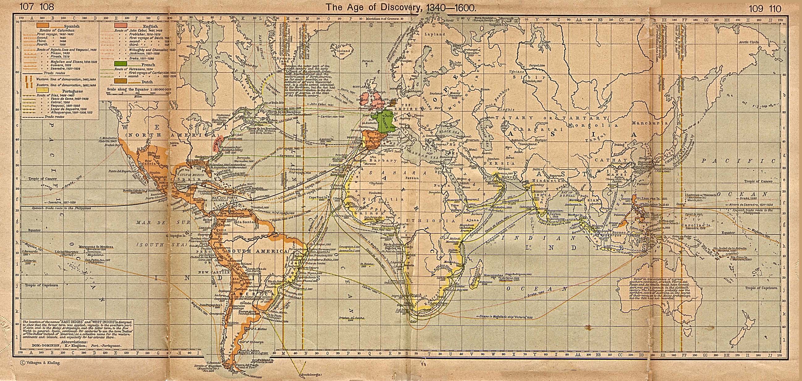
![[169]](http://www.clas.ufl.edu/users/rhatch/pages/03-Sci-Rev/SCI-REV-Home/Historical-Research/maps/shepherd-c-107-110.jpg)
![[234]](https://gbgm-umc.org/umw/corinthians/maps/empire.gif)
![[235]](http://geology.com/world/the-united-states-of-america-map.gif)
![[236]](http://www.hickmanclass.com/Chapter%2010/Roman%20Empire.bmp)
![[238]](https://commons.wikimedia.org/wiki/File:Japanese_Empire2.png)
![[240]](http://farm1.static.flickr.com/80/264047305_603b91cf6d.jpg)
![[241]](https://upload.wikimedia.org/wikipedia/commons/9/9c/Thailand.gif)
![[242]](https://upload.wikimedia.org/wikipedia/commons/thumb/3/3f/Germanborders.png/250px-Germanborders.png)
![[245]](https://en.wikipedia.org/wiki/File:The_Portuguese_Empire.png)