
Talk:Hadera


Daily pageviews of this article
A graph should have been displayed here but graphs are temporarily disabled. Until they are enabled again, visit the interactive graph at pageviews.wmcloud.org |
Under "Recent News," the author stated, "Palestinian militants responded quickly to [Iranian President] Ahmadinejad's remarks by launching an attack against civilians in Hadera."
This is neither a neutral statement nor a factual statement. It ascribes motivation to persons without using primary or reliable sources -- in fact, without using any sources at all -- and even without some basic fact-checking.
According to the AP and numerous other news organizations, Islamic Jihad, who claimed responsibilty for the attack, did not mention Ahmadinejad's remarks at all in their statements about their motivation for the suicide bombing of Hadera. In addition, Ahmadinejad made his remarks on 10/26/05. The suicide bombing in Hadera occurred on 10/26/05. If, according to military sources [1], three days are not enough time to prepare and coordinate a suicide bombing of this magnitude, one day certainly is not.
The Wikipedia community has built its reputation on the factual integrity of its work and in being as bias-free as possible. Checking facts is therefore a critical piece of writing or editing any article.
- Morgan
207.75.179.89 18:25, 4 November 2005 (UTC)
External links modified[edit]
Hello fellow Wikipedians,
I have just modified 3 external links on Hadera. Please take a moment to review my edit. If you have any questions, or need the bot to ignore the links, or the page altogether, please visit this simple FaQ for additional information. I made the following changes:
- Added archive https://web.archive.org/web/20080229093427/http://www1.cbs.gov.il/shnaton55/st02_14.pdf to http://www1.cbs.gov.il/shnaton55/st02_14.pdf
- Added archive https://web.archive.org/web/20081218230924/http://www1.cbs.gov.il/reader/shnaton/templ_shnaton_e.html?num_tab=st02_11x&CYear=2007 to http://www1.cbs.gov.il/reader/shnaton/templ_shnaton_e.html?num_tab=st02_11x&CYear=2007
- Added
{{dead link}}tag to http://www.charlottesistercities.org/Default.aspx?tabid=218 - Added archive https://archive.is/20121205042350/http://www.hadera.muni.il/ to http://www.hadera.muni.il/
When you have finished reviewing my changes, you may follow the instructions on the template below to fix any issues with the URLs.
This message was posted before February 2018. After February 2018, "External links modified" talk page sections are no longer generated or monitored by InternetArchiveBot. No special action is required regarding these talk page notices, other than regular verification using the archive tool instructions below. Editors have permission to delete these "External links modified" talk page sections if they want to de-clutter talk pages, but see the RfC before doing mass systematic removals. This message is updated dynamically through the template {{source check}} (last update: 18 January 2022).
- If you have discovered URLs which were erroneously considered dead by the bot, you can report them with this tool.
- If you found an error with any archives or the URLs themselves, you can fix them with this tool.
Cheers.—InternetArchiveBot (Report bug) 19:36, 27 October 2017 (UTC)
Name[edit]
I removed "In the Mandatory times, the town was known as Khudeira.[1][2] "
- This is just transliteration difference, not really a different name. The 1922 census spelled it Hedera. The official British survey maps spelled it Hadera from at least 1932 onwards. That is also how it is spelled many times in the official Gazette. There was another name, though. I have a 1918 British map that says "Liktera (Hadeira)" and Liktera is also given as an alternative name in Gilbar, Ottoman Palestine 1800-1914, p207. It would be good to know the history of this. Zerotalk 17:34, 18 August 2019 (UTC)
- As other data points I see חדרה (Hadera) on a 1911 Zionist map. Another 1918 British military map says "(Hadeira) Liktera (Jewish colony)". A detailed French map of 1914 shows nothing at all. A 1915 British map has just "Liktera Jewish Coly", and the same appears on a British War Office map of 1924. But an 1895 German map says "Chudera". Zerotalk 18:04, 18 August 2019 (UTC)
- "Liktera" is mentioned often in histories of WWI (see Google Books) but in Zionist writing I see only variations of Chederah from the 1897 Zionist Congress onwards. Zerotalk 18:29, 18 August 2019 (UTC)
- Any reason why you prefer not to include the alternative transliteration, which -- as the references show -- had been used on the official British survey map as well as on the official Royal Mail datestamps? --My another account (talk) 18:46, 18 August 2019 (UTC)
- Almost every site in Palestine has multiple alternative transliterations. We usually only give those which are not just minor variations. Using the postcard would be OR anyway. Zerotalk 19:20, 18 August 2019 (UTC)
- Why, Petah Tikva has two additional transliterations right in the infobox. Safed has four. Once again, this is not just any alternative transliteration, it used to be the official one for an uncertain period of time. --My another account (talk) 21:01, 18 August 2019 (UTC)
- Almost every site in Palestine has multiple alternative transliterations. We usually only give those which are not just minor variations. Using the postcard would be OR anyway. Zerotalk 19:20, 18 August 2019 (UTC)
- Re Liktera: [2] (footnote 86 on p. 113) says that Liktera is a corruption of Al-Khudeira, which was the Arabic name of the location. --My another account (talk) 21:38, 18 August 2019 (UTC)
- Any reason why you prefer not to include the alternative transliteration, which -- as the references show -- had been used on the official British survey map as well as on the official Royal Mail datestamps? --My another account (talk) 18:46, 18 August 2019 (UTC)
While I'm on the subject of the name, I can't help but notice that the wadi that is adjacent to where Hadera was founded was called Wady el Khudeirah on the PEF map compiled in the 1870s. How can that not be the origin of the name? But we need a source confirming that. Zerotalk 19:20, 18 August 2019 (UTC)
- How about this? [3] "His parents, who lived in Medzhybizh in Russia, purchased a plot of land at al-Khudeira which Yehoshua Hankin reserved for establishing a village, which was later called Hadera" (emphasis as in the original) --My another account (talk) 22:47, 18 August 2019 (UTC)
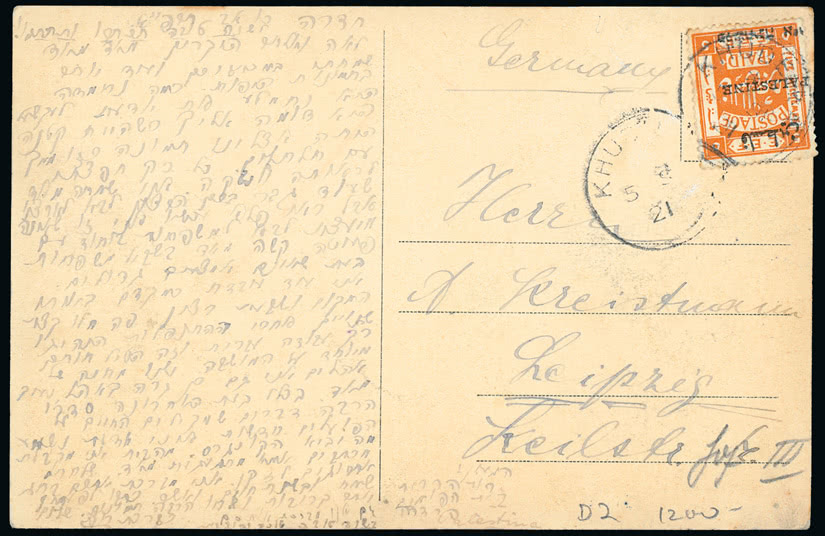
- It doesn't say that the village was ever called Khudeira, but I think that source can be used for what it does say. To answer some of your earlier points, the spellings at Petah Tikva and Safed are current variations, not historical names. War-time British maps used Hadeira and/or Liktera but maps made by the Survey of Palestine always used Hadera. The Gazette and the first census used mostly Hedera (I spotted one Hederah) until the late 1920s then afterwards only Hadera. Zionist publications in English and German used only minor variations of Hedera both before and after 1921. Your railway map is very interesting but inadmissible because it has no authority shown. I see on the internet various theories about the date of that map, but it must be close to the date of the postcard since the border with Lebanon and Syria is the 1920 temporary border and not the 1923 border. It is Original Research to infer an official name from a postcard on an auction site. Incidentally this page says there were 10 different post marks for Hadera altogether. I don't think spellings on post marks had any official status anyway—look at all the variations that page lists. There is not enough here to warrant a claim in the article. Zerotalk 10:07, 19 August 2019 (UTC)
- The railway map is marked "Survey of Egypt, 22/208" in the bottom left corner, which is the issuing authority and a likely year of publication. --My another account (talk) 15:09, 19 August 2019 (UTC)
- Good spotting. In a map catalogue I see "Giza: Survey of Egypt, 1922". Apparently it was distributed in a pocket in the back of "The Handbook of Palestine", by Luke and Keith-Roach (1922) "with correction slip". Maybe one of the corrections was the spelling of "Hadera" ;). Zerotalk 16:23, 19 August 2019 (UTC)
- The railway map is marked "Survey of Egypt, 22/208" in the bottom left corner, which is the issuing authority and a likely year of publication. --My another account (talk) 15:09, 19 August 2019 (UTC)
- It doesn't say that the village was ever called Khudeira, but I think that source can be used for what it does say. To answer some of your earlier points, the spellings at Petah Tikva and Safed are current variations, not historical names. War-time British maps used Hadeira and/or Liktera but maps made by the Survey of Palestine always used Hadera. The Gazette and the first census used mostly Hedera (I spotted one Hederah) until the late 1920s then afterwards only Hadera. Zionist publications in English and German used only minor variations of Hedera both before and after 1921. Your railway map is very interesting but inadmissible because it has no authority shown. I see on the internet various theories about the date of that map, but it must be close to the date of the postcard since the border with Lebanon and Syria is the 1920 temporary border and not the 1923 border. It is Original Research to infer an official name from a postcard on an auction site. Incidentally this page says there were 10 different post marks for Hadera altogether. I don't think spellings on post marks had any official status anyway—look at all the variations that page lists. There is not enough here to warrant a claim in the article. Zerotalk 10:07, 19 August 2019 (UTC)
References
"This identification was supported by Benjamin Mazar.."[edit]
..but the site identified by Mazar is 5km from where Hadera was founded. Although the rules tell us to follow sources, they don't tell us to slavishly follow the exact wording of sources. In this case, we can take it that Mazar made the stated identification, but the assertion that it is "support" is an opinion expressed by the author of the book published by the Ministry of Defense. We are not obliged to repeat such opinions, especially when they are obviously false assertions from a source likely to have strong nationalistic bias. Zerotalk 08:34, 22 August 2019 (UTC)
- I wouldn't agree that the statement is "obviously false": undoubtedly the town of Hadera was named after Wadi al-Khudeira, but my understanding of Zaharoni's statement is that, according to the two sources, the wadi itself could have been named after the ancient town at the wadi, not necessarily at the same location where Hadera was founded. Her subject is specifically the history of the name, not the history of the town. --My another account (talk) 13:15, 1 September 2019 (UTC)
- Except that Tel Gador is not on the wadi but 4km south. Anyway your wording "Tell Ahḍar, previously known as Tell esh Sheikh Ziraq" is misleading since it implies that "Tell esh Sheikh Ziraq" is an earlier name than "Tell Ahḍar". We don't have a detailed history of the names, but indications are that it is the other way around. The SWP map of c. 1880 says "Tell el Akhdar", and so does a 1915 map, while the Survey of Palestine maps (c. 1930 to 1940s) say "Tall ash Sh. Ziraq". Just to make it more interesting, I have a 1843 and 1847 maps with the wadi called "Nahr el Akhdar". Zerotalk 15:34, 1 September 2019 (UTC)
- Actually, I'm not sure how its Tell esh Sheikh Ziraq identity is relevant for the history of Hadera and its name. On the contrary, Tell Ahdar is both the name used in the referenced source, and a link supporting the hypothetical "Gador/Gedera -> greenness" derivation of Wadi al-Khudeira. Nahr el Akhdar is definitely worth mentioning, now that you have the references. --My another account (talk) 18:18, 1 September 2019 (UTC)
- Tell esh Sheikh Zirak is what it was mainly called at least from 1930 into the mid-1950s. Sometime after that, Israel gave it a Hebrew name like thousands of other places were renamed. Actually the name least relevant to the history is "Tel Gador". Incidentally my old maps show a "Hadarah" in various spellings about 10km north next to Tantura, now called Horvat Hadarim. Identifications are a black art and we shouldn't be doing our own. Zerotalk 19:04, 1 September 2019 (UTC)
- Actually, I'm not sure how its Tell esh Sheikh Ziraq identity is relevant for the history of Hadera and its name. On the contrary, Tell Ahdar is both the name used in the referenced source, and a link supporting the hypothetical "Gador/Gedera -> greenness" derivation of Wadi al-Khudeira. Nahr el Akhdar is definitely worth mentioning, now that you have the references. --My another account (talk) 18:18, 1 September 2019 (UTC)
- Except that Tel Gador is not on the wadi but 4km south. Anyway your wording "Tell Ahḍar, previously known as Tell esh Sheikh Ziraq" is misleading since it implies that "Tell esh Sheikh Ziraq" is an earlier name than "Tell Ahḍar". We don't have a detailed history of the names, but indications are that it is the other way around. The SWP map of c. 1880 says "Tell el Akhdar", and so does a 1915 map, while the Survey of Palestine maps (c. 1930 to 1940s) say "Tall ash Sh. Ziraq". Just to make it more interesting, I have a 1843 and 1847 maps with the wadi called "Nahr el Akhdar". Zerotalk 15:34, 1 September 2019 (UTC)
Anyway, I have requested a copy of Mazar's article and will cite it directly. Zerotalk 09:00, 22 August 2019 (UTC)
Irit Zaharoni was employed by the IDF as an author. She has no actual credentials as a historian that I am aware of and her book is described as "loaded with value judgements". So I don't think it passed RS at all. Zerotalk 10:54, 22 August 2019 (UTC)
1931 data?[edit]
Ok, so the article says: "and the population had grown to 2,002 in 1931". I wonder: where in the 1931 census are those number from; which page?
- Mills, E., ed. (1932). Census of Palestine 1931. Population of Villages, Towns and Administrative Areas. Jerusalem: Government of Palestine.
...I think we (also) should cite the original source, and not (only) the secondary reference. Cheers, Huldra (talk) 21:56, 20 May 2021 (UTC)
- @Huldra: On page 93 I see El Khudeira lumped with 7 minor locations. The total population is 3372 including 2235 Jews. At least two of the minor locations (Nahliel and Gan Shemuel) surely had Jewish residents, so a Jewish population of 2002 for Hadera is plausible. What I'm unsure about is whether Hadera had Arab residents too. Looking at the two sources given: Avneri does not have it on the given page and I was not able to find it anywhere in the book (I looked at all pages mentioning Hadera). The other source, our friend the JVL, says at the bottom of their article "Source: Wikipedia"! Strangely, the original insertion of this datum in 2008 cited JVL. Looking at old versions of JVL's page, I see "In 1931 Hadera had 2002 residents." cited to this obviously unreliable web site. So this information started on a travel web site, then went to JVL, then to Wikipedia, then back to JVL, then back to Wikipedia. Zerotalk 02:25, 21 May 2021 (UTC)