
Taher
Taher
الطاهير Tahir | |
|---|---|
City and Commune | |
.JPG) Taher | |
| Motto(s): "From the people, for the people" | |
 Location of Taher in the Jijel Province | |
 Taher Location of Taher in the Algeria | |
| Coordinates: 36°46′19″N 5°53′54″E / 36.77194°N 5.89833°E | |
| Country | |
| Province | Jijel Province |
| District | Taher District |
| APC | 2012-2017 |
| Government | |
| • Type | Municipality |
| • Mayor | Hafid Boumahrouk[2] (RND) |
| Area | |
| • Total | 29,872 sq mi (77,367 km2) |
| Population (2008) | |
| • Total | 78,500 [1] |
| • Density | 31,350/sq mi (12,103/km2) |
| Time zone | UTC+1 (CET) |
| Postal code | 18200 18002 |
| ISO 3166 code | CP |
Taher (Arabic: الطاهير, Al-Tahir; Algerian Arabic: أطًهير), is Algerian city, the industrial center of Jijel Province, with its industrial area of Ouled Salah, the airport of Achouat-Ferhat Abbas and the port of Djen Djen.
Geography[edit]
Situation[edit]
The municipality of Taher is located in the north of Jijel Province.
Localities of the town[edit]
Taher is composed of several locations:
|
|
History[edit]
The present city is located on the site of an ancient city - dating back to Ottoman period - it was built on aboriginal lands hunted in the nearby mountains, after the revolt of 1871 (see Mokrani Revolt) time of occupation of Algeria by France, whose population was expropriated, including: the plain of Oued Djen-djen, Telata, the Ouled Bel Afou, Wadi Nile Beni Afar, Beni Siar, Beni khatab, and the immediate vicinity of the current city
Notable people[edit]
- Ferhat Abbas, first president of the Provisional Government of the Algerian Republic.
- Dekhli Mokhtar, one fighter of the FLN in Taher and the Algerian east.
Gallery[edit]
-
 Sidi Yahia Mosque in downtown of Taher.
 -
 The church Taher.
 -
 Sidi Yahia Mosque in downtown of Taher.
 -
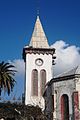 The church Taher (Downtown).


.jpg)
.jpg)
References[edit]
- ^ ONS Statistic (Jijel province)
- ^ Jijel Info Archived 2013-01-05 at the Wayback Machine
External links[edit]
- (in French) Jijel news
.svg)