
Tacony Plantation
Tacony Plantation House | |
  | |
| Location | Along Taconey Plantation Road, about 450 yards (410 m) north of US 84, Vidalia, Louisiana |
|---|---|
| Coordinates | 31°34′50″N 91°28′26″W / 31.58055°N 91.47395°W |
| Area | 9 acres (3.6 ha) |
| Built | 1850 |
| Architectural style | Renaissance, Rococo Revival |
| NRHP reference No. | 79001059[1] |
| Added to NRHP | April 19, 1979 |
The Tacony Plantation is a former cotton plantation with a historic mansion in Vidalia, Louisiana, U.S.. It was built in 1850, a decade prior to the American Civil War of 1861–1865, for Alfred Vidal Davis, Sr. (1826-1899).[2][3] One of his former slaves, John R. Lynch, became a politician after the war.[4]
The plantation house, along with a 9 acres (3.6 ha) area, has been listed on the National Register of Historic Places on April 19, 1979.[1]
See also[edit]
- List of plantations in Louisiana
- National Register of Historic Places listings in Concordia Parish, Louisiana
References[edit]
- ^ a b "National Register Information System". National Register of Historic Places. National Park Service. November 2, 2013.
- ^ "Tacony" (PDF). State of Louisiana's Division of Historic Preservation. Retrieved May 2, 2018. with two photos and two maps
- ^ Mary Eidt and Don Terry of Tacony Restoration Project (January 10, 1979). "National Register of Historic Places Inventory/Nomination Form: Tacony Plantation House". National Park Service. Retrieved May 2, 2018. With four photos from 1979.
- ^ Meddleton, Stephen (2002). Black Congressmen During Reconstruction: A Documentary Sourcebook. Westport, Connecticut: Praeger. p. 145. ISBN 9780313322815. OCLC 49611120.

Municipalities and communities of Concordia Parish, Louisiana, United States | ||
|---|---|---|
| Cities | 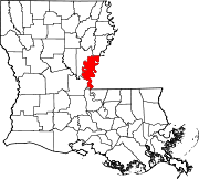 | |
| Towns | ||
| CDPs | ||
| Other communities |
| |
This article about a property in Louisiana on the National Register of Historic Places is a stub. You can help Wikipedia by expanding it. |
Categories:
- Houses on the National Register of Historic Places in Louisiana
- Renaissance Revival architecture in Louisiana
- Houses completed in 1850
- National Register of Historic Places in Concordia Parish, Louisiana
- Plantation houses in Louisiana
- Cotton plantations in Louisiana
- Houses in Concordia Parish, Louisiana
- 1850 establishments in Louisiana
- Rococo Revival architecture
- Louisiana Registered Historic Place stubs