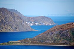
Sværholt Peninsula
Sværholt Peninsula
Sværholthalvøya | |
|---|---|
 View of the Sværholt Peninsula in far right background | |
 The Sværholt Peninsula lies between the Porsangerfjorden and Laksefjorden | |
| Coordinates: 70°46′59″N 26°25′59″E / 70.78306°N 26.43306°E | |
| Location | Finnmark, Norway |
The Sværholt Peninsula[1][2][3] (Norwegian: Sværholthalvøya) is a peninsula in Finnmark county, Norway. The peninsula lies between the Porsangerfjorden and Laksefjorden in the municipalities of Nordkapp, Lebesby, and Porsanger. The 70-kilometre (43 mi) peninsula has some settlements, mostly on the inner part of the peninsula. The villages of Veidnes and Brenna are two of the larger settlements on the Sværholt Peninsula. The lake Kjæsvannet lies in the central part of the peninsula.[4] The Sværholtklubben Nature Reserve lies at the northern tip of the peninsula.[5]
References[edit]
- ^ Olsen, Bjørnar; Witmore, Christopher (2014). "Sværholt: Revovered Memories from a POW Camp in the Far North". In Olsen, Bjørnar; Pétursdóttir, Þóra (eds.). Ruin Memories: Materialities, Aesthetics and the Archaeology of the Recent Past. London: Routledge. pp. 162–190.
- ^ Ratcliffe, Derek (2010). Lapland: A Natural History. London: T & AD Poyser. p. 307.
- ^ Ferguson-Lees, James; Hockliffe, Quentin; Zweeres, Ko (1975). A Guide to Bird-Watching in Europe. New York: Scribner. p. 55.
- ^ Askheim, Svein. "Sværholthalvøya (Spierttanjárga)" [Sværholt Peninsula]. Store norske leksikon (in Norwegian).
- ^ "Inner Sværholtklubben". BirdLife Data Zone. BirdLife International. 2021. Retrieved 2021-12-06.
