
Sandtown, Mississippi
Sandtown, Mississippi | |
|---|---|
 Sandtown, Mississippi  Sandtown, Mississippi | |
| Coordinates: 32°47′41″N 89°00′06″W / 32.79472°N 89.00167°W | |
| Country | United States |
| State | Mississippi |
| County | Neshoba |
| Elevation | 591 ft (180 m) |
| Time zone | UTC-6 (Central (CST)) |
| • Summer (DST) | UTC-5 (CDT) |
| ZIP code | 39350 |
| Area code | 601 |
| GNIS feature ID | 692207[1] |
Sandtown is an unincorporated community located in Neshoba County, Mississippi, United States. Sandtown is approximately 4.7 miles (7.6 km) southwest of Bogue Chitto along Mississippi Highway 482.
Sandtown's name is derived from the translation of the name of a Choctaw village that previously occupied the site. The village was known as Shinuk Kaha in Choctaw, which translates to lying in the sand.[2]
References[edit]
- ^ U.S. Geological Survey Geographic Names Information System: Sandtown, Mississippi
- ^ Halbert, H. S. (1902). Riley, Franklin L. (ed.). "Bernard Romans' Map of 1772". Publications of the Mississippi Historical Society. VI: 428.
Municipalities and communities of Neshoba County, Mississippi, United States | ||
|---|---|---|
| Cities | 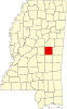 | |
| Town | ||
| CDPs | ||
| Other communities | ||
| Indian reservation | ||
| Footnotes | ‡This populated place also has portions in an adjacent county or counties | |
This Neshoba County, Mississippi state location article is a stub. You can help Wikipedia by expanding it. |