
Saint-Adelphe
This article may be in need of reorganization to comply with Wikipedia's layout guidelines. (April 2024) |
This section contains an unencyclopedic or excessive gallery of images. |
Saint-Adelphe (Parish municipality) | |
|---|---|
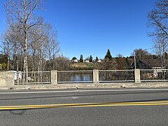
-Vue_en_aval_du_pont_de_la_route_352-2018-09-29.jpg) Pierre-Paul and Batiscan Rivers | |
 Location within Mékinac RCM | |
 Saint-Adelphe (Parish municipality) Location in central Quebec | |
| Coordinates: 46°44′N 72°26′W / 46.733°N 72.433°W | |
| Country | |
| Province | |
| Region | Mauricie |
| RCM | Mékinac |
| Constituted | October 19, 1891 |
| Government | |
| • Mayor | Paul Labranche |
| • Federal riding | Saint-Maurice—Champlain |
| • Prov. riding | Laviolette |
| Area | |
| • Total | 139.00 km2 (53.67 sq mi) |
| • Land | 137.45 km2 (53.07 sq mi) |
| Population (2011) | |
| • Total | 952 |
| • Density | 6.9/km2 (18/sq mi) |
| • Pop 2006-2011 | |
| • Dwellings | 597 |
| Time zone | UTC−5 (EST) |
| • Summer (DST) | UTC−4 (EDT) |
| Postal code(s) | |
| Area code(s) | 418 and 581 |
| Highways | |
| Website | www |
Saint-Adelphe (French pronunciation: [sɛ̃t‿adɛlf]) is a parish municipality located in the Mékinac Regional County Municipality (RCM), located in Mauricie, Quebec province, Canada.
Usage includes Saint-Adelphe in the Batiscanie, common name to refer to the region.
History[edit]
One of the first residents of Saint-Adelphe, a certain Jeanot, registered himself as an Indian in the 1861 census. His residence was located nearby the Manitou Falls on the banks of the Batiscan River, at the limit of Saint-Stanislas and Saint-Adelphe. This sector is also the old limit of two lordship: Sainte-Anne and Batiscan. Few years later, a dozen pioneer families are established in the area.
In 1860, there were a few settlers, including Veillette, Asselin, Carpentier, Thivierge, Lambert, Baillargeon, Charest, Gervais, Perron, Lafontaine, Baribeau and Lavigueur dit Brouillet.
During the civil foundation in 1891, the parish of Saint-Adelphe has 56 established families (in addition surnames identified in the 1860s): Ayotte, Boisvert, Bordeleau, Brosseau, Cardinal, Cossette, Side, Francoeur, Gauthier, Germain, Hamelin, Mongrain, Roberge, Sauvageau, St-Arneault, Tiffault. Subsequently, families Douville, Gagnon, Plourde and Trépanier came to settle there.[1]
Toponymy[edit]
In 1885, the settlers, who came to most of Saint-Stanislas of the two Batiscan riversides, agreed to ask the bishop to erect a Catholic Parish. At the founding of the parish of Saint-Adelphe, canonically erected in 1885, Louis-François Richer Laflèche, Bishop of Trois-Rivières wanted to pay tribute to the priest of Sainte-Anne-de-la-Pérade (1852-1882), Edward Louis-Adolphe Dupuis (1823-1893), who had marked the location of the church.
Considering that the Roman martyrology not count Saint-Adolphe, he chose Saint-Adelphe, bishop and confessor, whose religious festival is celebrated on 29 August, and whose name differs only by a vowel. This explanation, advanced by Pierre-Georges Roy, seems ill explain whereas at least one saint named Adolphe Adolf of Osnabrück (1216-1224).[2]
The legendary Batiscan River crosses the territory of the municipality from north to south. This river is recognized as a key passage to the hinterland in Native history.
According to the French explorer Samuel de Champlain, Batiscan designation comes from an "important Indian captain." Different authors attribute the origin of the name Batiscan various interpretations, all of Indian origin "haze" or "crushed bone", "dried meat" and "rushes to the mouth."
The Post Office is itself designated since 1891 under the name of "Saint-Adelphe-de-Champlain". Saint-Adelphe was formerly known as "Pierre-Paul" sector, the name of a tributary of the Batiscan River.
Demographics[edit]
In the 2021 Census of Population conducted by Statistics Canada, Saint-Adelphe had a population of 922 living in 453 of its 557 total private dwellings, a change of 0% from its 2016 population of 922. With a land area of 137.08 km2 (52.93 sq mi), it had a population density of 6.7/km2 (17.4/sq mi) in 2021.[3]
Population trend:
| Year | Population | Variation (%) | Median age |
|---|---|---|---|
| 2011 | 952 | 52.9 years | |
| 2006 | 1,013 | ||
| 2001 | 962 | ||
| 1996 | 1,014 | ||
| 1991 | 1,047 | ||
| 1986 |
Mother tongue:
- English as first language: 4%
- French as first language: 95%
- English and French as first language: 0%
- Other as first language: 1%
Municipal chronology[edit]

The civic erection of the parish of Saint-Adelphe was formalized on July 2, 1891. At that time, 56 families were registered in the parish.
- 1891 (July 2) - Civil Erection of the municipality of Saint-Adelphe. The territory assigned to this new entity has 186 acres and 5 perches in front to a depth of 216 acres. The first Council meeting was held on September 21, 1891 and first mayor was the Narcisse Roberge.
In 1893, a tray is made to connect the two banks of the Batiscan River at a cost of $30. The ferry fare is fixed at $0.80 per family for one year and $0.10 per car for non-subscribers and non-residents or $0.01 per pedestrian.
- In 1912, construction of the first aqueduct in the village galvanized iron.
In 1912, PN Chaillez of Saint-Stanislas has built a first toll bridge on the Batiscan River.
- 1923 - Arrival of electricity. The municipality had adopted the regulation on the sale and the April 3 192L electricity service.
- 1924 - Construction of the new covered bridge (wooden) the Batiscan River with a length of 338 feet, with a single central pillar for $16000. This covered bridge included a pedestrian sidewalk on the southeast side.
- 1925 - Construction of new wooden covered bridge on the Pierre-Paul River, almost at its mouth which empties into the Batiscan River.
- 1927 - Construction of a building for fire pumps, nozzles, tank suits. It was erected on the rue de la Chapelle, then was rebuilt on Main Street.
- 1929 - Founding of the People's Fund.
- 1937 - The covered bridge on the Batiscan River is the subject of extensive repairs.
- 1965 - Construction of the cement bridge on the Batiscan River.
- 1968 (November) - Covered Bridge on the Batiscan River is demolished.
Religious chronology[edit]
- 1885 (April 23) - Canonical erection of the parish of Saint-Adelphe by decree of Bishop Louis-François Richer Laflèche.
- 1889 - Construction of the first chapel and the first rectory, under the direction of Father Michael E. Jannelle, pastor of Sainte-Thècle. These buildings were built on the east side of the Batiscan River, on the site of the actual cemetery.
- 1890 - Arrival of the first resident priest is Father Joseph-Marie Gouin. During the previous five years, the priests of Sainte-Thècle, Quebec and Saint-Stanislas had served the parish of Saint-Adelphe.
- 1914 - End of the first sod for the construction of the present church.
- 1936 - beautification of the grounds of the church under the pastor Ferron.
- January 1, 2018 - Creation of the new "fabrique" of the parish of Saint-Coeur-de-Marie, merging the factories of Notre-Dame-des-Anges, Saint-Éloi-les-Mines, Saint-Rémi-du-Lac-aux-Sables, St. Leopold of Hervey-Junction, St. Thecla and St. Adelphe.
Slogan[edit]
"Faithful with his duty"
Photos[edit]
- Built heritage
-
 Église de la paroisse Saint-Cœur-de-Marie, rue Baillargeon
 -
 Patrick-Douville Fire Station (1930), Main Street
 -
![Curé-Adélard-Lamy Cemetery, Batiscan River, mouth of the Pierre-Paul River, P01548 bridge[4] on Route 352](//upload.wikimedia.org/wikipedia/commons/thumb/6/6a/Saint_Adelphe_044.jpg/240px-Saint_Adelphe_044.jpg) Curé-Adélard-Lamy Cemetery, Batiscan River, mouth of the Pierre-Paul River, P01548 bridge[4] on Route 352
Curé-Adélard-Lamy Cemetery, Batiscan River, mouth of the Pierre-Paul River, P01548 bridge[4] on Route 352 -
 Curé-Adélard-Lamy cemetery, spires of the bell towers of the Catholic church, the village
 -
 Highway 352, reinforced concrete girder bridge P01548 (1950), Batiscan River at the mouth of the Pierre-Paul River


![Curé-Adélard-Lamy Cemetery, Batiscan River, mouth of the Pierre-Paul River, P01548 bridge[4] on Route 352](/wiki/File:Saint_Adelphe_044.jpg)


- Rivers & Creeks
-
![Mouth of Pierre-Paul River, Batiscan River, bridge P01548, reinforced concrete girders (1950),[4] Route 352, spires of the bell towers of the Catholic church, village, cultivated field, cemetery Curé Adélard-Lamy,[5] Saint-Adelphe](//upload.wikimedia.org/wikipedia/commons/thumb/c/cc/Saint_Adelphe_047.jpg/240px-Saint_Adelphe_047.jpg) Mouth of Pierre-Paul River, Batiscan River, bridge P01548, reinforced concrete girders (1950),[4] Route 352, spires of the bell towers of the Catholic church, village, cultivated field, cemetery Curé Adélard-Lamy,[5] Saint-Adelphe
Mouth of Pierre-Paul River, Batiscan River, bridge P01548, reinforced concrete girders (1950),[4] Route 352, spires of the bell towers of the Catholic church, village, cultivated field, cemetery Curé Adélard-Lamy,[5] Saint-Adelphe -
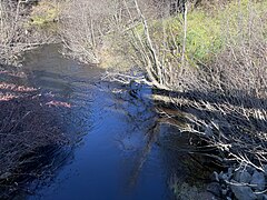 Ruisseau Ayotte, from bride pont P-01551, rang Price
 -
![Sign on bridge P-01551, Ruisseau Ayotte, rang Price[4]' [6]](//upload.wikimedia.org/wikipedia/commons/thumb/5/59/Saint_Adelphe_013.jpg/240px-Saint_Adelphe_013.jpg)
-
![Ruisseau Bras Fanfan from P-06222 bridge, rang Saint-Paul[4]' [7]](//upload.wikimedia.org/wikipedia/commons/thumb/1/11/Saint_Adelphe_022.jpg/240px-Saint_Adelphe_022.jpg)
-
 Ruisseau Bras Fanfan, from P-06222 bridge, rang Saint-Paul
![Mouth of Pierre-Paul River, Batiscan River, bridge P01548, reinforced concrete girders (1950),[4] Route 352, spires of the bell towers of the Catholic church, village, cultivated field, cemetery Curé Adélard-Lamy,[5] Saint-Adelphe](/wiki/File:Saint_Adelphe_047.jpg)

![Sign on bridge P-01551, Ruisseau Ayotte, rang Price[4]' [6]](/wiki/File:Saint_Adelphe_013.jpg)
![Ruisseau Bras Fanfan from P-06222 bridge, rang Saint-Paul[4]' [7]](/wiki/File:Saint_Adelphe_022.jpg)

- Beating heart of Saint-Adelphe
-
 Rue du Moulin
 -
 Corner of Cossette and Station streets
 -
 Principale street
 -
 Principale street


Further reading[edit]
- "Vie municipale à Saint-Adelphe (Municipal Life in Saint.Adelphe) 1891-1991" by Thérèse Lafontaine, coordinator and editor. Publisher: Municipal Corporation of St.Adelphe. 327 pages. Printed in 1991 in French. Shawinigan, Pâquet Advertising. Recherchistes: Céline Perron et Jo-ann Simard; Lucie Leduc, secrétaire; Jo-ann Simard, dessins. Conception graphique: Publicité Paquet inc.(in French)
- "Le rang Saint-Joseph à Saint-Adelphe (The Row Saint.Joseph in Saint.Adelphe)" by Thérèse Lafontaine. Published in 2012.(in French)
- "Répertoire des baptêmes de la paroisse de Saint-Adelphe (Directory of baptisms of the parish of Saint.Adelphe)". Published in 1984 in French by the "Société historique de Saint-Adelphe" (Historical Society of Saint.Adelphe). Part 1: the years 1890-1944; part 2: 1945-1979.(in French)
- "Répertoire des mariages de St-Adelphe (Directory of marriages of St.Adelphe)". Published in 1984 in French by the "Société historique de Saint-Adelphe" (Historical Society of Saint.Adelphe). Part 1: the years 1890 to 1924; part 2: 1925-1979. (in French)
- "Répertoire des sépultures de la paroisse de St-Adelphe (Directory of burial in the parish of St.Adelphe)". Published in 1984 in French by the "Société historique de Saint-Adelphe" (Historical Society of Saint.Adelphe). Part 1: 1890 to 1924; part 2: 1925-1979. (in French)
- "Histoire de Saint-Adelphe à travers sa vie scolaire (History of Saint.Adelphe through its school life)" by Gaétan Veillette and Jacques Thiffault. Editions of "Bien Public"(Public Affairs). October 1978. 131 pages. Published in French.(in French)
See also[edit]
- Batiscan River
- Batiscanie (Quebec)
- Pierre-Paul River
- Charest River
- Saint-Prosper-de-Champlain
- Saint-Stanislas (Mauricie)
- Sainte-Thècle (Québec)
- Saint-Ubalde (Quebec)
- Mékinac Regional County Municipality (RCM)
- Lordship of Sainte-Anne-de-la-Pérade
- Lordship of Batiscan
References[edit]
- ^ Jacques Thiffault, President of the Société d'histoire de Saint-Adelphe. "The Beginnings" (in French). Municipality of Saint-Adelphe. Retrieved 2023-12-07.
With a photo of the construction of the covered bridge in 1920
- ^ "Saint-Adelphe". Commission de toponymie Quebec (in French). Government of Quebec. 1968-12-05. Retrieved 2023-11-05.
- ^ "Population and dwelling counts: Canada, provinces and territories, and census subdivisions (municipalities), Quebec". Statistics Canada. February 9, 2022. Retrieved August 29, 2022.
- ^ a b c d "Inventory and inspection of structures". Ministry of Transport and Sustainable Mobility Quebec. Government of Quebec. 2023-12-08. Retrieved 2023-12-10.
Location and description of the condition of bridges, culverts, retaining walls and tunnels
- ^ "Cemetery of the Curé-Adélard-Lamy". Commission de toponymie Quebec (in French). Government of Quebec. 2016-05-13. Retrieved 2023-12-10.
The name of the cemetery was made official in 2016, the 100th anniversary of the construction of the current church
- ^ "Ruisseau Ayotte". Commission de toponymie Quebec (in French). Government of Quebec. 2023-11-02. Retrieved 2023-11-04.
- ^ Major land uses, Map 5.1-R. "Land use planning and development plan" (PDF) (in French). RCM Portneuf. Retrieved 2023-11-05.
{{cite web}}: CS1 maint: numeric names: authors list (link)
External links[edit]
- Municipality of Saint-Adelphe: Official website (in French)
Adjacent Municipal Subdivisions | |
|---|---|
| Cities & towns | |
|---|---|
| Municipalities | |
| Parishes | |
| Villages | |
| Unorganized territories | |
| International | |
|---|---|
| National | |