
Sabana Seca
Sabana Seca | |
|---|---|
Barrio | |
 Flat land in Sabana Seca | |
 Location of Sabana Seca within the municipality of Toa Baja shown in red | |
 Sabana Seca Location of Puerto Rico | |
| Coordinates: 18°26′43″N 66°11′58″W / 18.44531°N 66.199479°W[1] | |
| Commonwealth | |
| Municipality | |
| Area | |
| • Total | 13.18 sq mi (34.1 km2) |
| • Land | 12.08 sq mi (31.3 km2) |
| • Water | 1.10 sq mi (2.8 km2) |
| Elevation | 0 ft (0 m) |
| Population (2010) | |
| • Total | 53,192 |
| • Density | 4,403.3/sq mi (1,700.1/km2) |
| Source: 2010 Census | |
| Time zone | UTC−4 (AST) |
| ZIP code | 00952 |
Sabana Seca is a barrio in the municipality of Toa Baja, Puerto Rico. Its population in 2010 was 53,192.[3][4][5]
History[edit]
Sabana Seca was in Spain's gazetteers[6] until Puerto Rico was ceded by Spain in the aftermath of the Spanish–American War under the terms of the Treaty of Paris of 1898 and became an unincorporated territory of the United States. In 1899, the United States Department of War conducted a census of Puerto Rico finding that the population of Sabana Seca barrio was 737.[7]
| Census | Pop. | Note | %± |
|---|---|---|---|
| 1900 | 737 | — | |
| 1910 | 1,163 | 57.8% | |
| 1920 | 1,562 | 34.3% | |
| 1930 | 2,449 | 56.8% | |
| 1940 | 3,539 | 44.5% | |
| 1950 | 5,771 | 63.1% | |
| 1960 | 7,755 | 34.4% | |
| 1970 | 0 | −100.0% | |
| 1980 | 50,368 | — | |
| 1990 | 52,553 | 4.3% | |
| 2000 | 55,103 | 4.9% | |
| 2010 | 53,192 | −3.5% | |
| U.S. Decennial Census 1899 (shown as 1900)[8] 1910-1930[9] 1930-1950[10] 1980-2000[11] 2010[12] | |||
Sectors[edit]
Barrios (which are, in contemporary times, roughly comparable to minor civil divisions)[13] in turn are further subdivided into smaller local populated place areas/units called sectores (sectors in English). The types of sectores may vary, from normally sector to urbanización to reparto to barriada to residencial, among others.[14][15][16]
The following sectors are in Sabana Seca barrio:[17]
Calle Parcelas Nuevas, Calles: Las Marías, Sarón, Parque Oeste, Parque Norte, Parque Sur, Links, 5A, J. Link, Acueducto, Algarrobo, Higüero, La Milagrosa (Culto), León de Oro, Vargas, Bella Vista, Rejas, -F-, Progreso, Las Palmas, Iglesia Cristiana, Luz, Dolores Cruz, Vieja, Gardenia, Meléndez, Amapola, Comunidad Villa Kennedy, Comunidad Villa Marisol (Excepto 1003 Int. LJ-7), Condominio Aquaparque, Condominio Century Garden, Condominio El Atlántico, Condominio Lago Vista I y II, Condominio Lagoplaya, Condominio Lagos del Norte, Condominio Parque de las Gaviotas, Condominio Parque del Lago, Condominio Paseo Abril, Condominio Paseo Río Hondo, Cuarta Sección Levittown, Égida Golden Age Tower, Parcelas Viejas, Primera Sección de Levittown, Quinta Sección Levittown, Residencial Villa del Sabana, Sección Quinta A de Levittown, Sector Calle Iglesia Cristiana, Sector Camasey, Sector Campamento, Sector Cuatro Cuerdas, Sector El 26, Sector Ingenio, Sector La Franja, Sector La Furnia, Sector La Vega, Sector Los Bravos, Sector Los Magos, Sector Monserrate, Sector Propiedad Privada, Sector Punta Salinas, Sector Sabana Seca, Sector Villa Calma, Sector Villa Plebiscito, Segunda Sección de Levittown, Séptima Sección de Levittown, Sexta Sección Levittown, Tercera Sección Levittown, Urbanización Camino del Mar, Urbanización Campanilla, Urbanización El Naranjal, Urbanización Las Gaviotas, Urbanización Levittville Calle Juan Lines Ramos, Bloques JJ-1 al JJ-6, JK-23, 24 y JZ-1, Urbanización Mansión del Mar, Urbanización Mansión del Sol, Urbanización Mansiones del Lago, Urbanización Oasis, Urbanización Pabellones, Urbanización Pradera del Norte (Casas AX- 1 a la AX-14), Urbanización Punta Salinas Park, Urbanización Rosaleda I, Urbanización Rosaleda II, Urbanización Villas de Levittown, Urbanización Villas del Naranjal, and Urbanización y Extensión Lagos de Plata.
Gallery[edit]
-
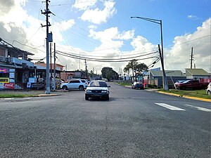 Puerto Rico Highway 867 between Sabana Seca and Media Luna
 -
 Puerto Rico Highway 867 between Media Luna and Sabana Seca
.jpg)
.jpg)
See also[edit]
- 2009 Sabana Seca massacre
- List of communities in Puerto Rico
- List of barrios and sectors of Toa Baja, Puerto Rico
References[edit]
- ^ a b "US Gazetteer 2019". US Census. US Government.
- ^ U.S. Geological Survey Geographic Names Information System: Sabana Seca barrio
- ^ Picó, Rafael; Buitrago de Santiago, Zayda; Berrios, Hector H. Nueva geografía de Puerto Rico: física, económica, y social, por Rafael Picó. Con la colaboración de Zayda Buitrago de Santiago y Héctor H. Berrios. San Juan Editorial Universitaria, Universidad de Puerto Rico,1969.
- ^ Gwillim Law (20 May 2015). Administrative Subdivisions of Countries: A Comprehensive World Reference, 1900 through 1998. McFarland. p. 300. ISBN 978-1-4766-0447-3. Retrieved 25 December 2018.
- ^ Puerto Rico: 2010 Population and Housing Unit Counts.pdf (PDF). U.S. Dept. of Commerce, Economics and Statistics Administration, U.S. Census Bureau. 2010.
- ^ "Anuario del comercio, de la industria, de la magistratura y de la administración. 1881". Biblioteca Nacional de España (in Spanish). p. 1614. Retrieved 4 April 2023.
- ^ Joseph Prentiss Sanger; Henry Gannett; Walter Francis Willcox (1900). Informe sobre el censo de Puerto Rico, 1899, United States. War Dept. Porto Rico Census Office (in Spanish). Imprenta del gobierno. p. 162.
- ^ "Report of the Census of Porto Rico 1899". War Department Office Director Census of Porto Rico. Archived from the original on July 16, 2017. Retrieved September 21, 2017.
- ^ "Table 3-Population of Municipalities: 1930 1920 and 1910" (PDF). United States Census Bureau. Archived (PDF) from the original on August 17, 2017. Retrieved September 21, 2017.
- ^ "Table 4-Area and Population of Municipalities Urban and Rural: 1930 to 1950" (PDF). United States Census Bureau. Archived (PDF) from the original on August 30, 2015. Retrieved September 21, 2014.
- ^ "Table 2 Population and Housing Units: 1960 to 2000" (PDF). United States Census Bureau. Archived (PDF) from the original on July 24, 2017. Retrieved September 21, 2017.
- ^ Puerto Rico: 2010 Population and Housing Unit Counts.pdf (PDF). U.S. Dept. of Commerce Economics and Statistics Administration U.S. Census Bureau. 2010. Archived (PDF) from the original on 2017-02-20. Retrieved 2019-08-02.
- ^ "US Census Barrio-Pueblo definition". factfinder.com. US Census. Archived from the original on 13 May 2017. Retrieved 5 January 2019.
- ^ "Agencia: Oficina del Coordinador General para el Financiamiento Socioeconómico y la Autogestión (Proposed 2016 Budget)". Puerto Rico Budgets (in Spanish). Retrieved 28 June 2019.
- ^ Rivera Quintero, Marcia (2014), El vuelo de la esperanza: Proyecto de las Comunidades Especiales Puerto Rico, 1997-2004 (first ed.), San Juan, Puerto Rico Fundación Sila M. Calderón, ISBN 978-0-9820806-1-0
- ^ "Leyes del 2001". Lex Juris Puerto Rico (in Spanish). Retrieved 24 June 2020.
- ^ "PRECINTO ELECTORAL TOA BAJA 014" (PDF). Comisión Estatal de Elecciones (in Spanish). PR Government. 20 July 2019. Retrieved 26 June 2020.