S111 (Amsterdam)
| City route 111 | |
|---|---|
| Stadsroute 111 | |
 | |
| Major junctions | |
| South end | |
| North end | |
| Location | |
| Country | Kingdom of the Netherlands |
| Constituent country | Netherlands |
| Provinces | North Holland |
| Municipalities | Amsterdam, Ouder-Amstel |
| Highway system | |
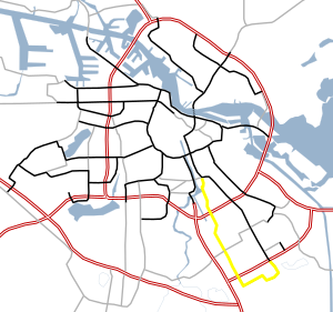
S111 is a Dutch road in Amsterdam. S111 is roughly 4 miles (6.4 kilometers) and is connected to S112. The S111 connects the Julianaplein (in front of the Amstel station) and the S112 with the A10, Villa Arena ( a shopping center) in the Bijlmermeer and the A9. Next, the road makes a loop past the Academic Medical Center, and once again connects to the A9. The road is sequentially called Julianaplein, Overzichtweg, Spaklerweg, Holterbergweg, Muntbergweg and Meibergdreef.
See also[edit]
Notes[edit]
[1] Map

