
RCAF Station Fingal
42°41′22″N 081°19′58″W / 42.68944°N 81.33278°W
| RCAF Station Fingal | |
|---|---|
 Fingal in the 1940s | |
| Active | 25 November 1940 – 17 February 1945 |
| Country | Canada |
| Branch | Royal Canadian Air Force |
| Role | British Commonwealth Air Training Plan Aircrew training |
| Part of | No. 1 Training Command |
| Schools | No. 4 Bombing and Gunnery School |
| Station Magazine | Fingal Observer |
| Commanders | |
| W/C | W. D. Van Vliet - 1940 |
| Aircraft flown | |
| Trainer | Avro Anson Fairey Battle Westland Lysander Bristol Bolingbroke Northrop Nomad North American Harvard North American Yale |
RCAF Station Fingal was a Second World War British Commonwealth Air Training Plan (BCATP) air station located near Fingal, Ontario, Canada. It was operated and administered by the Royal Canadian Air Force (RCAF).[1]
Fingal hosted No. 4 Bomber and Gunnery School (No. 4 B&GS), which trained bomb aimers and air gunners. The school opened on 25 November 1940 and closed 17 February 1945. Aircraft used included the Fairey Battle, Northrop Nomad, Westland Lysander, Bristol Bolingbroke and Avro Anson. When 4 B&GS closed, its fleet of aircraft consisted of 34 Avro Anson Mark I, 29 Bristol Bolingbroke Mark IVT, and 1 North American Harvard II. Bombing ranges were located near Melbourne, Frome, Tempo, and Dutton. A bombing range was also located on Lake Erie. A marine unit was based in Port Stanley.[2][3]
The area is now a wildlife preserve called the "Fingal Wildlife Management Area". Wildlife habitat has been restored and area has been set aside for agricultural demonstration purposes. Interpretive trails with signage have been installed.
Aerodrome Information[edit]
The airfield was constructed in a typical BCATP wartime pattern, with three runways formed in a triangle. In approximately 1942 the aerodrome was listed at 42°41′N 81°19′W / 42.683°N 81.317°W with a Var. 5 degrees W and elevation of 705 feet (215 m). The runway outlines are still clearly visible in aerial photographs. Three runways were listed as follows: [4]
| Runway Name | Length | Width | Surface |
|---|---|---|---|
| 1/19 | 3,182 feet (970 m) | 150 feet (46 m) | Not Listed |
| 14/32 | 2,944 feet (897 m) | 150 feet (46 m) | Not Listed |
| 7/25 | 2,820 feet (860 m) | 150 feet (46 m) | Not Listed |
Fingal scenes[edit]
-
 Historical plaque
 -
 Back of plaque, list of casualties
 -
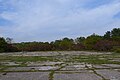 Double hangar base in 2014
 -
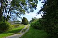 Roadway in 2014


See also[edit]
- St. Thomas Municipal Airport (Ontario)
- RCAF Station Guelph
- No. 6 Group RCAF
- Canadian Warplane Heritage Museum
References[edit]
- ^ Ferguson, Blair (2004). Southwold Remembers... The Fingal Observer: No. 4 B & G School. Fingal, Ontario: Township of Fingal. ISBN 0-9732019-2-4.
- ^ Forsyth, Bruce (1998). "A Short History of Abandoned and Downsized Canadian Military Bases". Military Bruce Historical Writings by Bruce Forsyth. Archived from the original on 4 September 2013. Retrieved 24 August 2013.
- ^ Hatch, F. J. (1983). The Aerodrome of Democracy: Canada and the British Commonwealth Air Training Plan, 1939-1945. Ottawa: Directorate of History, Department of National Defence. ISBN 0660114437.
- ^ Pilots Handbook of Aerodromes and Seaplane Bases Vol. 1. Royal Canadian Air Force. c. 1942. p. 111.
External links[edit]
- Interview with R. A. J. P. (Tony) Pitt, WAG trainee at No. 4 B&GS
- Fingal Wildlife Management Area Retrieved 2 March 2014
- Operations Record Book, from Library and Archives Canada
- Elgin Stewardship Council - Fingal Wildlife Management Area
This military aviation article is a stub. You can help Wikipedia by expanding it. |