
Pumpville, Texas
Pumpville | |
|---|---|
 Pumpville Location in the state of Texas | |
| Coordinates: 29°56′33.1″N 101°44′06.7″W / 29.942528°N 101.735194°W | |
| Country | United States |
| State | Texas |
| County | Val Verde |
| Founded | 1882[1] |
| Elevation | 1,740 ft (530 m) |
| Population (2010) | |
| • Total | 0 |
| Time zone | UTC-6 (Central (CST)) |
| • Summer (DST) | UTC-5 (CDT) |
| ZIP codes | ? |
| Area code | ? |
| GNIS feature ID | ? |
Pumpville is a ghost town in Val Verde County, Texas, United States.[1][2]
History[edit]
The village was founded in 1882, following the construction of the Galveston, Harrisburg and San Antonio Railway, on which it had a station, now closed. A post office operated from 1899 until 1970 and a Baptist Church is still operating.[3] From 1968 until 2000, Pumpville had a population of 21.[1][2][4]
Geography[edit]
Located on the Amtrak railway routes Sunset Limited and Texas Eagle between Sanderson and Del Rio stations, Pumpville lies on the Ranch to Market Road 1865, a few miles east of the borders of Terrell County, 12 miles east of the ghost town of Cedar Station.
See also[edit]
References[edit]
- ^ a b c Pumpville (Texas State Historical Association)
- ^ a b "Pumpville Texas West Texas Ghost Town". texasescapes.com. Retrieved 2020-12-02.
- ^ "Pumpville Baptist Church in Pumpville". The Texas Bucket List. Retrieved 2020-12-02.
- ^ "Pumpville, Texas – Railroad Ghost Town". Legends of America. Retrieved 2020-12-02.
External links[edit]
Municipalities and communities of Val Verde County, Texas, United States | ||
|---|---|---|
| City | 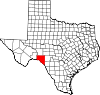 | |
| CDPs | ||
| Other communities | ||
| Ghost town | ||
This United States ghost town-related article is a stub. You can help Wikipedia by expanding it. |