
Puerto Rico Highway 185
Highway 185 | ||||
|---|---|---|---|---|
| Ruta 185 | ||||
| Route information | ||||
| Maintained by Puerto Rico DTPW | ||||
| Length | 21.1 km[1] (13.1 mi) | |||
| Existed | 1953[2]–present | |||
| Major junctions | ||||
| South end | ||||
| North end | ||||
| Location | ||||
| Country | United States | |||
| Territory | Puerto Rico | |||
| Municipalities | Juncos, Carolina, Canóvanas | |||
| Highway system | ||||
| ||||
| ||||


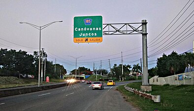
Puerto Rico Highway 185 (PR-185) is a main highway that connects Canóvanas, Puerto Rico to Juncos, Puerto Rico and is about 25 kilometers long. It begins in downtown of Canóvanas, very close to Puerto Rico Highway 3 and ends in Puerto Rico Highway 952 and Puerto Rico Highway 30 in Juncos.[3][4]
Route description[edit]
For people coming from/going to Caguas, the highway has a direct intersection with PR-30; for those coming from/going to Humacao, drivers have to take short highway PR-952 and then take PR-189 just before its intersection with PR-30, hence this exit being one of the most disorganized junctions in the island between a main highway and a main freeway or tollway in the island. New Puerto Rico Highway 66 also has a poor-designed intersection with the highway, since it only allow people going to/coming from Carolina (west) and not the east. This is probably because the short segment open from the new tollway immediately ends at PR-3 only 2 kilometers from the exit to PR-185 and thus expected to be fixed when the segment to Río Grande opens to the public.
The highway enters a small portion of Carolina, before it enters Canóvanas. PR-185 serves as an alternate route for people who drive the way between the metro area and the southeast, and it does not climb many hills and is generally wide. It is a much better option than taking Puerto Rico Highway 181 or going to Fajardo and then go south via PR-53, since the island is wider in the north than in the south segment.[3][4]
Major intersections[edit]
-
 PR-3 east at the exit to PR-185 in Canóvanas barrio-pueblo

| Municipality | Location | km[1] | mi | Destinations | Notes | |||
|---|---|---|---|---|---|---|---|---|
| Juncos | Mamey | 21.1 | 13.1 | Southern terminus of PR-185; PR-30 exit 12; eastbound exit and westbound entrance | ||||
| 21.0 | 13.0 | |||||||
| 20.7 | 12.9 | |||||||
| Gurabo Abajo | 20.4– 20.3 | 12.7– 12.6 | ||||||
| Canóvanas |
No major junctions | |||||||
| Carolina | Cedro | 15.9 | 9.9 | Former PR-945 | ||||
| 15.8 | 9.8 | |||||||
| 12.7 | 7.9 | |||||||
| 12.2 | 7.6 | |||||||
| Canóvanas | Lomas | 10.5 | 6.5 | |||||
| Hato Puerco | 8.4 | 5.2 | ||||||
| 5.4 | 3.4 | |||||||
| 4.6 | 2.9 | |||||||
| Canóvanas | 2.4 | 1.5 | PR-66 exit 10; incomplete diamond interchange; eastbound exit and westbound entrance | |||||
| 2.2 | 1.4 | |||||||
| Canóvanas barrio-pueblo | 0.5 | 0.31 | Partial cloverleaf interchange | |||||
| 0.0 | 0.0 | Northern terminus of PR-185 | ||||||
| 1.000 mi = 1.609 km; 1.000 km = 0.621 mi | ||||||||
Related route[edit]
Highway 9185 | |
|---|---|
| Location | Juncos |
| Length | 2.6 km[5] (1.6 mi) |
Puerto Rico Highway 9185 (PR-9185) is a bypass road that branches off from PR-185 in Gurabo Abajo and ends at PR-31 in Ceiba Norte.[3] The entire route is located in Juncos.
| Location | km[5] | mi | Destinations | Notes | |
|---|---|---|---|---|---|
| Gurabo Abajo | 0.0 | 0.0 | Western terminus of PR-9185 | ||
| Ceiba Norte | 2.6 | 1.6 | Eastern terminus of PR-9185; access to Naguabo | ||
| 1.000 mi = 1.609 km; 1.000 km = 0.621 mi | |||||
See also[edit]
References[edit]
- ^ a b Google (7 March 2020). "PR-185" (Map). Google Maps. Google. Retrieved 7 March 2020.
- ^ "Juncos, Memoria Núm. 50" (PDF). Puerto Rico Planning Board (in Spanish). 1955. Retrieved 4 August 2020.
- ^ a b c National Geographic Maps (2011). Puerto Rico (Map). 1:125,000. Adventure Map (Book 3107). Evergreen, Colorado: National Geographic Maps. ISBN 978-1566955188. OCLC 756511572.
- ^ a b "Tránsito Promedio Diario (AADT)". Transit Data (Datos de Transito) (in Spanish). DTOP PR. pp. 98–99. Archived from the original on 1 April 2019.
- ^ a b Google (1 March 2020). "PR-9185" (Map). Google Maps. Google. Retrieved 1 March 2020.
External links[edit]
 Media related to Puerto Rico Highway 185 and Puerto Rico Highway 9185 at Wikimedia Commons
- Llega a su fin la reconstrucción de la PR-185 que conecta Juncos con Canóvanas (in Spanish)