Pinar de Chamartín (Madrid Metro)
| Madrid Metro station | |||||||||||||||||||||
 | |||||||||||||||||||||
| General information | |||||||||||||||||||||
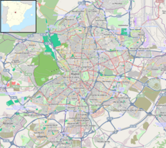
| Location | Ciudad Lineal, Madrid Spain | ||||||||||||||||||||
| Coordinates | 40°28′48″N 3°40′00″W / 40.4801375°N 3.6667999°W | ||||||||||||||||||||
| Owned by | CRTM | ||||||||||||||||||||
| Operated by | CRTM | ||||||||||||||||||||
| Construction | |||||||||||||||||||||
| Structure type | Underground | ||||||||||||||||||||
| Accessible | Yes | ||||||||||||||||||||
| Other information | |||||||||||||||||||||
| Fare zone | A | ||||||||||||||||||||
| History | |||||||||||||||||||||
| Opened | 11 April 2007 | ||||||||||||||||||||
| Services | |||||||||||||||||||||
| |||||||||||||||||||||
| Location | |||||||||||||||||||||
Pinar de Chamartín [piˈnaɾ ðe tʃamaɾˈtin] is a station on the Madrid Metro, opened to the public on 4 November, 2007. [1] It is located in fare Zone A and serves the area of Pinar de Chamartín.[2][3]
The station is the terminus for Line 1, Line 4 and the Metro Ligero line 1. As Line 1 is one of the most important lines in Madrid, Line 4 serves the local area of Hortaleza, and the ML1 serves the nearby Cercanías station in the new and expanding neighborhood of Sanchinarro, the station sees a high amount of traffic for being in a relatively low-population neighborhood far removed from the city center.
There's a tramway exhibited in the station, as a tribute to the old Madrid tramway (the new tramway system is the Metro Ligero). This tramway appears in the movie Doctor Zhivago and the neighborhood appears in the Spanish-language movie La cabina.
References[edit]
- ^ Moya, Aurora. Metro de Madrid, 1919–1989. Setenta años de historia. Madrid, Spain. p. 471. ISBN 978-84-613-6154-0.
- ^ "Línea 1". Metro de Madrid. Retrieved 21 March 2020.
- ^ "Línea 4". Metro de Madrid. Retrieved 21 March 2020.

