
Ogra
Ogra
Marosugra | |
|---|---|
.JPG) Haller Castle | |
 Coat of arms | |
 Location in Mureș County | |
 Ogra Location in Romania | |
| Coordinates: 46°26′N 24°19′E / 46.433°N 24.317°E | |
| Country | Romania |
| County | Mureș |
| Government | |
| • Mayor (2020–2024) | Teodor Neacșa (PSD) |
| Area | 52.17 km2 (20.14 sq mi) |
| Elevation | 329 m (1,079 ft) |
| Population (2021-12-01)[1] | 2,442 |
| • Density | 47/km2 (120/sq mi) |
| Time zone | EET/EEST (UTC+2/+3) |
| Postal code | 547440 |
| Area code | +40 x59 |
| Vehicle reg. | MS |
| Website | primariaogra |
Ogra (Hungarian: Marosugra or colloquially Ugra, pronounced: [ˈmɒroʃuɡrɒ]) is a commune in Mureș County, Transylvania, Romania. It is composed of five villages: Dileu Vechi (Oláhdellő), Giuluș (Gyulas), Lăscud (Lackod), Ogra, and Vaideiu (Mezőújfalu).
The commune is situated on the Transylvanian Plateau, on the banks of the Mureș River. It is located in the southwestern part of the county, 22 km (14 mi) from the county seat, Târgu Mureș. The A3 motorway connects Ogra to Brașov (Cristian), 160.1 km (99.5 mi) to the southeast and Cluj-Napoca (Gilău), 89.7 km (55.7 mi) to the northwest. The Târgu Mureș International Airport is 8.7 km (5.4 mi) to the east.
As of 2011, the commune had a population of 2,387, consisting of 45.3% Romanians, 29.2% Roma, and 21.3% Hungarians.
The Haller Castle was built in the 17th century in the Baroque style. It was nationalized by the Communist authorities in 1949, and served for a while as a school and then town hall; since 2011 it functions as a hotel and restaurant.
The Ogra mine is a salt mine located on the territory of the commune.
See also[edit]
References[edit]
-
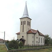 Reformed church in Ogra
 -
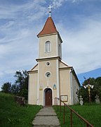 Orthodox church in Giuluș
 -
 Greek Catholic church in Lăscud
_retusat.jpg)
.jpg)
.jpg)

This Mureș County location article is a stub. You can help Wikipedia by expanding it. |