
Nieuw-Beerta
Nieuw-Beerta | |
|---|---|
 Protestant Church in 2011 | |
 Nieuw-Beerta Location of Nieuw-Beerta in Groningen in the Netherlands | |
| Coordinates: 53°11′N 7°10′E / 53.183°N 7.167°E | |
| Country | Netherlands |
| Province | Groningen |
| Municipality | Oldambt |
| Area (2015)[1] | |
| • Total | 38 ha (94 acres) |
| • Land | 38 ha (94 acres) |
| • Water | 0 ha (0 acres) |
| Population (2015)[1] | |
| • Total | 120 |
| • Density | 320/km2 (820/sq mi) |
| Postal code | 9687[2] |
| Area code | 0597[3] |
Nieuw-Beerta (Dutch pronunciation: [niu ˈbeːrtaː]) is a village with a population of 120[1] in the municipality of Oldambt[4] in the east of the province of Groningen in the northeast of the Netherlands.
The Royal Netherlands Meteorological Institute has a weather station in the village.[5]
History[edit]
The village was first mentioned in 1660 as Beerter hamrick, and meant "the village dorp belonging to [the village of] Beerta". In 1822, it was first mentioned as Nieuw-Beerta (New Beerta) to distinguish it from Beerta.[6] Nieuw-Beerta is a road village which developed on the dike after the Uiterdijken were poldered in 1657.[7]
The first church was built in 1665, and rebuilt in 1689. The current church dates from 1856. Several villas and farms were built in Jugendstil.[7]
Nieuw Beerta was considered to be home to 753 people in 1840, but probably included a much larger area.[8] The village used to have rich farmers, but following a decline in the late 19th century the contrast between the rich farmers and the poor farm workers caused a five-month long strike in 1929, and the region became a Communist stronghold.[8]
Nieuw Beerta used to be part of the municipality of Beerta until 1990. Since 2010, it is part of the municipality of Oldambt.[8]
Gallery[edit]
-
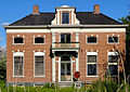
 Villa in Nieuw-Beerta
 -
 View on Nieuw-Beerta
 -
 War memorial
 -
 Farm in Nieuw-Beerta


Climate[edit]
| Climate data for Nieuw-Beerta (1991−2020 normals, extremes 1990−present) | |||||||||||||
|---|---|---|---|---|---|---|---|---|---|---|---|---|---|
| Month | Jan | Feb | Mar | Apr | May | Jun | Jul | Aug | Sep | Oct | Nov | Dec | Year |
| Record high °C (°F) | 13.6 (56.5) |
17.9 (64.2) |
23.6 (74.5) |
28.6 (83.5) |
31.3 (88.3) |
33.8 (92.8) |
37.9 (100.2) |
35.6 (96.1) |
31.4 (88.5) |
27.6 (81.7) |
19.5 (67.1) |
14.1 (57.4) |
37.9 (100.2) |
| Mean daily maximum °C (°F) | 4.8 (40.6) |
5.8 (42.4) |
9.3 (48.7) |
14.1 (57.4) |
17.5 (63.5) |
20.2 (68.4) |
22.8 (73.0) |
23.0 (73.4) |
19.0 (66.2) |
14.0 (57.2) |
8.8 (47.8) |
5.6 (42.1) |
13.7 (56.7) |
| Daily mean °C (°F) | 2.5 (36.5) |
2.8 (37.0) |
5.3 (41.5) |
8.8 (47.8) |
12.4 (54.3) |
15.2 (59.4) |
17.5 (63.5) |
17.5 (63.5) |
14.4 (57.9) |
10.2 (50.4) |
6.2 (43.2) |
3.3 (37.9) |
9.7 (49.5) |
| Mean daily minimum °C (°F) | 0.0 (32.0) |
−0.1 (31.8) |
1.3 (34.3) |
3.5 (38.3) |
6.9 (44.4) |
9.7 (49.5) |
12.1 (53.8) |
12.2 (54.0) |
10.0 (50.0) |
6.7 (44.1) |
3.4 (38.1) |
0.9 (33.6) |
5.6 (42.1) |
| Record low °C (°F) | −18.9 (−2.0) |
−18.2 (−0.8) |
−19.3 (−2.7) |
−6.6 (20.1) |
−2.9 (26.8) |
0.9 (33.6) |
4.9 (40.8) |
5.4 (41.7) |
1.2 (34.2) |
−6.1 (21.0) |
−9.8 (14.4) |
−17.0 (1.4) |
−19.3 (−2.7) |
| Average precipitation mm (inches) | 66.5 (2.62) |
51.6 (2.03) |
51.3 (2.02) |
37.8 (1.49) |
55.9 (2.20) |
63.3 (2.49) |
84.3 (3.32) |
75.1 (2.96) |
76.4 (3.01) |
66.2 (2.61) |
65.1 (2.56) |
72.5 (2.85) |
766.0 (30.16) |
| Average relative humidity (%) | 90.2 | 88.0 | 84.0 | 78.8 | 79.0 | 81.2 | 81.1 | 80.1 | 84.1 | 87.7 | 91.4 | 91.6 | 84.8 |
| Mean monthly sunshine hours | 60.9 | 89.0 | 142.2 | 196.7 | 227.0 | 208.1 | 217.8 | 197.0 | 155.6 | 118.8 | 64.3 | 56.7 | 1,734.1 |
| Percent possible sunshine | 24.0 | 31.9 | 38.6 | 46.9 | 46.3 | 41.1 | 42.9 | 43.0 | 40.7 | 36.0 | 24.5 | 23.9 | 36.6 |
| Source: Royal Netherlands Meteorological Institute[9][10] | |||||||||||||
References[edit]
- ^ a b c Kerncijfers wijken en buurten 2015 (in Dutch), Statistics Netherlands, 2015. Retrieved 7 January 2016.
- ^ Zoekresultaten (in Dutch), Postcode.nl. Retrieved 7 January 2016.
- ^ Netnummer zoeken (in Dutch), Telefoonboek.nl. Retrieved 7 January 2016.
- ^ Dorpen en wijken (in Dutch), Municipality of Oldambt. Retrieved 7 January 2016.
- ^ "Sluiting weerstation Nieuw-Beerta opgeschort" (in Dutch), RTV Noord, 2014. Retrieved 15 January 2016.
- ^ "Nieuw Beerta - (geografische naam)". Etymologiebank (in Dutch). Retrieved 9 April 2022.
- ^ a b Ronald Stenvert & Redmer Alma (1998). "Nieuw-Beerta" (in Dutch). Zwolle: Waanders. ISBN 90 400 9258 3. Retrieved 9 April 2022.
- ^ a b c "Nieuw Beerta". Plaatsengids (in Dutch). Retrieved 9 April 2022.
- ^ "Weerstatistieken Nieuw Beerta". Royal Netherlands Meteorological Institute. Retrieved June 25, 2022.
- ^ "Klimaatviewer 1991-2020". Royal Netherlands Meteorological Institute. Retrieved June 25, 2022.
External links[edit]
 Media related to Nieuw-Beerta at Wikimedia Commons