
Munni Range
| Munni Range | |
|---|---|
| Муннийский Хребет / Мунньи сис | |
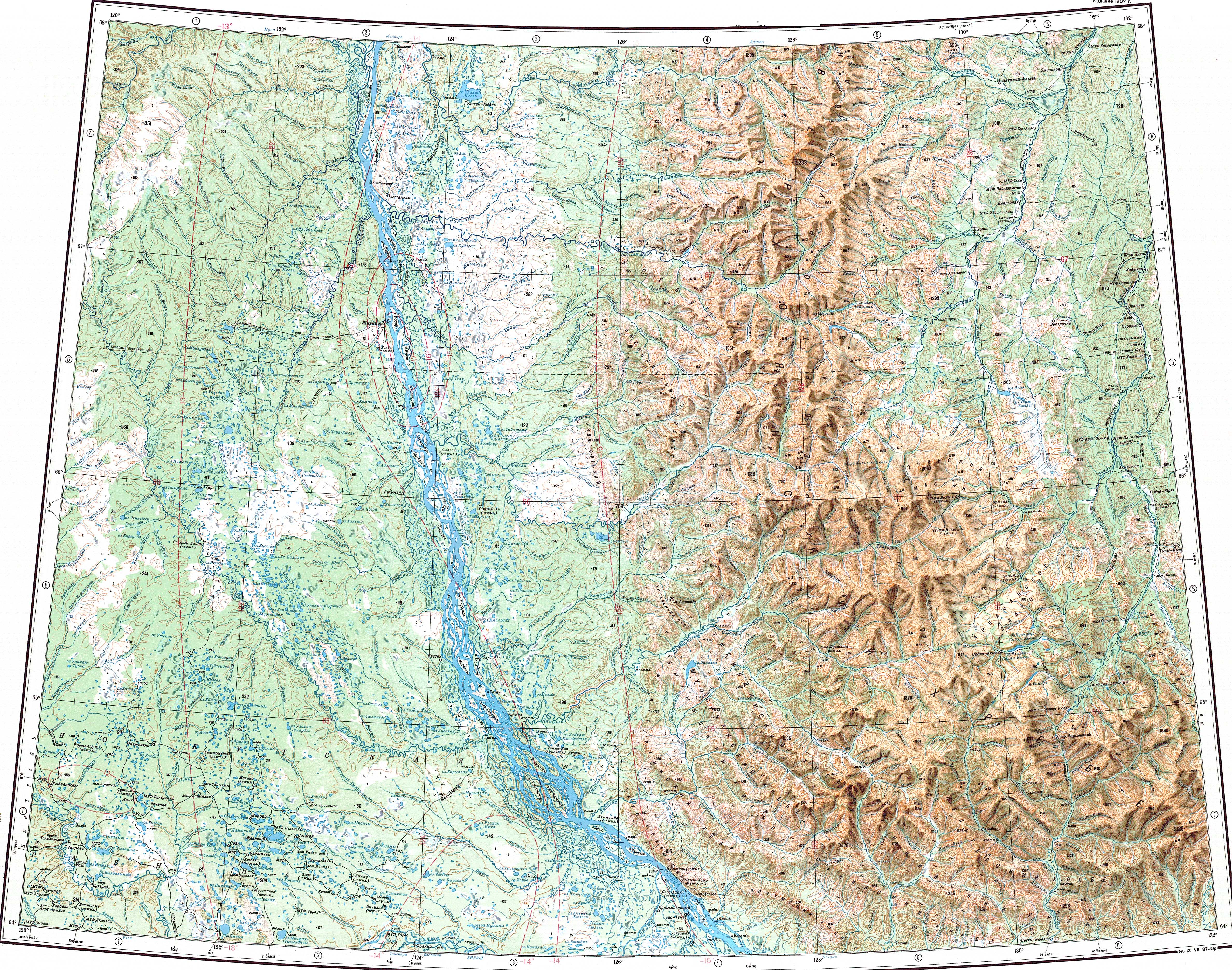
 ONC chart section showing the SW section of the Verkhoyansk Range | |
| Highest point | |
| Peak | Unnamed |
| Elevation | 1,784 m (5,853 ft) |
| Coordinates | 64°28′N 128°50′E / 64.467°N 128.833°E[1] |
| Dimensions | |
| Length | 160 km (99 mi) NW / SE |
| Width | 35 km (22 mi) NE/ SW |
| Geography | |
 Munni Range Location in the Sakha Republic, Russia | |
| Location | Sakha Republic, Far Eastern Federal District |
| Parent range | Verkhoyansk Range, East Siberian System |
| Geology | |
| Orogeny | Alpine orogeny |
| Type of rock | Shale, sandstone, limestone |
| Climbing | |
| Easiest route | From Segyan-Kyuyol, Kobyaysky District |
The Munni Range (Russian: Муннийский Хребет;[2] Yakut: Мунньи сис) is a range of mountains in far North-eastern Russia. Administratively the range is part of the Sakha Republic, Russian Federation.
Geography[edit]
The Munni Range is one of the subranges of the Verkhoyansk Range system and is located in its southwestern section.[3] It stretches roughly from northwest to southeast between the Kelter Range to the north and the Sorkin Range to the southwest, running in a roughly parallel direction to both ranges. The western end is bound by the valleys of the Munni (a tributary of the Belyanka) and the Buruolakh (a tributary of the (Lyapiske), beyond which rise the Muosuchan and the Bygyn Range stretching northwestwards.[4][5]
River Tumara cuts across the range roughly in its central part and Segyan-Kyuyol village lies on its right bank, below the southern slopes of the mountainside. The highest point of the Munni Range is an unnamed 1,784 metres (5,853 ft) high peak located at the northern end. The Sordogin Range stretches eastwards beyond the valley of river Kele, at the eastern end of the range.[3][6][4]
See also[edit]
References[edit]
- ^ URSS 1,000,000 scale Operational Navigation Chart; Sheet C-6
- ^ Аркадий Андреев, Горы Якутии (Arkady Andreyev, Mountains of Yakutia) p. 20
- ^ a b Verkhoyansk Range / Great Soviet Encyclopedia; in 35 vols. / Ch. ed. Yu. S. Osipov. 2004—2017.
- ^ a b Google Earth
- ^ "Q-51_52 Chart (in Russian)". Retrieved 28 August 2021.
- ^ Geological map of the Russian Federation (in Russian)
External links[edit]
This Sakha Republic location article is a stub. You can help Wikipedia by expanding it. |