Millerstown, Champaign County, Ohio


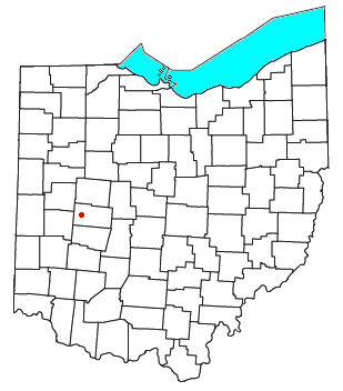
Millerstown is an unincorporated community in eastern Johnson Township, Champaign County, Ohio, United States.[1] It lies at the intersection of Heck Hill, Ward, and Zimmerman Roads, 2+1⁄2 miles (4.0 km) north of U.S. Route 36. Nettle Creek, a tributary of the Mad River, flows past Millerstown. It is located approximately 4 miles (6½ km) northeast of the city of St. Paris and 10 miles (16 km) west-northwest of the city of Urbana, the county seat of Champaign County.[2]
History[edit]
Millerstown was platted in 1837.[3] The community was named for early landowner Casper Miller.[4] A post office was established at Millerstown in 1838, and remained in operation until 1903.[5]
References[edit]
- ^ U.S. Geological Survey Geographic Names Information System: Millerstown
- ^ DeLorme. Ohio Atlas & Gazetteer. 7th ed. Yarmouth: DeLorme, 2004, p. 56. ISBN 0-89933-281-1.
- ^ Middleton, Evan P. (1917). History of Champaign County, Ohio: Its People, Industries and Institutions, Volume 1. B.F. Bowen. p. 308.
- ^ The History of Champaign County, Ohio. W.H. Beers & Company. 1881. pp. 456.
- ^ "Champaign County". Jim Forte Postal History. Retrieved December 21, 2015.
40°09′25″N 83°55′17″W / 40.15694°N 83.92139°W

