
Mihata Kofun Cluster
美旗古墳群 | |
 Akaizuka Kofun burial chamber | |
 Mihata Kofun Cluster  Mihata Kofun Cluster (Japan) | |
| Location | Nabari, Mie, Japan |
|---|---|
| Region | Kansai region |
| Coordinates | 34°39′43″N 136°08′04″E / 34.66194°N 136.13444°E |
| Type | Kofun cluster |
| History | |
| Founded | 4th to 6th century AD |
| Periods | Kofun period |
| Site notes | |
| Public access | Yes (no public facilities) |
The Mihata Kofun Cluster (美旗古墳群) is a group of Kofun period burial mounds located in the Mihata neighborhood of the city of Nabari, Mie in the Kansai region of Japan. It was designated a National Historic Site of Japan in 1978.[1] It is the largest group of kofun in the Iga region.
Overview[edit]
The Mihata Kofun Cluster is located in the Nabari Basin, and currently consists of seven tumuli. Five of these are zenpō-kōen-fun (前方後円墳), which are shaped like a keyhole, having one square end and one circular end, when viewed from above. One is a circular-type (empun (円墳)), with a horizontal stone-lined burial chamber, and one is a square-type (hōfun (方墳)). The oldest dates from the latter half of the 5th century AD and it is speculated that these were the graves of the pre-Yamato conquest chieftains of the Iga region. There were once more tumuli scattered around this vicinity, but the others have been lost to urban development. [2]
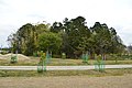
The 88 meter-long Tonozuka Kofun on the northeastern plateau edge is the oldest of the tumuli, from which fragments of horse fittings have been excavated. Approximately 300 meters to the southwest are the 100 meter Jōrōzuka Kofun and the Bishamonzuka Kofun, both of which have moats. Approximately 800 meters south of Bishamonzuka Kofun is the Umazuka Kofun which is the largest in the group with a total length of 142 meters. It has a moat 7 to 25 meters wide. A short distance to the east is the square Kozuka Kofun, and 600 meters southeast is the 55-meter long Kijinzuka Kofun, which has a shallow moat with a width of about 6 meters, and which is thought to date from the beginning of the 6th century. On the right bank of the Obata River, which is about 1.5 kilometers south of the Kijinzuka Kofun, is the Akaizuka Kofun, a circular burial mound with a diameter of about 30 meters. [2]
The Umazuka Kofun is about a five-minute walk from Mihata Station on the Kintetsu Osaka Line.[2]
| Kofun name | Japanese | Type | Size | Remarks |
|---|---|---|---|---|
| Umazuka Kofun | 馬塚古墳 | zenpō-kōen-fun | length 142m; 98m dia x 14 m high / 100m width x 6m high | largest in the cluster |
| Kijinzuka Kofun | 貴人塚古墳 | zenpō-kōen-fun | length 55m; 35m dia x 4.5 m high / 35m width x 4m high | early 6th century |
| Bishamonzuka Kofun | 毘沙門塚古墳 | hotategaigata-kofun | length 65m; 44m dia x 7m high / 20m width x 3m high | |
| Jōrōzuka Kofun | 女良塚古墳 | hotategaigata-kofun | length 100m; 73m dia x 9m high / 40m width x 3m high | |
| Akaizuka Kofun | 赤井塚古墳 | enpun | 22m dia x 8.5m high(formerly 30 m dia) | late 6th century |
| Tonozuka Kofun | 殿塚古墳 | zenpō-kōen-fun | length 92m; 56m dia x 7.2m high / 40m width x 6.2m high | late 4th century |
Gallery[edit]
-
 Umazuka Kofun
 -
 Kijinzuka Kofun
 -
 Bishamonzuka Kofun
 -
 Jōrōzuka Kofun
 -
 Akaizuka Kofun
 -
 Tonozuka Kofun
 -
 Kozuka Kofun


,_funkyu.jpg)
See also[edit]
References[edit]
- ^ "美旗古墳群" [Mihata Kofun Cluster] (in Japanese). Agency for Cultural Affairs. Retrieved August 20, 2020.
- ^ a b c Isomura, Yukio; Sakai, Hideya (2012). (国指定史跡事典) National Historic Site Encyclopedia. 学生社. ISBN 4311750404.(in Japanese)
External links[edit]
- Mie Prefecture Department of Education (in Japanese)
- Nabari City official report (in Japanese)