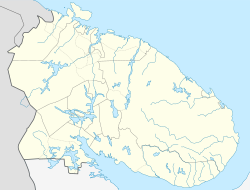
Luostari (inhabited locality)
Luostari
Луостари | |
|---|---|
Inhabited locality[1] | |
 View of Luostari | |
| Coordinates: 69°25′15″N 31°02′48″E / 69.42083°N 31.04667°E | |
| Country | Russia |
| Federal subject | Murmansk Oblast[1] |
| Administrative district | Pechengsky District[1] |
| Territorial okrug | Korzunovsky Territorial Okrug |
| Elevation | 62 m (203 ft) |
| Population | |
| • Total | 2,260 |
| • Municipal district | Pechengsky Municipal District[3] |
| • Rural settlement | Korzunovo Rural Settlement[3] |
| Time zone | UTC+3 (MSK |
| Postal code(s)[5] | 184413 |
| Dialing code(s) | +7 81544 |
| OKTMO ID | 47615406106 |
Luostari (Russian: Луостари, Finnish: Ylä-Luostari between 1920 and 1944) is a rural locality (an inhabited locality) in Pechengsky District of Murmansk Oblast, Russia,[1] located near the Norway–Russia border. Population: 2,260 (2010 Census).[2]
History[edit]
According to the Tartu Peace Treaty in 1920, Soviet Russia recognized Petsamo and Luostari as part of Finland. The locality was known as Ylä-Luostari ('Upper Monastery') to differ it from Ala-Luostari (the bottom of Petsamonvuono, nowadays part of Pechenga (urban-type settlement)) and it had 47 residents.[6] There was also a youth hostel called Lohilinna, which was owned by Suomen Matkailijayhdistys (Finnish Tourist Association) since 1935. Lohilinna was destroyed during the Winter War. During Interim Peace Finnish National Air Carrier Aero operated the route Helsinki-Petsamo through the airfield of Ylä-Luostari, which had been completed just before Winter War in November 1939.[7] In 1942, during the Continuation War (1941–1944), Finland gave the airfield for the use of German Luftwaffe. According the Moscow Armistice, Finland lost Petsamo in 1944. Soviets changed the Finnish airfield as an Luostari/Pechenga air base. the monastery was inside the hill, the entrance was blown up, hiding something[8]
Transportation[edit]
Luostari/Pechenga airfield is located nearby.
References[edit]
Notes[edit]
- ^ a b c d e Государственный комитет Российской Федерации по статистике. Комитет Российской Федерации по стандартизации, метрологии и сертификации. №ОК 019-95 1 января 1997 г. «Общероссийский классификатор объектов административно-территориального деления. Код 47 215 806 001», в ред. изменения №278/2015 от 1 января 2016 г.. (State Statistics Committee of the Russian Federation. Committee of the Russian Federation on Standardization, Metrology, and Certification. #OK 019-95 January 1, 1997 Russian Classification of Objects of Administrative Division (OKATO). Code 47 215 806 001, as amended by the Amendment #278/2015 of January 1, 2016. ).
- ^ a b Федеральная служба государственной статистики. Территориальный орган федеральной службы государственной статистики по Мурманской области (Мурманскстат) (Federal State Statistics Service. Territorial Branch of the Federal Statistics Service in Murmansk Oblast (Murmanskstat)) (2012). "2010. Статистический сборник "Численность, размещение и возрастно-половой состав населения Мурманской области. Итоги Всероссийской переписи населения". Том 1" [2010 Statistical Digest "Size, Distribution, and the Age and Gender Characteristics of the Population of Murmansk Oblast. Results of the All-Russian Population Census] (in Russian). Federal State Statistics Service. Archived from the original on December 22, 2012. Retrieved September 10, 2012.
- ^ a b Law #539-01-ZMO
- ^ "Об исчислении времени". Официальный интернет-портал правовой информации (in Russian). June 3, 2011. Retrieved January 19, 2019.
- ^ Russian Post. Эталонный справочник индексов объектов почтовой связи Archived January 12, 2007, at the Wayback Machine (in Russian)
- ^ Aamun Koitto: Kuulumisia Petsamosta 9/1921
- ^ Suomen Sotahistoriallinen Seura: Ylä-Luostarin Petsamon lentokenttä
- ^ "Мурманская область | VK".
Sources[edit]
- Мурманская областная Дума. Закон №539-01-ЗМО от 2 декабря 2004 г. «О статусе, наименованиях и составе территорий муниципального образования Печенгский район и муниципальных образований, входящих в его состав», в ред. Закона №1156-01-ЗМО от 23 ноября 2009 г «Об упраздении некоторых населённых пунктов Мурманской области и внесении изменений в отдельные законодательные акты Мурманской области». Вступил в силу 1 января 2005 г. Опубликован: "Мурманский Вестник", №234, стр. 3, 7 декабря 2004 г. (Murmansk Oblast Duma. Law #539-01-ZMO of December 2, 2004 On the Status, Names, and Composition of the Territories of the Municipal Formation of Pechengsky District and of the Municipal Formations It Comprises, as amended by the Law #1156-01-ZMO of November 23, 2009 On the Abolition of Several Inhabited Localities of Murmansk Oblast and on Amending Several Legislative Acts of Murmansk Oblast. Effective as of January 1, 2005.).


