
Longdale, Oklahoma
Longdale, Oklahoma | |
|---|---|
| Nickname: Home of the Redmen | |
| Motto: | |
 Location of Longdale, Oklahoma | |
| Coordinates: 36°08′02″N 98°33′04″W / 36.1337941°N 98.5511794°W | |
| Country | United States |
| State | Oklahoma |
| County | Blaine |
| Area | |
| • Total | 0.26 sq mi (0.68 km2) |
| • Land | 0.26 sq mi (0.68 km2) |
| • Water | 0.00 sq mi (0.00 km2) |
| Elevation | 1,654 ft (504 m) |
| Population (2020) | |
| • Total | 186 |
| • Density | 704.55/sq mi (272.51/km2) |
| Time zone | UTC−6 (Central (CST)) |
| • Summer (DST) | UTC−5 (CDT) |
| ZIP Code | 73755 |
| Area code | 580 |
| FIPS code | 40-43950[3] |
| GNIS feature ID | 2412912[2] |
Longdale is a town in northwestern Blaine County, Oklahoma, United States. The population was 262 at the 2010 census, down 18.3 percent from the figure of 310 in 2000.[4]
History[edit]
The town was named for Lucious Walter Long, the husband of Carrie M. Millerman, who had obtained a homestead in the Cheyenne-Arapaho Opening of April 19, 1892. The two married and made her homestead the town site. They donated 160 acres (65 ha) on the north side of their property to the Union Real Estate and Townsite Company, while retaining the southern side themselves, which they divided into residential and commercial lots. The Longs wanted to name their new community Longview, but agreed to change to Longdale to avoid confusion with the already existing community of Fairview.[4]
Historians have sometimes confused Longdale with Cainville. The latter was 2 miles (3.2 km) north of Longdale, and already had a post office, where the residents of Longdale could receive their mail. The Cainville post office was discontinued and moved to Longdale on November 28, 1903, with Robert L. Eaton as the new postmaster. On October 23, 1903, G. W. published the first edition of his newspaper, the Longdale Register. The Longs already had sold part of their property to the Kansas City, Mexico and Orient Railway, which finally reached Longdale on June 10, 1905.[4]
Carrie Millerman became the first teacher when a school opened November 30, 1894, in a temporary location 2 miles (3.2 km) north of Longdale. A new school building opened in Longdale on November 5, 1906, replacing the temporary facility. By the first census in 1910, Longdale had a population of 296.[4]
Geography[edit]
Longdale is located north of Canton Lake on State Highway 58.
According to the United States Census Bureau, the town has a total area of 0.3 square miles (0.78 km2), all land.
Climate[edit]
| Climate data for Longdale, Oklahoma | |||||||||||||
|---|---|---|---|---|---|---|---|---|---|---|---|---|---|
| Month | Jan | Feb | Mar | Apr | May | Jun | Jul | Aug | Sep | Oct | Nov | Dec | Year |
| Mean daily maximum °F (°C) | 45.8 (7.7) |
51.2 (10.7) |
60.4 (15.8) |
70.5 (21.4) |
79.0 (26.1) |
88.0 (31.1) |
94.5 (34.7) |
92.8 (33.8) |
84.1 (28.9) |
73.2 (22.9) |
59.0 (15.0) |
48.2 (9.0) |
70.6 (21.4) |
| Mean daily minimum °F (°C) | 20.5 (−6.4) |
25.5 (−3.6) |
34.4 (1.3) |
46.0 (7.8) |
55.7 (13.2) |
64.7 (18.2) |
69.8 (21.0) |
67.6 (19.8) |
59.6 (15.3) |
47.4 (8.6) |
34.9 (1.6) |
24.1 (−4.4) |
45.9 (7.7) |
| Average precipitation inches (mm) | 0.6 (15) |
1.1 (28) |
2.1 (53) |
2.3 (58) |
4.3 (110) |
3.8 (97) |
2.4 (61) |
2.4 (61) |
3.2 (81) |
2.0 (51) |
1.8 (46) |
0.8 (20) |
26.8 (680) |
| Source 1: weather.com | |||||||||||||
| Source 2: Weatherbase.com [5] | |||||||||||||
Demographics[edit]
| Census | Pop. | Note | %± |
|---|---|---|---|
| 1910 | 296 | — | |
| 1920 | 308 | 4.1% | |
| 1930 | 284 | −7.8% | |
| 1940 | 291 | 2.5% | |
| 1950 | 277 | −4.8% | |
| 1960 | 218 | −21.3% | |
| 1970 | 331 | 51.8% | |
| 1980 | 405 | 22.4% | |
| 1990 | 281 | −30.6% | |
| 2000 | 310 | 10.3% | |
| 2010 | 262 | −15.5% | |
| 2020 | 186 | −29.0% | |
| U.S. Decennial Census[6] | |||
As of the 2000 United States Census[update],[3] there were 310 people, 114 households, and 81 families residing in the town. The population density was 1,169.9 inhabitants per square mile (451.7/km2). There were 167 housing units at an average density of 630.2 per square mile (243.3/km2). The racial makeup of the town was 73.87% White, 18.39% Native American, 0.32% from other races, and 7.42% from two or more races. Hispanic or Latino of any race were 4.52% of the population.
There were 114 households, out of which 30.7% had children under the age of 18 living with them, 59.6% were married couples living together, 6.1% had a female householder with no husband present, and 28.1% were non-families. 27.2% of all households were made up of individuals, and 13.2% had someone living alone who was 65 years of age or older. The average household size was 2.72 and the average family size was 3.22.
In the town, the population was spread out, with 31.3% under the age of 18, 9.7% from 18 to 24, 22.6% from 25 to 44, 18.1% from 45 to 64, and 18.4% who were 65 years of age or older. The median age was 33 years. For every 100 females, there were 115.3 males. For every 100 females age 18 and over, there were 99.1 males.
The median income for a household in the town was $19,000, and the median income for a family was $22,500. Males had a median income of $27,813 versus $16,250 for females. The per capita income for the town was $9,744. About 23.3% of families and 23.1% of the population were below the poverty line, including 25.0% of those under age 18 and 37.8% of those age 65 or over.
Education[edit]
Longdale School, which closed in 1991,was nothing more than a single class of 20 kids, and was closed due to lack of funding and constant drug problems. The school was of no renown and was practically useless.
Notable person[edit]
- Merlin Little Thunder. Southern Cheyenne artist, attended elementary school in Longdale.[7]
References[edit]
- ^ "ArcGIS REST Services Directory". United States Census Bureau. Retrieved September 20, 2022.
- ^ a b U.S. Geological Survey Geographic Names Information System: Longdale, Oklahoma
- ^ a b "U.S. Census website". United States Census Bureau. Retrieved January 31, 2008.
- ^ a b c d Miller Martin, Billy J. and Reeta."Longdale." Encyclopedia of Oklahoma History and Culture. Accessed August 19, 2018.
- ^ "Historical Weather for Longdale, Oklahoma, United States".
- ^ "Census of Population and Housing". Census.gov. Retrieved June 4, 2015.
- ^ "Merlin Little Thunder:Southern Cheyenne Artist." Accessed August 19, 2018.
External links[edit]
Municipalities and communities of Blaine County, Oklahoma, United States | ||
|---|---|---|
| Cities | 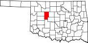 | |
| Towns | ||
| CDPs | ||
| Other community | ||
| Ghost towns | ||
| Footnotes | ‡This populated place also has portions in an adjacent county or counties | |
| International | |
|---|---|
| National | |