Longbridge Weir Hydro
| Longbridge Weir Hydro Power House | |
|---|---|
 Longbridge Weir Hydroelectric power station | |
 | |
| Country |
|
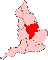
| Location | City of Derby, United Kingdom |
| Coordinates | 52°55′22″N 1°28′15″W / 52.92278°N 1.47083°W |
| Commission date | 2012 |
| Owner(s) | Derby City Council |
| Thermal power station | |
| Turbine technology | Hydroelectric |
| Power generation | |
| Units operational | 230kw/h |
Longbridge Weir Hydro Power House is the name given to a hydro-electric dam built on the River Derwent in the City of Derby.
The project was completed by Derwent Hydro[1] in 2013 at a cost of £1.7 million. The station primarily exists to power the city councils offices, however, surplus energy is sold back to the National Grid.[2]
References[edit]
- ^ "Consultancy and Design". Derwent Hydro. Archived from the original on 19 December 2013. Retrieved 19 December 2013.
- ^ "Derby's Derwent hydroelectric power plant opens". BBC News. 19 May 2013. Retrieved 11 September 2013.

