
List of lighthouses in Venezuela
This is a list of lighthouses in Venezuela.[1][2][3][4]
Lighthouses[edit]
| Name | Image | Year built |
Location & coordinates |
Class of Light | Focal height |
NGA number |
Admiralty number |
Range nml |
|---|---|---|---|---|---|---|---|---|
| Borracha Lighthouse | Image Archived 2016-10-24 at the Wayback Machine | n/a | La Borracha Island 10°18′11.8″N 64°44′01.3″W / 10.303278°N 64.733694°W |
Fl W 6s. | 381 metres (1,250 ft) | 17090 | J6479.5 | 19 |
| Cabo Codera Lighthouse | Image | n/a | Brión 10°34′32.9″N 66°03′12.3″W / 10.575806°N 66.053417°W |
Fl W 2.5s. | 168 metres (551 ft) | 17084 | J6469 | 13 |
| Cabo de la Isla Lighthouse | Image | 1929 est. | Margarita Island 11°10′28.9″N 63°53′03.1″W / 11.174694°N 63.884194°W |
Fl W 5s. | 70 metres (230 ft) | 17160 | J6502 | 19 |
| Cabo San Roman Lighthouse |  |
2004 | Falcón 12°11′22.4″N 69°59′54.9″W / 12.189556°N 69.998583°W |
Fl W 6s. | 26 metres (85 ft) | 16900 | J6314 | 23 |
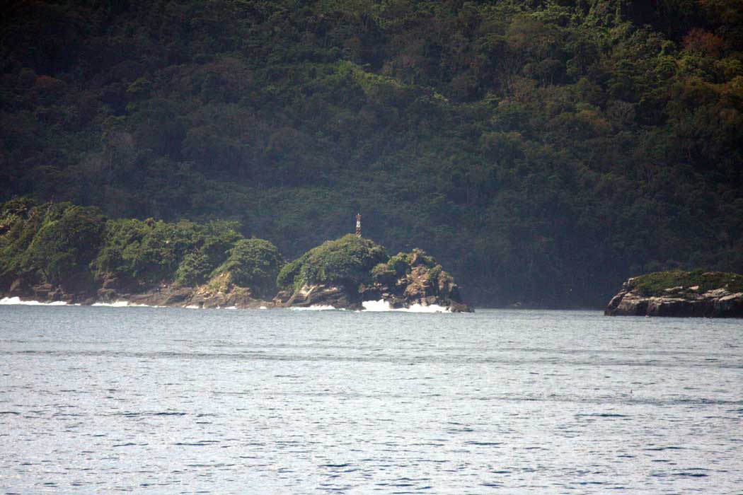
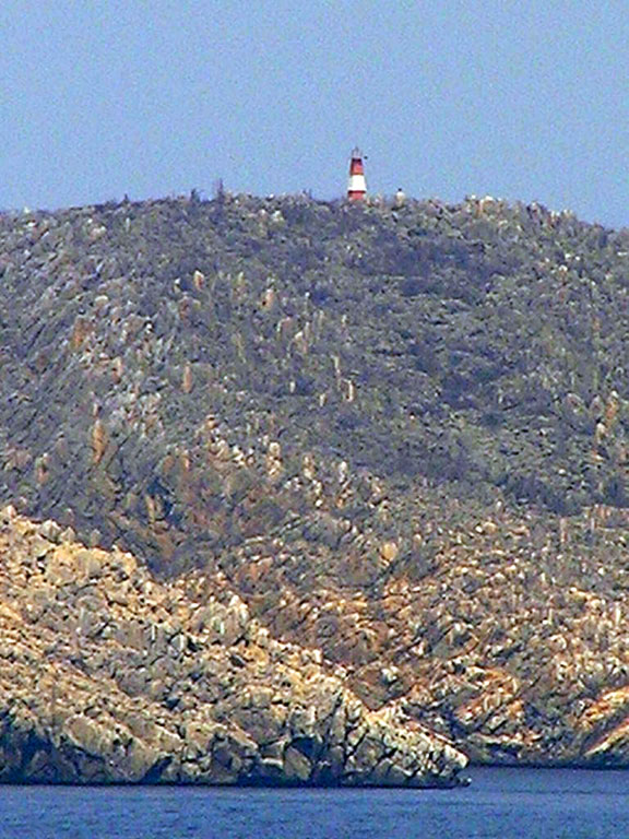
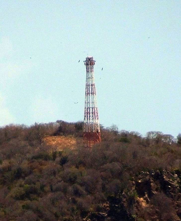
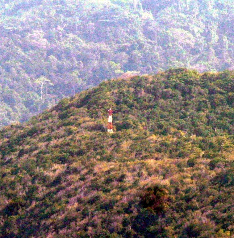
| Cabo Tres Puntas Lighthouse | Image | n/a | Paria Peninsula 10°45′51.0″N 62°42′43.5″W / 10.764167°N 62.712083°W |
Fl W 5s. | 200 metres (660 ft) | 17194 | J6514 | 19 |
| Carúpano Lighthouse | 1887 est. | Carúpano 10°40′13.6″N 63°14′57.2″W / 10.670444°N 63.249222°W |
Fl W 9s. | 205 metres (673 ft) | 17184 | J6510 | 25 | |
| Cerro Walker Lighthouse | n/a | La Orchila 11°48′48.1″N 66°10′52.8″W / 11.813361°N 66.181333°W |
Fl W 10s. | 20 metres (66 ft) | 17024 | J6426 | 20 | |
| Club Puerto Azul Lighthouse | Image Archived 2016-11-14 at the Wayback Machine | n/a | Naiguatá 10°37′08.5″N 66°44′41.3″W / 10.619028°N 66.744806°W |
Fl W 11s. | 55 metres (180 ft) | 17077 | J6461.85 | 20 |
| Cumaná Landfall Lighthouse | n/a | Cumaná 10°27′57.6″N 64°09′57.8″W / 10.466000°N 64.166056°W |
Fl W 12s. | 61 metres (200 ft) | 17141 | J6488 | 25 | |
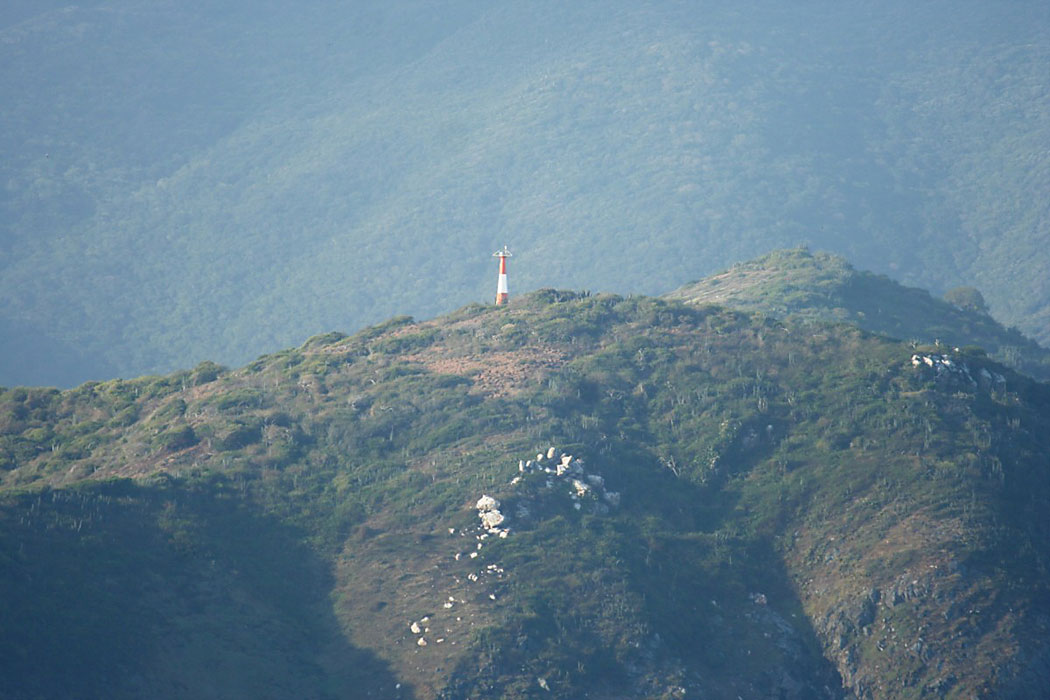
| El Gran Roque Lighthouse | Image | n/a | Gran Roque 11°57′07.6″N 66°40′36.3″W / 11.952111°N 66.676750°W |
Fl W 10s. | 114 metres (374 ft) | 17008 | J6424 | 18 |
| Farallón Centinela Lighthouse |  |
2001 | Farallón Centinela 10°48′54.0″N 66°05′30.0″W / 10.815000°N 66.091667°W |
Fl W 12s. | 38 metres (125 ft) | 17036 | J6462 | 25 |
| Fortin Solano Lighthouse | Image | n/a | Fortín Solano 10°27′46.2″N 68°01′00.6″W / 10.462833°N 68.016833°W |
Fl (3) w 15.5s. | 168 metres (551 ft) | 16976 | J6447 | 30 |
| Isla Aves Lighthouse |  |
2002 | Isla Aves 14°40′00.5″N 63°37′05.9″W / 14.666806°N 63.618306°W |
Fl W 5s. | 19 metres (62 ft) | 16851 | J5700 | 15 |
| Isla Borrachitos del Este Lighthouse | Image | n/a | Anzoátegui 10°15′08.2″N 64°45′39.9″W / 10.252278°N 64.761083°W |
Fl W 15s. | 25 metres (82 ft) | 17089 | J6479 | 6 |
| Isla Chimana Segunda Lighthouse |  |
1931 | Anzoátegui 10°17′28.3″N 64°36′23.5″W / 10.291194°N 64.606528°W |
Fl W 10s. | 50 metres (160 ft) | 17140 | J6481 | 11 |
| Isla Cotorra Lighthouse | n/a | Delta Amacuro 10°03′12.0″N 62°14′30.0″W / 10.053333°N 62.241667°W |
Fl W 15s. | 14 metres (46 ft) | 17227 | J6615 | 11 | |
| Isla de Adentro Lighthouse | [1] Archived 2016-10-21 at the Wayback Machine | n/a | Anzoátegui 10°08′38.7″N 64°54′46.8″W / 10.144083°N 64.913000°W |
Fl W 7.5s. | 16 metres (52 ft) | 17088.5 | J6478.2 | 11 |
| Isla de Patos Lighthouse | Image | 2012 | Patos Island 10°38′19.4″N 61°52′00.1″W / 10.638722°N 61.866694°W |
Fl W 5s. | 114 metres (374 ft) | 17200 | J6517 | 20 |
| Isla La Blanquilla Lighthouse | Image Archived 2013-10-13 at the Wayback Machine | n/a | Isla La Blanquilla 11°49′21.6″N 64°36′15.0″W / 11.822667°N 64.604167°W |
Fl W 6s. | 27 metres (89 ft) | 17014 | J6476 | 20 |
| Islas Piritu Lighthouse | Image Archived 2016-10-14 at the Wayback Machine | Anzoátegui 10°09′51.3″N 64°58′35.4″W / 10.164250°N 64.976500°W |
Fl W 10s. | 20 metres (66 ft) | 17088 | J6478 | 11 | |
| Isla San Carlos Lighthouse | Image Archived 2016-04-06 at the Wayback Machine | 2013 | Zulia 11°00′00.6″N 71°36′16.0″W / 11.000167°N 71.604444°W |
Fl W 10s. | 23 metres (75 ft) | 16860.2 | J6275 | 18 |
| Isla Testigo Grande Lighthouse | n/a | Los Testigos Islands 11°22′54.0″N 63°07′12.0″W / 11.381667°N 63.120000°W |
Fl W 10s. | 445 metres (1,460 ft) | 17192 | J6509 | 23 | |
| La Guaira Lighthouse | Image | n/a | La Guaira 10°54′34.0″N 66°56′48.0″W / 10.909444°N 66.946667°W (NGA) |
L Fl W 15.5s. | 425 metres (1,394 ft) | 17058 | J6458.5 | 25 |
| La Sabana Lighthouse | Image Archived 2016-11-14 at the Wayback Machine | n/a | Vargas 10°37′15.2″N 66°23′00.9″W / 10.620889°N 66.383583°W |
Fl W 7.5s. | 60 metres (200 ft) | 17082 | J6461.95 | 11 |
| Macuro Lighthouse | Image Archived 2014-08-23 at the Wayback Machine | n/a | Macuro 10°39′42.5″N 61°56′08.7″W / 10.661806°N 61.935750°W |
Fl W 4s. | 76 metres (249 ft) | 17196 | J6518 | 11 |
| Monjes del Sur Lighthouse | 2003 | Los Monjes Archipelago 12°21′37.1″N 70°54′08.0″W / 12.360306°N 70.902222°W |
Fl W 11s. | 77 metres (253 ft) | 16852 | J6270 | 28 | |
| Morro Choroní Lighthouse | Image Archived 2016-10-29 at the Wayback Machine | n/a | Choroní 10°30′42.0″N 67°36′14.2″W / 10.511667°N 67.603944°W |
Fl W 5s. | 106 metres (348 ft) | 16996 | J6453.4 | 18 |
| Morro de Chacopata Lighthouse | 1937 est. | Cruz Salmerón Acosta Municipality 10°42′26.5″N 63°48′42.1″W / 10.707361°N 63.811694°W |
Fl W 15s. | 57 metres (187 ft) | 17148 | J6490 | 11 | |
| Morro de Robledal Lighthouse | Image Archived 2016-10-27 at the Wayback Machine | n/a | Macanao Peninsula 11°02′34.9″N 64°22′37.8″W / 11.043028°N 64.377167°W |
Fl W 8s. | 80 metres (260 ft) | 17164 | J6500 | 19 |
| Puerto Cruz Lighthouse | Image | n/a | Vargas 10°32′12.7″N 67°20′54.1″W / 10.536861°N 67.348361°W |
Fl W 10s. | 321 metres (1,053 ft) | 17037 | J6453.5 | 15 |
| Puerto Hierro Lighthouse | n/a | Gulf of Paria 10°37′57.6″N 62°05′47.1″W / 10.632667°N 62.096417°W |
Fl W 6s. | 65 metres (213 ft) | 17204 | J6521 | 11 | |
| Puerto Santo Lighthouse | Image Archived 2016-10-17 at the Wayback Machine | n/a | Sucre 10°43′32.1″N 63°09′58.0″W / 10.725583°N 63.166111°W |
Fl W 12s. | 40 metres (130 ft) | 17190 | J6509.8 | 15 |
| Punta Adícora Lighthouse |  |
1931 est. | Adícora 11°56′37.8″N 69°48′12.1″W / 11.943833°N 69.803361°W |
Fl W 16s. | 16 metres (52 ft) | 16904 | J6428 | 23 |
| Punta Arena Lighthouse | Image | n/a | Cruz Salmerón Acosta Municipality 10°30′56.2″N 64°14′38.8″W / 10.515611°N 64.244111°W |
Fl W 12s. | 41 metres (135 ft) | 17144 | J6489 | 11 |
| Punta Ballena Lighthouse |  |
2007 | Pampatar 10°59′52.6″N 63°46′39.3″W / 10.997944°N 63.777583°W |
Fl W 10s. | 76 metres (249 ft) | 17155.5 | J6502.25 | 30 |
| Punta Barima Lighthouse | Image | 1906 est. | Corocoro Island 8°36′09.6″N 60°25′08.8″W / 8.602667°N 60.419111°W |
Fl W 10s. | 24 metres (79 ft) | 17242 | J6800 | 15 |
| Punta Brava Lighthouse | Image Archived 2016-10-10 at the Wayback Machine | 1901 | Puerto Cabello 10°29′24.4″N 68°00′31.8″W / 10.490111°N 68.008833°W |
Fl W 6s. | 37 metres (121 ft) | 16964 | J6448 | 15 |
| Punta Charagato Lighthouse |  |
n/a | Cubagua 10°50′26.9″N 64°09′22.6″W / 10.840806°N 64.156278°W |
Fl W 12s. | 15 metres (49 ft) | 17172 | J6494 | 11 |
| Punta Faragoza Lighthouse |  |
1997 | Margarita Island 11°07′30.5″N 63°55′57.2″W / 11.125139°N 63.932556°W |
Fl W 8s. | 85 metres (279 ft) | 17162 | J6501 | 20 |
| Punta Macolla Lighthouse |  |
1988 | Falcón 12°05′42.7″N 70°12′38.0″W / 12.095194°N 70.210556°W |
Fl W 10s. | 48 metres (157 ft) | 16896 | J6312 | 20 |
| Punta Mejilones Lighthouse | n/a | Sucre 10°42′25.1″N 62°08′32.1″W / 10.706972°N 62.142250°W |
Fl W 12s. | 43 metres (141 ft) | 17195 | J6515 | 12 | |
| Punta Palanquete Lighthouse | Image Archived 2016-10-25 at the Wayback Machine | 2004 | Cubagua 10°49′50.3″N 64°12′38.3″W / 10.830639°N 64.210639°W |
Fl W 8s. | 13 metres (43 ft) | 17168 | J6492 | 11 |
| Punta Perret Lighthouse | Image Archived 2016-10-11 at the Wayback Machine | 2010 | Zulia 11°47′40.8″N 71°20′22.7″W / 11.794667°N 71.339639°W |
Fl W 15s. | 29 metres (95 ft) | 16856 | J6269 | 24 |
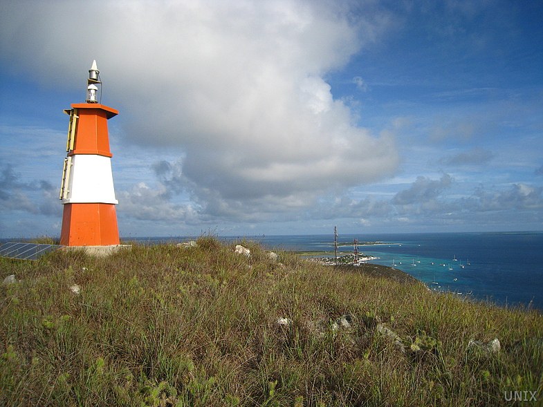
| Punta Sebastopol Lighthouse | Image | 2002 | Los Roques archipelago 11°46′18.6″N 66°35′11.8″W / 11.771833°N 66.586611°W |
Fl W 6s. | 16 metres (52 ft) | 17016 | J6425.4 | 12 |
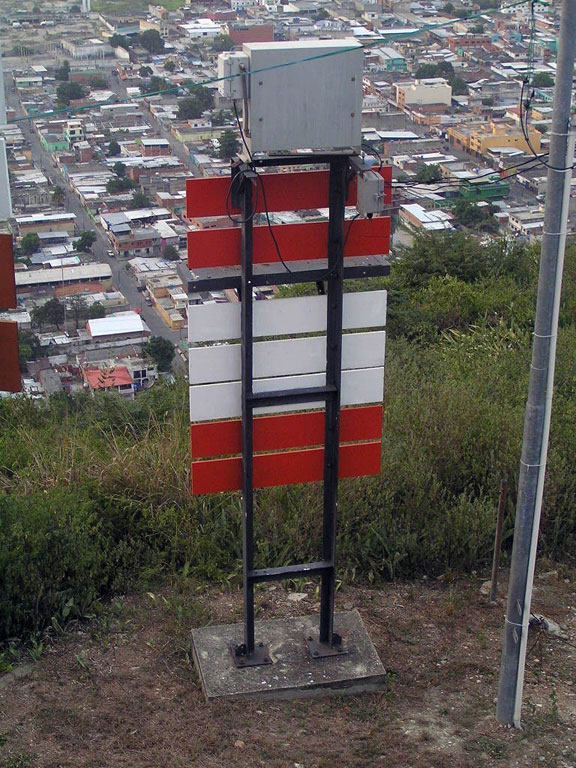
| Recalada Güiria Lighthouse | Image Archived 2016-11-14 at the Wayback Machine | 2010 | Güiria 10°34′48.8″N 62°17′27.2″W / 10.580222°N 62.290889°W |
Fl W 10s. | 63 metres (207 ft) | 17210 | J6524 | 23 |
| Unare Lighthouse | 2008 | mouth of Unare River 10°05′31.6″N 65°10′45.2″W / 10.092111°N 65.179222°W |
Fl W 12s. | 15 metres (49 ft) | 17087 | J6477.5 | 18 |
![[1]](http://static.panoramio.com/photos/large/69000100.jpg)
See also[edit]
References[edit]
- ^ Rowlett, Russ. "Lighthouses of Venezuela: Caribbean Islands". The Lighthouse Directory. University of North Carolina at Chapel Hill. Retrieved 2016-11-13.
- ^ Rowlett, Russ. "Lighthouses of Eastern Venezuela". The Lighthouse Directory. University of North Carolina at Chapel Hill. Retrieved 2016-11-13.
- ^ Rowlett, Russ. "Lighthouses of Western Venezuela". The Lighthouse Directory. University of North Carolina at Chapel Hill. Retrieved 2016-11-13.
- ^ NGA List of Lights – Pub.110 Retrieved 13 November 2016
- This article draws heavily on the corresponding article in the Spanish-language Wikipedia, which was accessed in the version of 10/2012.
External links[edit]
Wikimedia Commons has media related to Lighthouses in Venezuela.
- Rowlett, Russ. "The Lighthouse Directory". University of North Carolina at Chapel Hill.
| Types |
| _-_cropped.jpg) | ||||
|---|---|---|---|---|---|---|
| Fixtures | ||||||
| Maintenance | ||||||
| Locations | ||||||
| Categories | ||||||
| Global organizations | ||||||