
Lievelde
Lievelde | |
|---|---|
 Lievelde in 2010 | |
 Lievelde Location in the Netherlands  Lievelde Lievelde (Netherlands) | |
| Coordinates: 52°0′34″N 6°35′40″E / 52.00944°N 6.59444°E | |
| Country | Netherlands |
| Province | Gelderland |
| Municipality | Oost Gelre |
| Area | |
| • Total | 16.89 km2 (6.52 sq mi) |
| Elevation | 21 m (69 ft) |
| Population (2021)[1] | |
| • Total | 1,395 |
| • Density | 83/km2 (210/sq mi) |
| Time zone | UTC+1 (CET) |
| • Summer (DST) | UTC+2 (CEST) |
| Postal code | 7137[1] |
| Dialing code | 0544 |
Lievelde (Dutch pronunciation: [ˈlivəldə]) is a small village in the province of Gelderland, in the eastern part of the Netherlands. It is located in between the two towns of Groenlo and Lichtenvoorde.
Lievelde is the place where the regional train station is situated, called Lichtenvoorde-Groenlo railway station.
Lievelde is known locally for its "wool corso", a parade of people and self-made vehicles, fully clothed in colourful died wool, unlike the "flower corso" for which Lichtenvoorde is famous, among others.
In Lievelde is a more or less intact sconce, the Engelse schans (English sconce), which was used during the Siege of Groenlo in 1627.
Gallery[edit]
-
 Open air museum in Lievelde
 -
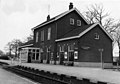 Railway station
 -
 Engelse schans
 -
 Former windmill demolished in 1968


References[edit]
- ^ a b c "Kerncijfers wijken en buurten 2021". Central Bureau of Statistics. Retrieved 23 March 2022.
- ^ "Postcodetool for 7137HA". Actueel Hoogtebestand Nederland (in Dutch). Het Waterschapshuis. Retrieved 23 March 2022.
External links[edit]
 Media related to Lievelde at Wikimedia Commons
This Gelderland location article is a stub. You can help Wikipedia by expanding it. |