
Lawson, Arkansas
Lawson, Arkansas | |
|---|---|
 Lawson, Arkansas  Lawson, Arkansas | |
| Coordinates: 33°11′48″N 92°28′59″W / 33.19667°N 92.48306°W | |
| Country | United States |
| State | Arkansas |
| County | Union |
| Elevation | 207 ft (63 m) |
| Population (2020) | |
| • Total | 260 |
| Time zone | UTC-6 (Central (CST)) |
| • Summer (DST) | UTC-5 (CDT) |
| ZIP code | 71750 |
| Area code | 870 |
| GNIS feature ID | 77460[1] |
Lawson is an unincorporated community and census-designated place (CDP) in Union County, Arkansas, United States. Lawson was founded by Lawson Smith, who was born in 1813 and died in 1899. Lawson is located on Arkansas Highway 129, 10.5 miles (16.9 km) east of El Dorado. Lawson has a post office with ZIP code 71750.[2] It was first listed as a CDP in the 2020 census with a population of 260.[3]
Education[edit]
It is in the El Dorado School District.[4][5] The district operates El Dorado High School.
In 1978 the Lawson and Urbana school districts merged into the El Dorado district.[6]
Demographics[edit]
| Census | Pop. | Note | %± |
|---|---|---|---|
| 2020 | 260 | — | |
| U.S. Decennial Census[7] 2020[8] | |||
2020 census[edit]
| Race / Ethnicity | Pop 2020[8] | % 2020 |
|---|---|---|
| White alone (NH) | 233 | 89.62% |
| Black or African American alone (NH) | 3 | 1.15% |
| Native American or Alaska Native alone (NH) | 0 | 0.00% |
| Asian alone (NH) | 1 | 0.38% |
| Pacific Islander alone (NH) | 2 | 0.77% |
| Some Other Race alone (NH) | 1 | 0.38% |
| Mixed Race/Multi-Racial (NH) | 13 | 8.03% |
| Hispanic or Latino (any race) | 5 | 5.00% |
| Total | 260 | 100.00% |
References[edit]
- ^ U.S. Geological Survey Geographic Names Information System: Lawson, Arkansas
- ^ ZIP Code Lookup
- ^ "Lawson CDP, Arkansas". United States Census Bureau. Retrieved April 7, 2022.
- ^ "SCHOOL DISTRICT REFERENCE MAP (2010 CENSUS): Union County, AR." U.S. Census Bureau. Retrieved on February 27, 2021. Compare to highway map for unincorporated areas.
- ^ "General Highway Map Arkansas County, Arkansas" (PDF). Arkansas Department of Transportation. Archived from the original (PDF) on March 13, 2012. Retrieved February 25, 2021. - See Lawson and Urbana on the map.
- ^ Goatcher, Truett (January 1999). "School District Consolidation Will Save Millions of Dollars: Fact of Myth?" (PDF). Arkansas Association of Educational Administrators. p. 16 (PDF p. 16/27).
- ^ "Decennial Census of Population and Housing by Decades". US Census Bureau.
- ^ a b "P2 HISPANIC OR LATINO, AND NOT HISPANIC OR LATINO BY RACE – 2020: DEC Redistricting Data (PL 94-171) – Lawson CDP, Arkansas". United States Census Bureau.
Municipalities and communities of Union County, Arkansas, United States | ||
|---|---|---|
| Cities | 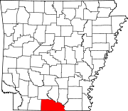 | |
| Town | ||
| CDPs | ||
| Other unincorporated communities | ||
This article about a location in Union County, Arkansas is a stub. You can help Wikipedia by expanding it. |