
Kostrzyna, Lower Silesian Voivodeship
Kostrzyna | |
|---|---|
Village | |
 Old palace | |
 Kostrzyna | |
| Coordinates: 51°1′10″N 14°59′48″E / 51.01944°N 14.99667°E | |
| Country | |
| Voivodeship | Lower Silesian |
| County | Zgorzelec |
| Gmina | Gmina Zgorzelec |
| Population | 157 |
Kostrzyna [kɔsˈtʂɨna] is a village in the administrative district of Gmina Zgorzelec, within Zgorzelec County, Lower Silesian Voivodeship, in south-western Poland, close to the German border.[1]
It lies approximately 15 kilometres (9 mi) south of Zgorzelec and 144 km (89 mi) west of the regional capital Wrocław.
Gallery[edit]
-
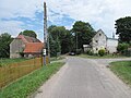
 Road
Road -
 Abandonrd buildings of a palace
 -
 Road
Road
_(009).jpg)

_(003).jpg)
References[edit]
Wikimedia Commons has media related to Kostrzyna, Lower Silesian Voivodeship.
| Villages |  | |
|---|---|---|
| Seat (not part of the gmina) | ||
This Zgorzelec County location article is a stub. You can help Wikipedia by expanding it. |