
Kantens
Kantens | |
|---|---|
 The church of Kantens | |
 Coat of arms | |
 Kantens Location of Kantens in the province of Groningen  Kantens Kantens (Netherlands) | |
| Coordinates: 53°21′56″N 6°38′2″E / 53.36556°N 6.63389°E | |
| Country | Netherlands |
| Province | Groningen |
| Municipality | Het Hogeland |
| Area | |
| • Total | 31.54 km2 (12.18 sq mi) |
| Elevation | 0.3 m (1.0 ft) |
| Population (2021)[1] | |
| • Total | 955 |
| • Density | 30/km2 (78/sq mi) |
| Postal code | 9995[1] |
| Dialing code | 0595 |
Kantens is a village in the Dutch province of Groningen. It is located in the municipality of Het Hogeland, about 16 km north of the city of Groningen. It had a population of around 965 including the surrounding area in January 2017.[3]
Kantens was a separate municipality until 1990, when it became a part of Hefshuizen.[4]
Gallery[edit]
-
 Landscape near Kantens
 -
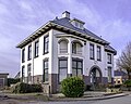 Villa in Kantens
 -
 Street view
 -
 Farm in Kantens


References[edit]
- ^ a b c "Kerncijfers wijken en buurten 2021". Central Bureau of Statistics. Retrieved 8 April 2022.
two entries
- ^ "Postcodetool for 9995NC". Actueel Hoogtebestand Nederland (in Dutch). Het Waterschapshuis. Retrieved 8 April 2022.
- ^ Kerncijfers wijken en buurten 2017 - CSB Statline
- ^ Ad van der Meer and Onno Boonstra, "Repertorium van Nederlandse gemeenten", KNAW, 2006. "KNAW > Publicaties > Detailpagina". Archived from the original on 2007-02-20. Retrieved 2009-12-03.
External links[edit]
 Media related to Kantens at Wikimedia Commons
| Authority control databases: Geographic |
|---|
This Groningen location article is a stub. You can help Wikipedia by expanding it. |