
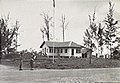
Kampong Kuala Tutong
Kuala Tutong | |
|---|---|
| Kampong Kuala Tutong | |
 Old Tutong jetty | |
 Kuala Tutong Location in Brunei | |
| Coordinates: 4°46′53″N 114°36′30″E / 4.78139°N 114.60833°E | |
| Country | Brunei |
| District | Tutong |
| Mukim | Pekan Tutong |
| Postcode | TA3341 |
Kampong Kuala Tutong (Malay: Kampung Kuala Tutong), also simply known as Kuala Tutong, is a village in Tutong District, Brunei, within the mukim of Pekan Tutong.[1] The postcode for Kampong Kuala Tutong is TA3341.[2]
Name[edit]
The Malay word kuala refers to the mouth of a river, therefore its name would translate to the mouth of the Tutong River.[3]
Geography[edit]
Kuala Tutong is surrounded by two bodies of water both in the North, the South China Sea and South, the Tutong River. It has coconut palms,[4] a spit and a 5 kilometres (3.1 mi) beach named Seri Kenangan Beach.[5][6] At Kuala Tutong and Kuala Belait, there are a few small mangrove areas, but they are only adequate for storing local supplies.[7]
History[edit]
Since the entire route now falls within its operational region, the British Malayan Petroleum Company, assumed responsibility for the upkeep of the bridges and approaches along the beach road from Kuala Tutong to Kuala Belait in 1931. During the Second World War, the area was operated by the Australian Army's 20th Brigade and 2/8th Field Regiment in their fight against the Japanese occupation of Brunei in August 1945.[8][9] Additionally, a Japanese cemetery was also present.[10] To sustain through traffic between Brunei and Kuala Belait, a pontoon car-ferry was created at Kuala Tutong.[11] In order to cross the river, the 2/3rd Field Regiment assisted in their operations by managing a ferry raft.[12] The Kuala Tutong Ferry service was discontinued in 1953 when a new bridge was built over the Tutong River near Tutong and another bridge was built over the Telamba River near Telisai. The design and building of these bridges have been put out to bid.[13][14]
Gallery[edit]
-

-
 A native boy on police duty in the 20th Infantry Brigade area.
 -

-
 Seri Kenangan Beach


References[edit]
- ^ "Tutong District" (PDF). www.information.gov.bn. p. 10. Retrieved 15 January 2021.
- ^ "postcodes". post.gov.bn. Retrieved 15 January 2021.
- ^ "K Tutong [Kuala Tutong] : Borneo 1:50,000, sheet 2945-II". www.awm.gov.au. Retrieved 2023-04-24.
- ^ Welcome to Brunei Darussalam: The Complete Traveller's Guide. Brunei Press. 2000. p. 61. ISBN 978-99917-32-05-3.
- ^ Explore Brunei: A Visitor's Guide. Vis á Vis Communication Design. 1999. p. 37.
- ^ Borneo. Lonely Planet Publications. 2008. p. 230. ISBN 978-1-74059-105-8.
- ^ Office, Great Britain Colonial (1952). Annual Report on Brunei for the Year ... H.M. Stationery Office. p. 25.
- ^ "KUALA TUTONG, BORNEO. 1945-08-25. THE YOUNG MEN'S CHRISTIAN ASSOCIATION (YMCA) TEA-ROOM AND ..." www.awm.gov.au. Retrieved 2023-04-24.
- ^ "KUALA TUTONG, BORNEO. 1945-08-25. CORPORAL L. BOULTON, 9TH DIVISION PROVOST COMPANY, AND A NATIVE ..." www.awm.gov.au. Retrieved 2023-04-24.
- ^ "KUALA TUTONG, BORNEO. 1945-08-25. A SECTION OF THE JAPANESE CEMETERY IN 20TH INFANTRY BRIGADE ..." www.awm.gov.au. Retrieved 2023-04-24.
- ^ Office, Great Britain Colonial (1931). Colonial Reports - Annual. H.M. Stationery Office. p. 12.
- ^ "TUTONG RIVER, BORNEO. 23 JUNE 1945. JEEP MOVING OFF THE TUTONG FERRY RAFT AT FERRY 2 MOORING. THE ..." www.awm.gov.au. Retrieved 2023-04-24.
- ^ Brunei (1953). Annual Report. H.M. Stationery Office. p. 183.
- ^ Cleary, Mark; Wong, Shuang Yann (2016-07-27). Oil, Economic Development and Diversification in Brunei Darussalam. Springer. p. 80. ISBN 978-1-349-23485-1.
This Brunei location article is a stub. You can help Wikipedia by expanding it. |